


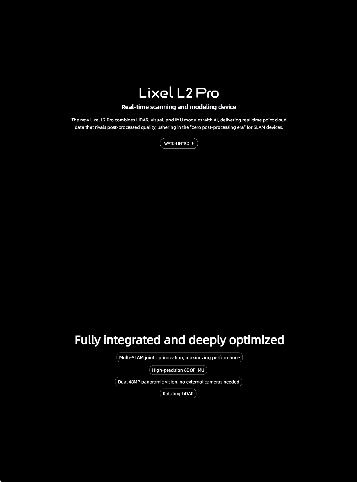
xgrids Lixel L2PRO Handheld 3D Laser Scanner Scan Rate of 320,000pts/s Laser Scanner for Survey Engineering
Product Introduction
The xgrids Lixel L2 PRO handheld scanner is an outstanding device for 3D real-time scanning and modeling. Below is a detailed evaluation of this device:
I. Device Specifications and Technical Parameters
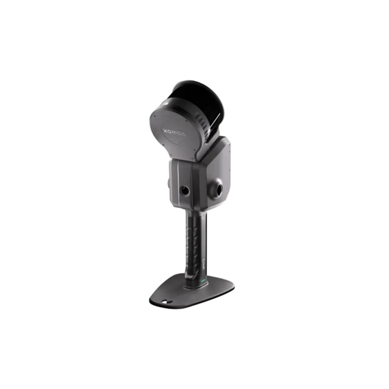
The xgrids Lixel L2 PRO excels in device specifications, with a handheld unit weight of 1.7kg (excluding battery), making it suitable for prolonged operation. It boasts a storage capacity of up to 1TB, satisfying the need for large-capacity data storage. The data interface adopts USB 3.1 Gen2, enabling faster transmission speeds. The device is also equipped with a high-resolution color camera (48 million × 2 pixels) and core components such as a LiDAR, providing hardware support for high-quality scanning results.
II. Scanning Performance
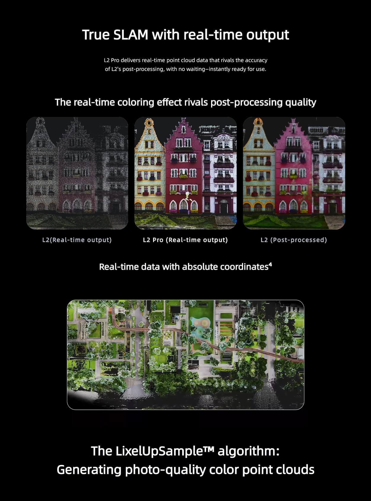
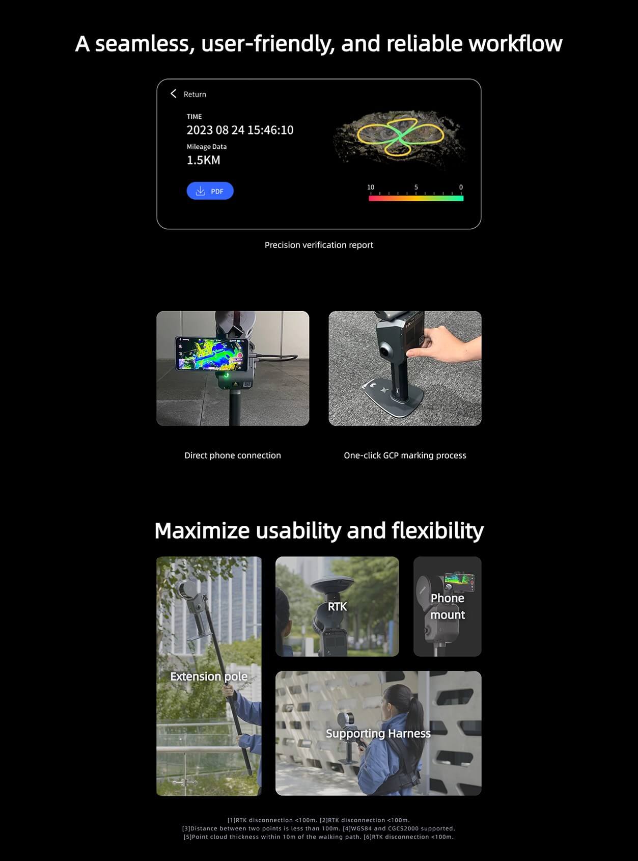
●Real-time True-color Point Cloud: The xgrids Lixel L2 PRO can generate high-quality true-color point cloud data in real time, with realistic color reproduction, eliminating the need for external panoramic devices. This feature allows users to preview real scene colors during the scanning process, improving work efficiency.
●High Precision: The device offers an absolute accuracy of up to 3cm and a relative accuracy of 1cm (post-processing), meeting various high-precision surveying and mapping requirements. In actual tests, the absolute difference between point cloud measurements and on-site measurements remains within 3 centimeters, with an average error of ±1 centimeter, demonstrating good accuracy performance.
●Efficient Scanning: With a scanning rate of up to 640,000 points per second (32 threads), the device can quickly capture detailed information in the scene. Additionally, it supports real-time RTK integration, further enhancing positioning accuracy and stability.
III. Convenience and Ease of Use
●Operation Convenience: The xgrids Lixel L2 PRO supports the installation of the LixelGo software on Android phones, enabling Bluetooth + hotspot connection to the device. Users can easily control the device via their phone, view scanning results and device status in real time.
●Rich Post-processing Software: The device comes with one-stop 3D post-processing software such as LixelStudio and LccStudio, providing functions such as point cloud data viewing, editing, model production, and post-processing to meet diverse user needs.
●High Integration: The panoramic camera is integrated into the device body, resulting in a sleeker appearance and more convenient use. Furthermore, the device supports accessories such as backpack scanning systems and extension poles, further expanding its application scenarios and flexibility.
IV. Wide Range of Applications
The xgrids Lixel L2 PRO is widely used in topographic surveying, engineering measurement, urban renewal, mining exploration, agricultural and forestry surveys, emergency surveying and mapping, and other fields. Its high-precision, high-efficiency scanning performance, and rich post-processing software support enable users to easily handle various complex scenarios and surveying and mapping requirements.
V. Conclusion
In summary, the xgrids Lixel L2 PRO handheld scanner performs excellently in terms of device specifications, scanning performance, convenience and ease of use, and application scenarios. It not only provides users with more efficient and precise scanning solutions but also injects new vitality into the development of 3D intelligent technology through the introduction of innovative technologies. Therefore, the xgrids Lixel L2 PRO is a highly recommended 3D real-time scanning and modeling device.
The following are the parameters and performance of the xgrids Lixel L2 PRO handheld scanner:
I. Parameters
●Weight and Dimensions of the Handheld Unit:
●Weight: 1.7kg (excluding battery), allowing for extended operation.
●Dimensions: 180mm x 130mm x 400mm.
●Shell and Material:
●Shell Material: Aluminum alloy, sturdy and durable.
●Storage and Interfaces:
●Storage Capacity: 1TB SSD, meeting the demand for large-capacity data storage.
●Data Interface: USB 3.1 Gen2, enabling faster data transfer.
●Battery and Endurance:
●Battery Capacity: 46.8wh.
●Single Battery Endurance: 90 minutes, suitable for prolonged outdoor operations.
●Wireless Connectivity:
●Supports Wi-Fi and Bluetooth connections, specifically models 802.11a/b/g/n/ac, with frequency ranges of 2.42.4835GHz and 5.155.85GHz.
●Core Components:
●Laser: Class 1/905nm, with a laser field of view of 360° x 270°, and an operating range of 0.5m to 120m (or 0.5m to 300m, depending on the specific application scenario).
●Color Camera: Resolution up to 48 million x 2 pixels, capable of capturing rich color information.
●Monochrome Camera: Resolution of 1 x 1MP, used to enhance the details of scanned data.
II. Performance
●Scanning Performance:
●Scanning Rate: Up to 640,000 points/second (32 threads), quickly capturing detailed information in the scene.
●Real-time True-color Point Cloud: Capable of generating high-quality true-color point cloud data in real time, with lifelike color reproduction, without the need for external panoramic devices.
●High Precision: Absolute accuracy with RMSE of 3cm for both elevation and plane, real-time relative accuracy RMSE of 2cm, and post-processing relative accuracy RMSE of up to 1cm, meeting various high-precision surveying and mapping needs.
●Special Features:
●Visual-assisted Positioning: Enhances positioning accuracy during scanning.
●Real-time RTK Integration: Improves positioning accuracy and stability, supports connection to network CORS, and directly outputs point cloud data with absolute coordinates.
●LixelCyberColor Technology: Further enhances the color reproduction and realism of point cloud data.
●Convenience and Ease of Use:
●Easy Operation: Supports installation of the LixelGo software on Android phones, enabling Bluetooth + hotspot connection to the device, allowing users to view scanning results and device status in real time.
●Rich Post-processing Software: Equipped with one-stop 3D post-processing software such as LixelStudio and LccStudio, providing functions for viewing, editing, model production, and post-processing of point cloud data.
●Application Scenarios:
●Widely used in topographic surveying and mapping, engineering measurement, urban renewal, mining exploration, forestry and agriculture surveys, emergency surveying and mapping, and other fields. Its high-precision, high-efficiency scanning performance, and rich post-processing software support enable users to easily handle various complex scenarios and surveying and mapping needs.
In summary, the xgrids Lixel L2 PRO handheld scanner excels in both parameters and performance, making it a highly recommended high-performance 3D real-time scanning and modeling device.
Logistics information


Logistics information