


xgrids Lixel L2 Handheld 3D Laser Scanner Scan Rate of 320,000pts/s Laser Scanner for Survey Engineering
Product Introduction
The xgrids Lixel L2/32 handheld 3D scanner is a device with excellent performance and powerful functions. The following is a detailed evaluation of it:
I. Hardware Configuration and Performance
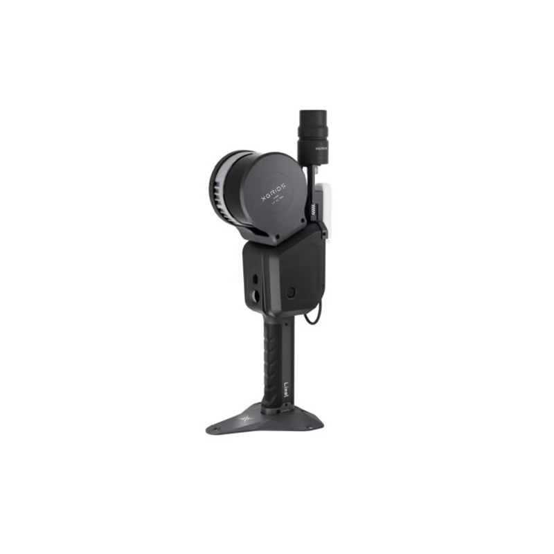
1.High Integration: The Lixel L2 integrates a LiDAR, a three-color camera, a high-precision inertial navigation system, and a high-performance computer into one device, enabling it to generate centimeter-level accurate true-color point cloud models in real-time during data collection. This highly integrated hardware design not only improves the portability of the device but also ensures the accuracy and efficiency of data collection.
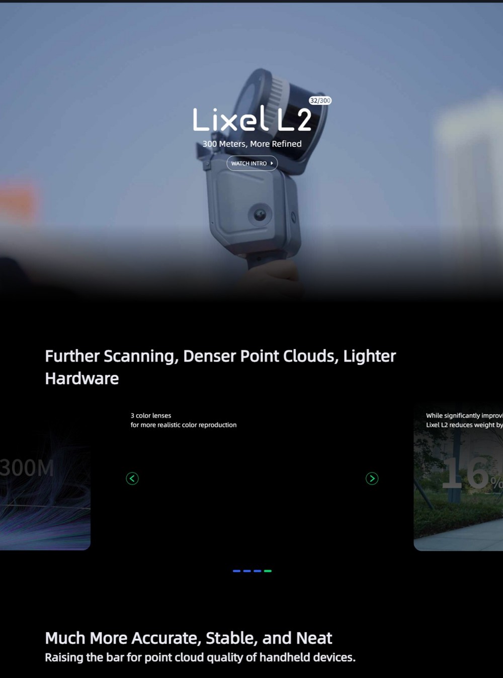
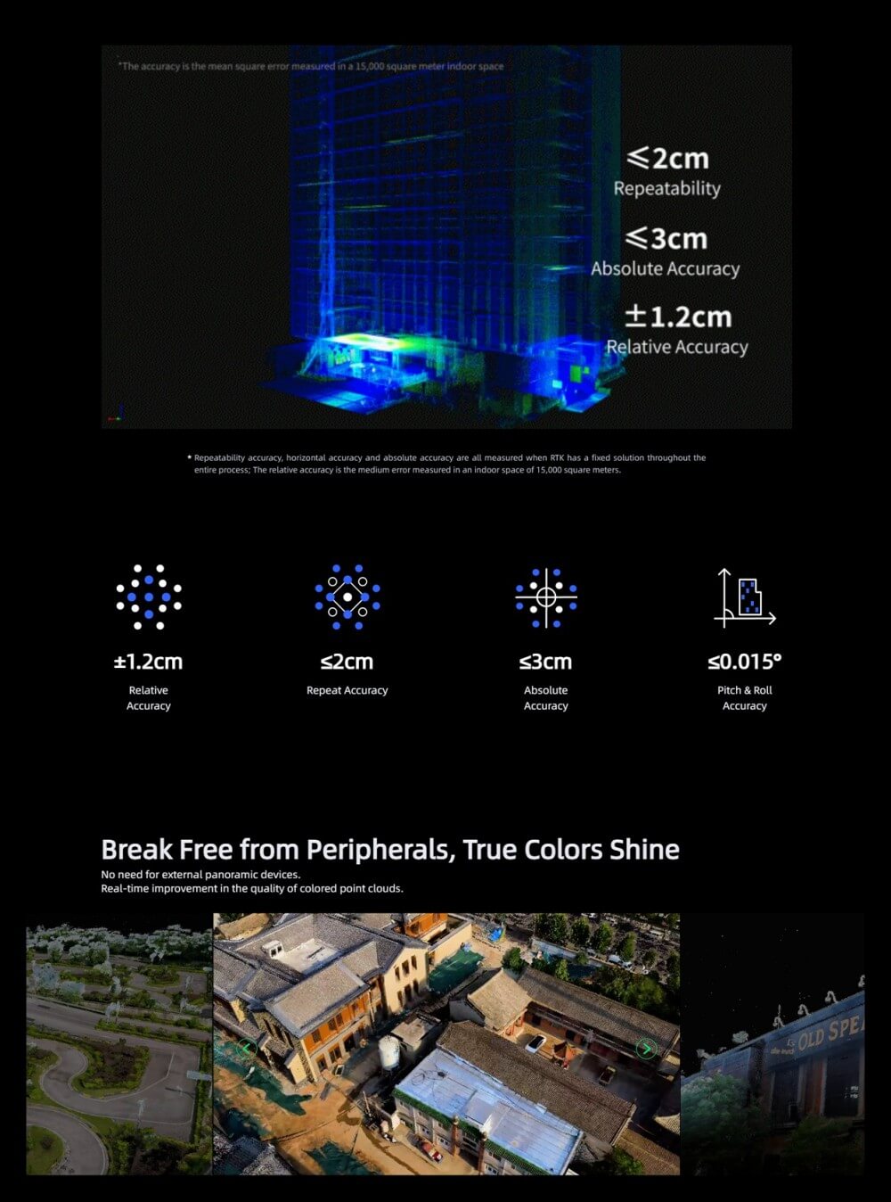
2.High-precision Measurement: The Lixel L2 has a ranging capability of up to 300 meters, with a relative accuracy of ±1.2cm (measured when RTK has a fixed solution throughout), an absolute accuracy of ≤3cm, and a repeatability accuracy of ≤2cm (or ≤3cm, with slight variations depending on different sources). This level of accuracy allows the Lixel L2 to provide reliable data support in multiple application scenarios.
3.Efficient Operation: The Lixel L2 can operate for up to 90 minutes (or 1.5 hours, with slight variations depending on different sources) per scan, fully meeting the requirements for data integrity and accuracy in complex scenarios. Additionally, the device supports resumable scanning, ensuring efficient and continuous measurement of large scenes. The real-time calculation and modeling function makes the measurement results immediately usable, significantly shortening the data processing cycle.
II. Software Functions and Operational Convenience
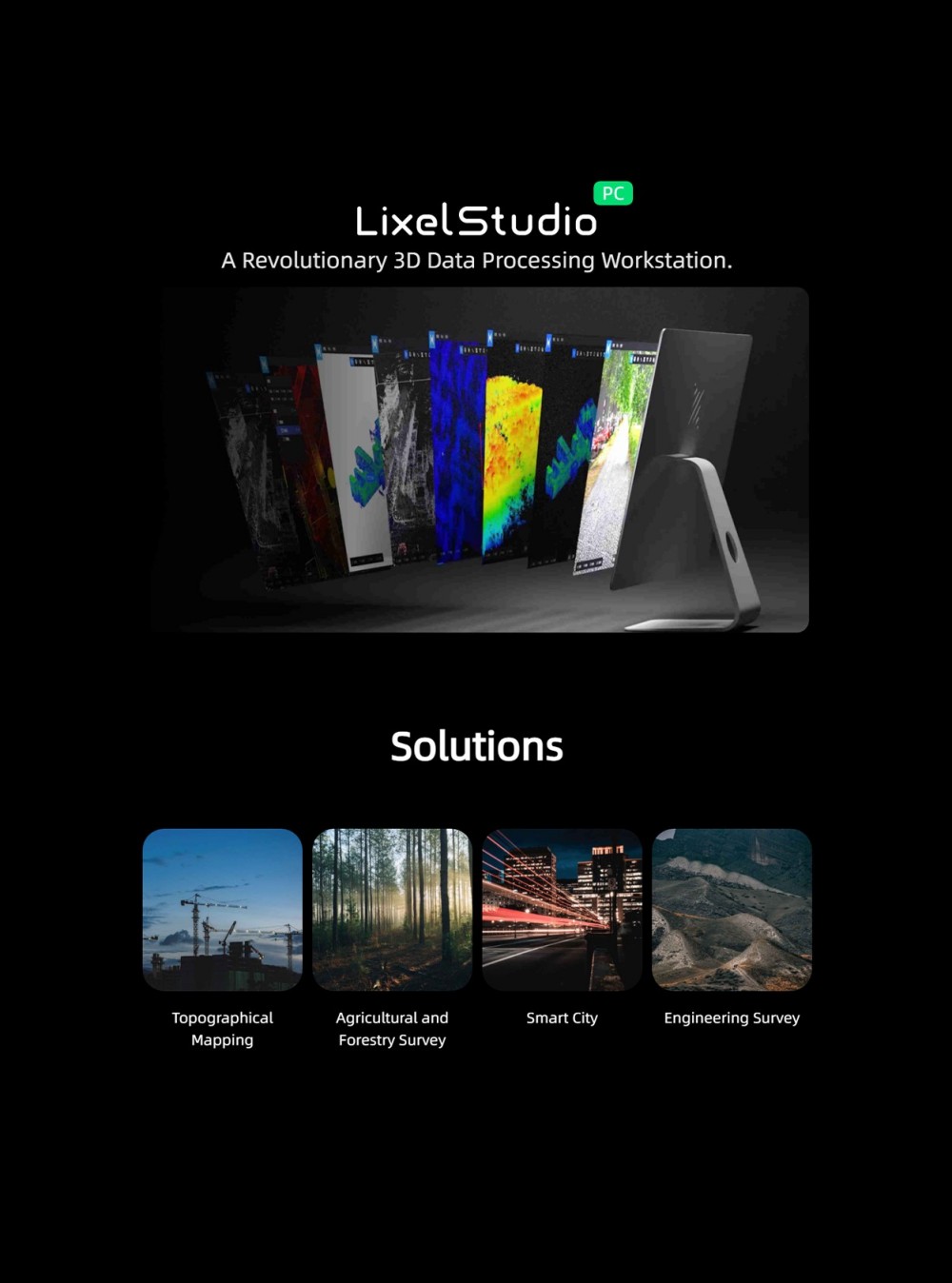
1.One-stop 3D Post-processing Software: The Lixel L2 comes with LixelStudio software, which provides rich functions for viewing and editing point cloud data, model generation, and post-processing, facilitating data processing and analysis for users.
2.Mobile Phone Control: The Lixel L2 supports full-process scanning operation control through a mobile app. Operators can view camera footage, elevation, and true-color point clouds in real-time on their phones, avoiding missed or incorrect data collection. The app also displays information such as battery level, network status, memory, measurement range, and collection status, making the operation process more intuitive and controllable.
3.Visual-assisted Positioning and Laser Field of View: The Lixel L2 supports visual-assisted positioning, with a laser field of view of 360°×270°, providing a wider field of view and higher positioning accuracy during data collection.
III. Application Scenarios and Expandability
1.Wide Range of Application Scenarios: The Lixel L2 handheld 3D scanner is widely used in topographic surveying and mapping, engineering measurement, urban renewal, mining exploration, forestry and agriculture surveys, emergency mapping, verticality inspection, and other fields. Its high precision and efficiency make it play an important role in these fields.
2.Diverse Accessories: The Lixel L2 supports a variety of accessories, such as extension poles, to meet the needs of different operation scenarios and measurement areas. This wide range of application scenarios and expandability allows the Lixel L2 to play a significant role in multiple industries.
IV. User Feedback and Market Recognition
The Lixel L2 handheld 3D scanner has been successfully applied in multiple projects, such as the Qingdao Jiaozhou Bay Second Submarine Tunnel project and the pile volume measurement project. The successful application of these projects not only verifies the performance and accuracy of the device but also provides strong support for its application in more fields. At the same time, customer recognition of the Lixel L2 further proves its market value and competitiveness.
In summary, the xgrids Lixel L2 handheld 3D scanner is a device with excellent performance, powerful functions, easy operation, and a wide range of application scenarios. It can play an important role in multiple fields, providing reliable data support and solutions for users.
Product Features
The xgrids Lixel L2/32 handheld scanner is a high-performance device for 3D real-time reconstruction. Below are its detailed parameters and performance features:
I. Parameters
●Ranging Range: 0.5 meters to 300 meters, meeting the surveying and mapping needs of various scenarios.
●Laser Field of View: 360°×270°, providing a broader acquisition field.
●Scanning Data Rate: Up to 640,000 points per second, ensuring dense and accurate point cloud data.
●Weight: The handheld unit weighs less than 1.6 kilograms, making it easy to carry and operate.
●Accuracy:
●Relative Accuracy: ±1.2 centimeters (measured under specific conditions).
●Repeatability Accuracy: ≤2 centimeters.
●Absolute Accuracy: ≤3 centimeters.
●Battery: Adopts a clip-on battery design for quick replacement and extended working time.
●Operating Temperature: -20°C to 50°C, adapting to various environmental conditions.
●Storage Capacity: 1TB (may vary depending on configuration), satisfying large data storage requirements.
●Protection Level: IP54, with certain dust and water resistance capabilities.
II. Performance Features
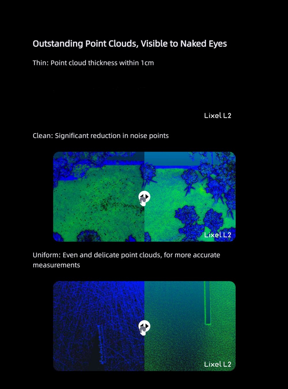
●Real-time True-color Point Cloud: Generates high-quality true-color point cloud data in real time without the need for external panoramic devices, with realistic color reproduction.
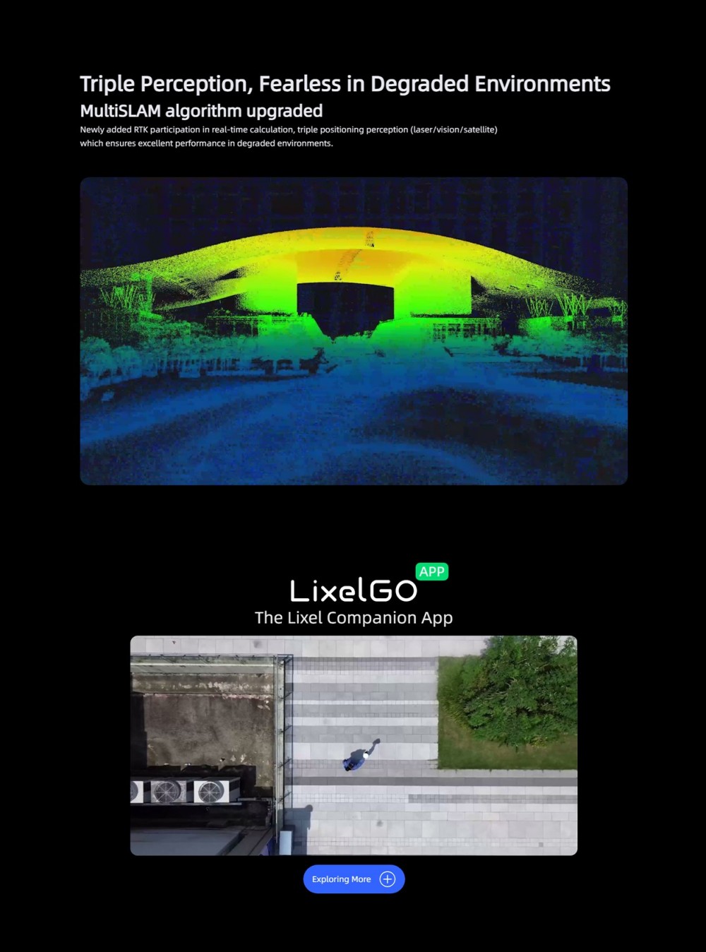
●Triple Positioning Perception: Combines laser, vision, and satellite triple positioning technologies to maintain outstanding performance even in degraded environments.
●MultiSLAM Algorithm Upgrade: The new MultiSLAM algorithm supports RTK real-time participation in calculation, improving positioning accuracy and stability.
●One-stop 3D Post-processing Software: Equipped with LixelStudio and other one-stop 3D post-processing software, providing rich functions such as point cloud data viewing, editing, model production, and post-processing.
●Convenient Operating Experience: Supports mobile phone control, real-time browsing of collection results, and one-screen overview of device status for more convenient and efficient operation.
In summary, the xgrids Lixel L2/32 handheld scanner excels in both parameters and performance, meeting the application needs of various scenarios such as real-scene modeling, architectural surveying and mapping, and engineering surveying. Its high accuracy, real-time true-color point cloud, triple positioning perception, and other features give it significant advantages in the industry.
Logistics information


Logistics information