


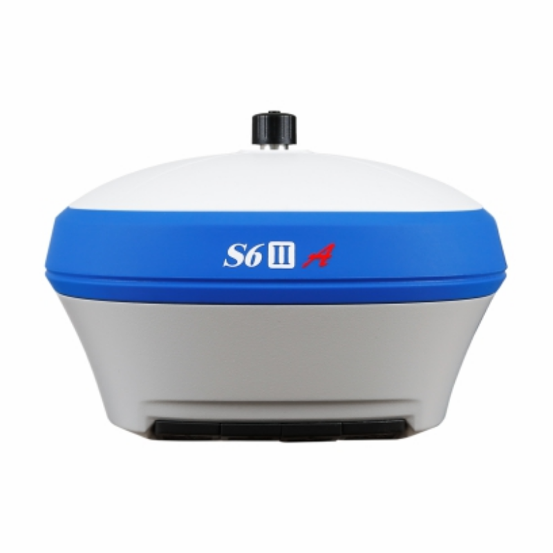
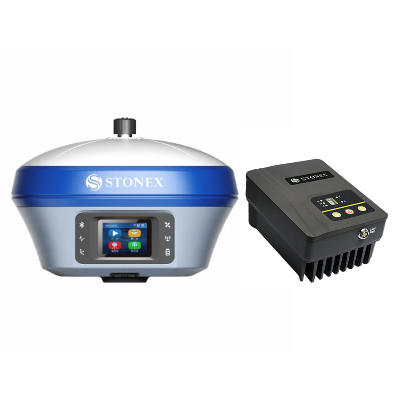
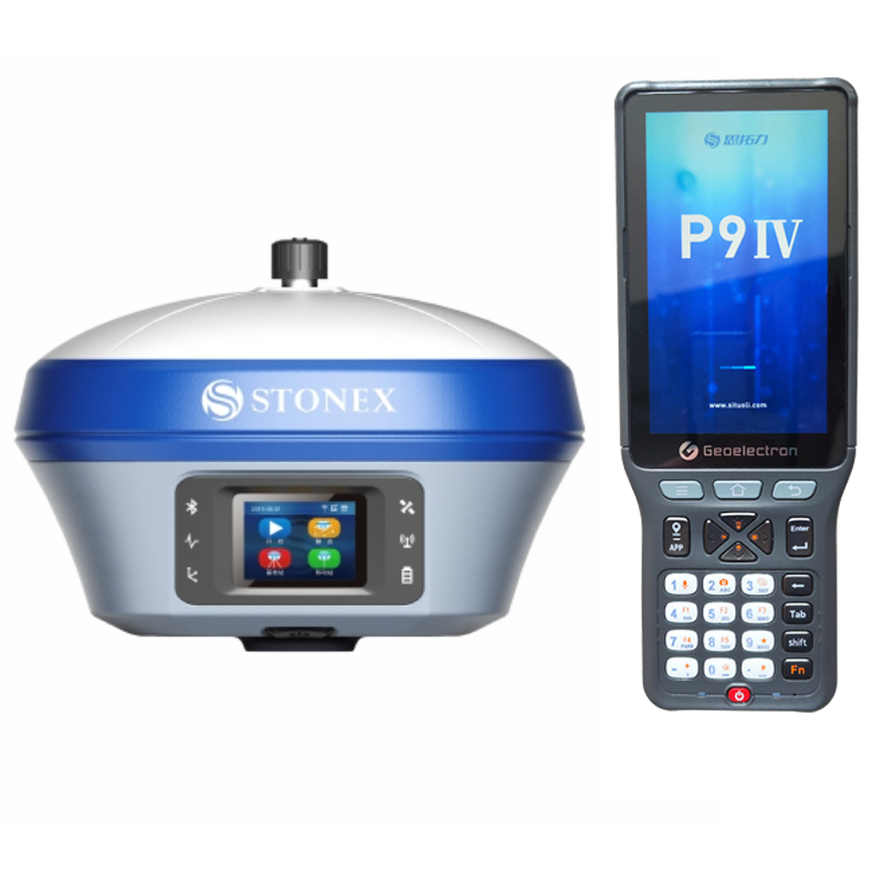
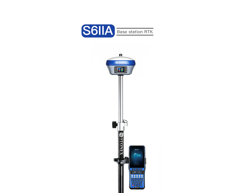
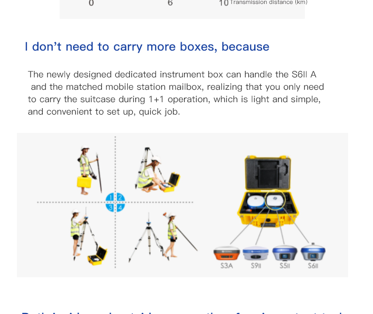
Stonex S6II / S990A GNSS RTK Receiver Cheap GPS Survey Instrument
Product Features
The IMU system supports tilted measurement (TILT) with quick initialization, enabling the operator to obtain fast and accurate surveys. The color touch display and Web UI provide a quick and easy way to get complete control of the receiver.
The 1PPS port is an additional advantage available on this GNSS receiver because it can be applied to scenarios that require precise timing to ensure that multiple facilities work together or to scenarios that use the same parameters for the integration of systems based on precise timing.
S990+ works seamlessly with our Cube-a field software.
MULTI CONSTELLATION
The Stonex S990+ is a 1408-channel GNSS receiver that provides an excellent on-board real-time navigation solution with high accuracy. All GNSS signals, including GPS, GLONASS, BEIDOU, GALILEO, and QZSS, are included at no additional cost.
IMU TECHNOLOGY
The Stonex S990+ is equipped with IMU technology that allows for fast initialization and accurate measurements with an inclination up to 60°.
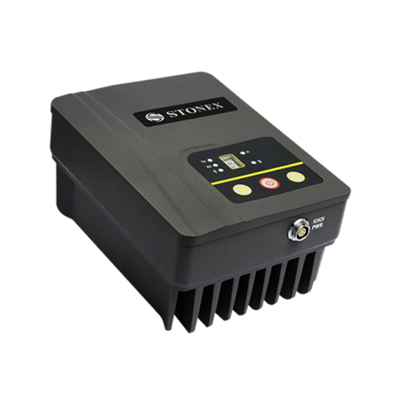
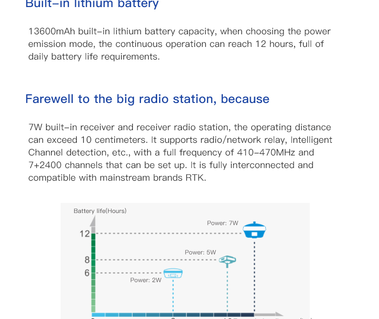
DOUBLE FREQUENCY RADIO (optional)
The Stonex S990+ is equipped with an integrated UHF double frequency radio that supports 410-470MHz and 902.4-928MHz, meeting the needs of each country.
4G MODEM
The Stonex S990+ is equipped with an internal 4G modem that operates with all world signals, ensuring a fast internet connection.
RGB
COLOR TOUCH DISPLAY
The Stonex S990+ is equipped with a color touch display that makes it easy to manage the most important functions.
LONG LASTING BATTERY
The internal 10,200mAh battery allows for up to 12 hours of operation
Technical Performance
The Stonex S6II / S990A is a highly acclaimed high-precision satellite positioning and measurement device in the surveying and mapping field, boasting exceptional performance and comprehensive functionality. Below is a detailed evaluation of the product:
I. Product Features and Technical Advantages
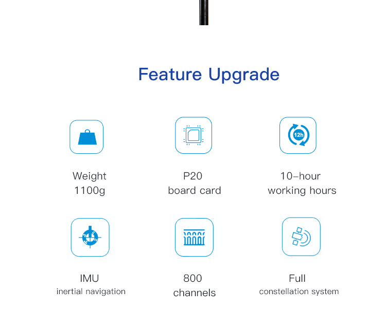
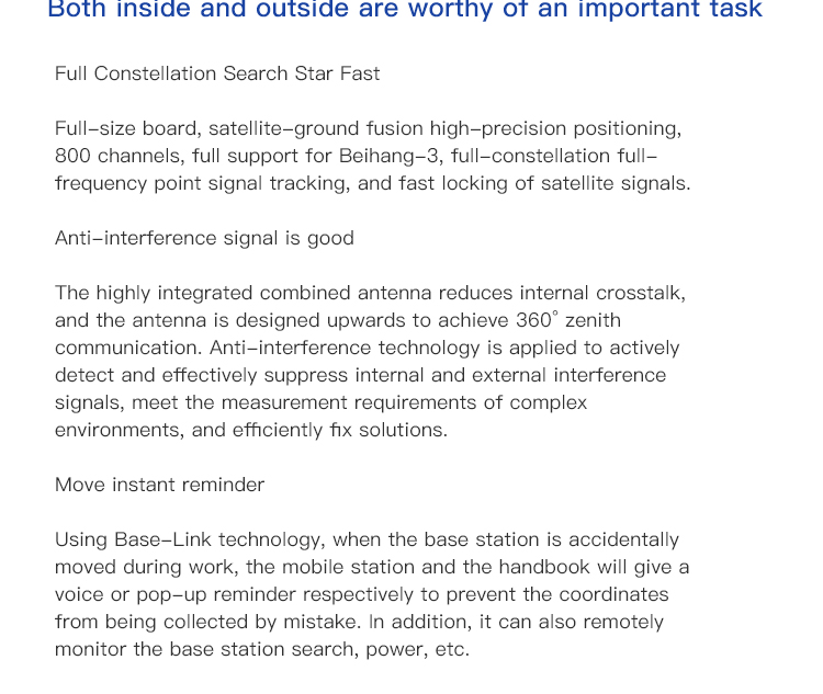
Full Constellation Support: The Stonex S6II / S990A supports global navigation satellite systems such as GPS, Glonass, Beidou, and Galileo, ensuring stable satellite signals in various environments.
High-Precision Measurement: Utilizing advanced inertial navigation and tilt measurement technology, it achieves centimeter-level accuracy without the need for calibration, even at tilt angles of up to 60°. Additionally, it features a standard star-chain continuation function, maintaining centimeter-level accuracy for a period even when the ground data link is interrupted.
Full Compatibility and Interoperability: The Stonex S6II / S990A supports all protocols and frequency bands, enabling interoperability with mainstream GNSS receivers on the market. With multiple radio channels and customizable frequencies, it facilitates operation in diverse environments.
Efficient Data Transmission and Storage: Equipped with a high-speed data transmission module, it supports various data transfer methods. Furthermore, its large-capacity storage design, with a standard 32GB of space expandable to 500GB, ensures the integrity and security of user data.
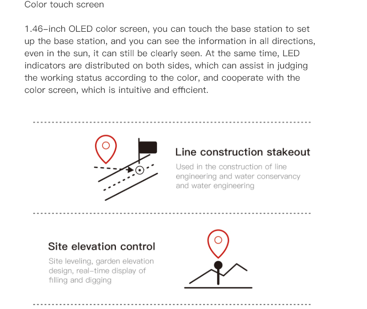
Intelligent Operation: The Stonex S6II / S990A features a high-definition color touchscreen and guided operation design, allowing users to proficiently use it without prior training. It also includes functions such as intelligent base stations and smart differential data transmission, further enhancing operational efficiency and accuracy.
II. Application Scenarios and Performance
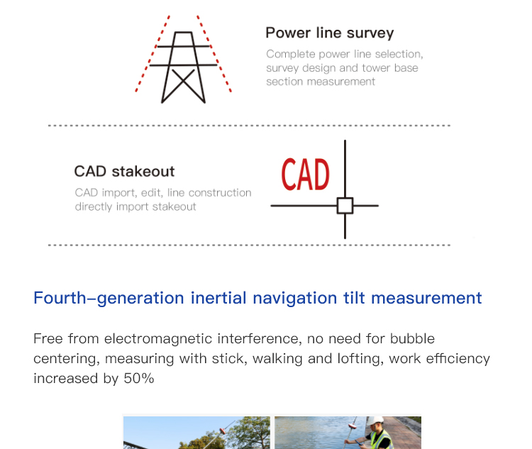
Engineering Surveying: The Stonex S6II / S990A excels in engineering surveying, swiftly and accurately completing various measurement tasks. Its full compatibility and high precision enable users to easily handle complex environments.
Power Surveying: In power surveying, the device's high-precision measurement and stable performance contribute to the accuracy of survey results. Additionally, its intelligent operation reduces the workload for surveying personnel.
Road Surveying and Staking: The Stonex S6II / S990A also demonstrates advantages in road surveying and staking. Its efficient data transmission and storage capabilities allow users to real-time acquire and process measurement data, thereby improving work efficiency.
III. User Feedback and Market Evaluation
According to user feedback and market evaluations, the Stonex S6II / S990A performs exceptionally well in terms of performance, accuracy, compatibility, and stability. Users have highly praised its efficient data transmission, intelligent operation design, and outstanding measurement accuracy. Furthermore, its robust appearance and user-friendly interface have also garnered favor among users.
IV. Conclusion
In summary, the Stonex S6II / S990A is a high-precision satellite positioning and measurement device with exceptional performance and comprehensive functionality. Its full constellation support, high-precision measurement, full compatibility and interoperability, efficient data transmission and storage, as well as intelligent operation, make it widely applicable in fields such as engineering surveying, power surveying, and road surveying and staking. Simultaneously, user feedback and market evaluations fully demonstrate its outstanding performance and quality. Therefore, for users requiring high-precision measurement equipment, the Stonex S6II is undoubtedly a worthwhile consideration.
Logistics information


Logistics information
Technical Specifications
| GNSS Features | Channels | 1408 |
| GPS | L1C/A, L2C, L2P, L5 | |
| GLONASS | L1C/A,L1P,L2C/A,L2P,L3* | |
| BDS | BDS-2: B1I, B2I, B3I BDS-3: B1I, B3I, B1C, B2a, B2b* | |
| GALILEO | E1, E5A, E5B, E6C, AltBOC* | |
| SBAS(WAAS/MSAS/EGNOS/GAGAN) | L1C/A, L5* | |
| IRNSS | L5* | |
| QZSS | L1, L2C, L5* | |
| MSS L-Band | BDS-PPP | |
| Positioning output rate | 1Hz~20Hz | |
| Initialization time | < 10s | |
| Initialization reliability | > 99.99% | |
| Positioning Precision | Code differential GNSS | Horizontal: 0.25 m + 1 ppm RMS Vertical: 0.50 m + 1 ppm RMS |
| Static(long observations) | Horizontal: 2.5 mm + 0.1 ppm RMS Vertical: 3 mm + 0.4 ppm RMS | |
| Static | Horizontal: 2.5 mm + 0.5 ppm RMS Vertical: 3.5 mm + 0.5 ppm RMS | |
| Rapid static | Horizontal: 2.5 mm + 0.5 ppm RMS Vertical: 5 mm + 0.5 ppm RMS | |
| PPK | Horizontal: 3 mm + 1 ppm RMS Vertical: 5 mm + 1 ppm RMS | |
| RTK(UHF) | Horizontal: 8 mm + 1 ppm RMS Vertical: 15 mm + 1 ppm RMS | |
| RTK(NTRIP) | Horizontal: 8 mm + 0.5 ppm RMS Vertical: 15 mm + 0.5 ppm RMS | |
| RTK initialization time | 2-8s | |
| SBAS positioning | Typically < 5m 3DRMS | |
| IMU | Less than 10mm + 0.7 mm/° tilt to 30° | |
| IMU tilt angle | 0° ~ 60° | |
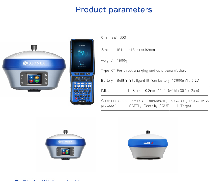
| Hardware Performance | Dimension | 151mmx151mmx94.5mm |
| Weight | 1350g | |
| Material | Magnesium aluminum alloy shell | |
| Operating temperature | -45℃ ~ +65℃ | |
| Storage temperature | -45℃ ~ +85℃ | |
| Humidity | 100% Non-condensing | |
| Waterproof/Dustproof | IP68 standard, protected from long time immersion to depth of 1m | |
| IP68 standard, fully protected against blowing dust | ||
| Shock/Vibration | Withstand 2 meters pole drop onto the cement ground naturally | |
| Power consumption | 2W | |
| Power supply | 6-28V DC, overvoltage protection | |
| Battery | 7.2v 10200mAh | |
| Battery life(Dual-battery) | 15h(Rover Bluetooth mode) | |
| WIFI | Modem | 802.11 b/g standard |
| WIFI hotspot | AP mode, Receiver broadcasts its hotspot form web UI accessing with any mobile terminals | |
| WIFI datalink | Client mode, Receiver can transmit and receive correction data stream via WiFi datalink | |
| Communications | I/O Port | 5-PIN LEMO external power port + RS232 |
| 7-PIN LEMO(USB, OTG and Ethernet) | ||
| 1 PPS data interface | ||
| SIM card slot(standard) | ||
| Internal UHF | Receiver and transmitter 1/2/3W (Just receiver 0.01W for Russia) | |
| Frequency range | 410 - 470MHz | |
| Communication protocol | Farlink, Trimtalk450s, SOUTH, HUACE, ZHD | |
| Communication range | Typically 10km with Farlink protocol | |
| Cellular mobile network | 4G network communication module | |
| Bluetooth | BLEBluetooth 4.0 standard, Bluetooth 2.1 + EDR | |
| NFC Communication | Realizing close range (shorter than 10cm) automatic pair between receiver and controller (controller requires NFC wireless communication module else) | |
| Data Storage/Transmission | Storage | 16GB SSD |
| Automatic cycle storage (The earliest data files will be removed automatically while the memory is not enough) | ||
| Support external USB storage | ||
| Data transmission | Plug and play mode of USB data transmission | |
| Supports FTP/HTTP data download | ||
| Data format | Static data format: STH, Rinex2.01, Rinex3.02, etc. | |
| Differential format: CMR(GPS only), CMR+(GPS only), RTCM 2.3, RTCM 3.0, RTCM 3.1, RTCM 3.2 | ||
| Navigation data format: NMEA 0183, PJK, Binary code | ||
| Network model support: VRS, FKP, MAC, fully support NTRIP protocol | ||
| Sensors | Electronic bubble | Controller software can display electronic bubble, checking leveling status of the carbon pole in real-time |
| IMU | Built-in IMU module, calibration-free and immune to magnetic interference | |
| Thermometer | Built-in thermometer sensor, adopting intelligent temperature control technology, monitoring and adjusting the receiver temperature | |
| User Interaction | Operating system | Linux |
| Buttons | Single button | |
| Indicators | 4 color LED indicators, Battery indicator | |
| Web interaction | With the access of the internal web interface management via WiFi or USB connection, users are able to monitor the receiver status and change the configurations freely | |
| Voice guidance | It provides status and operation voice guidance, and supports Chinese/English/Korean/Spanish/Portuguese/Russian/Turkish | |
| Secondary development | Provides secondary development kit, and opens the OpenSIC observation data format and interaction interface definition | |
| Cloud service | The powerful cloud platform provides online services like remote manage, firmware update, online register and etc. |
Note:
[1]QZSS L6 can be provided by firmware upgrade.
[2]The measurement accuracy, precision, reliability and initialization time depend on various factors, including tilt angle, number of satellites, geometric distribution, observation time, atmospheric conditions and multi-path validation, etc. The data are derived under normal conditions.
[3]Accuracies are dependent on GNSS satellite availability. Hi-Fix Positioning ends after 5 minutes without differential data.Hi-Fix is not available in all regions, check with your local sales representative for more information.
[4]Irregular operations such as rapid rotation and high-intensity vibration may affect the inertial navigation accuracy.
[5]The battery operating time is related to the operating environment, operating temperature and battery life.
Descriptions and Specifications are subject to change without notice