


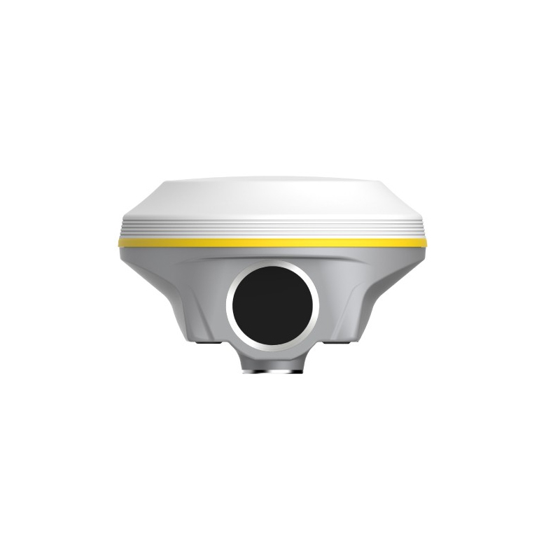


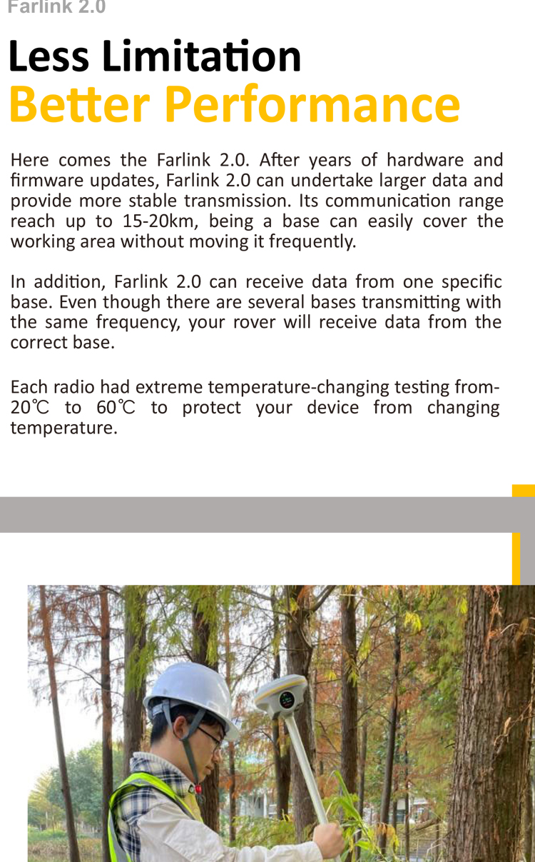
South INNO8 GNSS Receiver with 1598 Channels and IMU AR RTK for Drones Optics Instruments Adapt to Visual RTK SOUTH GNSS GPS RTK
Product Features
1.High-precision Measurement:
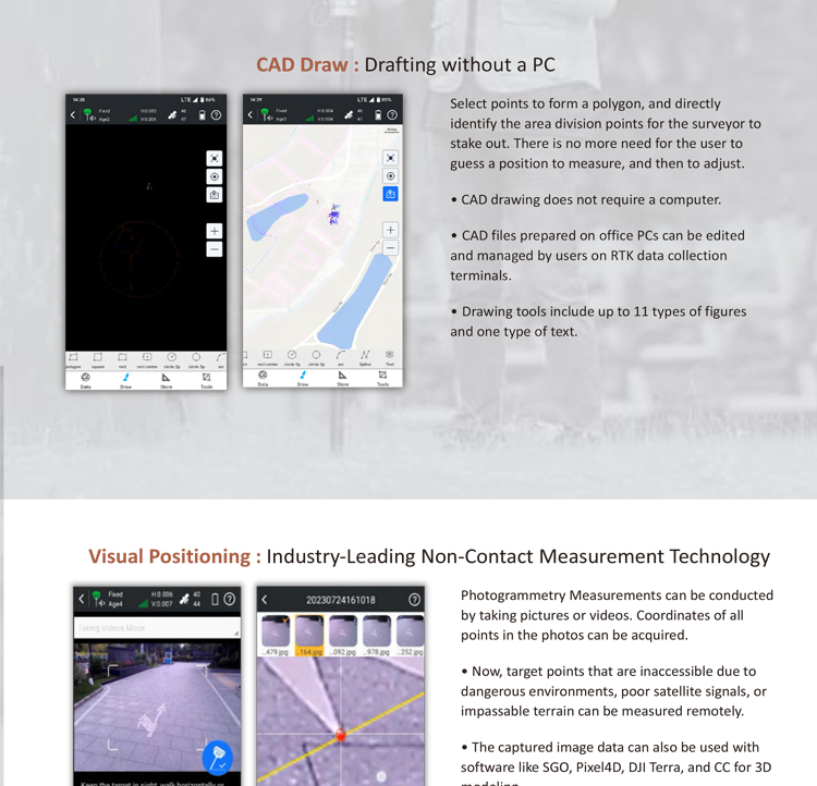
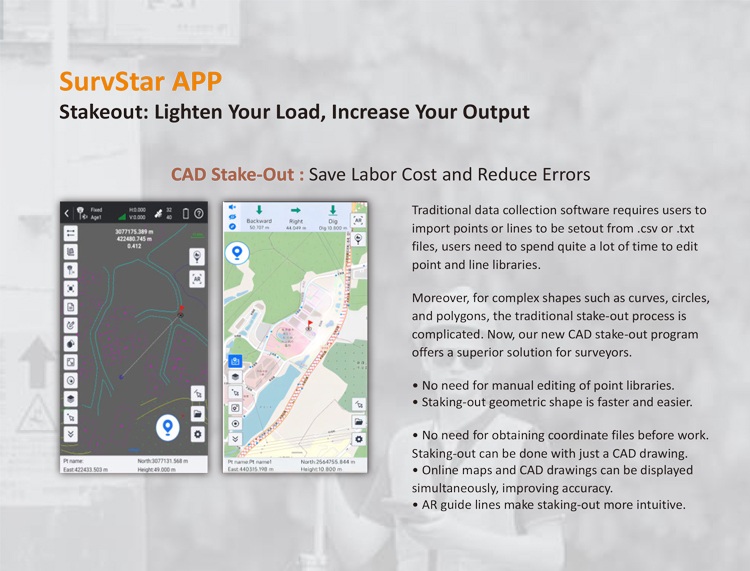
1.INNO8 integrates GNSS positioning technology, inertial navigation measurement technology, and photogrammetric technology. By capturing target images, it rapidly calculates the target point coordinates, enabling non-contact measurement.
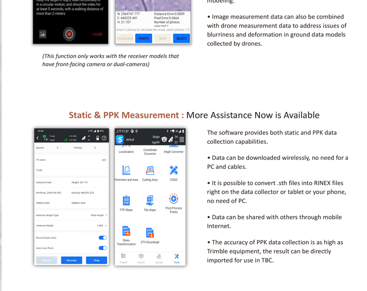
2.Static measurement accuracy reaches ±(2.5mm+0.5×10⁻⁶D) for the plane and ±(5mm+0.5×10⁻⁶D) for elevation (D is the length of the measured baseline); RTK measurement accuracy reaches ±(8mm+1×10⁻⁶D) for the plane and ±(15mm+1×10⁻⁶D) for elevation (D is the length of the measured baseline).
2.Multi-constellation Support:
1.Supports all current and planned GNSS constellations, including BDS (BeiDou), GPS, GLONASS, Galileo, etc. The all-constellation reception technology enhances positioning reliability and accuracy.
3.Intelligent Dynamic Positioning:
1.Adopts intelligent dynamic sensitivity positioning technology, adapting to various environmental changes and maintaining high accuracy even in harsh and long-distance positioning environments.
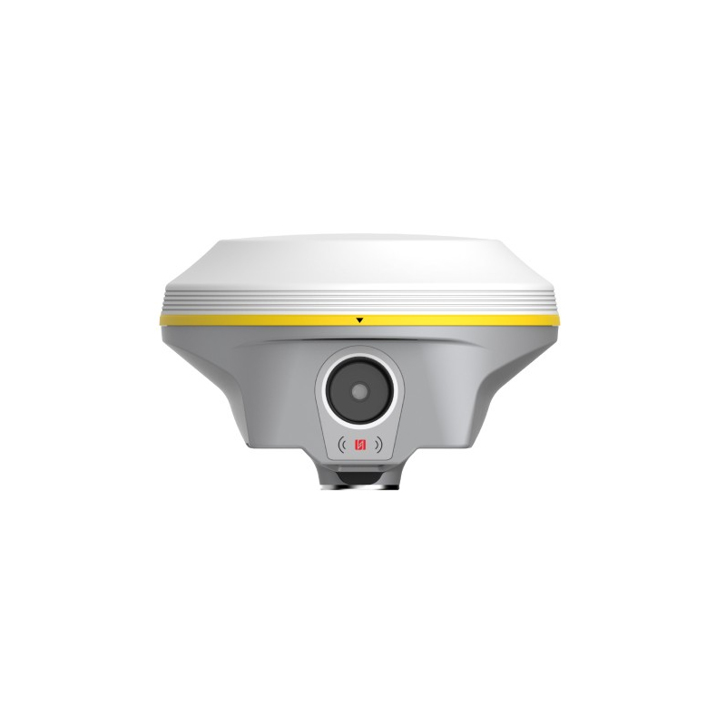
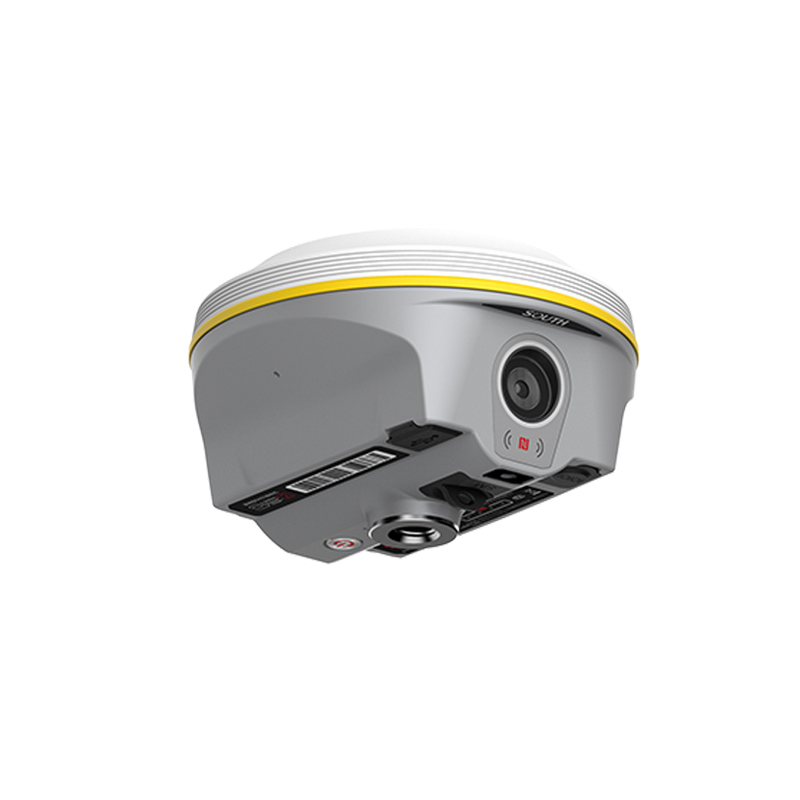
4.Built-in High-definition Camera:
1.The main unit is equipped with a high-definition camera, which can be used for photography and post-processing modeling, making it a powerful tool for aerial survey repairs and measurements. It also supports joint operations with drones to capture images in blind spots of drone shots, enabling refined 3D modeling.
5.Communication and Data Transmission:
1.Built-in radio antenna and integrated radio transceiver, supporting ultra-long-distance radio transmission. Additionally, it supports multiple wireless communication methods such as Wi-Fi, Bluetooth, and NFC, facilitating data transmission and device connection.
2.Equipped with a 4G full-network high-speed communication module, compatible with various CORS system accesses, ensuring continuous online operation of the main unit.
6.Intelligent Voice and Operation:
1.Adopts iVoice intelligent voice technology, supporting intelligent status announcements and voice operation prompts, with default support for multiple languages, convenient for users in different language environments.
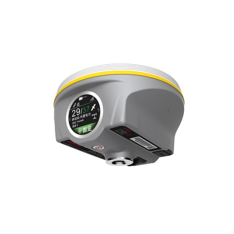
2.Equipped with a 1.39-inch circular color touchscreen with a resolution of 454×454, providing more intuitive and convenient user interaction.
7.High Protection Level and Durability:
1.INNO8 is made of magnesium alloy, with an IP68 protection level, resistant to 100% condensation, shockproof, and drop-resistant, suitable for various harsh environments.
Built-in 10000mAh high-performance lithium battery, supporting PD protocol fast charging, with long battery life to meet the needs of long-term operations.
Technological Innovation and Honors
1.Independent Innovation:
1.As the new flagship RTK of Southern Surveying and Mapping, INNO8 integrates multiple advanced technologies such as global instant fix technology, photogrammetric technology, and intelligent cloud AI algorithms, continuously enhancing the intelligence and efficiency of RTK operations.
2.The INNO8 DBD version positioning chip achieves signal reception and calculation for the pure BeiDou satellite navigation system, calculates pure BeiDou satellite frequencies, and features a purely domestic chip, ensuring safety, reliability, and independent controllability.
2.Honor and Certification:
1.INNO8 has passed expert evaluations and been recognized as an innovative product in surveying, mapping, and geographic information, being the only hardware product listed.
The INNO8 DBD version main unit has passed the safety, compliance, and functionality tests of the Ministry of Industry and Information Technology's DBD certification and has been included in the MIIT's DBD certification directory.
Application Scenarios
INNO8 is widely used in surveying and mapping, urban planning, construction, transportation planning, environmental monitoring, and other fields, providing high-precision, high-efficiency measurement solutions for these fields.
In summary, Southern INNO8 is a high-precision real-scene layout RTK product that integrates high-precision measurement, multi-constellation support, intelligent dynamic positioning, a built-in high-definition camera, multiple communication methods, intelligent voice and operation, as well as high protection level and durability. Its emergence provides a more intelligent, efficient, and measurement solution for surveying, mapping, and geographic information fields.
Industry Applications
The Southern INNO8, as the new flagship RTK product of Guangzhou Southern Surveying and Mapping Technology Co., Ltd., is widely used in multiple industries due to its advanced technology and multifunctionality. Here are some major applicable industries:
Surveying and Geomatics Industry:
● The INNO8 integrates GNSS positioning technology, inertial navigation measurement technology, and photogrammetric technology, enabling high-precision and efficient surveying operations.
● It can collaborate with drones to capture images in blind spots that drones cannot reach, achieving detailed 3D modeling and providing strong technical support for the surveying and geomatics industry.
Construction Engineering Industry:
● In projects such as road construction, earthwork construction, excavation measurement, and building measurement, the INNO8 can quickly and accurately obtain target point coordinates, enabling non-contact measurement and greatly improving the efficiency and accuracy of construction measurements.
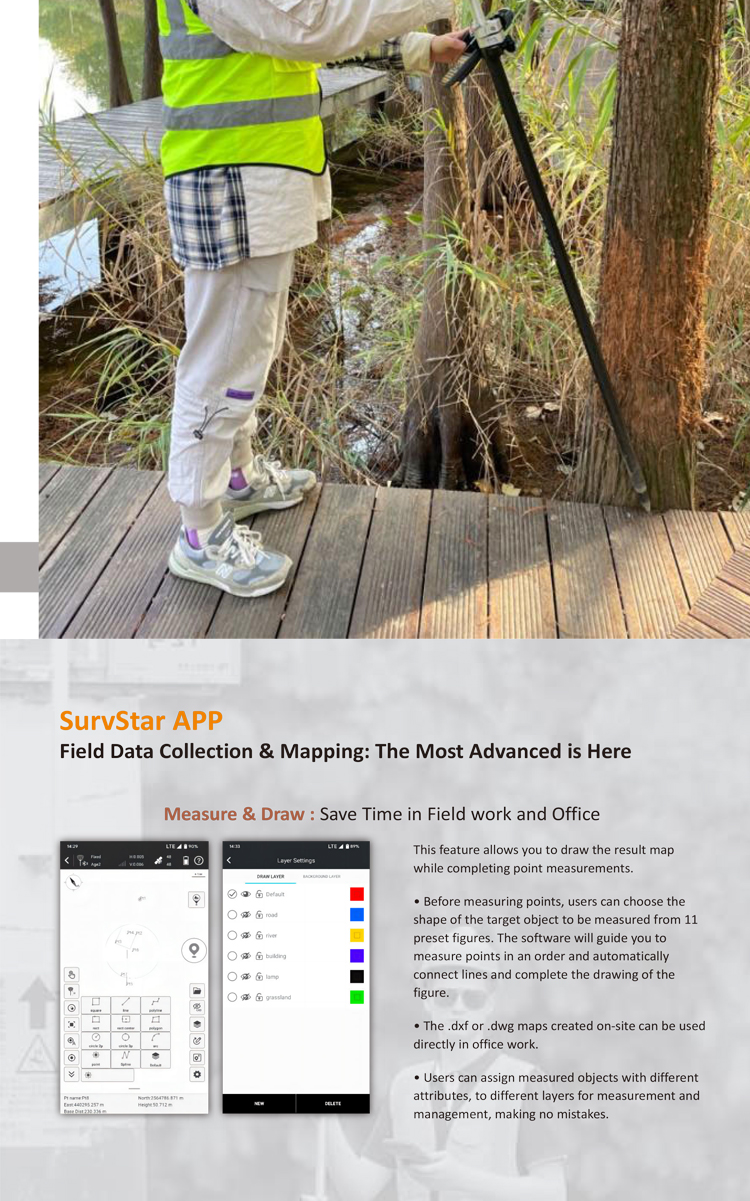
● Its built-in SurveyMap software addresses data processing and mapping challenges for engineers, enhancing data processing and map output efficiency in construction measurements.
Geological Disaster Monitoring and Prevention:
● The high-precision positioning capability and real-time data transmission function of the INNO8 make it play an important role in geological disaster monitoring.
● By regularly or continuously monitoring the displacement changes of geological disaster risk points, it can provide a scientific basis for early warning and prevention of geological disasters.
Transportation and Infrastructure Construction:
● In transportation and infrastructure construction, such as rail transit, bridges, and tunnels, the INNO8 can perform precise monitoring and measurement to ensure engineering quality and safety.
● Its powerful data processing and 3D modeling capabilities can provide comprehensive technical support for the planning, design, construction, and maintenance of transportation and infrastructure.
Agriculture and Land Resource Management:
● The INNO8 can be used in fields such as farmland planning, land resource surveys, and crop growth monitoring.
● By obtaining precise location and area information of farmland, it can provide a scientific basis for agricultural production and land resource management.
Environmental Protection and Ecological Monitoring:
● In the field of environmental protection and ecological monitoring, the INNO8 can be used to monitor changes in ecosystems such as forests, wetlands, and water sources.
● Through high-precision positioning and real-time data transmission, it can promptly identify issues in the ecological environment and take corresponding protective measures.
In summary, the Southern INNO8, with its high precision, high efficiency, multifunctionality, and ease of operation, plays a crucial role in multiple industries including surveying and geomatics, construction engineering, geological disaster monitoring and prevention, transportation and infrastructure construction, agriculture and land resource management, as well as environmental protection and ecological monitoring.
Logistics information


Logistics information
technical parameter
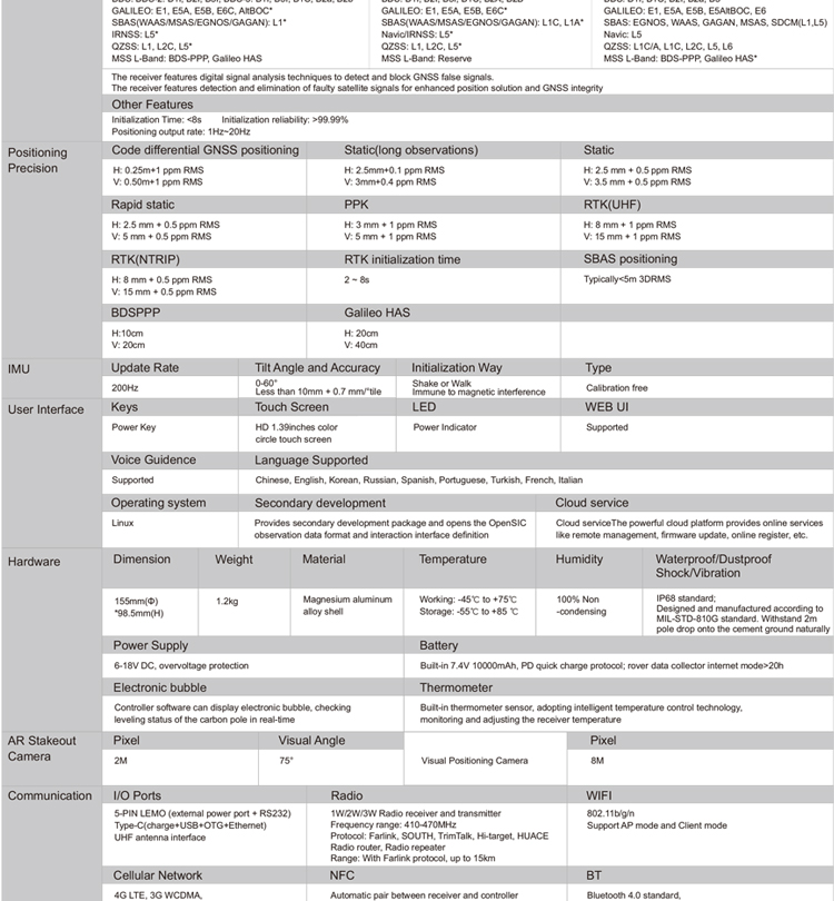
| GNSS Features | Channels | 1598 |
| GPS | L1C/A, L2C, L2P, L5 | |
| GLONASS | L1C/A,L1P,L2C/A,L2P,L3* | |
| BDS | BDS-2: B1I, B2I, B3I BDS-3: B1I, B3I, B1C, B2a, B2b* | |
| GALILEO | E1, E5A, E5B, E6C, AltBOC* | |
| SBAS(WAAS/MSAS/EGNOS/GAGAN) | L1C/A, L5* | |
| IRNSS | L5* | |
| QZSS | L1, L2C, L5* | |
| MSS L-Band | BDS-PPP | |
| Positioning output rate | 1Hz~20Hz | |
| Initialization time | < 10s | |
| Initialization reliability | > 99.99% | |
| Positioning Precision | Code differential GNSS | Horizontal: 0.25 m + 1 ppm RMS Vertical: 0.50 m + 1 ppm RMS |
| Static(long observations) | Horizontal: 2.5 mm + 0.1 ppm RMS Vertical: 3 mm + 0.4 ppm RMS | |
| Static | Horizontal: 2.5 mm + 0.5 ppm RMS Vertical: 3.5 mm + 0.5 ppm RMS | |
| Rapid static | Horizontal: 2.5 mm + 0.5 ppm RMS Vertical: 5 mm + 0.5 ppm RMS | |
| PPK | Horizontal: 3 mm + 1 ppm RMS Vertical: 5 mm + 1 ppm RMS | |
| RTK(UHF) | Horizontal: 8 mm + 1 ppm RMS Vertical: 15 mm + 1 ppm RMS | |
| RTK(NTRIP) | Horizontal: 8 mm + 0.5 ppm RMS Vertical: 15 mm + 0.5 ppm RMS | |
| RTK initialization time | 2-8s | |
| SBAS positioning | Typically < 5m 3DRMS | |
| IMU | Less than 10mm + 0.7 mm/° tilt to 30° | |
| IMU tilt angle | 0° ~ 60° | |
| Hardware Performance | Dimension | 155mm(φ)×98.5mm(H) |
| Weight | 1.2kg (battery included) | |
| Material | Magnesium aluminum alloy shell | |
| Operating temperature | -45℃ ~ +65℃ | |
| Storage temperature | -45℃ ~ +85℃ | |
| Humidity | 100% Non-condensing | |
| Waterproof/Dustproof | IP68 standard, protected from long time immersion to depth of 1m | |
| IP68 standard, fully protected against blowing dust | ||
| Shock/Vibration | Withstand 2 meters pole drop onto the cement ground naturally | |
| Power consumption | 2W | |
| Power supply | 6-28V DC, overvoltage protection | |
| Battery | 7.4V 3400mAh x 2 rechargeable, removable Li-ion battery | |
| Battery life(Dual-battery) | 15h(Rover Bluetooth mode) | |
| WIFI | Modem | 802.11 b/g standard |
| WIFI hotspot | AP mode, Receiver broadcasts its hotspot form web UI accessing with any mobile terminals | |
| WIFI datalink | Client mode, Receiver can transmit and receive correction data stream via WiFi datalink | |
| Communications | I/O Port | 5-PIN LEMO external power port + RS232 |
| 7-PIN LEMO(USB, OTG and Ethernet) | ||
| 1 PPS data interface | ||
| SIM card slot(standard) | ||
| Internal UHF | Receiver and transmitter 1/2/3W (Just receiver 0.01W for Russia) | |
| Frequency range | 410 - 470MHz | |
| Communication protocol | Farlink, Trimtalk450s, SOUTH, HUACE, ZHD | |
| Communication range | Typically 10km with Farlink protocol | |
| Cellular mobile network | 4G network communication module | |
| Bluetooth | BLEBluetooth 4.0 standard, Bluetooth 2.1 + EDR | |
| NFC Communication | Realizing close range (shorter than 10cm) automatic pair between receiver and controller (controller requires NFC wireless communication module else) | |
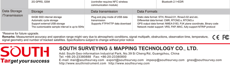
| Data Storage/Transmission | Storage | 16GB SSD |
| Automatic cycle storage (The earliest data files will be removed automatically while the memory is not enough) | ||
| Support external USB storage | ||
| Data transmission | Plug and play mode of USB data transmission | |
| Supports FTP/HTTP data download | ||
| Data format | Static data format: STH, Rinex2.01, Rinex3.02, etc. | |
| Differential format: CMR(GPS only), CMR+(GPS only), RTCM 2.3, RTCM 3.0, RTCM 3.1, RTCM 3.2 | ||
| Navigation data format: NMEA 0183, PJK, Binary code | ||
| Network model support: VRS, FKP, MAC, fully support NTRIP protocol | ||
| Sensors | Electronic bubble | Controller software can display electronic bubble, checking leveling status of the carbon pole in real-time |
| IMU | Built-in IMU module, calibration-free and immune to magnetic interference | |
| Thermometer | Built-in thermometer sensor, adopting intelligent temperature control technology, monitoring and adjusting the receiver temperature | |
| User Interaction | Operating system | Linux |
| Buttons | Single button | |
| Indicators | 4 color LED indicators, Battery indicator | |
| Web interaction | With the access of the internal web interface management via WiFi or USB connection, users are able to monitor the receiver status and change the configurations freely | |
| Voice guidance | It provides status and operation voice guidance, and supports Chinese/English/Korean/Spanish/Portuguese/Russian/Turkish | |
| Secondary development | Provides secondary development kit, and opens the OpenSIC observation data format and interaction interface definition | |
| Cloud service | The powerful cloud platform provides online services like remote manage, firmware update, online register and etc. |