01
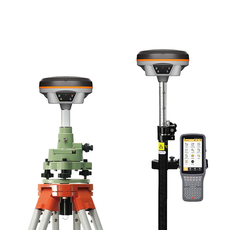

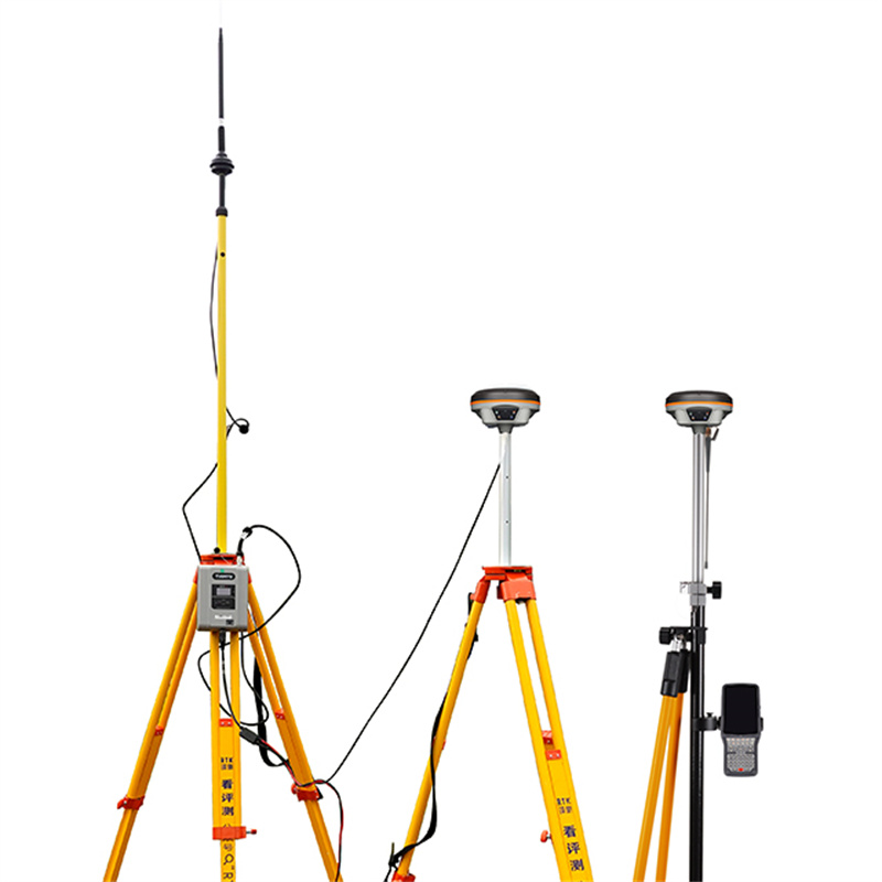

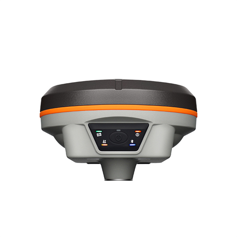


South Galaxy G2 GPS RTK With 1598 Channels Full Signal Tracking RTK Receiver Galaxy G2 Land Surveying GNSS RTK
the parameters of the Southern Mapping Pole RTK
1. Basic parameters
Brand: Southern Surveying and Mapping
Model: Pole RTK
Satellite tracking: with 965 channels, support five-star sixteen-frequency signal tracking, can receive 50 + stars instantaneously. At the same time, it supports the north three satellites and QZSS satellites, with strong signal and strong anti-interference ability.
Weight: The equipment is designed to be light and suitable for field operations.
Duration: built-in 6800mAh high-performance lithium battery, support 18 hours long battery life. It supports Type-C + PD flash charging, which can meet the operation requirements of one day after charging for one hour. It also supports charging treasure charging to meet the operation requirements of higher intensity.
Network communication: Support 4G network communication.
2. Accuracy parameters
Static accuracy: plane accuracy is (2.5mm +0.5 × 10⁻⁶D), elevation accuracy is (5mm +0.5 × 10⁻⁶D)(D is the measured baseline length, in mm).
Dynamic accuracy: plane accuracy is (8mm +1 × 10⁻⁶D), elevation accuracy is (15mm +1 × 10⁻⁶D)(D is the measured baseline length, in mm).
3. Environmental parameters
Operating temperature: The device can operate in a wide temperature range of -45°C +75°C (or -25°C +65°C, different models or versions may vary).
Storage temperature: Performance is not affected when the device is stored in the temperature range of -55°C +85°C (or -35°C +80°C, different models or versions may vary).
Humidity: 100% condensation resistance.
Protection level: IP68 level, with excellent waterproof and dustproof performance.
Shockproof: The equipment is sturdy in design and can resist 2 meters of falling with the pole to ensure stability and reliability in harsh environments.
4. Other features
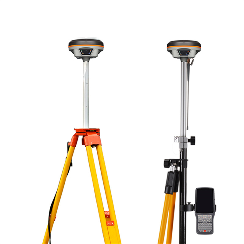
Built-in IMU inertial measurement sensor: It can automatically correct the coordinates according to the tilt direction and angle of the centering rod, without centering, point-to-point measurement.
Electronic bubble: Handbook software can display electronic bubble, real-time check the leveling of the centering rod.
Temperature sensor: built-in temperature sensor, using intelligent temperature control technology, real-time monitoring and adjustment of the host temperature.
Built-in tilt attitude module: it can always interpret the attitude information of the host, and can accurately judge and remind when the base station moves and topples.
Data transmission: Support USB, FTP download, HTTP data transmission and other data transmission methods.
Initialization time: less than 10 seconds (or 5 seconds initialization, different models or versions may be different), can quickly enter the working state.
Positioning output frequency: 1Hz ~ 20Hz, to meet the needs of high-precision measurement.
5. Application sites
The equipment is suitable for engineering survey, land surveying and mapping, forestry survey, environmental monitoring and other fields, and can provide high-precision and high-efficiency measurement solutions.
Please note that the above parameters may vary depending on the product model, version update or different sales channels. When purchasing or using, please be sure to refer to the latest product manual provided by the official or consult the official customer service to obtain the most accurate information.
Product Features
High precision positioning:
Equipped with a new Beidou high-precision SoC positioning chip to ensure the accuracy and reliability of measurement data.
Support the whole constellation full frequency points, especially including the Beidou-3 satellite system, to provide more extensive and stable satellite signal coverage, enhance positioning accuracy and stability.
Multi-Channel Design:
The built-in 1598 channel means that the receiver can track and process a large number of satellite signals at the same time, thereby improving positioning speed and accuracy, especially in complex environments.
Efficient Endurance:
Adopt Type-C speed flash charging technology to support fast charging and reduce waiting time.
The battery life is up to 18 hours, which meets the needs of long-term field operations and reduces the trouble of frequent charging.
Advanced Measurement Systems:
Equipped with a new generation of inertial navigation measurement system, combined with GNSS positioning technology, to provide a more convenient and efficient measurement experience. The inertial navigation system can continue to provide position information through the built-in inertial navigation element when the satellite signal is poor or interrupted, ensuring the continuity and accuracy of the measurement.
Other Features:
The product may also have other advanced features, such as CAD lofting support, intelligent interactive interface, portable design, etc., which together enhance the ease of use and practicality of the product.
South Galaxy G2 GPS RTK full signal tracking RTK receiver is the 1 land survey GNSS RTK device that integrates high-precision positioning, multi-channel design, efficient endurance and advanced measurement system. It can meet the needs of high-precision measurement in complex environments, and provide reliable technical support for engineering measurement, topographic mapping, agricultural surveying and mapping and other fields.
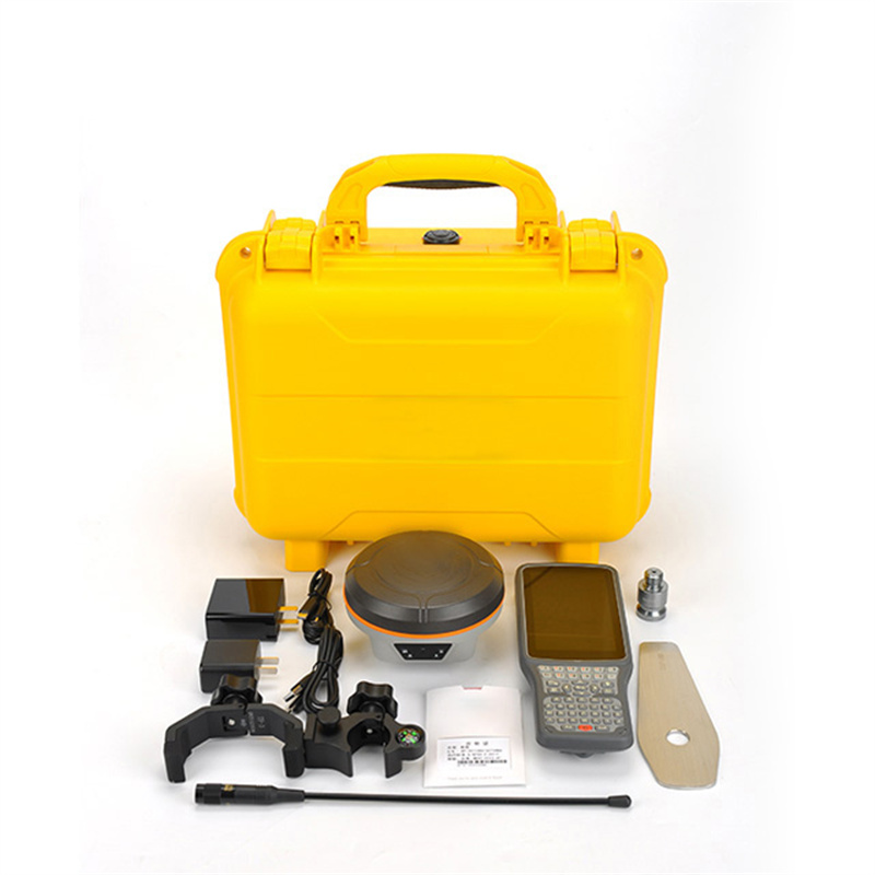
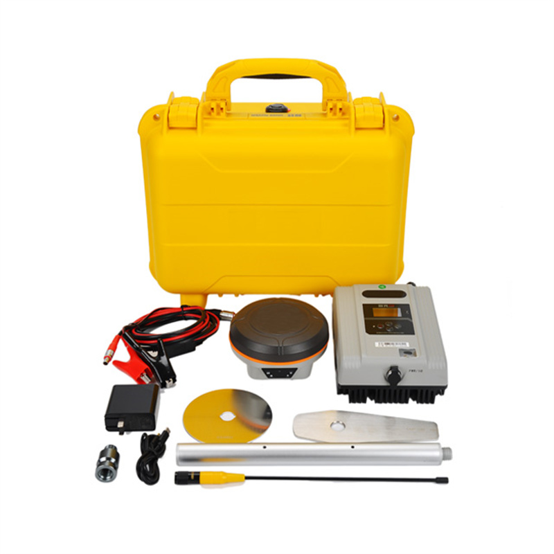
Logistics information


Logistics information
technical parameter
| GNSS Features | Channels | 1598 |
| GPS | L1C/A, L2C, L2P, L5 | |
| GLONASS | L1C/A,L1P,L2C/A,L2P,L3* | |
| BDS | BDS-2: B1I, B2I, B3I BDS-3: B1I, B3I, B1C, B2a, B2b* | |
| GALILEO | E1, E5A, E5B, E6C, AltBOC* | |
| SBAS(WAAS/MSAS/EGNOS/GAGAN) | L1C/A, L5 (Just for the satellites supporting L5) | |
| IRNSS | L5* | |
| QZSS | L1, L2C, L5* | |
| MSS L-Band | BDS-PPP | |
| Positioning output rate | 1Hz~20Hz | |
| Initialization time | < 10s | |
| Initialization reliability | > 99.99% | |
| Positioning Precision | Code differential GNSS | Horizontal: 0.25 m + 1 ppm RMS Vertical: 0.50 m + 1 ppm RMS |
| Static(long observations) | Horizontal: 2.5 mm + 0.1 ppm RMS Vertical: 3 mm + 0.4 ppm RMS | |
| Static | Horizontal: 2.5 mm + 0.5 ppm RMS Vertical: 3.5 mm + 0.5 ppm RMS | |
| Rapid static | Horizontal: 2.5 mm + 0.5 ppm RMS Vertical: 5 mm + 0.5 ppm RMS | |
| PPK | Horizontal: 3 mm + 1 ppm RMS Vertical: 5 mm + 1 ppm RMS | |
| RTK(UHF) | Horizontal: 8 mm + 1 ppm RMS Vertical: 15 mm + 1 ppm RMS | |
| RTK(NTRIP) | Horizontal: 8 mm + 0.5 ppm RMS Vertical: 15 mm + 0.5 ppm RMS | |
| RTK initialization time | < 10s | |
| SBAS positioning | Typically < 5m 3DRMS | |
| IMU | Less than 10mm + 0.7 mm/° tilt to 30° | |
| IMU tilt angle | 0° ~ 60° | |
| Hardware Performance | Dimension | 130.5mm(φ)× 84mm(H) |
| Weight | 840g (battery included) | |
| Material | Magnesium aluminum alloy shell | |
| Operating temperature | -45℃ ~ +65℃ | |
| Storage temperature | -45℃ ~ +85℃ | |
| Humidity | 100% Non-condensing | |
| Waterproof/Dustproof | IP68 standard, protected from long time immersion to depth of 1m | |
| IP68 standard, fully protected against blowing dust | ||
| Shock/Vibration | Withstand 2 meters pole drop onto the cement ground naturally | |
| Power consumption | 4W | |
| Power supply | 6-28V DC, overvoltage protection | |
| Battery | Built-in 7.4 V 6800mAh rechargeable Lithium-ion battery | |
| Battery life(Dual-battery) | 16h (static mode) 10h (internal UHF base mode) 12h (rover mode) | |
| WIFI | Modem | 802.11 b/g standard |
| WIFI hotspot | AP mode, Receiver broadcasts its hotspot form web UI accessing with any mobile terminals | |
| WIFI datalink | Client mode, Receiver can transmit and receive correction data stream via WiFi datalink | |
| Communications | I/O Port | 5-PIN LEMO external power port + RS232 |
| 7-PIN LEMO(USB, OTG and Ethernet) | ||
| 1 PPS data interface | ||
| SIM card slot(standard) | ||
| Internal UHF | Receiver and transmitter 1/2/3W (Just receiver 0.01W for Russia) | |
| Frequency range | 410 - 470MHz | |
| Communication protocol | Farlink, Trimtalk450s, SOUTH, HUACE, ZHD | |
| Communication range | Typically 10km with Farlink protocol | |
| Cellular mobile network | 4G network communication module | |
| Bluetooth | BLEBluetooth 4.0 standard, Bluetooth 2.1 + EDR | |
| NFC Communication | Realizing close range (shorter than 10cm) automatic pair between receiver and controller (controller requires NFC wireless communication module else) | |
| Data Storage/Transmission | Storage | 16GB SSD |
| Automatic cycle storage (The earliest data files will be removed automatically while the memory is not enough) | ||
| Support external USB storage | ||
| Data transmission | Plug and play mode of USB data transmission | |
| Supports FTP/HTTP data download | ||
| Data format | Static data format: STH, Rinex2.01, Rinex3.02, etc. | |
| Differential format: CMR(GPS only), CMR+(GPS only), RTCM 2.3, RTCM 3.0, RTCM 3.1, RTCM 3.2 | ||
| Navigation data format: NMEA 0183, PJK, Binary code | ||
| Network model support: VRS, FKP, MAC, fully support NTRIP protocol | ||
| Sensors | Electronic bubble | Controller software can display electronic bubble, checking leveling status of the carbon pole in real-time |
| IMU | Built-in IMU module, calibration-free and immune to magnetic interference | |
| Thermometer | Built-in thermometer sensor, adopting intelligent temperature control technology, monitoring and adjusting the receiver temperature | |
| User Interaction | Operating system | Linux |
| Buttons | Single button | |
| Indicators | 3 color LED indicators, and Battery indicator | |
| Web interaction | With the access of the internal web interface management via WiFi or USB connection, users are able to monitor the receiver status and change the configurations freely | |
| Voice guidance | The intelligent voice technology provides status and operation voice guidance, supports Chinese/English/Korean/Spanish/Portuguese/Russian/Turkish | |
| Secondary development | Provides secondary development kit, and opens the OpenSIC observation data format and interaction interface definition | |
| Cloud service | The powerful cloud platform provides online services like remote manage, firmware update, online register and etc. |