


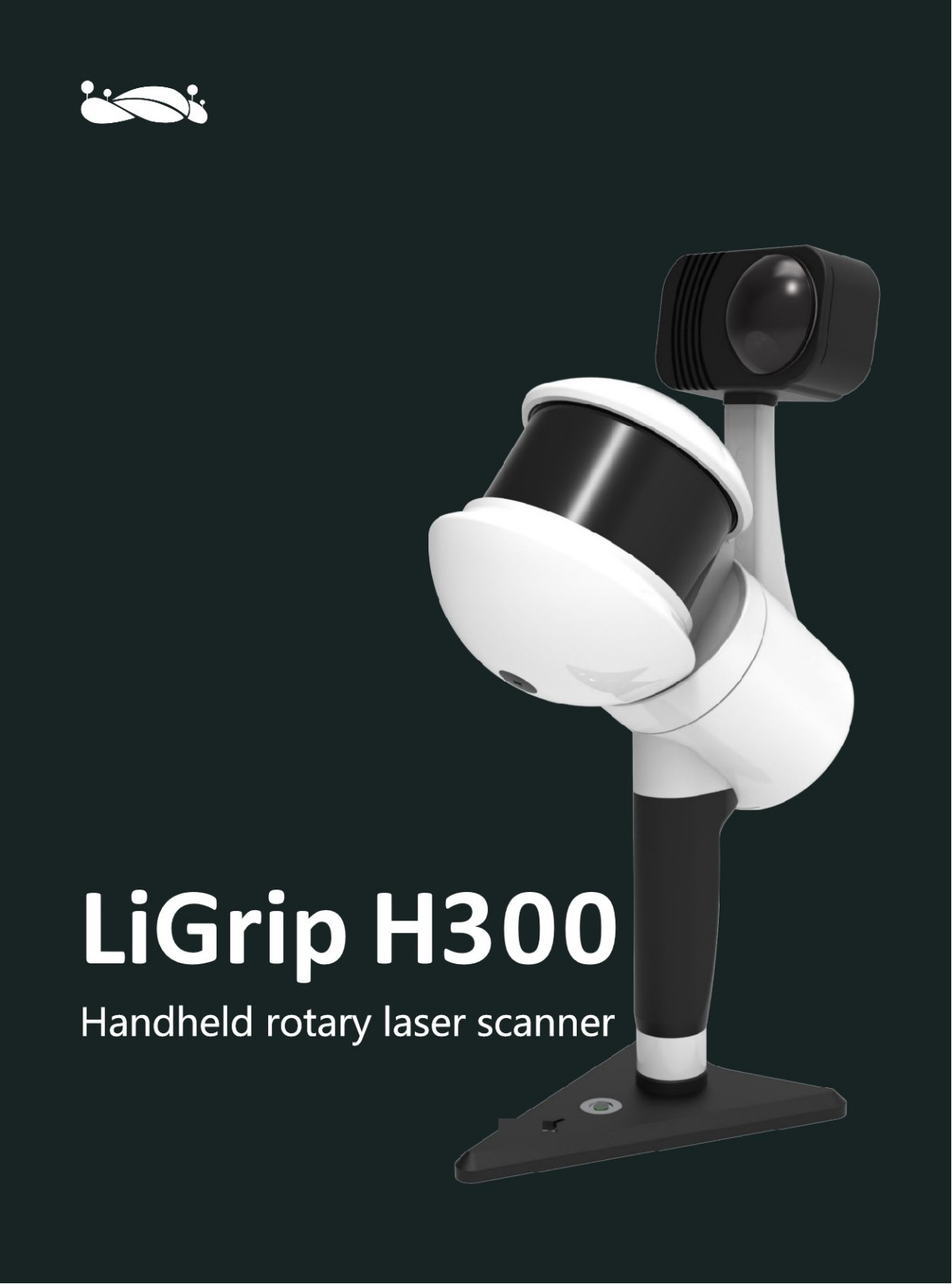
Outdoor Lidar 3D Scanning LiGrip H300 Handheld SLAM Rotary Laser Scanner for Survey Equipment Engineering
Product Introduction
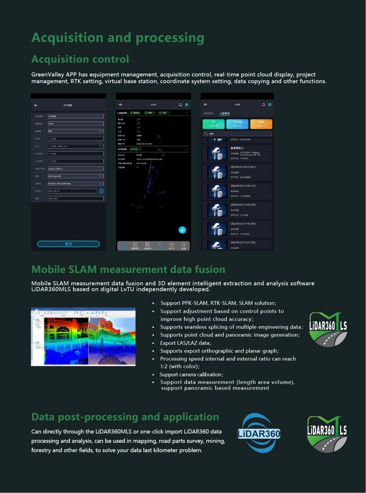
The LiGrip H300 handheld laser scanner is a 3D laser scanning device with outstanding performance and powerful functions. Here is a detailed evaluation of the product:
I. Product Design and Portability
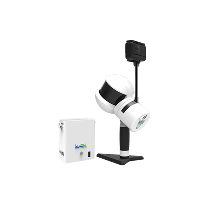
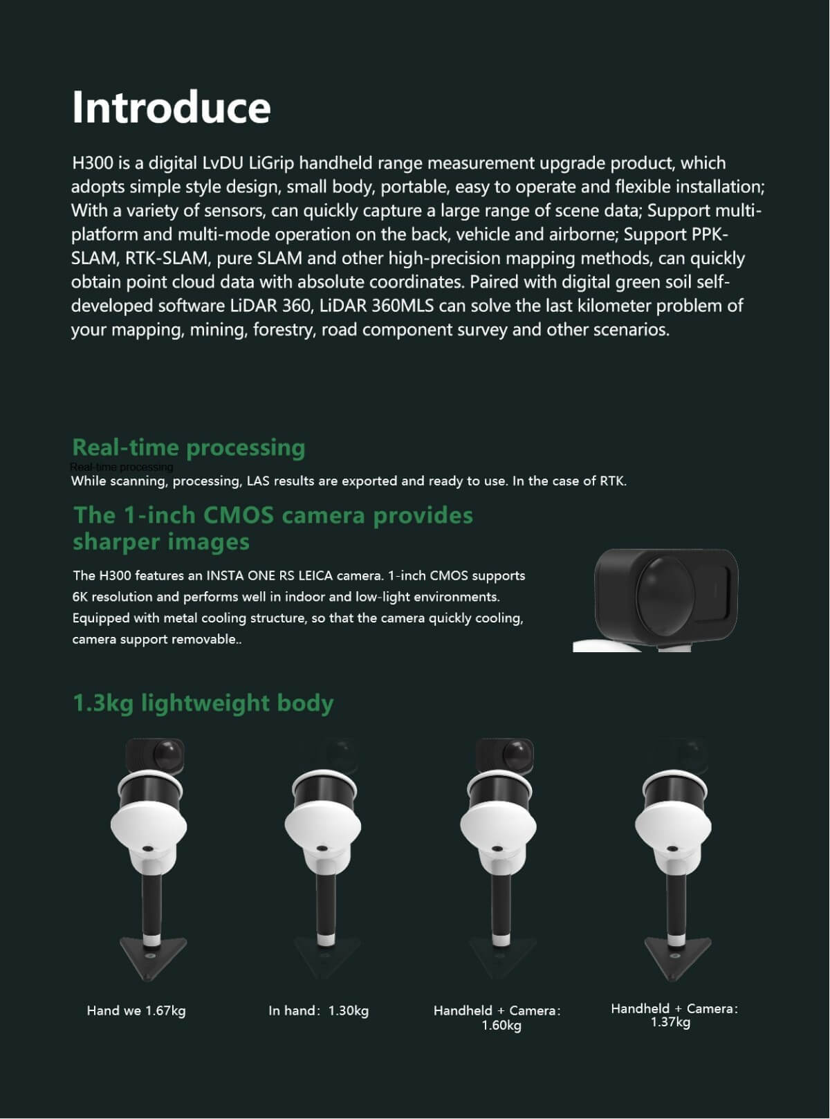
1.Minimalist Style: The LiGrip H300 adopts a minimalist design with a compact and lightweight body, weighing 1.3 kilograms when handheld (1.6 kilograms including the marking base and camera), making it easy to carry and operate.
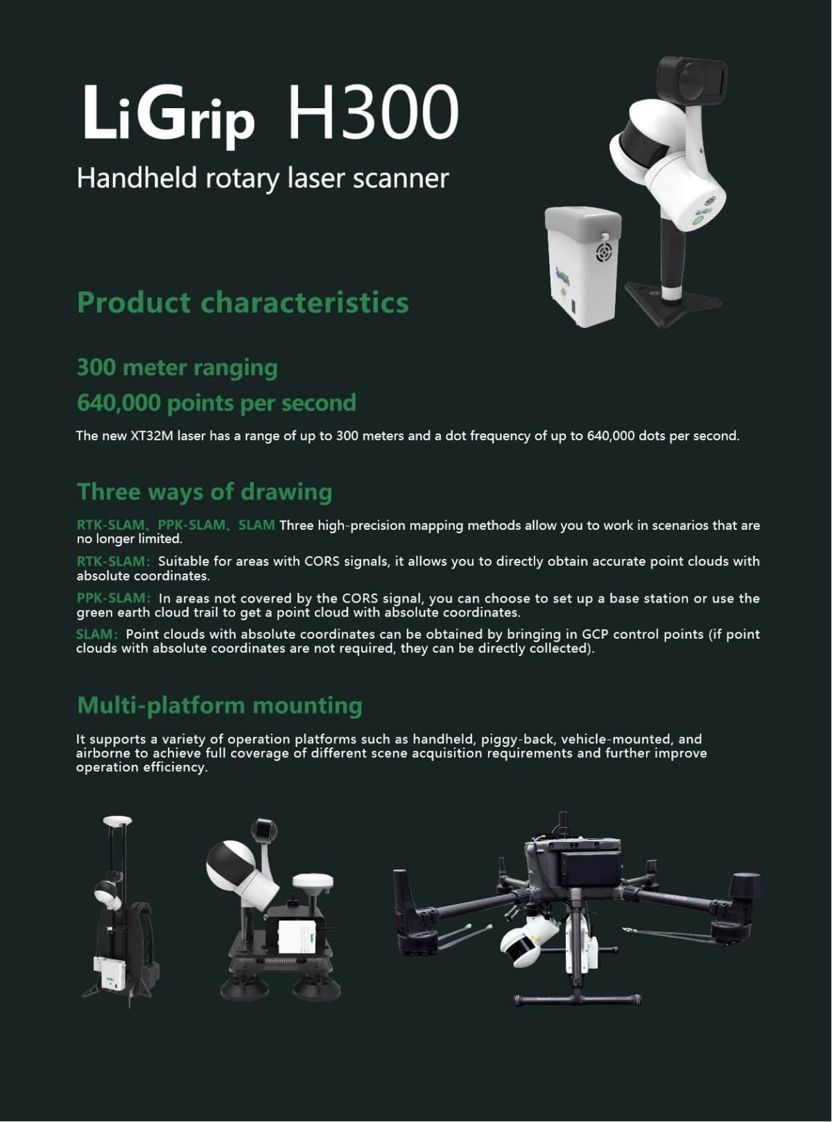
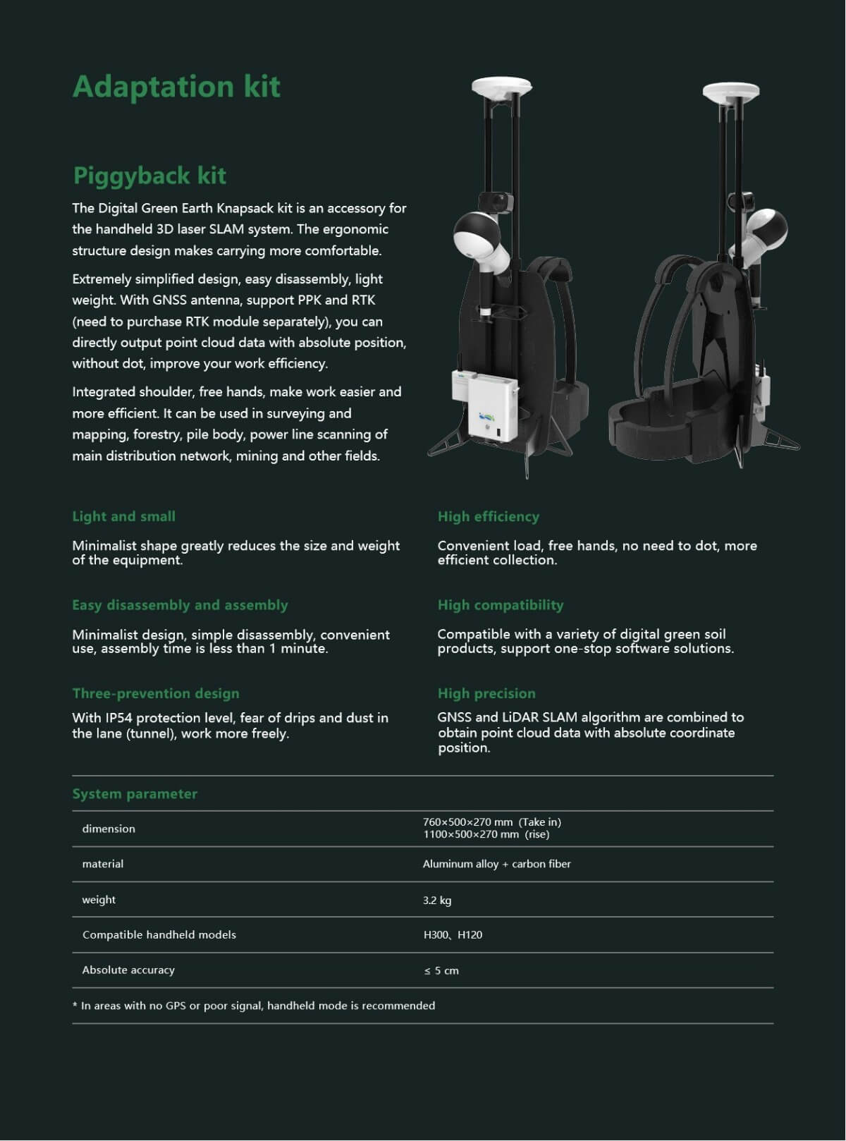
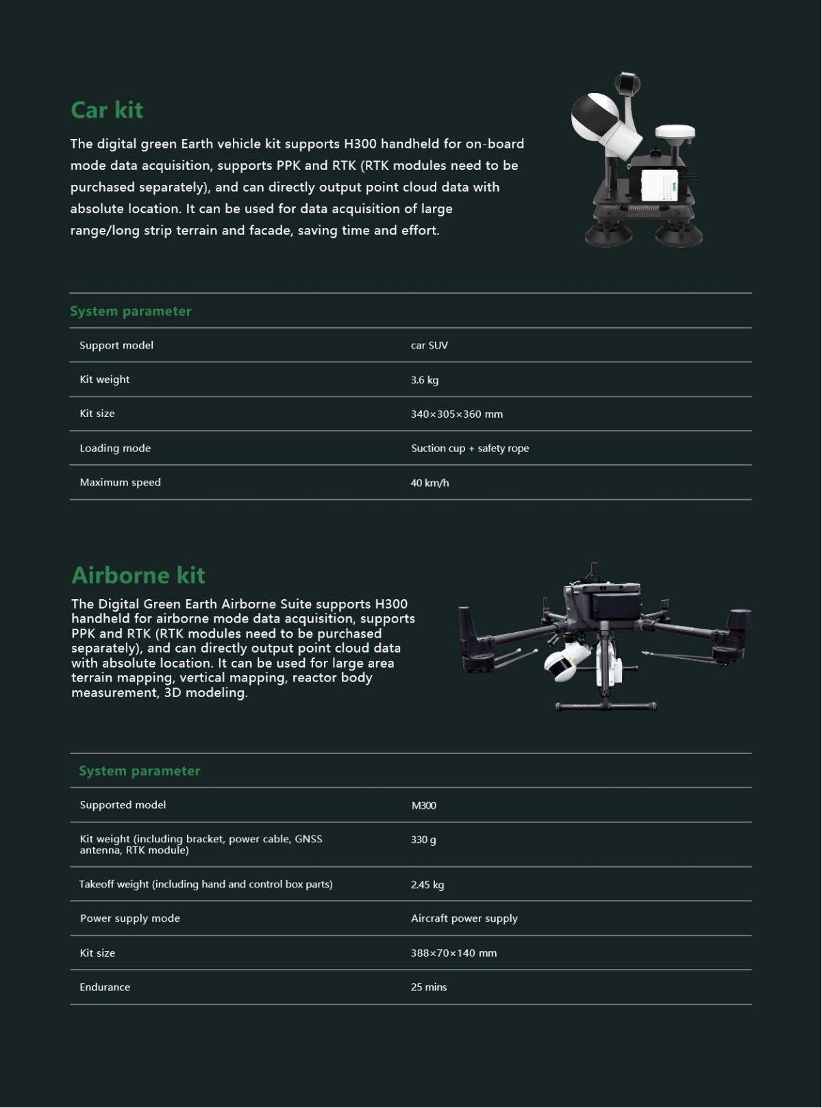
2.Flexible Installation: The product supports multiple installation methods, such as handheld, backpack-mounted, vehicle-mounted, and aircraft-mounted, catering to various collection needs in different scenarios.
II. Scanning Performance
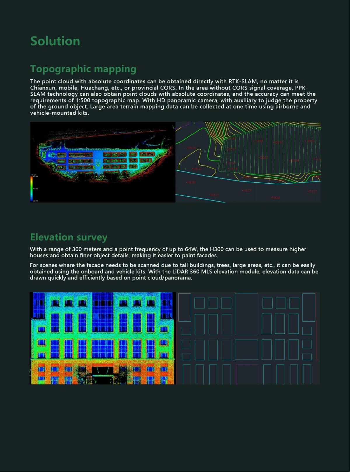
1.Long-Distance Ranging: Equipped with the new XT32M laser, the LiGrip H300 can measure distances up to 300 meters, making it suitable for large-area and long-distance scanning tasks.
2.High Point Frequency Scanning: With a point frequency of up to 640,000 points per second, it can quickly capture data from large-scale scenes, ensuring the precision and accuracy of the scanning results.
3.High-Precision Measurement: The LiGrip H300 offers an absolute accuracy of up to 5 centimeters, with even higher relative accuracy, meeting the requirements for high-precision surveying, mapping, and modeling.
III. Sensors and Imaging
1.Panoramic Camera: It is equipped with a 1-inch CMOS panoramic camera that supports 6K resolution, providing clear imaging and suitability for scanning tasks in indoor and low-light environments.
2.Multiple Sensors: Integrating multiple sensors, it can acquire various data from the scene in real time, enhancing the comprehensiveness and accuracy of the scanning results.
IV. Software and Data Processing
1.Proprietary Software Support: It supports Digital Green Soil's proprietary LiDAR 360 and LiDAR 360 MLS software, enabling rapid data processing and analysis, including automatic classification of point cloud data attributes and quick extraction of vector data.
2.Real-Time Processing: It supports data processing while scanning, with LAS outputs ready for immediate use, improving work efficiency.
V. Application Fields
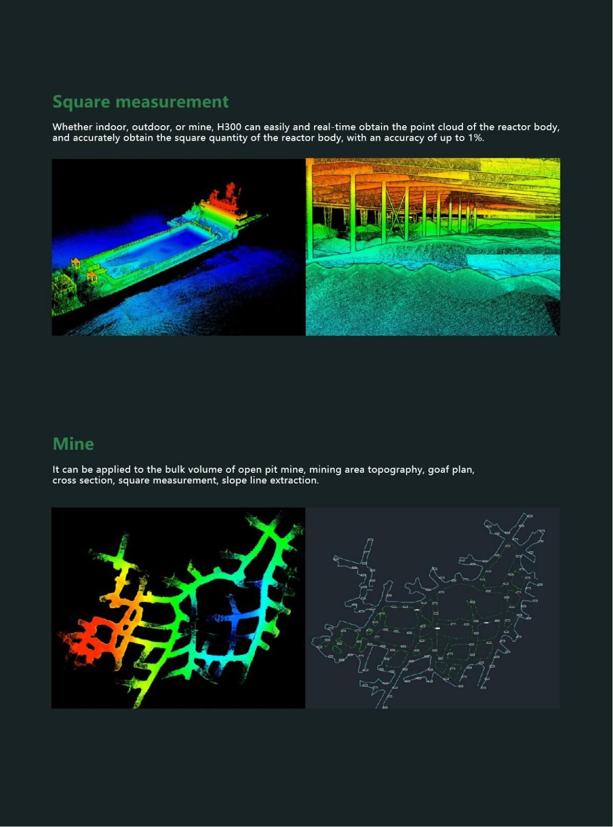
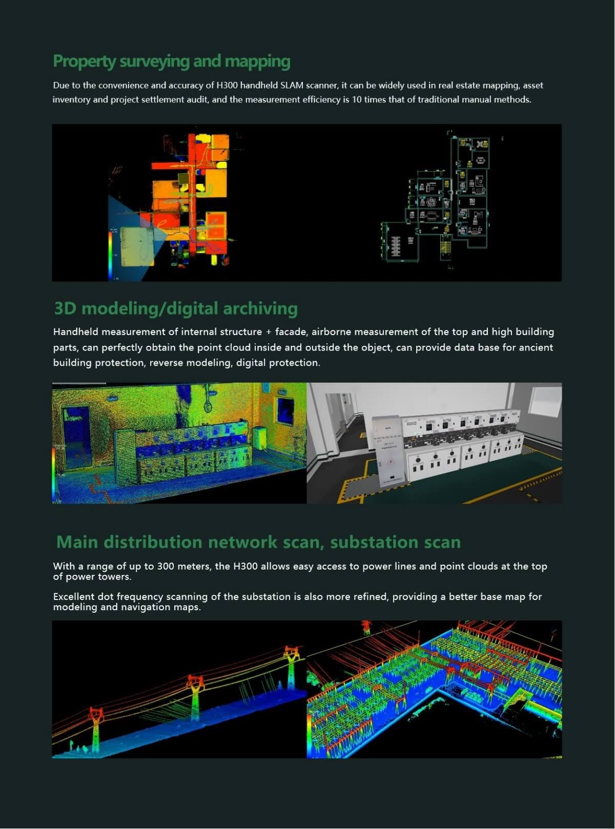
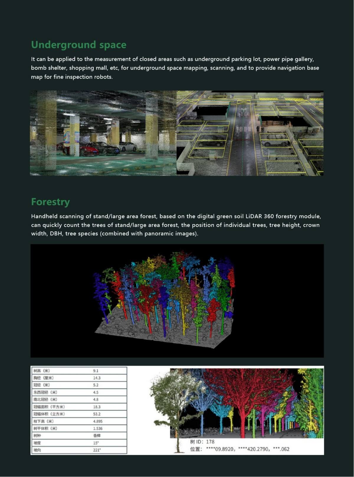
1.Wide Applicability: The LiGrip H300 can be applied in various fields such as surveying and mapping, mining, forestry, road component inventory, real estate surveying and mapping, 3D modeling, digital archiving, primary and secondary power grid scanning, substation scanning, and underground space surveying and mapping.
2.Specific Application Scenarios: It can be used for measuring the volume of piles, extracting topographic surveying and mapping data in mining areas, counting tree information in forests, conducting real estate surveying and mapping, and asset inventory.
VI. Other Features
1.Multiple Mapping Methods: It supports various high-precision mapping methods such as PPK-SLAM, RTK-SLAM, and pure SLAM, allowing for unrestricted operation scenarios.
2.High Protection Level: With an IP54 protection rating, it is suitable for various harsh environments.
3.Strong Battery Life: Each battery has a capacity of 5870mAh, providing up to 55 minutes of continuous scanning, meeting the needs of long-term scanning tasks.
In summary, the LiGrip H300 handheld laser scanner, with its excellent performance, powerful functions, and wide range of applications, has become a highly regarded 3D laser scanning device. Both professional surveyors and users in other fields can obtain efficient, accurate, and reliable scanning results from it.
Product Features
The detailed parameters of the LiGrip H300 handheld laser scanner are as follows:
I. Basic Parameters
●Handheld Size: 195mm×125mm×350mm
●Battery Box Size: 134mm×64.6mm×167mm
●Handheld Weight: 1.67kg (including marking base and camera)
●Voltage: 15.2V
●Storage Space: 512GB SSD
●Battery Capacity: 5870mAh
●Protection Level: IP54
●Ports: USB, Ethernet
II. LiDAR Parameters
●Laser Type: XT32M
●Scanning Frequency: 640,000 points/second
●Measurement Distance: Up to 300 meters
●LiDAR Accuracy: ≤1cm (under standard precision conditions and strict operational specifications)
●Scanning Field of View: 280°×360°
III. Camera Parameters
●Camera Type: INSTA ONE RS 1-inch Panoramic Edition
●CMOS Size: 1 inch
●Photo Resolution: 6528×3264
●Video Resolution: 6144×3072
●Camera Size: 95mm×60mm×55mm (including cooling structure)
●Supported Features: 6K resolution shooting, metal cooling structure, detachable
IV. RTK Module Parameters
●Satellite Systems: GPS+BDS+Glonass+Galileo+QZSS, supporting 5 constellations and 16 frequencies
●RTK Accuracy: 1cm+1ppm
●RTK Protocol: NTRIP protocol
●RTK Data Format: .rtk
●GNSS Raw Data Format: .log
●Size: 97mm×71mm×30mm
●Weight: 190g
V. Other Parameters
●Applicable Environments: Suitable for both indoor and outdoor scenarios
●Continuous Scanning Time: Up to 55 minutes
●Single Battery Operating Time: Approximately 3 hours (or 180 minutes)
●Device Operating Temperature: -20℃ to 40℃
●Device Storage Temperature: -40℃ to 70℃
●Battery Storage Temperature: Recommended storage temperature is 22℃ to 30℃
●Mapping Methods: Supports RTK-SLAM, PPK-SLAM, and pure SLAM real-time calculation
●Data Outcomes: Relative accuracy ≤1cm, absolute accuracy ≤5cm
●Point Cloud Formats: LAZ, LiData, etc.
In summary, the LiGrip H300 handheld laser scanner features high-performance LiDAR and camera modules, as well as a powerful RTK module, making it suitable for a variety of complex environments and application scenarios.
Logistics information


Logistics information