Is the Hi-Target V500 GNSS RTK Receiver Easy to Use?
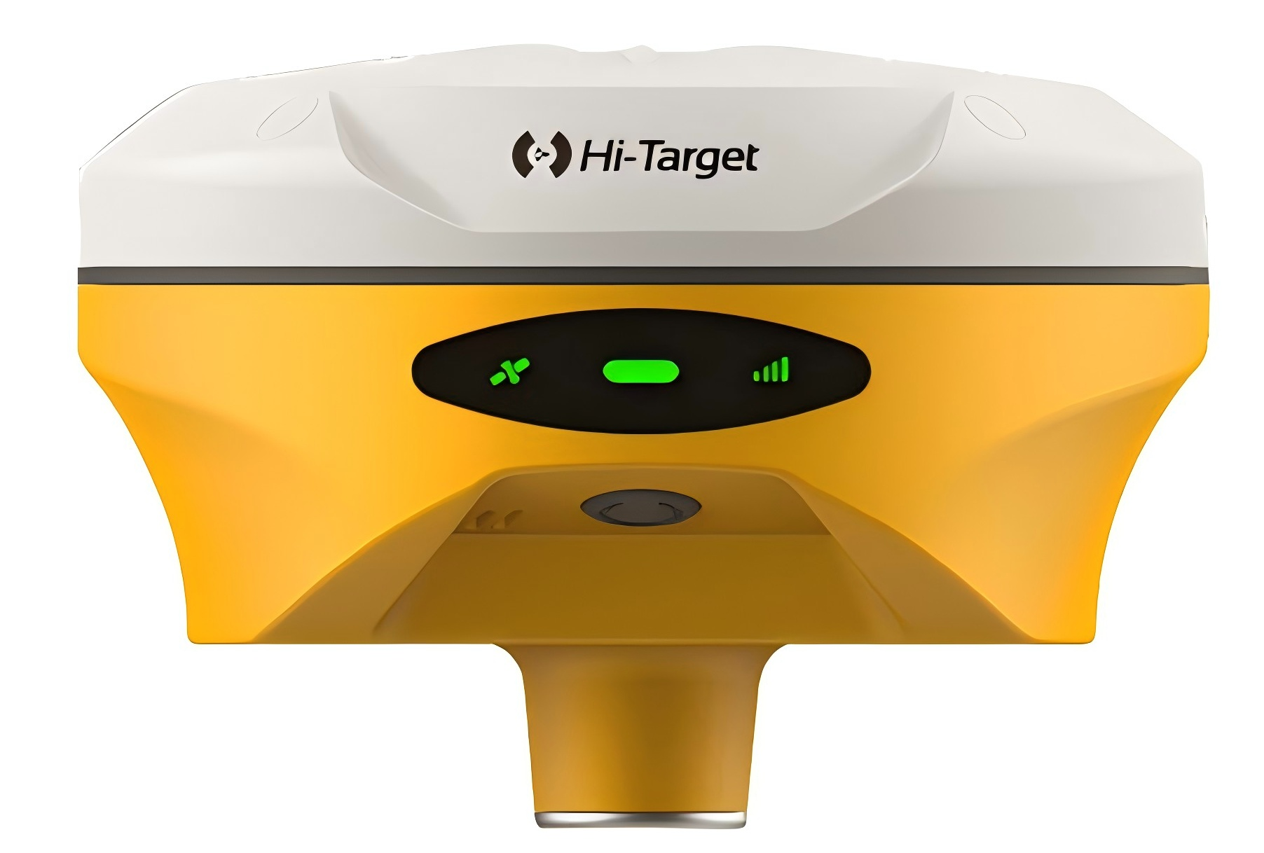
hi-target V500 GNSS RTK system
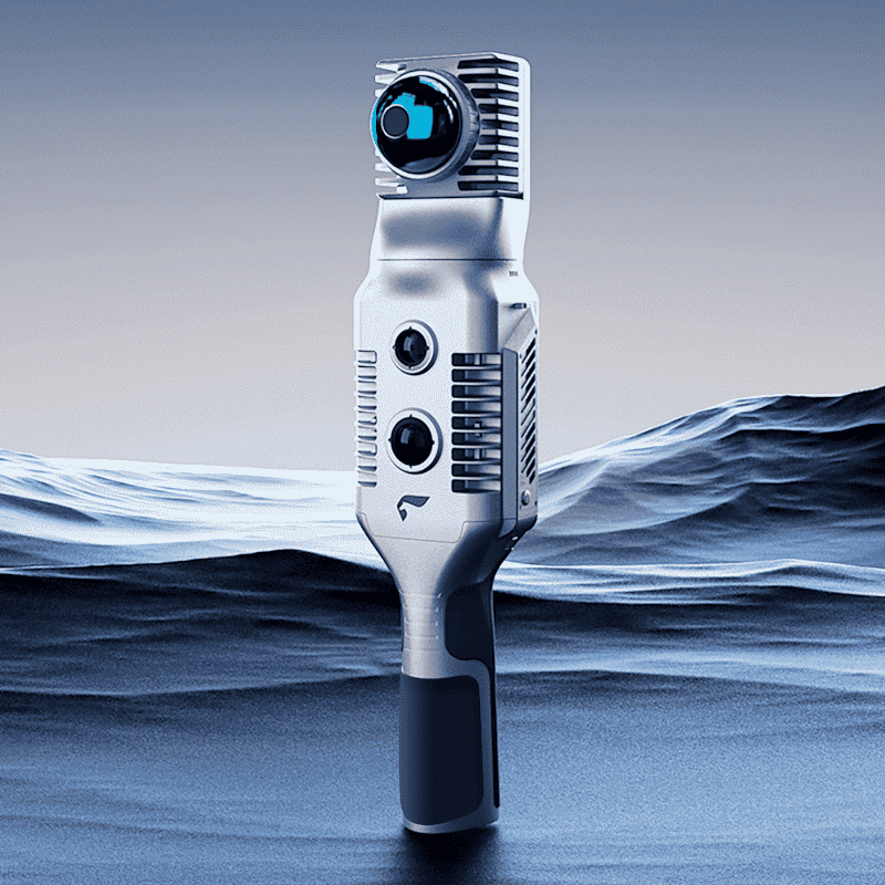
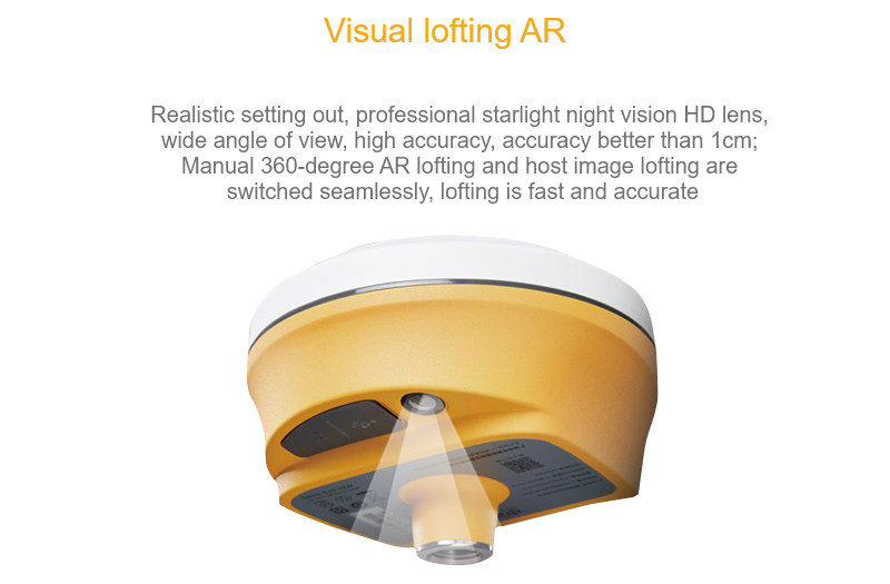
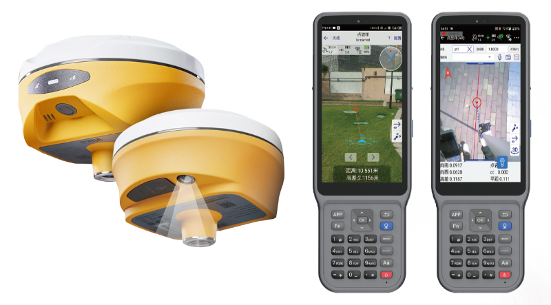
The V500 is equipped with a new upgraded HD starlight camera, which brings an excellent visual lofting experience in low light conditions. The compact and lightweight design makes it easier for users, and the 24-hour long battery life makes the V500 a viable and portable choice for surveyors and engineers
hi-target V500 GNSS RTK has better visual lofting experience
Visual positioning technology, can allow operators to easily find the lofting point. The combination of virtual and reality improves measurement efficiency by overlaying design files with real scenes.
Professional starlight night vision HD camera with wide angle has a very good performance
Built-in high-precision tilt measurement
-Based on the new generation of IMU, initialization is automatically performed at startup, and accurate coordinate data can be obtained without the GNSS receiver maintaining a horizontal state.
The performance is more stable, the results are more reliable, so that the measurement operation is more efficient and easier for the measurement engineer.
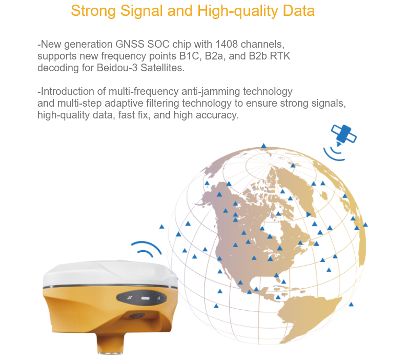
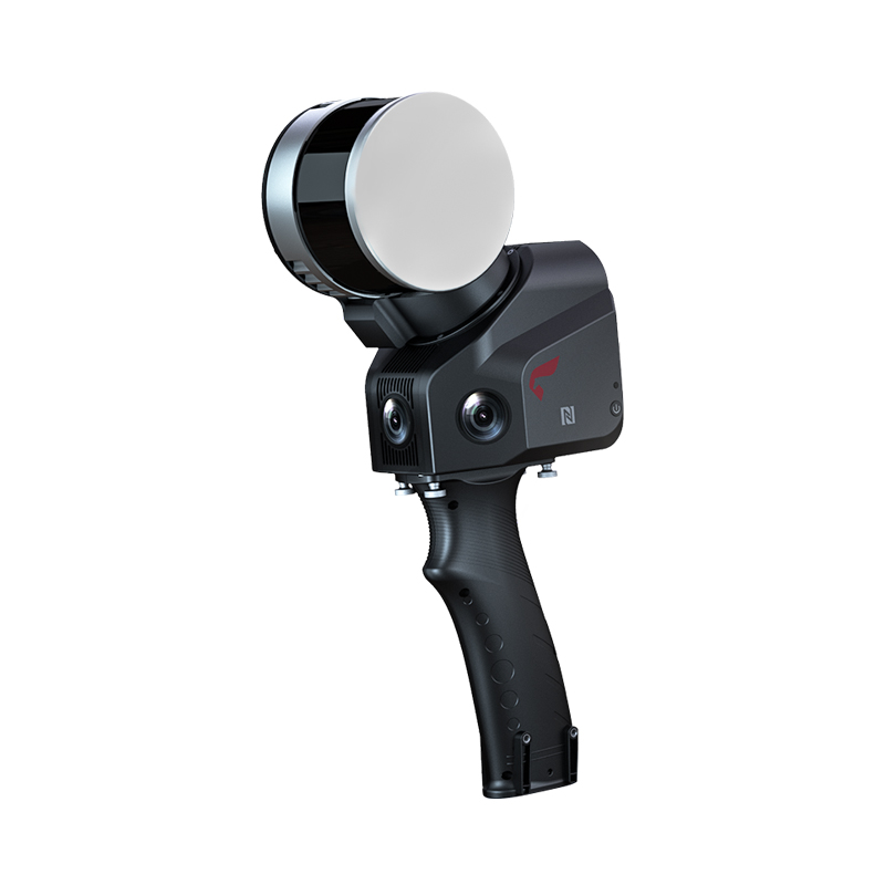
Full Constellation and Full Frequency
– Advanced GNSS SoC chip features 1408 channels, supporting new frequency points B1C, B2a, and B2b RTK decoding for Beidou-3 Satellites.
– Multi-frequency interference detection technology and multi-stage adaptive filtering technology with a strong signal, good data, fast fixed procedure, and high accuracy.
Regarding the RTK(Real Time Kinematic) measuring equipment of Zhonghaida V500, although the detailed information about V500 directly may be limited, we can infer its general characteristics and performance according to other product characteristics and industry trends of Zhonghaida brand. The following is a detailed analysis of the China Haida V500:
1. brand background
Zhonghaida (Guangzhou Zhonghaida Satellite Navigation Technology Co., Ltd.) is a leading satellite navigation and positioning technology solution provider in China, focusing on the research and development, manufacturing and application of high-precision positioning technology. Its products are widely used in surveying and mapping, agriculture, engineering, environmental monitoring and other fields, with high market awareness and good reputation.
Speculation of 2. product characteristics
High precision positioning:
As a product of China Haida brand, V500 is likely to have high-precision positioning function, support Beidou, GPS and other satellite navigation systems full constellation full band reception, to achieve centimeter-level or even millimeter-level positioning accuracy.
Quick Initialization:
Considering the development trend of modern RTK technology, V500 may adopt advanced initialization algorithms and technologies, which can realize rapid initialization in a short time and improve measurement efficiency.
Versatility:
V500 may integrate a variety of measurement functions, such as distance measurement, area measurement, angle measurement, etc., while supporting data recording, storage and export functions to facilitate user data management and analysis.
Portability:
As the 1 RTK measurement device, the V500 may have a lightweight and compact design that is easy to carry and operate. At the same time, it may also be equipped with a sturdy and durable shell and dust-proof and waterproof functions to adapt to various harsh working environments.
Intelligent operation:
V500 may adopt intelligent operating system and interface design, support touch screen operation, voice prompt and other functions, so that users can more easily carry out measurement operation and data management.
Long Endurance:
In order to meet the needs of long-term measurement, V500 may be equipped with high-capacity batteries and energy-saving technology to ensure that the equipment can still maintain stable performance during long-term operation.
3. Application Areas
China Haida V500 may be suitable for the following areas:
Engineering survey:
In road construction, bridge construction, tunnel excavation and other projects, V500 can provide high-precision measurement data to help engineers carry out accurate planning and design.
Agricultural Management:
V500 can play an important role in farmland planning, crop planting and soil monitoring, helping farmers to improve agricultural production efficiency and yield.
Environmental monitoring:
In the field of environmental monitoring, V500 can be used for topographic survey, water quality monitoring, air quality monitoring, etc., to provide strong technical support for environmental protection.
Urban Planning:
In urban planning, V500 can be used for urban spatial layout, transportation planning, public facilities construction and other aspects of the measurement and planning work.
4. Summary
Although there is limited specific information on the Zhonghaida V500, according to other product characteristics and industry trends of the Zhonghaida brand, we can speculate that the V500 may be the 1 RTK measuring device with high-precision positioning, fast initialization, versatility, portability, intelligent operation and long endurance. It is suitable for engineering measurement, agricultural management, environmental monitoring and urban planning, and can provide users with accurate and reliable measurement data and technical support.
Please note that the above content is only based on the speculation of existing information and industry trends, and the specific product characteristics and performance are subject to the official information released by China Haida.