
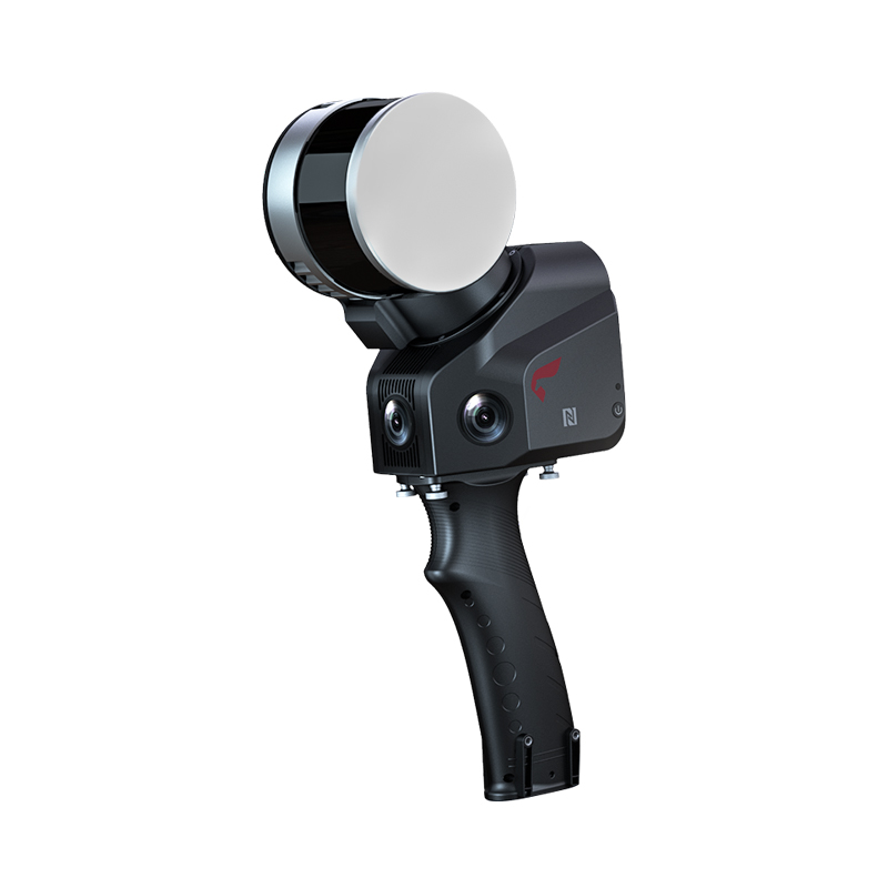
COMNAV N9 laser double-camera RTK: reshaping a new benchmark for high-precision mapping
COMNAV officially announced today that its latest flagship product-N9 laser dual camera RTK has been officially listed. As another masterpiece of COMNAV in the field of high-precision surveying and mapping, N9 laser dual-camera RTK integrates cutting-edge GNSS, IMU, laser and vision technologies, setting a new technical benchmark for the surveying and mapping industry.
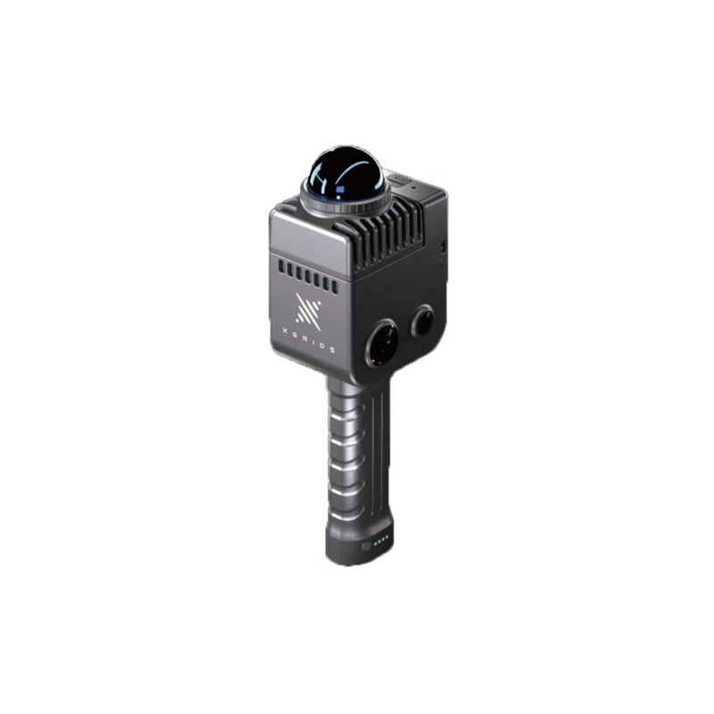
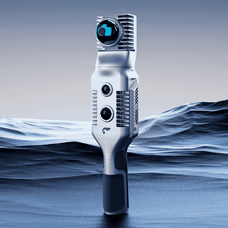
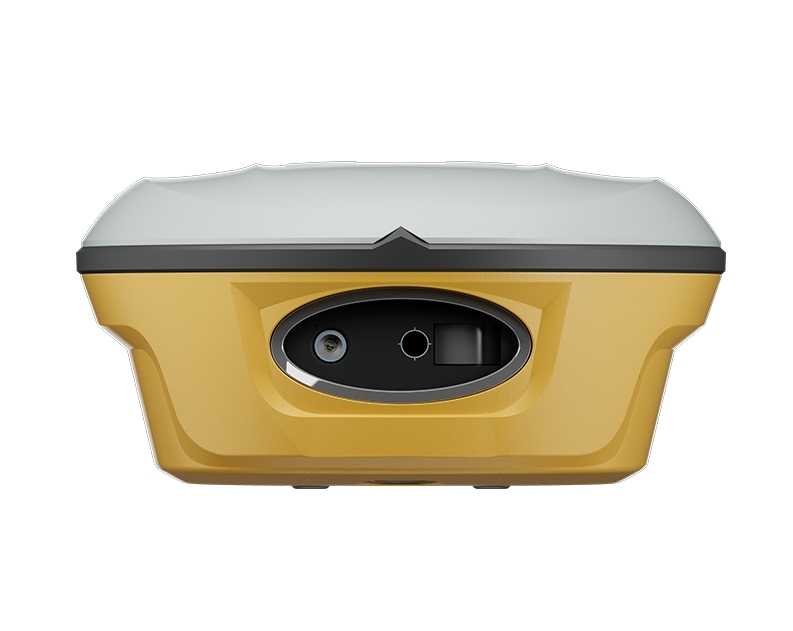
The N9 laser dual-camera RTK is another milestone product in the field of high-precision satellite navigation 1 COMNAV. It is equipped with a new laser visualization technology, which can display the position of the laser point and the real picture in real time, which greatly improves the intuitiveness and efficiency of surveying and mapping operations. The laser 3.0 module expands the maximum measurement radius to 50 meters, and the point position is clearly visible, which can be easily handled in complex environment or long-distance measurement.
In terms of hardware configuration, the N9 laser dual-camera RTK is equipped with a high-definition global low-light-level camera, which doubles the efficiency with dual-camera blessing. Professional-grade high-definition low-light-level lenses can refresh the lofting interface in real time with an accuracy better than 1cm, providing unprecedented accuracy for surveying and mapping operations. At the same time, the 360-degree AR lofting of the handbook and the host image lofting are seamlessly switched, bringing users an immersive lofting experience.
In addition, the N9 laser dual-camera RTK is also equipped with a full-protocol data transmission module, with a maximum transmission distance of up to 15 kilometers. This feature enables the product to easily cope with ultra-long-distance differential transmission scenarios, and the wireless relay mode makes it easier to expand data transmission. However, the new generation of super inertial navigation 4.0 technology realizes non-inductive initialization, anti-pole at shoulder, point-to-point measurement, and visualization of inertial navigation accuracy status, further improving the reliability and stability of measurement.
Since its inception, COMNAV has always been committed to the development and application of high-precision satellite navigation technology. From the initial difficult start, to now become a national "specialized new small giant enterprise", COMNAV has occupied a pivotal position in the field of high-precision satellite navigation. The launch of the N9 laser dual camera RTK once again demonstrates the strong strength of COMNAV in technological innovation and product development.
It is understood that COMNAV products have been widely used in surveying and mapping, precision agriculture, deformation monitoring, intelligent driving, digital construction, personnel positioning and other fields. While achieving remarkable results in the domestic market, COMNAV is also actively expanding the international market, bringing high-precision positioning products and solutions to the world. Especially in the African market, COMNAV's products have been successfully applied to CORS construction projects, highway construction projects, hospital construction and other infrastructure projects in many countries, making positive contributions to local economic development and social progress.
With the advent of the digital and intelligent era, the demand for high-precision surveying and mapping technology is growing. The launch of COMNAVN9 laser dual-camera RTK will undoubtedly provide more efficient, accurate and reliable surveying and mapping tools for the majority of surveying and mapping practitioners. In the future, COMNAV will continue to adhere to the development concept of "scientific and technological innovation and quality-oriented", and continue to introduce more high-precision satellite navigation products with independent intellectual property rights, so as to provide more high-quality and efficient services for users around the world.
The release of the N9 laser dual-camera RTK marks another solid step for COMNAV in the field of high-precision surveying and mapping. We have reason to believe that with the unremitting efforts of COMNAV, high-precision surveying and mapping technology will usher in a better tomorrow.