CHCNAV APACHE 3 Pro unmanned ship: a powerful instrument for innovation in the field of hydrographic survey
CHCNAV APACHE 3 Pro unmanned ship: a powerful tool for innovation in the field of hydrographic survey
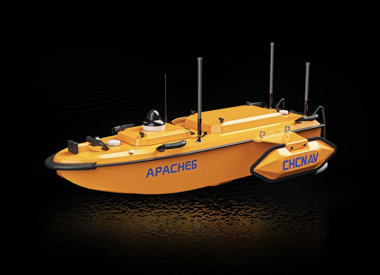
Recently, the APACHE 3 Pro unmanned ship launched by CHCNAV (China Survey Navigation) has attracted widespread attention in the field of hydrological measurement. With its excellent performance and innovative technology, it has brought new changes to the hydrological measurement of lakes, rivers and coastal areas.
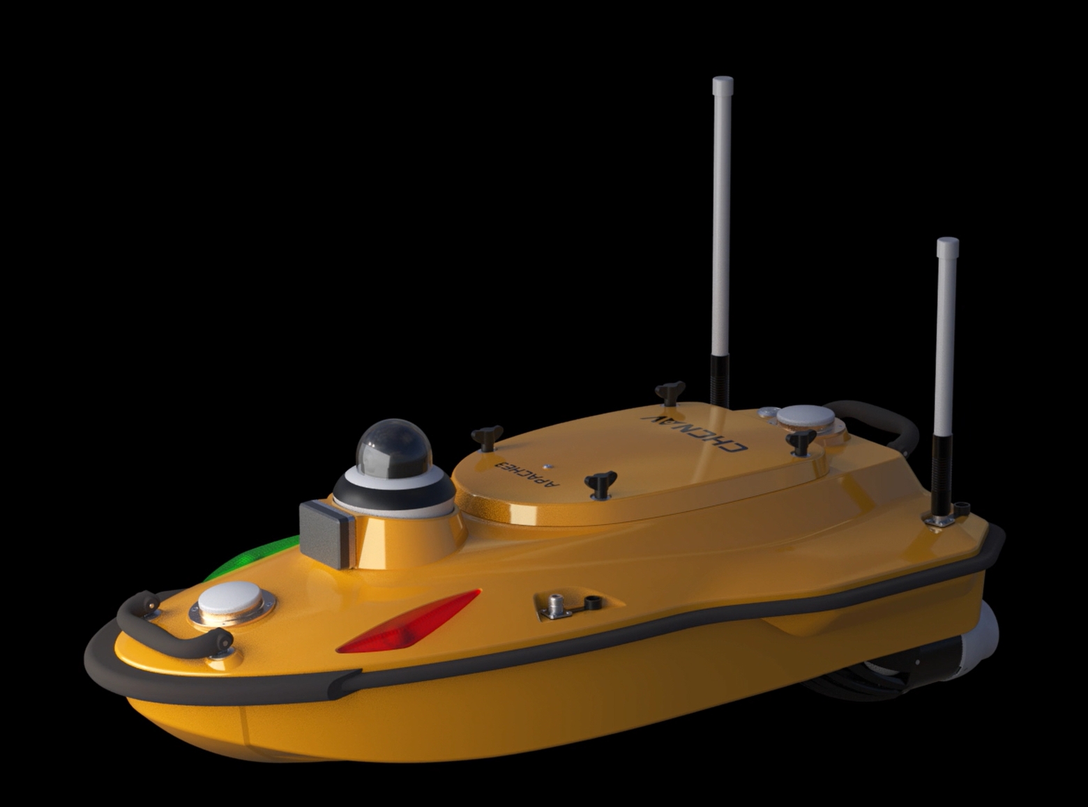
APACHE 3 Pro unmanned ship has achieved many breakthroughs in design and function. It integrates dual wireless 4G and LAN transmission modules, a feature that allows it to be easily deployed anywhere in the world, greatly extending the range of applications. In actual operations, whether in remote mountain lakes or vast coastal areas, a stable communication connection can be quickly established to ensure the real-time transmission of measurement data.
In terms of power and navigation performance, the unmanned ship is driven by an overspeed motor and has a strong power output. This 1 design enables flexible navigation in fast watersheds, always maintaining the best straight line. At the same time, the design of the motor protection cover and the inclined plane is unique, which effectively prevents the aquatic plants from being trapped and ensures the normal operation of the unmanned ship in the complex water environment. Its weight is only 7kg, super compact and light weight, easy to carry and transport, greatly improving the efficiency of the operation.
The safety function is a highlight of the APACHE 3 Pro unmanned ship. It has the function of automatically returning to the base. When encountering abnormal conditions such as insufficient power and signal loss, it can automatically plan the route to return to the designated place, avoiding the risk of equipment loss. Automatic obstacle avoidance function through advanced sensors and algorithms, real-time perception of the surrounding environment, automatically avoid obstacles, to ensure the safety of navigation. The real-time high-definition video feed function allows operators to understand the environment and operation conditions around the unmanned ship in real time, providing strong support for decision-making.
In terms of navigation and measurement, the unmanned ship integrates GNSS inertial navigation control box, which provides a reliable guarantee for accurate positioning. Single-beam bathymetry equipment can measure water depth quickly and accurately, which provides important data support for hydrological research, water conservancy engineering and other fields. For example, in dam surveying, the APACHE 3 Pro unmanned vessel can measure depths up to 300 meters and provide accurate GNSS positioning. Critical data for estimating dam capacity was provided by measuring the silt sediment height at the base of the dam. Due to the inflow of water, a large amount of silt will be deposited in the dam, resulting in a decrease in water storage. The use of APACHE 3 Pro unmanned ship for measurement can timely grasp the siltation at the bottom of the dam, provide a scientific basis for dredging work, and ensure the safe operation of the dam.
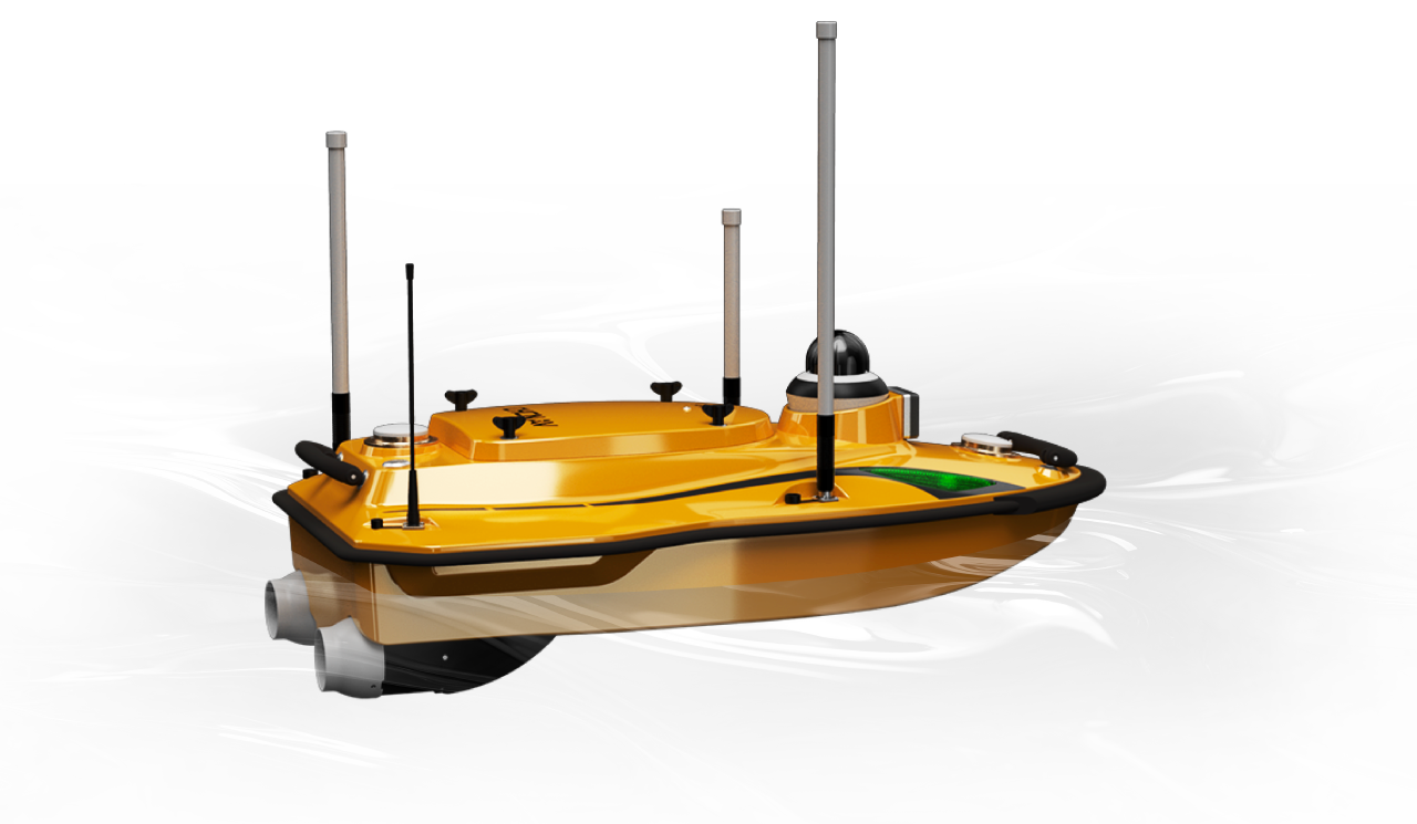
In the port area, measuring the height of the seabed is essential for determining where ships dock and dredging needs. The APACHE 3 Pro unmanned vessel can accurately measure the height of the seabed and generate detailed 3D models to support port planning and management. During the rainy season, the bottom of the dam bed rises due to siltation caused by a large amount of water flow into the dam area, which causes serious changes in the dam capacity. The use of the unmanned ship for regular measurement can detect the siltation in time, provide decision-making basis for the dredging work, and ensure the normal operation of the dam.
The launch of the CHCNAV APACHE 3 Pro unmanned ship not only represents a major advancement in hydrographic surveying technology, but also injects new vitality into the development of related industries. Its efficient, accurate and safe performance enables hydrological measurement to be carried out in an automated mode, which greatly improves productivity. At the same time, its portability allows it to be used in remote and hard-to-reach locations, meeting the measurement needs of different scenarios. With the continuous development of technology and the continuous expansion of applications, it is believed that APACHE 3 Pro unmanned ship will play a more important role in the field of hydrological measurement and make greater contributions to human cognition and protection of the natural environment.