


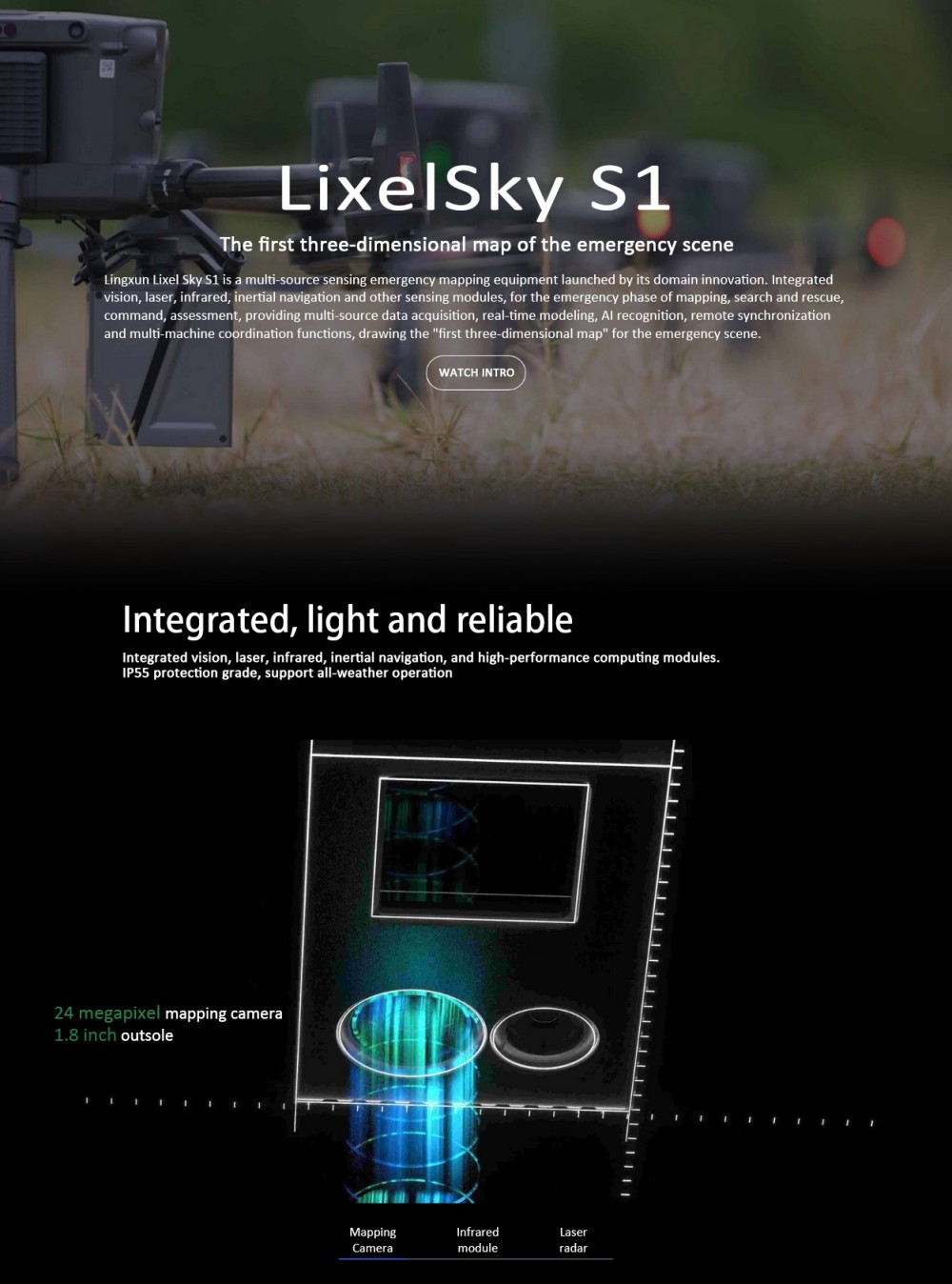
LixelSky S1 Surveying Equipment Scanner Cheap Price Hanhheld 3D Scanner Navigation LiDAR Waterproof Laser Scanner
Product Introduction
Logistics information


Logistics information
Technical Specifications
|
Brand |
xgrids |
|
Model |
LixelSky S1 |
|
Operation Mode |
Program Control |
|
Customization Support |
No |
|
Imported |
No |
|
Country of Origin |
Jiangxi, China |
|
Mapping Camera |
Effective Pixels |
24 million |
|
|
Shutter Type |
Mechanical Shutter |
||
|
Resolution |
640x512 (thermal imager photo resolution) |
||
|
Infrared Module |
Sensing Range |
-20~550°C (error ±3°C) |
|
|
Temperature Measurement Accuracy |
±2°C or ±2% @23°C |
||
|
LiDAR |
Laser Wavelength |
905nm |
|
|
Ranging Range |
300 meters (supports three returns, centimeter-level accuracy) |
||
|
Scanning Range |
450m @80% (@0 klx); 190m @10% (@100 klx) |
||
|
Scanning Mode |
Non-repetitive Scanning, Repetitive Scanning |
||
|
Supported Returns |
3 |
||
|
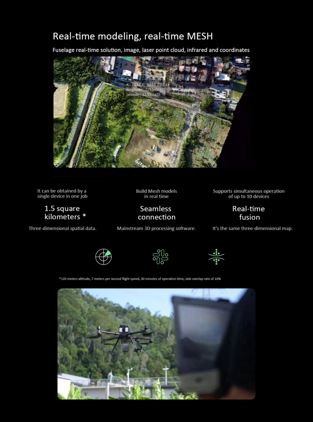
Real-time Modeling |
Supports real-time MESH |
||
|
Inertial Navigation Module |
High-performance inertial navigation module, supports real-time calculation |
||
|
Communication Functions |
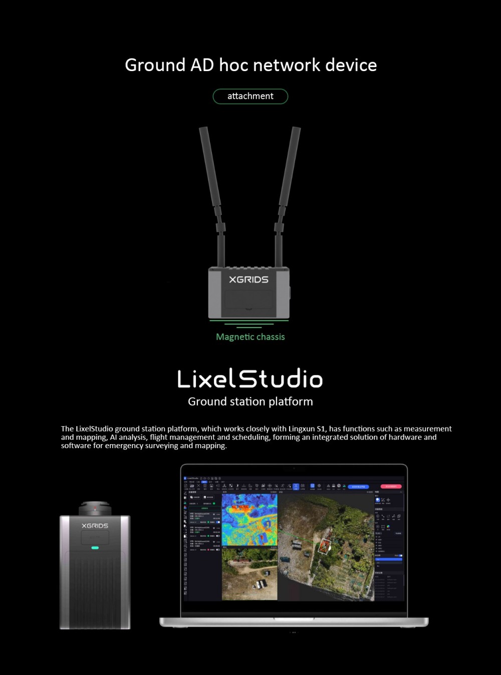
Self-organizing Network Communication |
Supports 10-kilometer self-organizing network image transmission |
|
|
Mobile Network Communication |
Built-in 4G module |
||
|
Wireless Connection |
Optional WiFi/wireless ad-hoc network |
||
|
Protection Level |
IP67, supports all-weather operation |
|
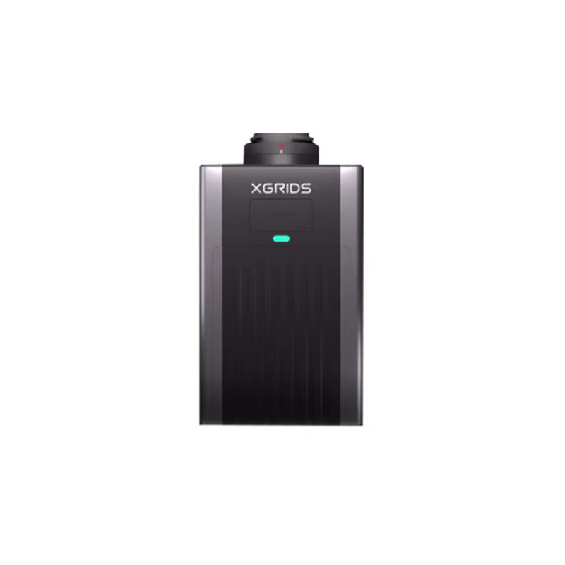
Dimensions |
135*119*83mm |
|
Weight |
1.2kg |
|
Shell Material |
Aluminum Alloy |
|
Operating Temperature |
-20°C to 50°C |
|
Accuracy |
10cm @ 50 meters |
|
Power Supply |
Drone mount power supply (or supports 15~24v power input) |
|
Power Consumption |
40w (typical), 68w (maximum) |
|
Laser Safety Class |
Class 1 (IEC 60825-1:2014), eye-safe |
|
Point Cloud Frequency |
Single return 240,000 pts/s; Triple return 720,000 pts/s |
|
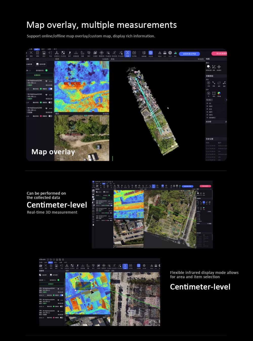
Software Support |
LixelStudio onboard plugins, etc. |
|
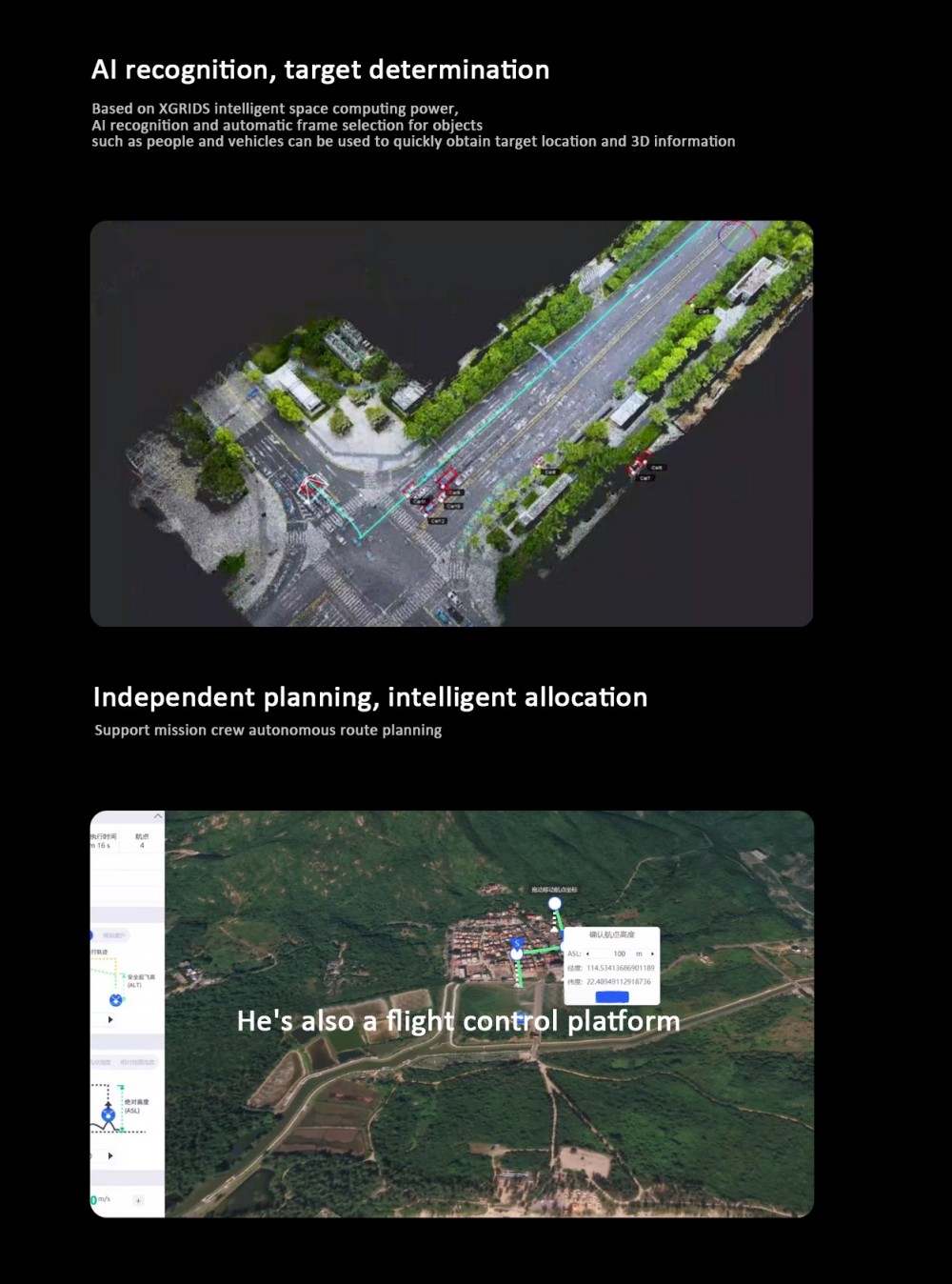
AI Recognition |
Based on xgrids' intelligent spatial computing capabilities, performs AI recognition and automatic bounding box annotation of objects such as people and vehicles, quickly obtaining target locations and 3D information. |
|
Multi-drone Collaboration |
Supports up to 10 devices operating simultaneously, achieving multi-source data fusion and efficient collaboration. |