


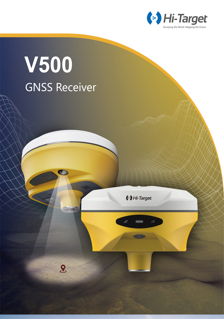
Hi-target V300/V500 with 1408 Channels GNSS RTK Land Surveying Equipment IMU
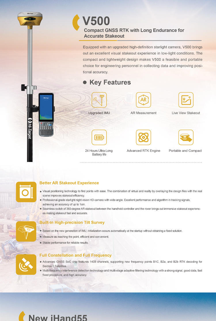
Product Features
Better visual Stakeout Experience
– Visual positioning technology to find points with ease. The combination of virtual and reality by overlaying the design files with the real scene improves stakeout efficiency.
– Professional-grade starlight night vision HD camera with wide angle. Excellent performance and algorithm in tracking signals, achieving an accuracy of up to 1cm.
– Seamless switch of 360-degree AR stakeout between the handheld controller and the rover brings out immersive stakeout experiences making stakeout fast and accurate.
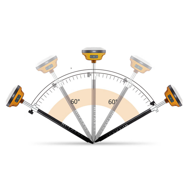
Built-in High-Precision Tilt Survey
– Based on the new generation of IMU, initialization occurs automatically at the startup without obtaining a fixed solution.
– Measure as reaching the point, efficient and convenient.
– Stable performance for reliable results.
Full Constellation and Full Frequency
– Advanced GNSS SoC chip features 1408 channels, supporting new frequency points B1C, B2a, and B2b RTK decoding for Beidou-3 Satellites.
– Multi-frequency interference detection technology and multi-stage adaptive filtering technology with a strong signal, good data, fast fixed procedure, and high accuracy.
Hi-target V300/V500
Hi-target V300/V500 is a measurement device integrating high-precision positioning and advanced visual technology, specially designed for centimeter-level precision measurement tasks. Here is a detailed evaluation of Hi-target V300/V500:
I. High-Precision Positioning
Hi-target V300/V500 utilizes the latest GNSS chip, supporting full constellation and full frequency band reception, ensuring centimeter-level positioning accuracy in various environments. Both horizontal position and elevation accuracy meet the requirements of professional measurement tasks. This feature makes Hi-target V300/V500 excel in scenarios requiring high-precision positioning, such as land surveying and construction.
II. Visual-Inertial Navigation Technology
Hi-target V300/V500 integrates visual and inertial navigation technologies, providing high-precision positioning not only in environments with good signal reception but also in areas with GPS signal obstruction or weak signals. The inertial navigation system continuously provides stable and accurate positioning data. This technical feature significantly enhances Hi-target V300/V500's adaptability in complex environments, improving measurement reliability and stability.
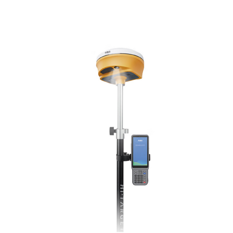
III. Real-Scene Stakeout Function
Hi-target V300/V500 supports high-definition cameras and features a real-scene stakeout function. With AR technology, users can directly view the actual position of stakeout points on the screen, making measurement and stakeout work more intuitive and accurate. This function not only improves work efficiency but also reduces operational difficulty, allowing beginners to quickly get started.
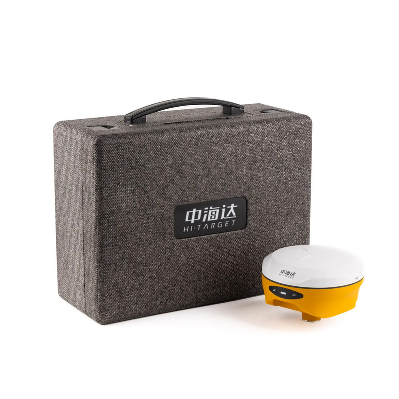
IV. Portability and Durability
Hi-target V300/V500 is designed to be lightweight and easy to carry, making it suitable for fieldwork. Additionally, it boasts excellent waterproof and dustproof performance, ensuring stable operation in harsh environments. This allows Hi-target V300/V500 to maintain outstanding performance in various complex environments.
V. Long Battery Life
The built-in large-capacity battery enables Hi-target V300/V500 to support continuous operation for extended periods, reducing the likelihood of work interruptions due to low battery. According to actual tests, the battery life can reach over 13 hours, fully meeting the demands of a day's work.
VI. User-Friendly Software Interface
The software interface of Hi-target V300/V500 is designed to be intuitive and easy to use, even for beginners. The software provides a wealth of measurement functions and data analysis tools, satisfying the needs of various complex measurement tasks.
VII. User Feedback
According to user feedback, Hi-target V300/V500 performs excellently in terms of stability and accuracy, accurately completing positioning tasks in open areas and complex urban environments. The high-definition real-scene stakeout function has also received positive reviews from users. However, some users have reported positioning deviations or signal instability in certain specific environments (such as areas with severe signal obstruction).
In summary, Hi-target V300/V500 is a high-performance, fully functional high-precision measurement device. It combines the latest GNSS technology, visual-inertial navigation technology, and high-definition real-scene stakeout function, providing accurate and reliable positioning data for surveyors. Although the price is relatively high, its ability to meet high-precision positioning requirements in professional fields and daily applications makes it an invaluable assistant for surveyors.
Logistics information


Logistics information
Specifications
| GNSS Feature | Specification | ||
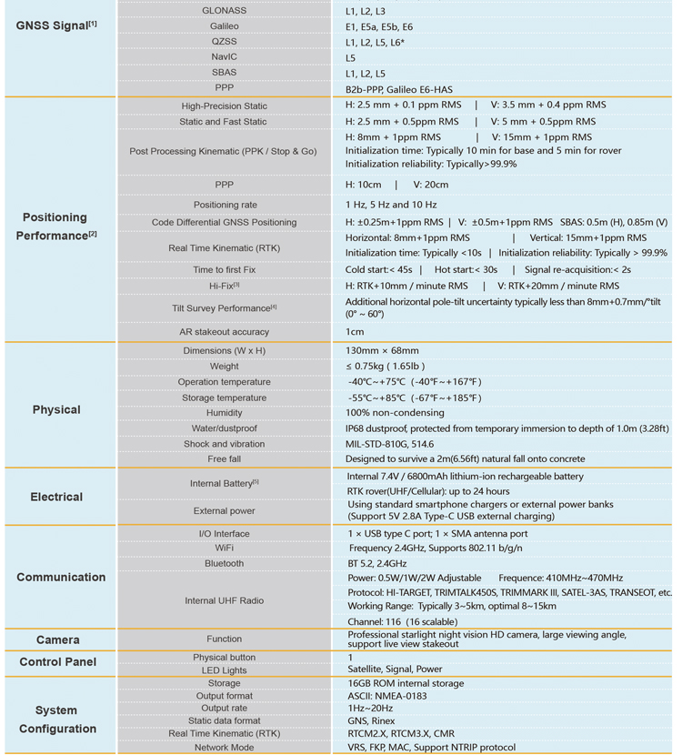
| GNSS Signal[1] | Channels | 1408 | |
| GPS | L1C/A, L1C, L2P(Y), L2C, L5 | ||
| BDS | B1l, B2l, B3l, B1C, B2a, B2b | ||
| GLONASS | L1, L2, L3 | ||
| Galileo | E1, E5a, E5b, E6 | ||
| QZSS | L1, L2, L5, L6* | ||
| NavIC | L5 | ||
| SBAS | L1, L2, L5 | ||
| PPP | B2b-PPP, Galileo E6-HAS | ||
| Positioning Performance[2] | High-Precision Static | H: 2.5 mm + 0.1 ppm RMS | V: 3.5 mm + 0.4 ppm RMS |
| Static and Fast Static | H: 2.5 mm + 0.5ppm RMS | V: 5 mm + 0.5ppm RMS | ||
| Post Processing Kinematic (PPK / Stop & Go) | H: 8mm + 1ppm RMS | V: 15mm + 1ppm RMS Initialization time: Typically 10 min for base and 5 min for rover Initialization reliability: Typically>99.9% | ||
| PPP | H: 10cm | V: 20cm | ||
| Positioning rate | 1 Hz, 5 Hz and 10 Hz | ||
| Code Differential GNSS Positioning | H: ±0.25m+1ppm RMS | V: ±0.5m+1ppm RMS SBAS: 0.5m (H), 0.85m (V) | ||
| Real Time Kinematic (RTK) | Horizontal: 8mm+1ppm RMS | Vertical: 15mm+1ppm RMS Initialization time: Typically <10s | Initialization reliability: Typically > 99.9% | ||
| Time to first Fix | Cold start:< 45s | Hot start:< 30s | Signal re-acquisition:< 2s | ||
| Hi-Fix[3] | H: RTK+10mm / minute RMS | V: RTK+20mm / minute RMS | ||
| Tilt Survey Performance[4] | Additional horizontal pole-tilt uncertainty typically less than 8mm+0.7mm/°tilt (0° ~ 60°) | ||
| AR stakeout accuracy | 1cm | ||
| Physical | Dimensions (W x H) | 130mm × 68mm | |
| Weight | ≤ 0.75kg ( 1.65lb ) | ||
| Operation temperature | -40℃~+75℃(-40℉~+167℉) | ||
| Storage temperature | -55℃~+85℃(-67℉~+185℉) | ||
| Humidity | 100% non-condensing | ||
| Water/dustproof |
IP68 dustproof, protected from temporary immersion to depth of 1.0m (3.28ft) |
||
| Shock and vibration | MIL-STD-810G, 514.6 | ||
| Free fall | Designed to survive a 2m(6.56ft) natural fall onto concrete | ||
| Electrical | Internal Battery[5] | Internal 7.4V / 6800mAh lithium-ion rechargeable battery | |
| RTK rover(UHF/Cellular): up to 24 hours | |||
| External power | Using standard smartphone chargers or external power banks (Support 5V 2.8A Type-C USB external charging) | ||
| Communication | I/O Interface | 1 × USB type C port; 1 × SMA antenna port | |
| WiFi | Frequency 2.4GHz, Supports 802.11 b/g/n | ||
| Bluetooth | BT 5.2, 2.4GHz | ||
| Internal UHF Radio | Power: 0.5W/1W/2W Adjustable Frequence: 410MHz~470MHz | ||
|
Protocol: HI-TARGET, TRIMTALK450S, TRIMMARK III, SATEL-3AS, TRANSEOT, etc. |
|||
| Working Range: Typically 3~5km, optimal 8~15km | |||
| Channel: 116(16 scalable) | |||
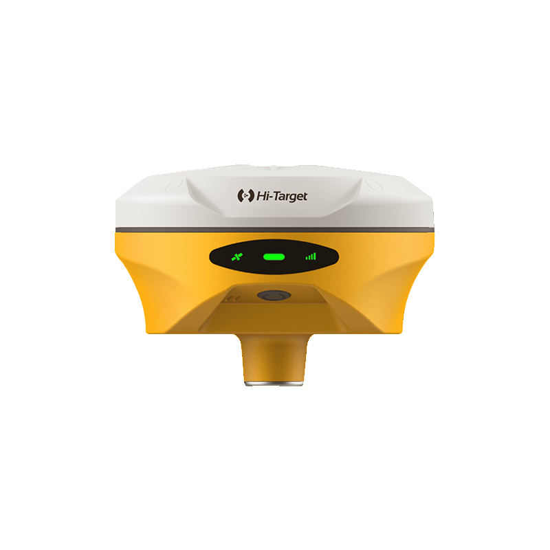
| Camera | Function | Professional starlight nightvision HD camera, large viewing angle, support live view stakeout | |
| Control Panel | Physical button | 1 | |
| LED Lights | Satellite, Signal, Power | ||
| System Configuration | Storage | 16GB ROM internal storage | |
| Output format | ASCII: NMEA-0183 | ||
| Output rate | 1Hz~20Hz | ||
| Static data format | GNS, Rinex | ||
| Real Time Kinematic (RTK) | RTCM2.X, RTCM3.X, CMR | ||
| Network Mode | VRS, FKP, MAC, Support NTRIP protocol | ||
Note:
[1]QZSS L6 can be provided by firmware upgrade.
[2]The measurement accuracy, precision, reliability and initialization time depend on various factors, including tilt angle, number of satellites, geometric distribution, observation time, atmospheric conditions and multi-path validation, etc. The data are derived under normal conditions.
[3]Accuracies are dependent on GNSS satellite availability. Hi-Fix Positioning ends after 5 minutes without differential data.Hi-Fix is not available in all regions, check with your local sales representative for more information.
[4]Irregular operations such as rapid rotation and high-intensity vibration may affect the inertial navigation accuracy.
[5]The battery operating time is related to the operating environment, operating temperature and battery life.
Descriptions and Specifications are subject to change without notice