


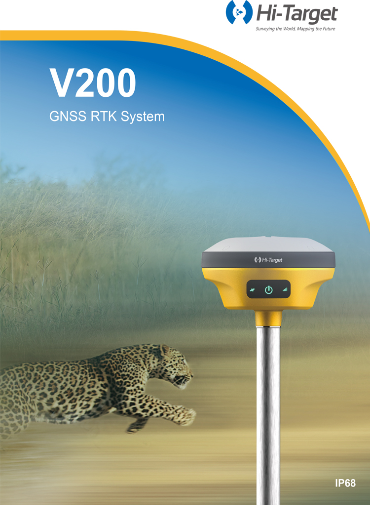
Hi-target V200 with 1408 Channels GNSS RTK Land Surveying Equipment IMU
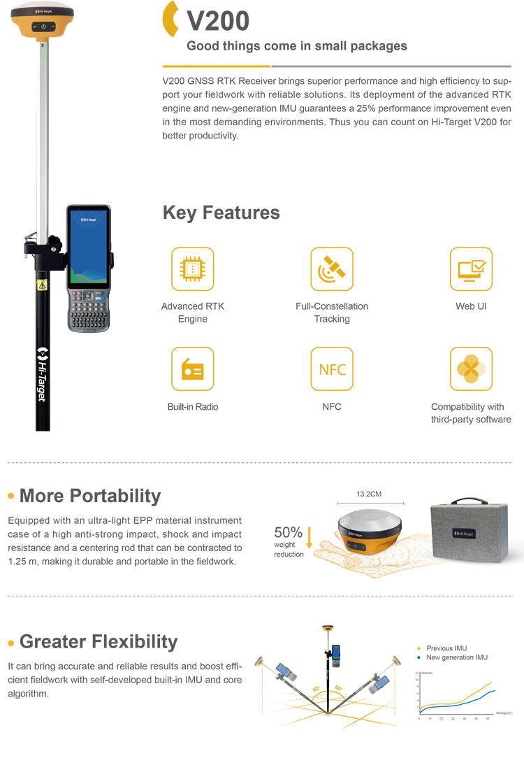
Product Features
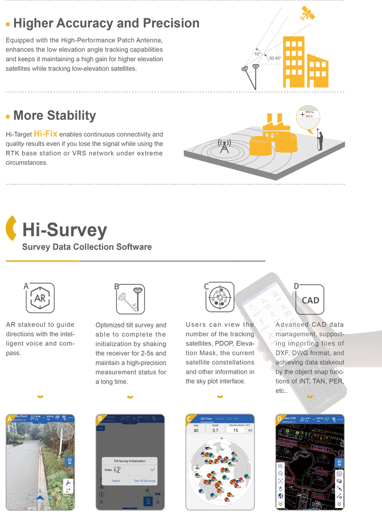
Higher Accuracy and Precision
Equipped with the High-Performance Patch Antenna, enhances the low elevation angle tracking capabilities and keeps it maintaining a high gain for higher elevation satellites while tracking low-elevation satellites.
More Stability
Hi-Target Hi-Fix enables continuous connectivity and quality results even if you lose the signal while using the RTK base station or VRS network under extreme circumstances.
More Portability
Equipped with an ultra-light EPP material instrument case of a high anti-strong impact, shock and impact resistance and a centering rod that can be contracted to 1.25 m, making it durable and portable in the fieldwork.
Greater Flexibility
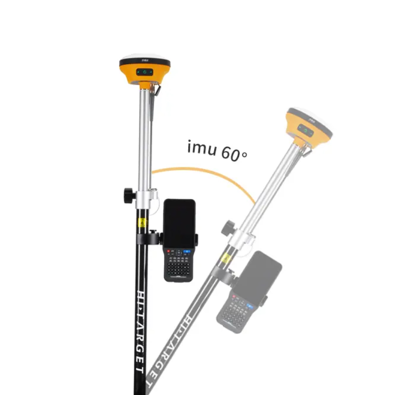
It can bring accurate and reliable results and boost efficient fieldwork with self-developed built-in IMU and core algorithm.
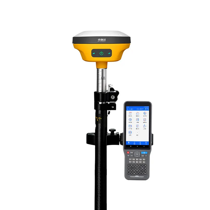
Hi-Target V200
Hi-Target V200 is a highly acclaimed high-precision RTK surveying instrument in the field of engineering surveying and mapping. Below is a detailed evaluation of the product:
I. Design and Portability
The Hi-Target V200 is designed with a focus on lightweight and compactness, weighing no more than 0.82KG and having a diameter of only 13.2cm. This design makes outdoor work more convenient. Additionally, it is equipped with a sturdy, wear-resistant, and impact-resistant instrument case made of ultra-light EPP material, which significantly reduces the overall weight and further enhances the portability and lifespan of the product. This design allows for easy transportation during self-driving outdoor work, making it highly suitable for field operations.
II. High-Precision Positioning Performance
The Hi-Target V200 supports all constellations and full frequency bands, including Beidou-3, and possesses strong signal reception capabilities and adaptive anti-interference characteristics. Its RTK positioning accuracy is extremely high, with a planar accuracy reaching centimeter level, specifically ±(8+1x10⁻⁶D)mm or ±(2.5+0.5×10^-6D)mm (there are slight differences in various evaluation data, but all indicate its high precision), and a vertical accuracy of ±(15+1x10⁻⁶D)mm. This high-precision positioning capability fully meets the requirements of various high-precision engineering surveying and mapping tasks.
III. Efficient Initialization and Measurement
The Hi-Target V200 has a very short initialization time, typically less than 10 seconds, and high initialization reliability, greatly improving measurement efficiency. In practical use, the device supports a one-click fixing function, making the measurement process simple and fast. Furthermore, it supports CORS services, allowing measurements to be taken immediately upon startup without additional configuration, further simplifying the operation process.
IV. Intelligence and Convenient Operation
The Hi-Target V200 is equipped with features such as a smart base station and intelligent voice control, making the measurement process more intelligent. Voice control of the device enables a convenient operating experience. Additionally, the device supports intelligent functions such as NFC quick connection and WebUI interaction, enhancing the user experience. The accompanying handheld devices, such as the iHand30 and iHand55, are equipped with powerful processors and the Android system, providing smooth operation and support for various measurement software, offering a comprehensive solution for measurement work.
V. Battery Life and Stability
The Hi-Target V200 is equipped with a high-capacity lithium battery, ensuring stable performance during long-term operation. Even in harsh environments, the device maintains good working conditions, meeting the needs of various complex measurement scenarios.
VI. Application Fields and Cost-Effectiveness
The Hi-Target V200 is suitable for multiple fields such as road staking, water conservancy projects, building construction, power surveying, and topographic surveying. Its high precision and stability perform excellently in various complex environments. Considering its high performance, rich functional configuration, as well as the good reputation and after-sales service of the Hi-Target brand, this product offers high cost-effectiveness.
In summary, the Hi-Target V200, with its high-precision positioning performance, efficient initialization and measurement, intelligence and convenient operation, battery life and stability, as well as wide application fields and high cost-effectiveness, has significant advantages and broad application prospects in the field of engineering surveying and mapping.
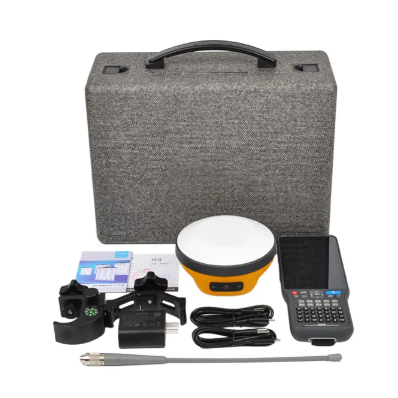
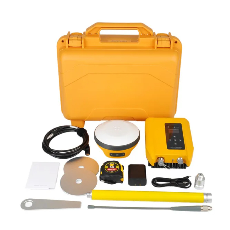
Logistics information


Logistics information
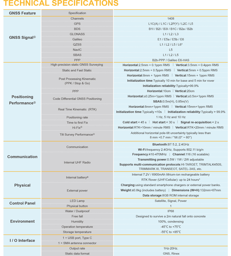
Technical Specifications
| GNSS Feature | Specification | |
| GNSS Signal | Channels | 1408 |
| GPS | L1C/A, L1C, L2P(Y), L2C, L5 | |
| BDS | B1l, B2l, B3l, B1C, B2a, B2b | |
| GLONASS | L1, L2, L3 | |
| Galileo | E1, E5a, E5b, E6 | |
| QZSS | L1, L2, L5, L6* | |
| NavIC | L5 | |
| SBAS | L1, L2, L5 | |
| PPP | B2b-PPP, Galileo E6-HAS | |
| Positioning Performance[2 | High-Precision Static | H: 2.5 mm + 0.1 ppm RMS V: 3.5 mm + 0.4 ppm RMS |
| Static and Fast Static | H: 2.5 mm + 0.5ppm RMS V: 5 mm + 0.5ppm RMS | |
| Post Processing Kinematic (PPK / Stop & Go) | H: 8mm + 1ppm RMS V: 15mm + 1ppm RMS Initialization time: Typically 10 min for base and 5 min for rover Initialization reliability: Typically>99.9% | |
| PPP | H: 10cm | V: 20cm | |
| Positioning rate | 1 Hz, 5 Hz and 10 Hz | |
| Code Differential GNSS Positioning | H: ±0.25m+1ppm RMS | V: ±0.5m+1ppm RMS SBAS: 0.5m (H), 0.85m (V) | |
| Real Time Kinematic (RTK) | Horizontal: 8mm+1ppm RMS | Vertical: 15mm+1ppm RMS Initialization time: Typically <10s | Initialization reliability: Typically > 99.9% | |
| Time to first Fix | Cold start:< 45s | Hot start:< 30s | Signal re-acquisition:< 2s | |
| Hi-Fix[3] | H: RTK+10mm / minute RMS | V: RTK+20mm / minute RMS | |
| Tilt Survey Performance[4] | Additional horizontal pole-tilt uncertainty typically less than 8mm+0.7mm/°tilt (0° ~ 60°) | |
| AR stakeout accuracy | 1cm | |
| Physical | Dimensions (W x H) | 132mm×67mm |
| Weight | ≤0.8kg (includes battery) | |
| Operation temperature | -40℃~+75℃(-40℉~+167℉) | |
| Storage temperature | -55℃~+85℃(-67℉~+185℉) | |
| Humidity | 100% non-condensing | |
| Water/dustproof | IP68 dustproof, protected from temporary immersion to depth of 1.0m (3.28ft) | |
| Shock and vibration | MIL-STD-810G, 514.6 | |
| Free fall | Designed to survive a 2m(6.56ft) natural fall onto concrete | |
| Electrical | Internal Battery[5 | nternal 7.2V / 6900mAh lithium-ion rechargeable battery |
| External power | RTK Rover (UHF/Cellular): up to 24 hours* | |
| Communication | I/O Interface | 1 × USB type C port; 1 × SMA antenna port |
| WiFi | Frequency 2.4GHz, Supports 802.11 b/g/n | |
| Bluetooth | BT 5.2, 2.4GHz | |
| Internal UHF Radio | Power: 0.5W/1W/2W Adjustable Frequence: 410MHz~470MHz | |
| Protocol: HI-TARGET, TRIMTALK450S, TRIMMARK III, SATEL-3AS, TRANSEOT, etc. Working Range: Typically 3~5km, optimal 8~15km | ||
| Channel: 116(16 scalable) |
Note:
[1]QZSS L6 can be provided by firmware upgrade.
[2]The measurement accuracy, precision, reliability and initialization time depend on various factors, including tilt angle, number of satellites, geometric distribution, observation time, atmospheric conditions and multi-path validation, etc. The data are derived under normal conditions.
[3]Accuracies are dependent on GNSS satellite availability. Hi-Fix Positioning ends after 5 minutes without differential data.Hi-Fix is not available in all regions, check with your local sales representative for more information.
[4]Irregular operations such as rapid rotation and high-intensity vibration may affect the inertial navigation accuracy.
[5]The battery operating time is related to the operating environment, operating temperature and battery life.
Descriptions and Specifications are subject to change without notice