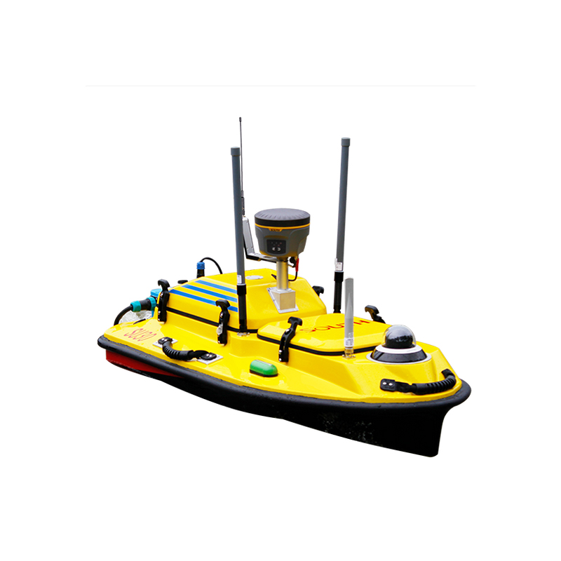


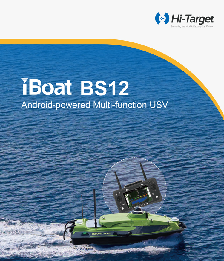
Hi-Target Portable Autopilot System for Marine Surveying Easy Operation Hi-Target iboat BS12 Survey USV Unmanned Surface Vehicle
Product Features
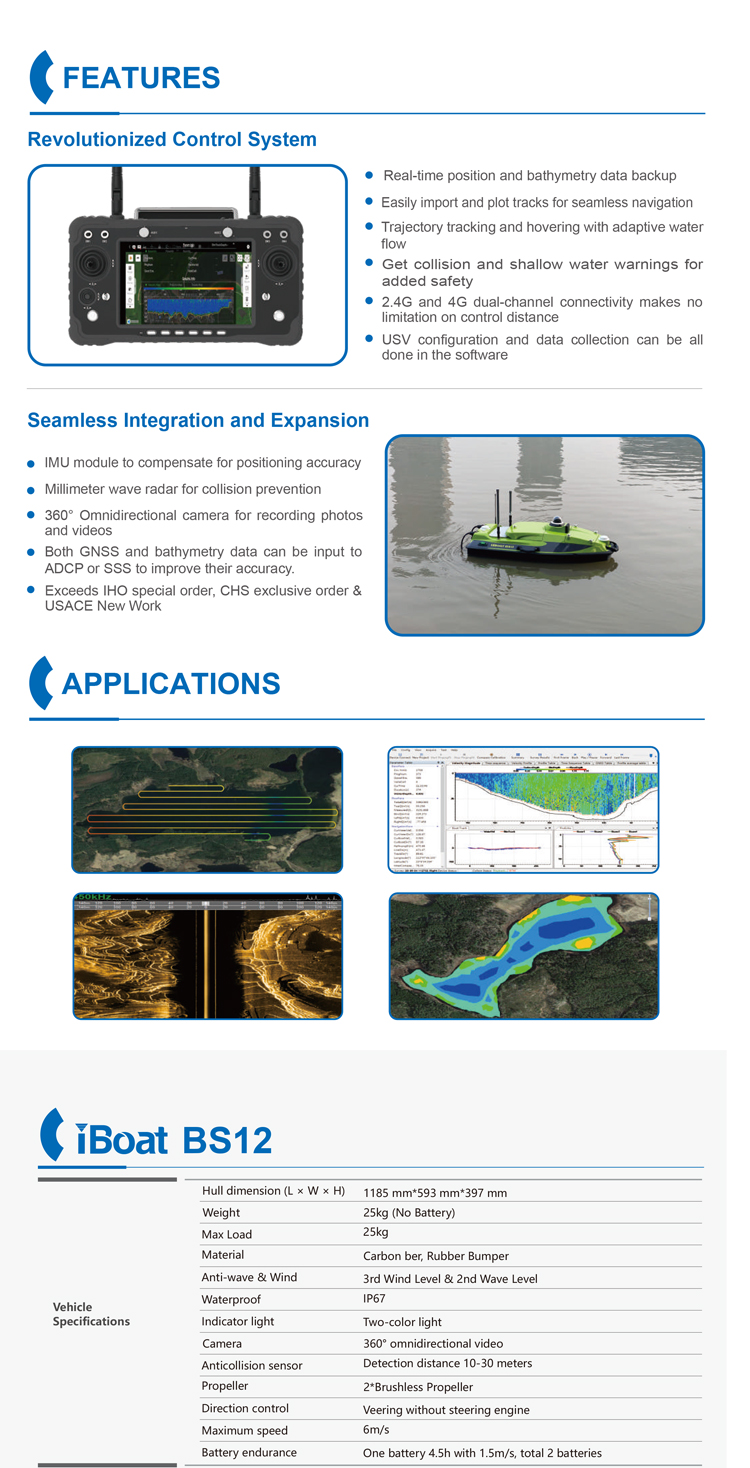
Intelligent Control System
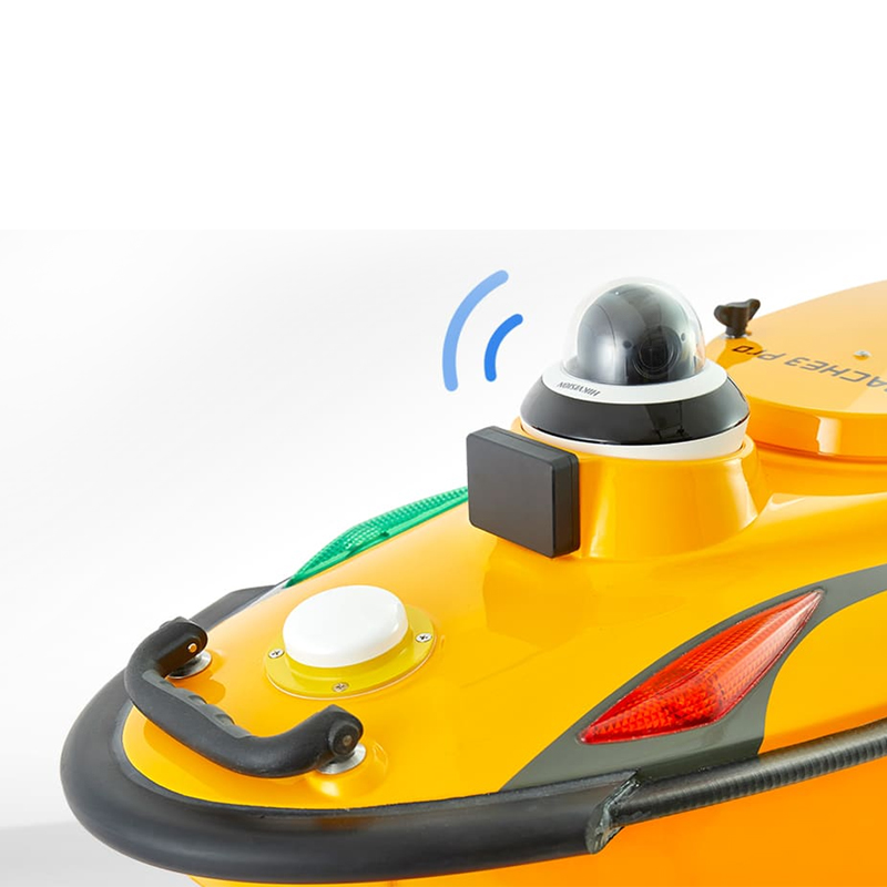
Millimeter-Wave Radar: Equipped with visual sensing capabilities, it enables intelligent obstacle avoidance to prevent collisions with obstacles.
Adaptive Flow Rate: It can automatically adjust its navigation posture based on water flow speed, ensuring a straight-line cross-section during round-trip measurements to maximize flow measurement accuracy.
One-Click Hovering: Supports fixed-point hovering and shallow-water hovering, facilitating precise shore measurements in complex water areas.
Autonomous Return: Features low-battery return and lost-connection return functions, ensuring the unmanned boat can safely return in case of low battery or loss of communication.
Measurement and Data Acquisition
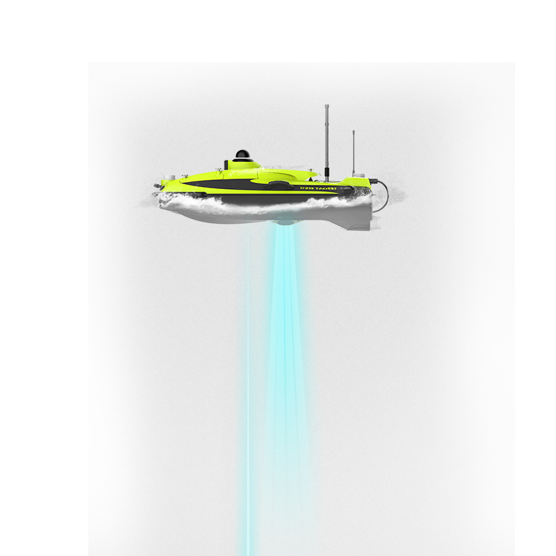
Integration of ADCP and Single-Beam Echo Sounder: Enables simultaneous depth and flow measurement, offering flexibility and efficiency.
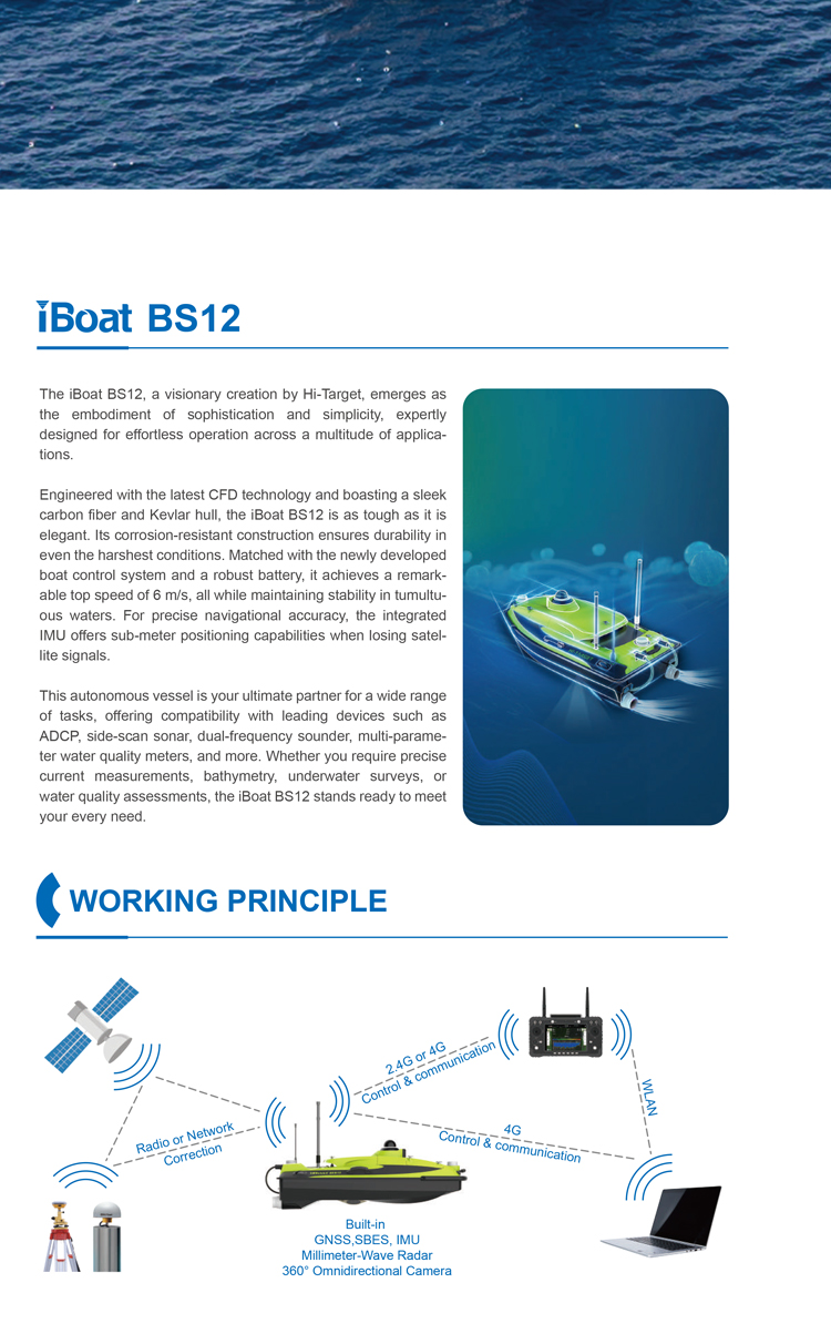
High-Precision Positioning: The integrated Inertial Measurement Unit (IMU) provides sub-meter positioning accuracy, ensuring the accuracy of measurement data.
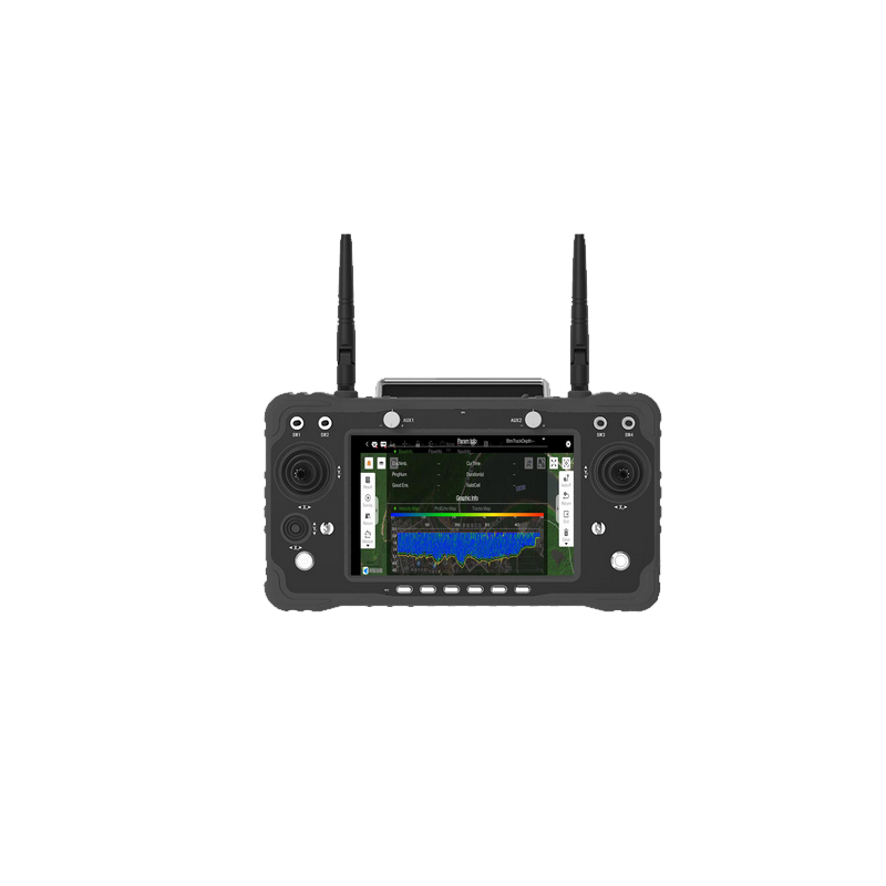
Hi-Survey Boat Android Software: Comes with an Android-powered smart remote control pre-installed with Hi-Survey Boat software, highly integrated to meet the needs of various hydrographic surveying and underwater mapping scenarios. The software supports project creation, conversion between geodetic and plane coordinates, satellite imagery loading, autonomous route planning, and other functions.
Application Scenarios and Advantages
Wide Range of Applications: Suitable for hydrographic surveying, underwater mapping, river cross-section topography, siltation, and earthwork measurement, among others.
Dual-Load Integration: Can carry multibeam, water quality analyzers, sub-bottom profilers, ADCPs, side-scan sonars, echo sounders, and other equipment, achieving one-step flow and depth measurement.
Efficient and Convenient: With the Android-powered smart remote control and Hi-Survey Boat software, data collection, processing, and storage can be easily achieved, enhancing work efficiency.
Price and Cost-Effectiveness
Affordable Pricing: Based on market conditions, the price of the iBoat BS12 unmanned boat is relatively reasonable, offering high cost-effectiveness.
After-Sales Service: As a reputable brand, Hi-Target provides comprehensive after-sales service and technical support, ensuring users receive prompt and effective assistance during use.
In summary, the Hi-Target iBoat BS12 unmanned boat excels in its propulsion system, intelligent control system, measurement and data acquisition capabilities, application scenarios and advantages, as well as price and cost-effectiveness. It is a dedicated Android-powered smart unmanned boat for hydrographic surveying, capable of meeting the demands of various application scenarios. It is a valuable asset in the fields of hydrographic surveying and underwater mapping.
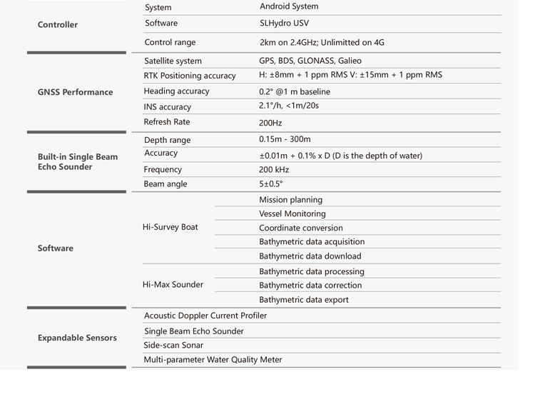
Product parameters
Basic Parameters
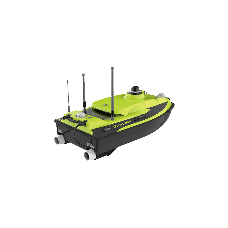
Model: iBoat BS12
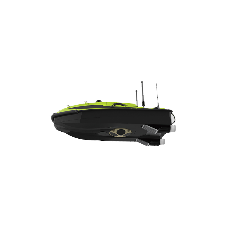
Hull Dimensions: 1185mm×593mm×397mm
Hull Material: Carbon fiber, Kevlar bulletproof cloth high-strength composite material
Hull Weight: 10kg
Performance Parameters
Wind and Wave Resistance: Up to 3rd-level wind and 2nd-level waves
Hull Design: M-shaped hull design for reduced drag and stable navigation
Positioning and Orientation: Built-in dual-antenna GNSS positioning and orientation system
Depth Measurement Frequency: 200KHz
Depth Measurement Beam Angle: 5°
Depth Measurement Range: 0.15~300m
Depth Measurement Accuracy: ±1cm+0.1%h (h represents water depth)
Functional Features
Android Smart System: Equipped with an Android system, smart remote control, and built-in Hi-Survey Boat software for highly integrated operation, meeting the needs of various scenarios in hydrographic surveying and underwater mapping.
Simultaneous Depth and Flow Measurement: Equipped with ADCP and single-beam echo sounder, capable of simultaneous depth and flow measurement, offering flexibility and efficiency.
Adaptive Flow Velocity: Ensures a straight cross-section during reciprocation, maximizing flow measurement accuracy.
Dual-Loading Integration: Can carry multibeam, water quality analyzers, sub-bottom profilers, ADCPs, side-scan sonars, echo sounders, and other equipment, enabling one-stop depth and flow measurement.
One-Click Hovering: Supports fixed-point hovering and shallow water hovering, ensuring more precise shoreline measurements.
Application Scenarios
Hydrographic Surveying: Used for measuring hydrographic parameters in rivers, lakes, reservoirs, and other water bodies.
Underwater Mapping: Suitable for underwater terrain mapping, underwater pipeline inspection, and other scenarios.
Other Application Scenarios: Also applicable for environmental monitoring, underwater archaeology, underwater rescue, and other fields.
Logistics information


Logistics information
technical parameter
| Vehicle Specifications | Hull dimension (L × W × H) | 1185 mm*593 mm*397 mm |
| Weight | 25kg (No Battery) | |
| Max Load | 25kg | |
| Material | Carbon ber, Rubber Bumper | |
| Anti-wave & Wind | 3rd Wind Level & 2nd Wave Level | |
| Indicator light | Two-color light | |
| Camera | 360° omnidirectional video | |
| Anticollision sensor | Detection distance 10-30 meters | |
| Propeller | 2*Brushless Propeller | |
| Waterproof | IP67 | |
| Direction contro | Veering without steering engine | |
| Maximum speed | 6m/s | |
| Battery endurance | One battery 4.5h with 1.5m/s, total 2 batteries | |
| Controller | System | Android System |
| Software | SLHydro USV | |
| Control range | 2km on 2.4GHz; Unlimitted on 4G | |
| GNSS Performance | Satellite system | GPS, BDS, GLONASS, Galieo |
| RTK Positioning accuracy | H: ±8mm + 1 ppm RMS V: ±15mm + 1 ppm RMS | |
| Heading accuracy | 0.2° @1 m baseline | |
| INS accuracy | 2.1°/h, <1m/20s | |
| Refresh Rate | 200Hz | |
| Built-in Single Beam Echo Sounder | Depth range | 0.15m - 300m |
| Accuracy | ±0.01m + 0.1% x D (D is the depth of water) | |
| Frequency | 200 kHz | |
| Beam angle | 5±0.5° | |
| Software | Hi-Survey Boat | Mission planning |
| Vessel Monitoring | ||
| Coordinate conversion | ||
| Bathymetric data acquisition | ||
| Bathymetric data download | ||
| Hi-Max Sounder | Bathymetric data processing | |
| Bathymetric data correction | ||
| Bathymetric data export |