


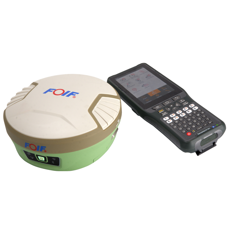
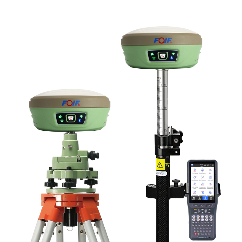

Foif a90 Gps Rtk Gnss Receiver Rtk Gps Gnss Surveying Base And Rover GNSS RTK
Product Features
The foif a90 is a high-precision RTK (Real Time Kinematic) surveying instrument that excels in the field of engineering surveying. Here is a detailed evaluation of its features:
I. High-Precision Measurement
Static Measurement Accuracy: The planimetric accuracy reaches ±(2.5mm+0.5ppm) RMS, and the elevation accuracy reaches ±(5mm+0.5ppm) RMS, meeting the demands of high-precision engineering surveying.
RTK Measurement Accuracy: The planimetric accuracy is ±(8mm+0.5ppm) RMS, and the elevation accuracy is ±(15mm+0.5ppm) RMS, maintaining high accuracy even during dynamic measurements.
II. Comprehensive Satellite System Support
The foif a90 supports a full range of satellite systems including BDS (BeiDou), GPS, GLONASS, Galileo, SBAS, IRNSS, and QZSS, with up to 555 channels, ensuring rapid and accurate satellite signal reception in various environments.
III. Powerful Performance
Rapid Initialization: The initialization time is less than 10 seconds, with a reliability of 99.9%, enhancing measurement efficiency.
Waterproof and Dustproof: With an IP68 rating, the instrument is designed to be stable and durable in harsh environments.
Smart Battery: The battery has a large capacity, providing long endurance, and features a battery level indicator for convenient monitoring.
IV. Convenient Operation and Expandability
Built-in Bluetooth and WiFi: Supports Bluetooth and WiFi connections, allowing direct connection to a handheld device via WiFi instead of Bluetooth, improving data transmission efficiency and convenience.
Differential Output: Supports multiple differential output formats such as RTCM2.3, RTCM3.X, RTCM3.2, CMR, and CMR+, accommodating various user needs.
Built-in Storage and Expandability: Equipped with 8GB of onboard memory and supports TF card expansion up to 32GB or more, ensuring data storage and backup.
V. Rugged and Durable Design
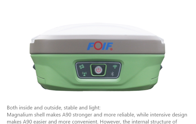
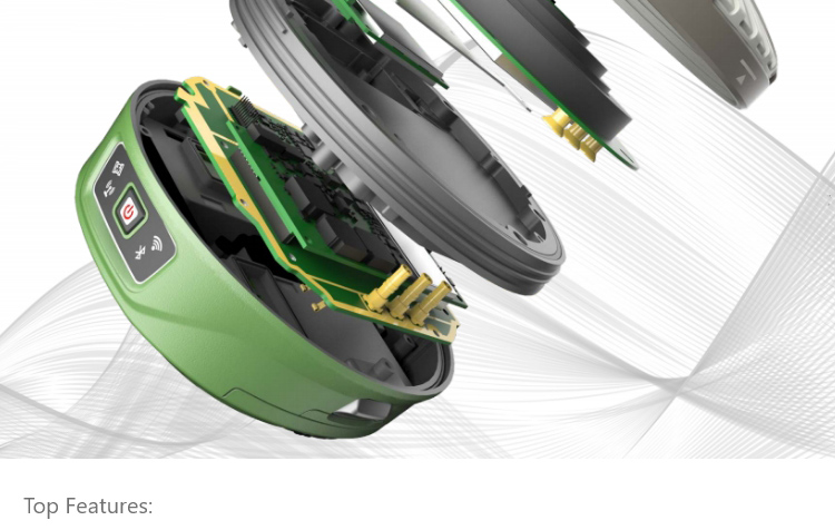
Shell Material: Made of magnesium-aluminum alloy, the shell is sturdy and reliable, with a certain degree of shock resistance.
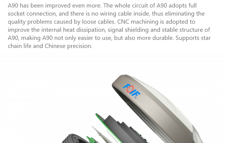
Integrated Design: The entire circuit adopts plug-in connections, eliminating quality issues caused by loose cables. The internal partitions are CNC-machined, enhancing internal heat dissipation, signal shielding, and structural stability.
VI. Wide Range of Applications
The foif a90 is suitable for engineering surveying and coordinate staking work in various fields such as electricity, transportation, construction, and water conservancy, meeting the high-precision measurement needs of different industries.
In summary, the foif a90 stands out in the field of engineering surveying with its high-precision measurement, comprehensive satellite system support, powerful performance, convenient operation and expandability, rugged and durable design, and wide range of applications. It offers high cost-effectiveness and competitiveness in the market.
Logistics information


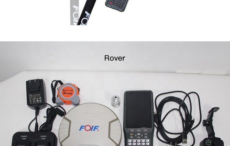
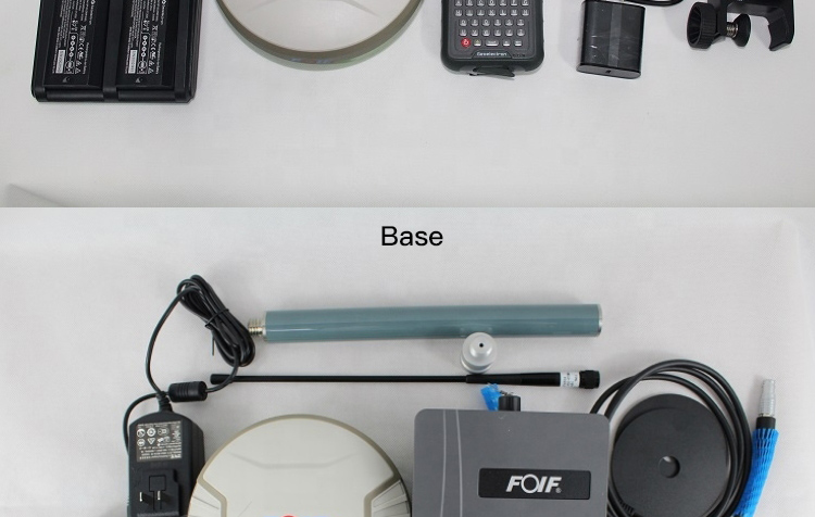
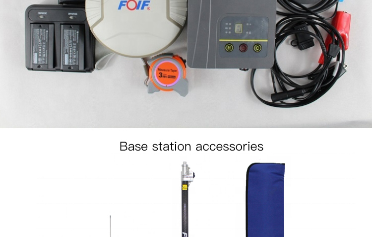
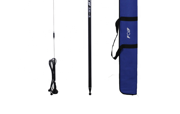
Logistics information
A90 GNSS Receiver Specifications
GNSS Engine
Channel : 1408
Signal received : All constellation and all band reception
BDS B1I/B2I/B3I/B1C/B2a/ B2b
GPS L1C/A/ L2P (Y )/L2C/L5 GLONASS G1/G2/G3
Galileo E1/E5a/ E5b/E6 QZSS L1/L2/L5
Performance
Time Accuracy(RMS):20 ns
Velocity Accuracy (RMS):0.03 m/s Cold start:<30 s
Initialization Time :<5s(typical) Initialization Reliability: >99.9% Single-point positioning(RMS):
Horizontal: 1.5m, Vertical: 2.5m DGPS(RMS):
Horizontal: 0.4m, Vertical: 0.8m Static:
Horizontal: ±(2.5mm+0.5ppm)RMS
Vertical: ±(5mm+0.5ppm)RMS RTK(RMS):
Horizontal: ±(8mm+1ppm)RMS Vertical: ±(15mm+1ppm)RMS
Data
Internal memory: 8GB standard , support s TF card extending to 32GB;
Differential data : RTCM V3 .x ;
Data format : NMEA 0183;
Data security: RTK survey data secured in three ways(synchronizing storage in both controller and A90 , and uploading to cloud for backup is available )
Environmental
Temperature: -30℃ to 60℃ for operating temperature,-40℃ to 80℃ for storage temperature;
Humidity: 100% condensing resistant;
Shock: 2 m pole drop resistant in normal temperature;
Protection: IP68
Configuration
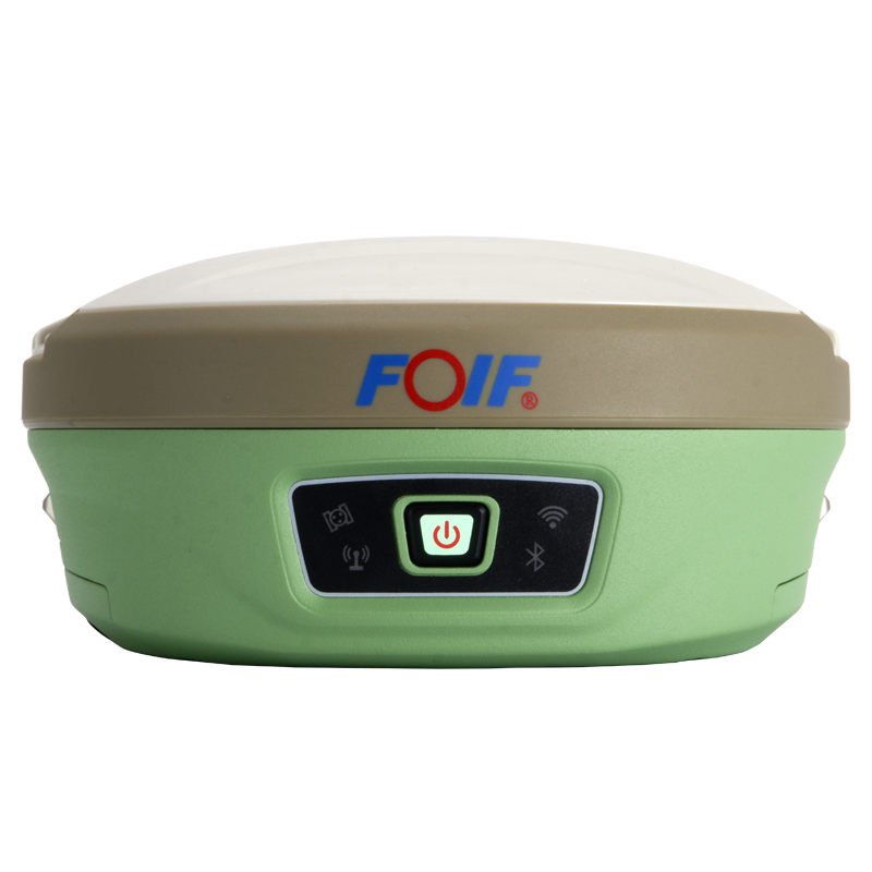
Bluetooth: built-in , Bluetooth 2 . 1+EDR/ Bluetooth 4 .0 BLE;
Electronic bubble: supported ;
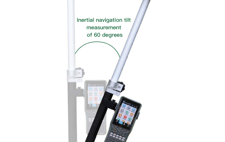
Tilt survey: IMU inertial navigation module, 6-axis 400Hz dynamic output , calibration-free;
Network communication: fits various networks;
WI FI :802 . 11b/g/n , can connect to controller through WI FI re placing Bluetooth , supports WebUI wireless management including firmware update , data download , settings , station setup;
Radio: internal 1w radio ( Rx/Tx ) with a typical working range of above 5km , external 2/35w radio (Tx ) with a typical working range of above 15km , and supports protocol like PCC-EOT, TrimTalk450S , TrimMarkIII , South , HiTarget , GeoTalk , GeoMark , etc
Physical
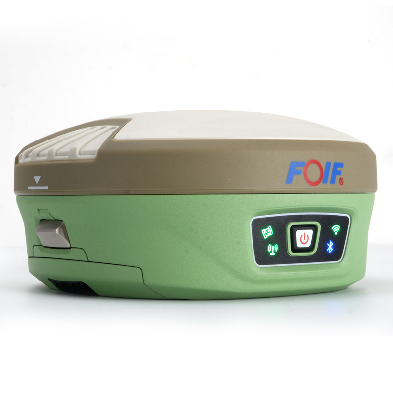
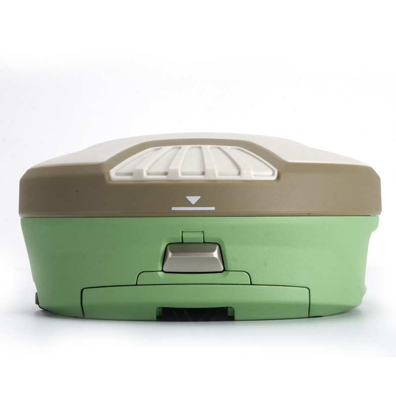
Size: 156mm*76mm(Φ x H ) ,
Material : bottom is magnesium alloy and top is polymer plastics;
Battery: 7 .4V x 3400mAh x 2pcs ,smart removable lithium battery(with power indicator ) ;
User interface: 4 LED indicator lights , 1 TF card s lot ,
1 SIM card s lot , 1 button , real-time voice broadcasting , TNC port(connecting built-in radio antenna ) ,
5-pin l emo port(connecting external power supply and external radio ) ,
7-pin l emo port(USB+serial port , connecting PC and controller )
Other
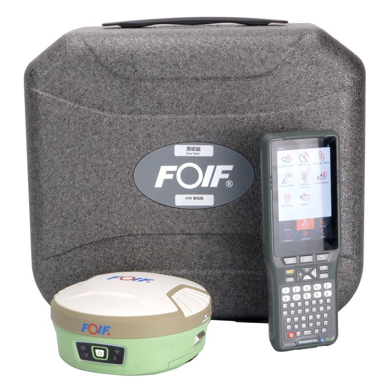
Controller:P9III or P9IV; Software: FOIF Surpad;
Application: Power system, land, construction, transportation, forestry, agriculture, deformation monitoring, water conservancy system