


Foif A70AR Gps Rtk Gnss Receiver Rtk Gps Gnss Surveying Base And Rover GNSS RTK
Technical Specifications
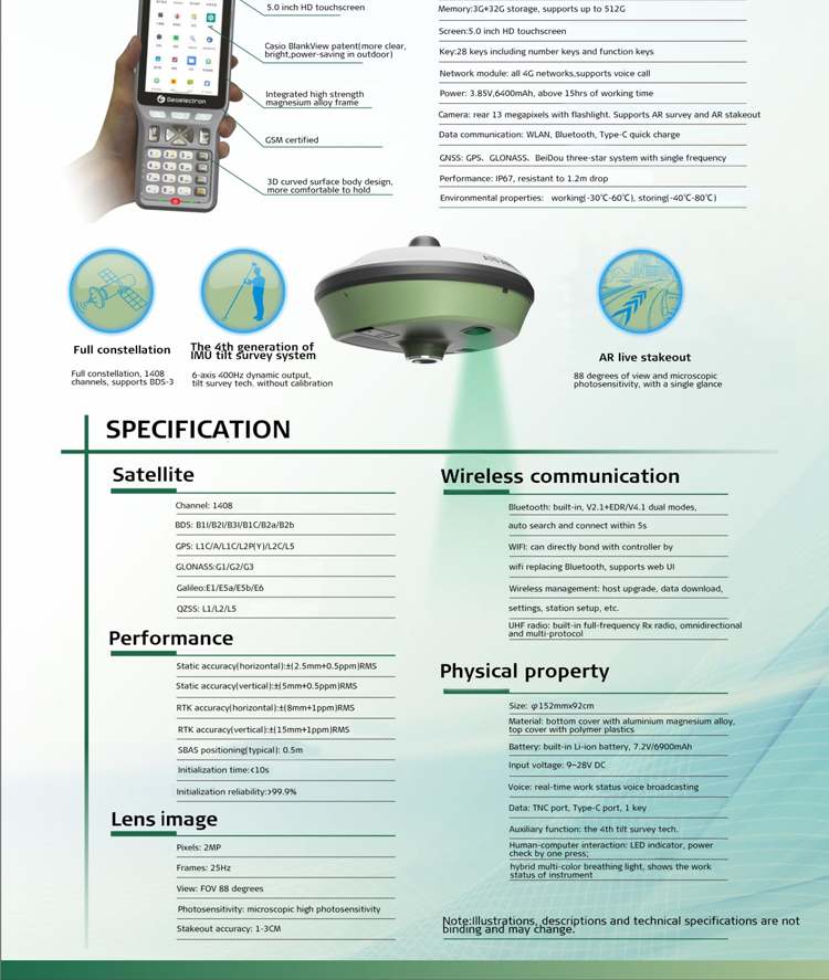
Static Accuracy: Horizontal ±2.5mm+0.5ppm, with vertical accuracy possibly differing (not directly specified but typically similar to or slightly worse than horizontal accuracy).
RTK Accuracy: Horizontal ±8mm+1ppm, vertical ±15mm+1ppm, meeting the requirements of most measurement tasks.
Image Resolution: 2MP, capable of capturing clear measurement images.
Initialization Time: Typically less than 5 seconds, enabling quick startup and measurement.
Operating System: Linux system, supporting WebUI web settings for convenient parameter configuration and data processing.
Application Scenarios
The foif a70AR is suitable for various measurement and staking tasks, such as engineering surveys, topographic surveys, construction projects, and other fields. Its high precision, high reliability, and augmented reality technology make it an ideal tool for these applications.
foif a70AR, as a GNSS receiver RTK measurement system that integrates Augmented Reality (AR) technology and Inertial Measurement Unit (IMU) tilt functionality, boasts a wide range of diverse application scenarios, primarily suitable for the following fields:
Engineering Surveys
In the realm of engineering surveys, foif a70AR provides high-precision positioning and measurement data, making it ideal for measurements related to infrastructure construction such as roads, bridges, and tunnels. Its 3D AR staking feature intuitively combines design data with actual terrain, enhancing staking accuracy and work efficiency. Furthermore, multi-channel support ensures stable measurements in various environments and conditions.
Topographic Surveys
For topographic surveys, foif a70AR accurately measures the elevation and coordinates of terrain surfaces, providing reliable data support for the creation of topographic maps and geographic information systems. Its AR technology displays terrain features in real-time, aiding surveyors in quickly identifying target locations and improving measurement accuracy and efficiency.
Construction Projects
In the field of construction, foif a70AR can be used for building positioning, staking, and monitoring tasks. Its high-precision measurements and real-time display capabilities ensure the accurate positioning and dimensions of buildings, while also monitoring structural deformation and settlement, thereby providing strong support for construction quality and safety.
Land Resource Management
In land resource management, foif a70AR is applicable for measuring land area, boundaries, and terrain, providing accurate data support for land resource planning, utilization, and protection. Its AR technology visually presents the distribution and utilization of land resources, assisting decision-makers in formulating reasonable land use plans.
Forestry and Agriculture
In forestry and agriculture, foif a70AR can be used for forest resource surveys, monitoring, and planning, as well as for farmland measurements and planning. Its high-precision measurements and real-time display capabilities help agricultural and forestry workers accurately grasp resource distribution and utilization, improving resource utilization efficiency and management levels.
In summary, foif a70AR, with its high precision, high reliability, and AR technology, demonstrates broad application prospects and enormous market potential across multiple fields.
Logistics information


Logistics information
A70AR GNSS Receiver Specifications
GNSS Engine
Channel : 1408
Signal received : All constellation and all band reception
BDS B1I/B2I/B3I/B1C/B2a/ B2b
GPS L1C/A/ L2P (Y )/L2C/L5 GLONASS G1/G2/G3
Galileo E1/E5a/ E5b/E6 QZSS L1/L2/L5
Performance
Time Accuracy(RMS):20 ns
Velocity Accuracy (RMS):0.03 m/s Cold start:<30 s
Initialization Time :<5s(typical) Initialization Reliability: >99.9% Single-point positioning(RMS):
Horizontal: 1.5m, Vertical: 2.5m DGPS(RMS):
Horizontal: 0.4m, Vertical: 0.8m Static:
Horizontal: ±(2.5mm+0.5ppm)RMS
Vertical: ±(5mm+0.5ppm)RMS RTK(RMS):
Horizontal: ±(8mm+1ppm)RMS Vertical: ±(15mm+1ppm)RMS
Data
Internal memory: 8GB standard, support s TF card extending to 32GB;
Differential data : RTCM V3 .x ; Data format : NMEA 0183;
Data security: RTK survey data secured in three ways(synchronizing storage in both controller and A90, and uploading to cloud for backup is available )
Environmental
Temperature: -30℃ to 60℃ for operating temperature,-40℃ to 80℃ for storage temperature;
Humidity: 100% condensing resistant;
Shock: 2 m pole drop resistant in normal temperature;
Protection: IP68
Configuration
Bluetooth: built-in , Bluetooth 2 . 1+EDR/ Bluetooth 4 .0 BLE;
Electronic bubble: supported ;
Tilt survey: IMU inertial navigation module, 6-axis 400Hz dynamic output , calibration-free;
Network communication: fits various networks;
WI FI: 802 . 11b/g/n , can connect to controller through WI FI re placing Bluetooth , supports WebUI wireless management including firmware update , data download , settings , station setup;
Radio: internal 1w radio ( Rx/Tx ) with a typical working range of above 5km , external 2/35w radio (Tx ) with a typical working range of above 15km , and supports protocol like PCC-EOT, TrimTalk450S , TrimMarkIII , South , HiTarget , GeoTalk , GeoMark , etc Physical
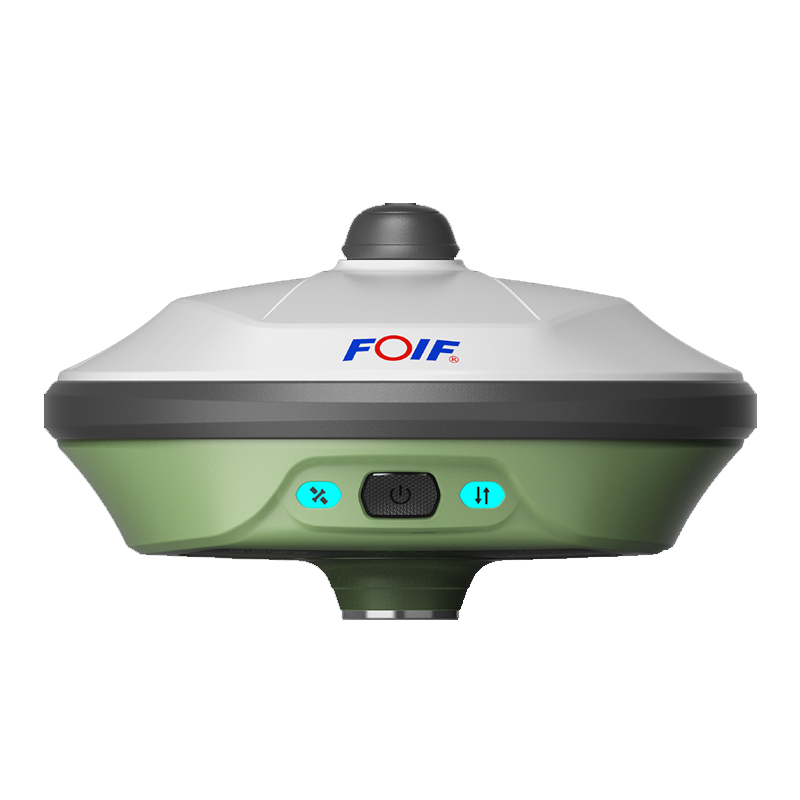
Size: 156mm*76mm(Φ x H ), Material : bottom is magnesium alloy and top is polymer plastics;
Battery: 7 .4V x 3400mAh x 2pcs, smart removable lithium battery(with power indicator );
User interface: 4 LED indicator lights, 1 TF card s lot, 1 SIM card s lot, 1 button, real-time voice broadcasting , TNC port(connecting built-in radio antenna ), 5-pin l emo port(connecting external power supply and external radio ), 7-pin l emo port(USB+serial port , connecting PC and controller )
Other
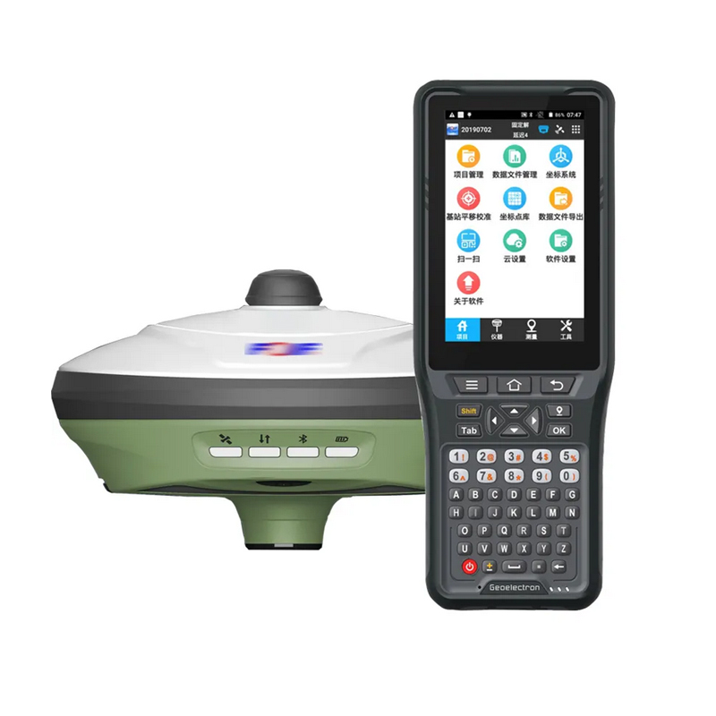
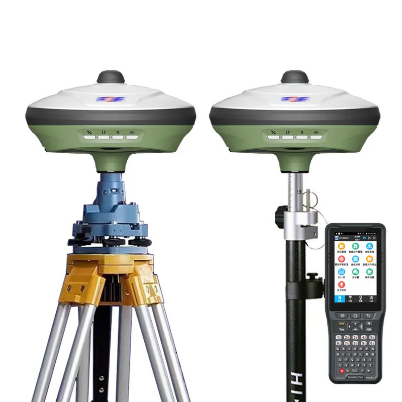
Controller:P9III or P9IV;
Software: FOIF Surpad;
Application: Power system, land, construction, transportation, forestry, agriculture, deformation monitoring, water conservancy system