


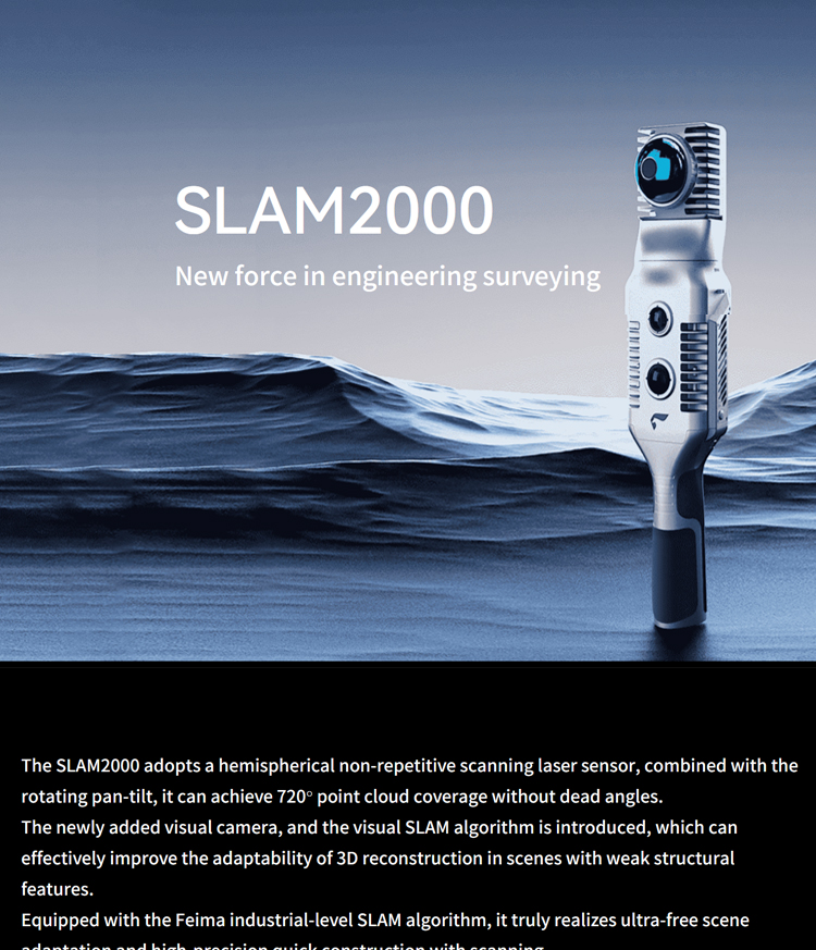
Feima Slam 2000 High Precision 3D Laser Scanner GPS RTK GNSS Test Instrument with High Accuracy
Product Features
1.High-precision Measurement:
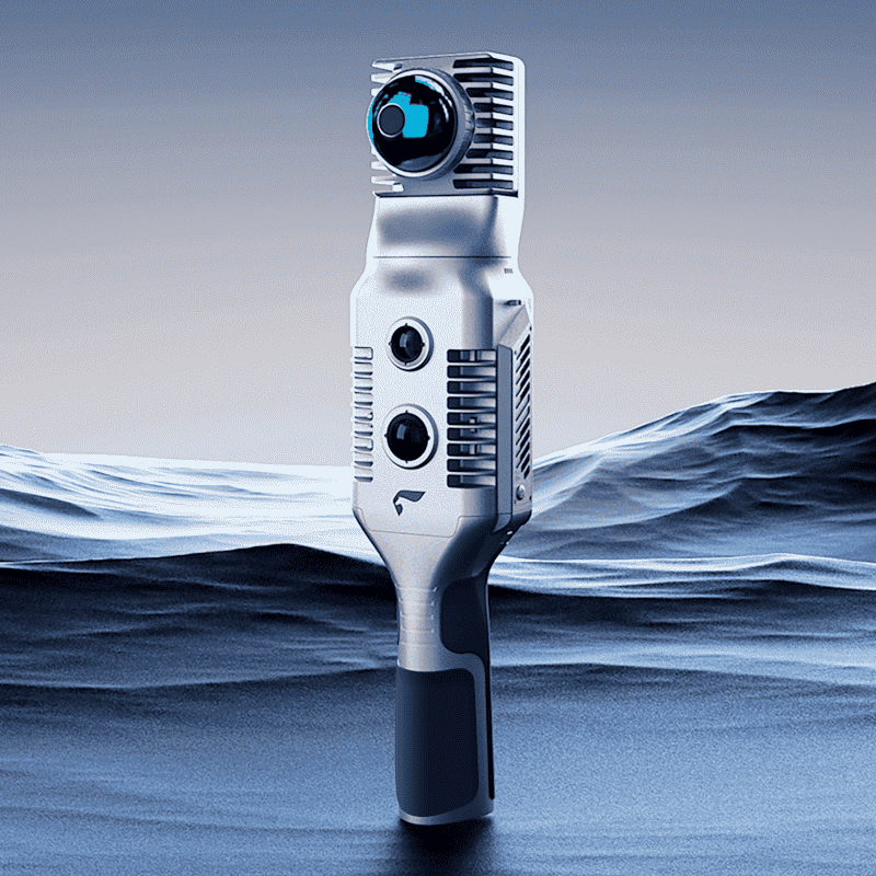
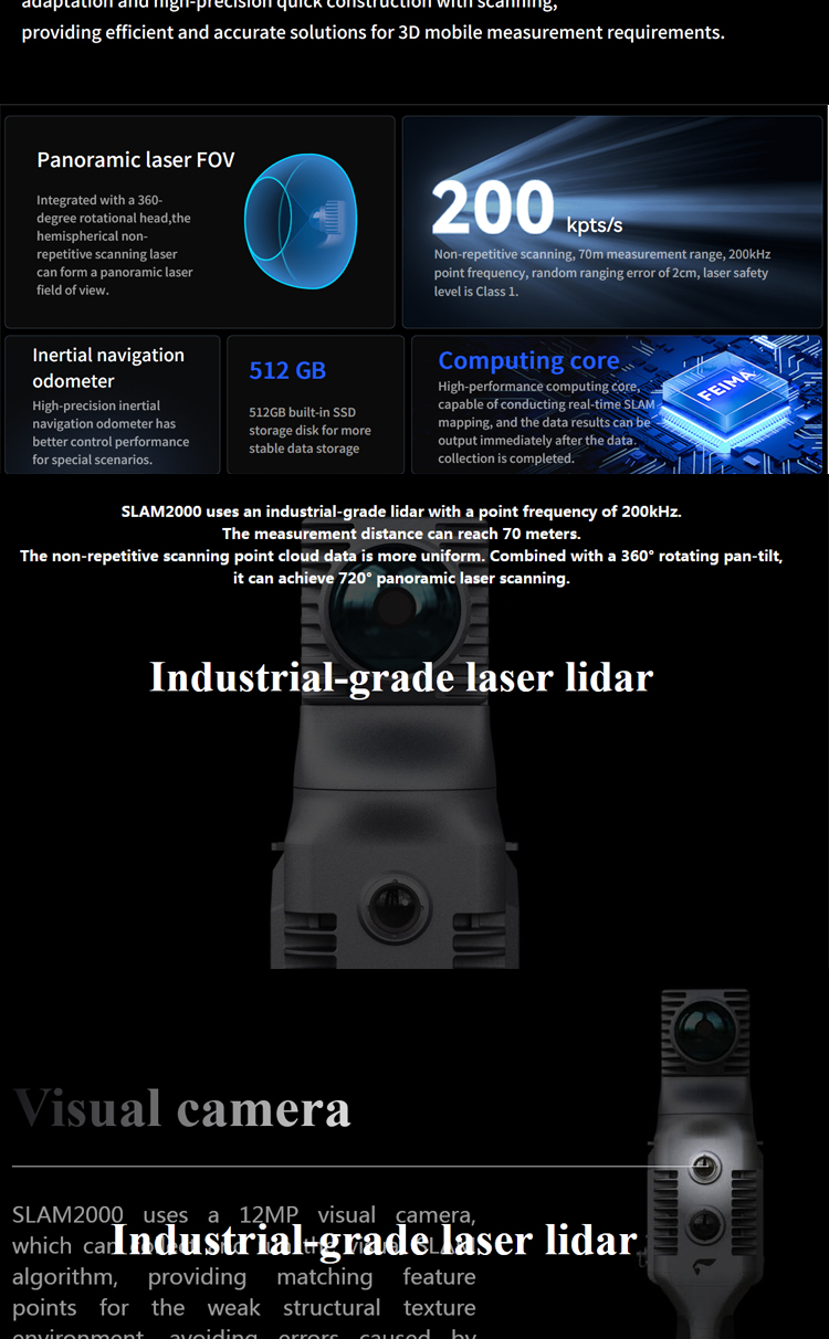
1.Pegasus SLAM2000 is equipped with a high-resolution laser sensor and visual camera, capable of non-repetitive scanning with a range of up to 70 meters and a point frequency of up to 200,000 points per second, ensuring the accuracy and completeness of measurement data.
2.The relative accuracy after post-processing can reach ≤2cm, real-time accuracy ≤3cm, point cloud thickness after post-processing ≤1cm, and real-time ≤2cm, meeting various high-precision measurement requirements.
2.Versatility:
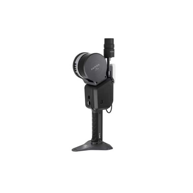
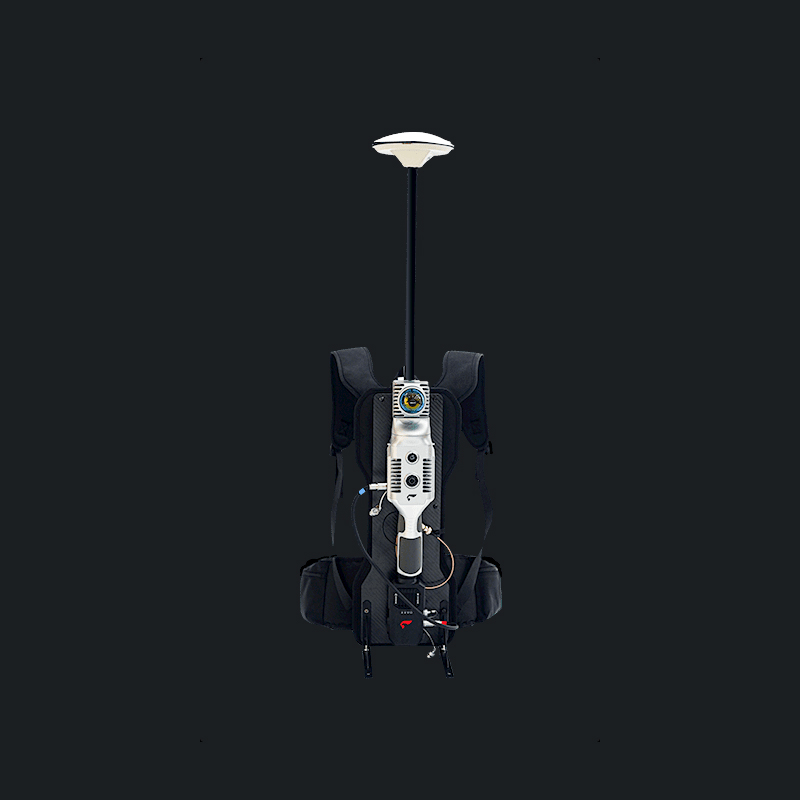
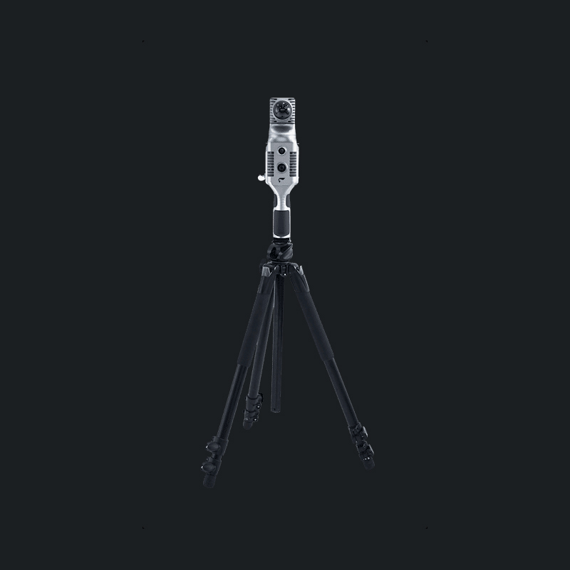
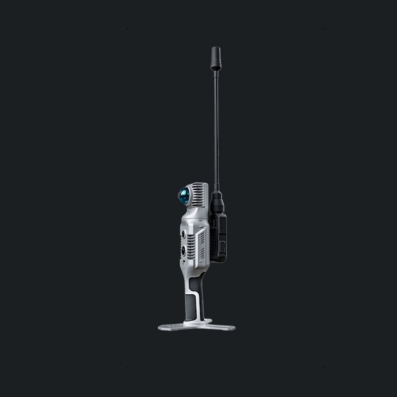
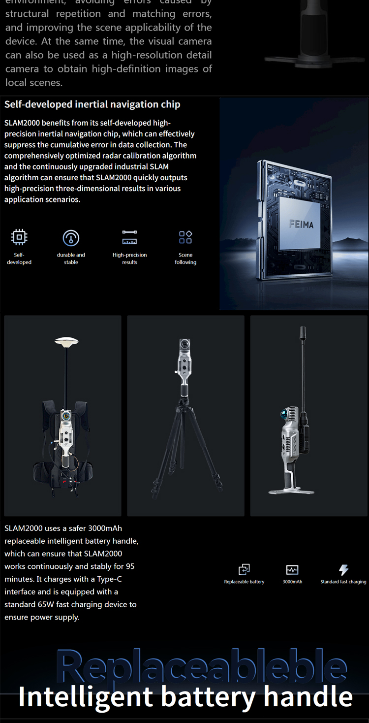
1.The device supports multiple measurement modes, including handheld, backpack, single-pole, etc., convenient for users to use in different scenarios.
2.It also has an autonomous roaming function, capable of autonomously planning paths and conducting scans, greatly improving measurement efficiency.
3.Portability and Durability:
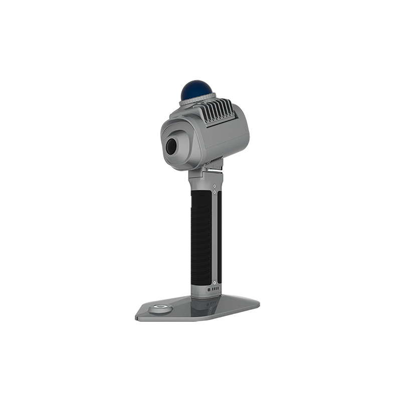
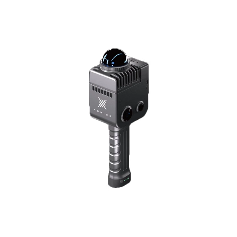
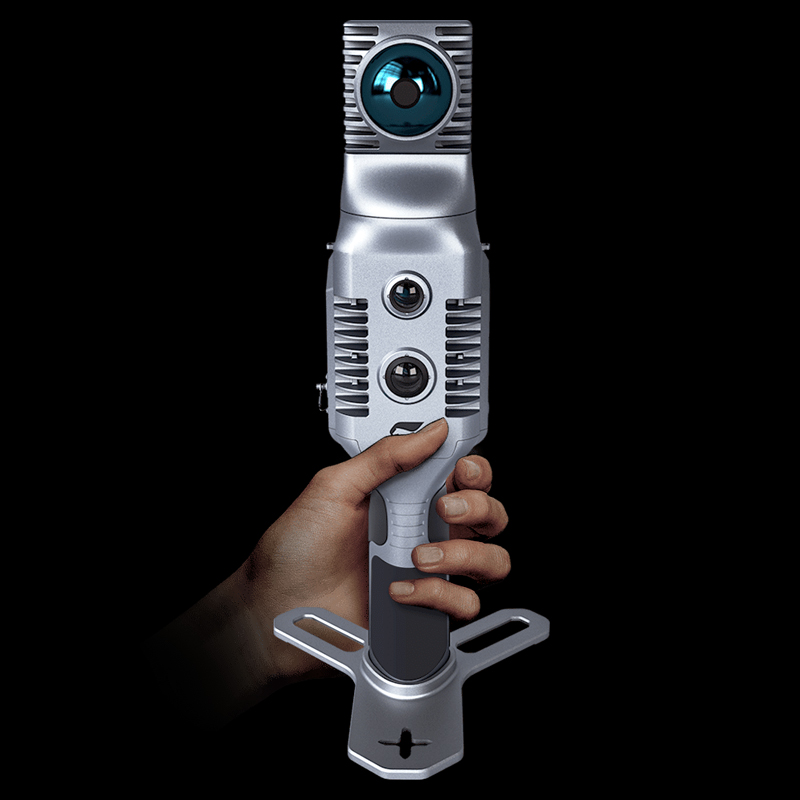
1.Pegasus SLAM2000 adopts a lightweight design, with the main unit weighing only 925g, making it easy for users to carry and operate.
2.The outer shell of the device is made of high-strength materials, with excellent drop and impact resistance, ensuring normal operation in various harsh environments.
4.Real-time Data Processing and Visualization:
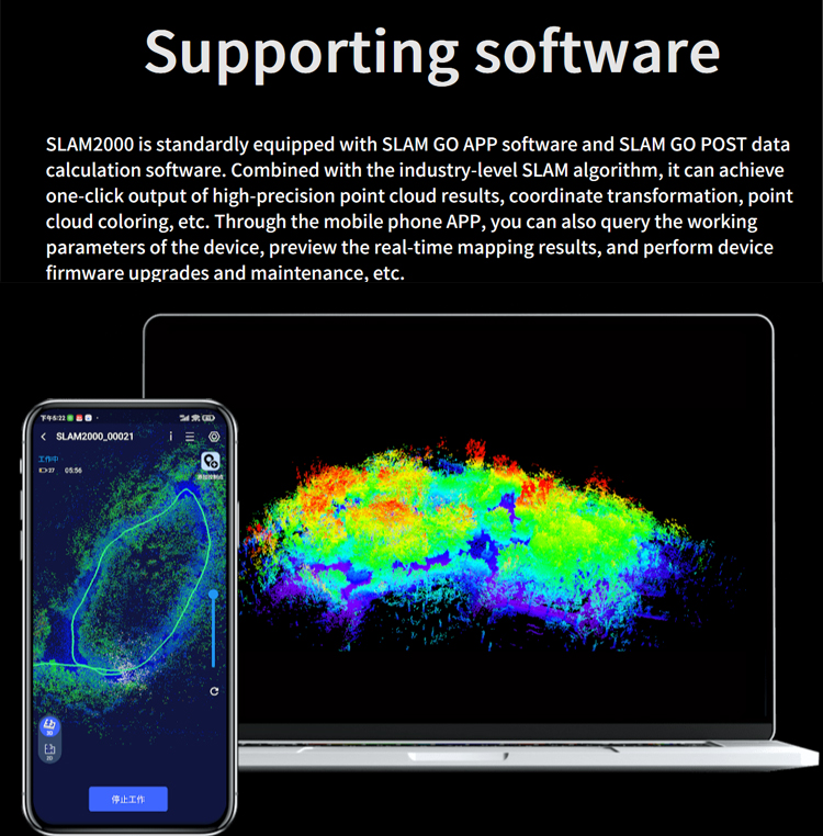
1.Pegasus SLAM2000 supports real-time coloring of color point clouds and real-time data browsing, allowing users to view and adjust measurement results during the scanning process.
It also supports exporting measurement data in multiple formats, facilitating subsequent data processing and analysis by users.
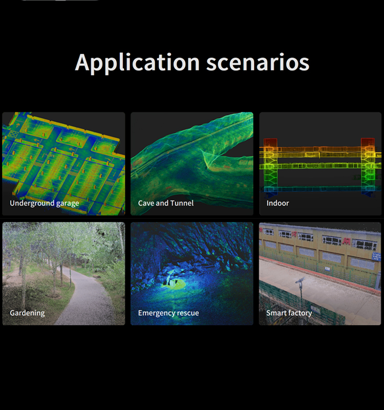
Application Fields
Pegasus SLAM2000 is widely used in various fields such as surveying and mapping, engineering measurement, and three-dimensional modeling. For example:
● In the construction industry, it can be used for three-dimensional modeling and deformation monitoring of buildings.
● In the power industry, it can be used for inspection and maintenance of power lines.
● In the transportation industry, it can be used for measurement and monitoring of infrastructure such as roads and bridges.
● In the field of cultural relics protection, it can be used for scanning and digital protection of ancient buildings.
advantages
High-precision Measurement:
Pegasus SLAM2000 is equipped with high-resolution laser sensors and visual cameras, capable of achieving high-precision three-dimensional measurement. With a measuring range of up to 70 meters and a point frequency of up to 200,000 points per second, it ensures the accuracy and completeness of measurement data.
The relative accuracy after post-processing can reach ≤2cm, and the real-time accuracy is ≤3cm. Such high-precision measurement capabilities give it significant advantages in various high-precision application scenarios.
Versatility and Flexibility:
The device supports multiple measurement modes, including handheld, backpack, single-pole, etc., providing users with great flexibility in different usage scenarios.
The autonomous roaming function enables the device to autonomously plan paths and conduct scans, greatly improving measurement efficiency and reducing the need for manual intervention.
Portability and Durability:
Pegasus SLAM2000 adopts a lightweight design, with the main unit weighing only 925g, making it very easy to carry and operate, especially suitable for outdoor or frequently mobile environments.
The outer shell of the device is made of high-strength materials, with excellent drop and impact resistance, ensuring its stability and reliability in various harsh environments.
Real-time Data Processing and Visualization:
It supports real-time coloring of color point clouds and real-time data browsing, allowing users to view and adjust measurement results during the scanning process, greatly improving work efficiency.
It also supports exporting measurement data in multiple formats, facilitating subsequent data processing and analysis by users, and meeting the data needs of different users.
Wide Range of Applications:
Pegasus SLAM2000 has broad application prospects in surveying and mapping, engineering measurement, three-dimensional modeling, and other fields. Whether it's for three-dimensional modeling and deformation monitoring in the construction industry, inspection and maintenance of power lines in the power industry, or measurement and monitoring of infrastructure in the transportation industry, it can provide efficient and precise solutions.
In summary, Pegasus SLAM2000 has become a highly regarded high-performance handheld LiDAR scanner in the market due to its advantages of high-precision measurement, versatility and flexibility, portability and durability, real-time data processing and visualization, as well as a wide range of applications.
Logistics information


Logistics information
technical parameter
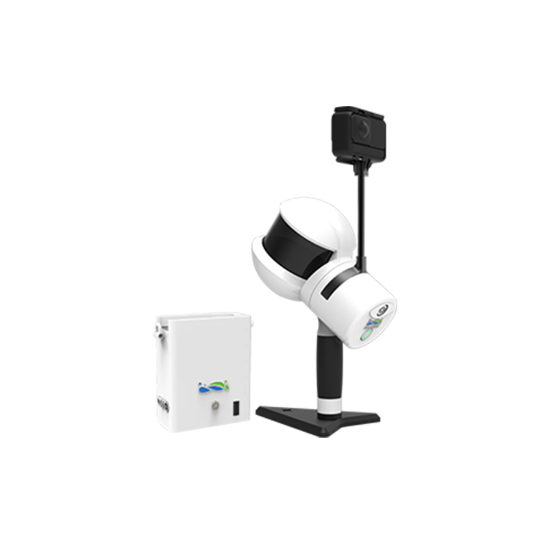
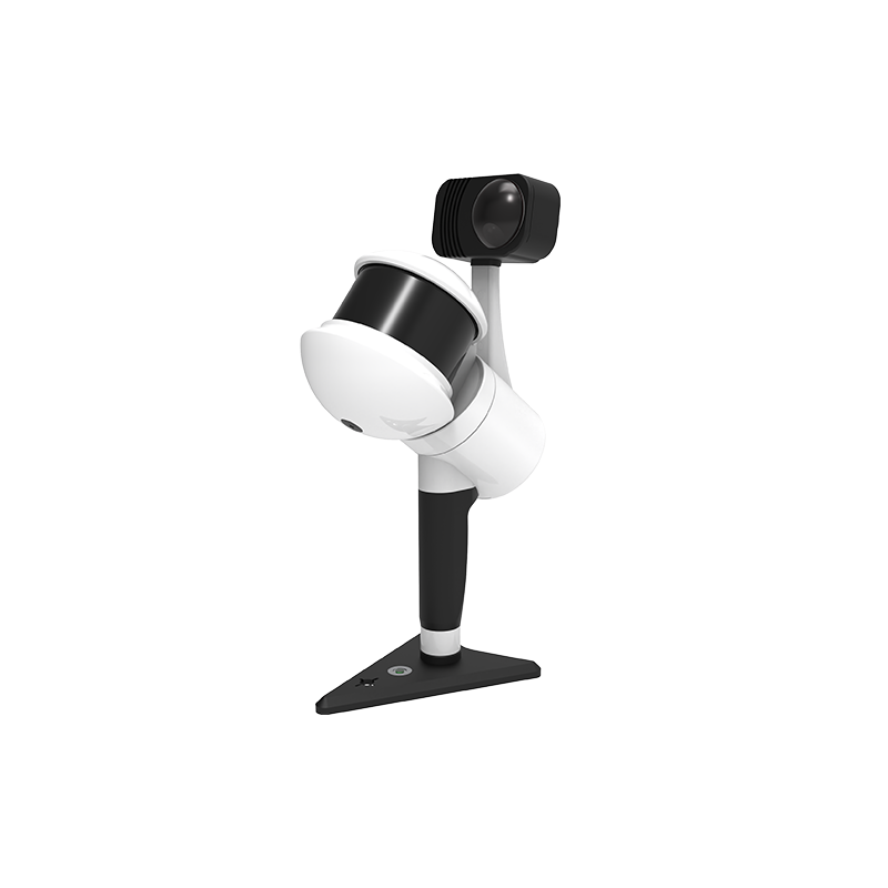
| Main body | Weight | 925 g ( Host ) 1450 g ( With handle and base ) |
| Power consumption | 20 W ( Typical ) | |
| Internal storage | 512 GB SSD | |
| Humidity | < 95% | |
| Scanning FOV | Panoramic 360° | |
| Dimensions | 94.5 mm x 84.6 mm x 219 mm ( Host ) 170 mm x 173.8 mm x 364.5 mm ( With handle and base ) | |
| Input voltage | 20 V | |
| Working temperature | -20 ℃ ~ 50 ℃ ( Operation ) , -40 ℃ ~ 70 ℃ ( Storage ) | |
| Protection class | IP54 | |
| Accuracy | Point cloud thickness | 1 cm ( Post-processing ) , 2 cm ( Real-time ) |
| Absolute accuracy | 5 cm ( Post-processing ) | |
| Relative accuracy | 2 cm ( Post-processing ) , 3 cm ( Real-time ) | |
| Laser scanner | Wavelength | 905 nm |
| Range | 0.1 m ~ 70 m @ 80% | |
| Laser pulse repetition rate | 200 kHz | |
| Frame rate | 10 Hz ( Typical ) | |
| Laser class | Class1 | |
| FOV | 360° ( H ) , -7° ~ 52° ( V ) | |
| Echo | Single ( Strongest ) | |
| Texture camera | Resolution | 12 MP |
| Frame rate | 30 Hz | |
| FOV | 210° ( Diagonal ) | |
| Interface | Resolution | 12 MP |
| FOV | 100° ( Diagonal ) | |
| USB Type-C1 | SSD data copy | |
| Gircular connector | Charge by PD power bank , OTG ( 5V ) | |
| USB Type-C2 | External power supply ( 20 V ) , External S-RTK | |
| WiFi | Supported | |
| Output voltage | 10.8 V | |
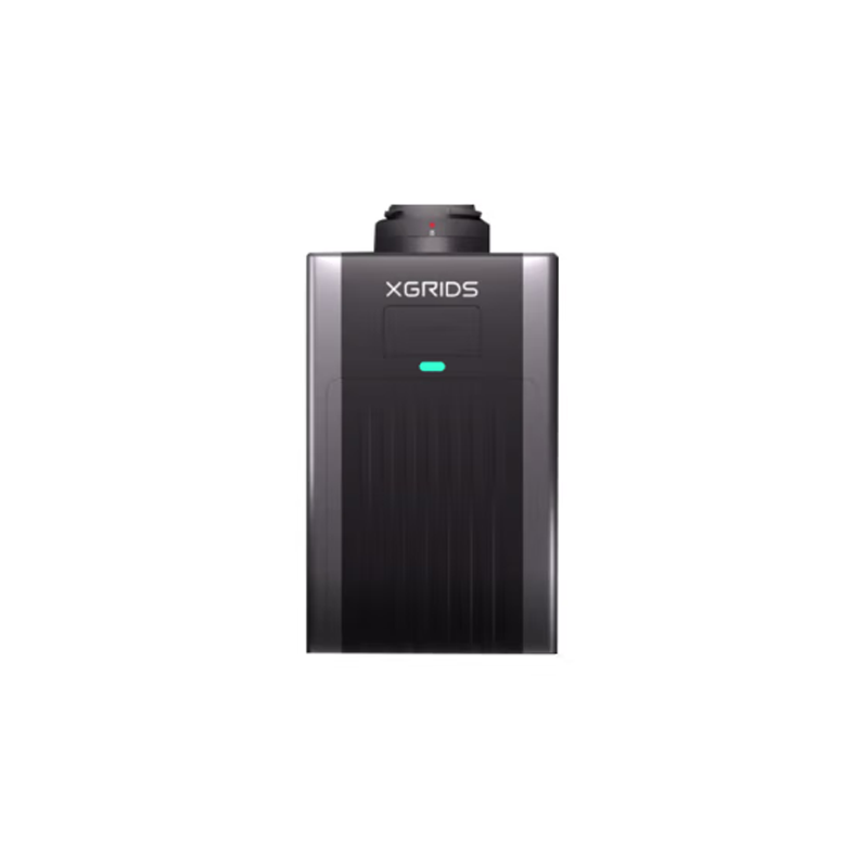
| Weight | 400 g | |
| Endurance | Approx 95 mins ( SLAM2000 only ) | |
| Input voltage | 5 V - 20 V | |
| Battery Capacity | 3000 mAh |