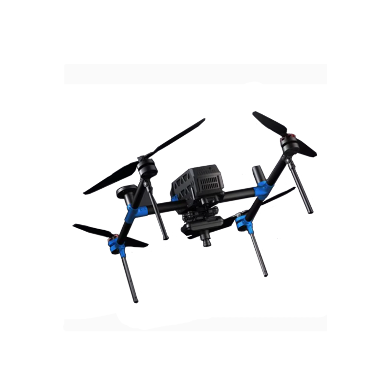
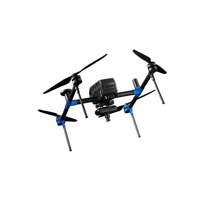

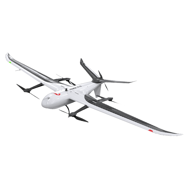
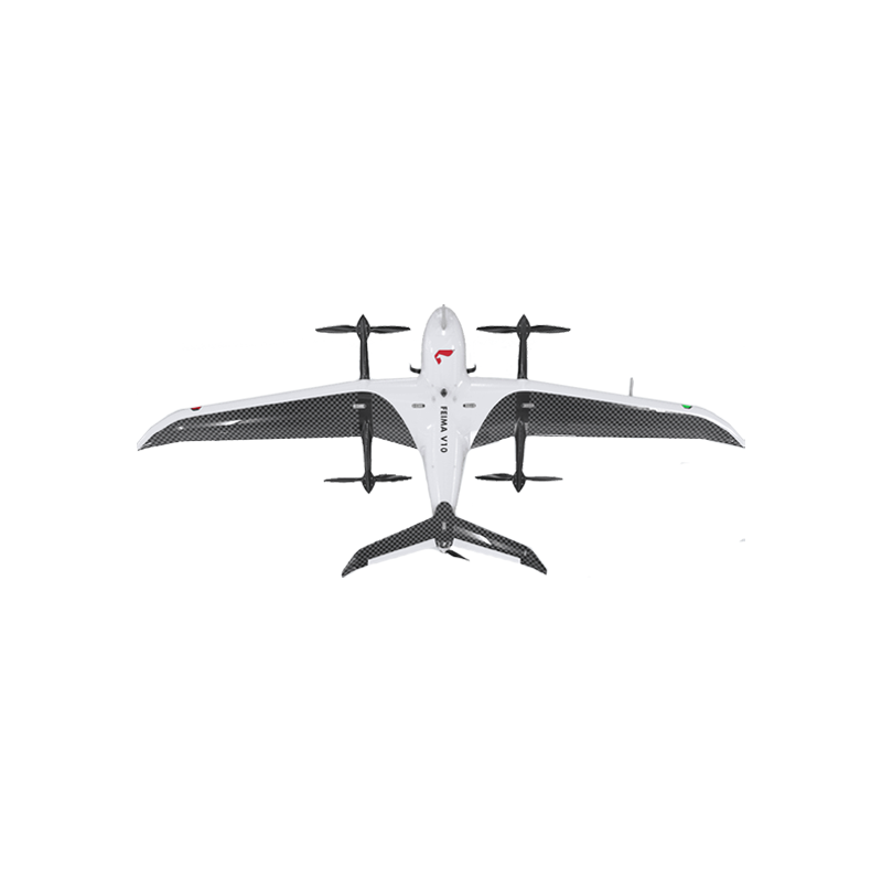

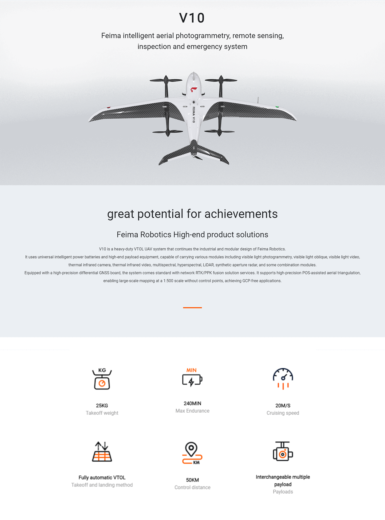
FEIMA ROBOTICS intelligent inspection system V10 fixed wing UAV
Logistics information


Technical Features
FEIMA ROBOTICS V10 fixed-wing UAV is the 1 high-performance and multi-functional UAV system. The following is a detailed evaluation of it:
Excellent performance of 1. technology
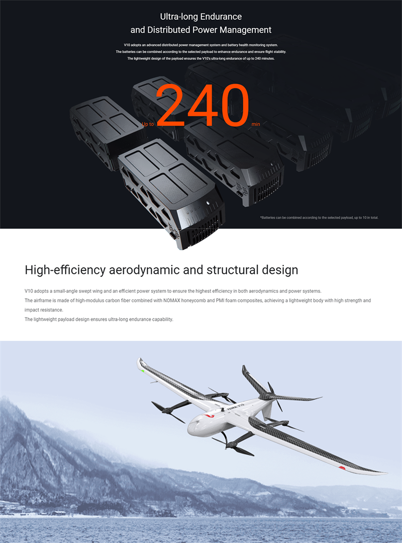
Vertical take-off and long endurance:
The V10 is capable of vertical take-off and landing, which gives it greater flexibility and applicability in tight spaces or complex terrain.
Its endurance is up to 240 minutes (under a load of 1kg), which ensures that the UAV can perform long patrol or mapping tasks.
Large load and multi-load support:
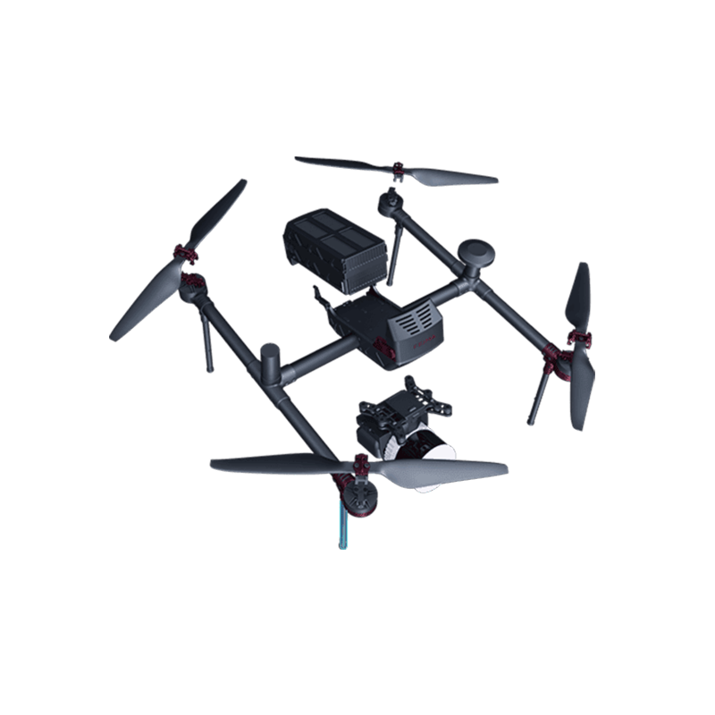
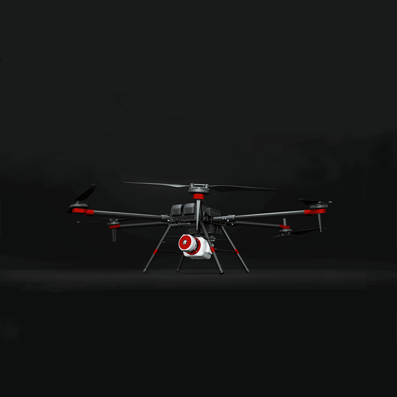
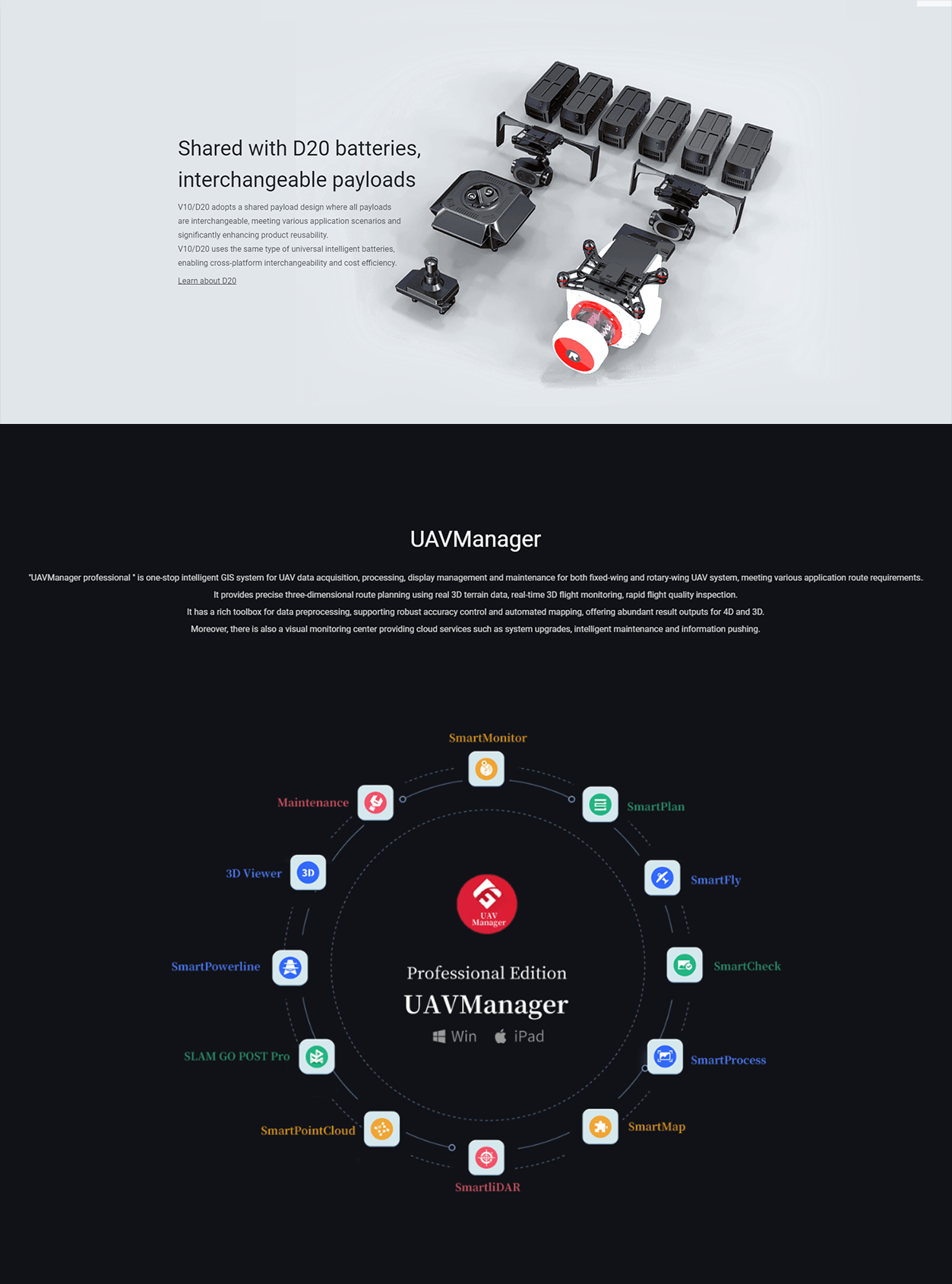
The V10 has a maximum load capacity of 8kg and can carry a variety of mission payloads, such as visible light aerial survey module, thermal infrared camera module, multi-spectral module, etc., to meet different application requirements.
All loads are universal and interchangeable, greatly increasing the value of product reuse.
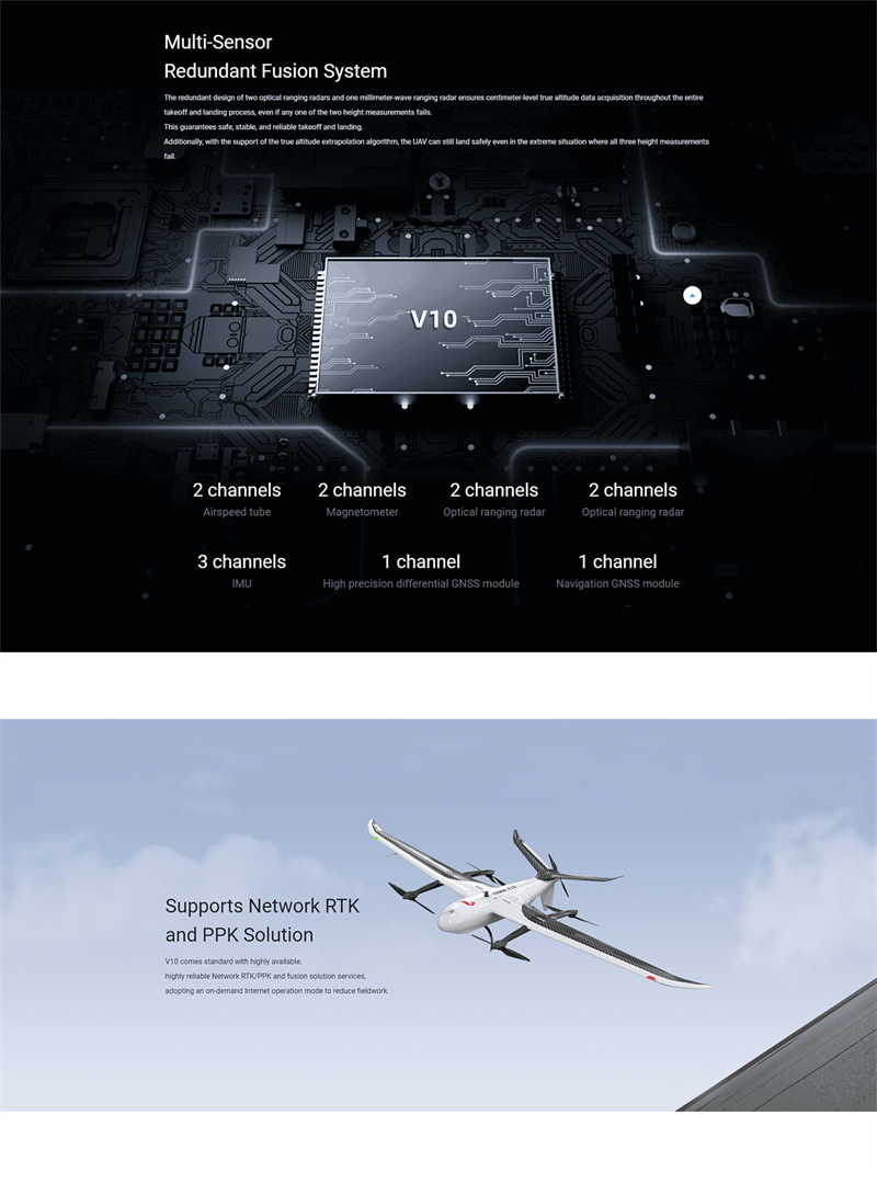
high precision navigation system:
V10 is equipped with a high-precision differential GNSS board, which provides RTK/PPK fusion calculation and high-precision POS auxiliary air three capabilities.
Standard high-availability, high-reliability network RTK/PPK and its fusion solution service, to take on-demand Internet operation mode, reduce the workload of the field.
- feature-rich and efficient
3d route planning and monitoring:
V10 supports accurate 3D route planning, accurate terrain following flight and 3D real-time flight monitoring.
This enables the UAV to maintain a stable flight attitude in complex terrain and transmit flight data in real time.
a key mapping and data processing:
The equipped UAV butler professional software supports the whole process of one-key mapping and one-key export of three-dimensional mapping.
At the same time, it supports the whole process laser data processing of high-precision combined navigation track solution, point cloud solution and point cloud post-processing, and provides DOM, DSM, TDOM, LAS point cloud and other data processing and browsing.
- safe and reliable design
Multiple backup systems:
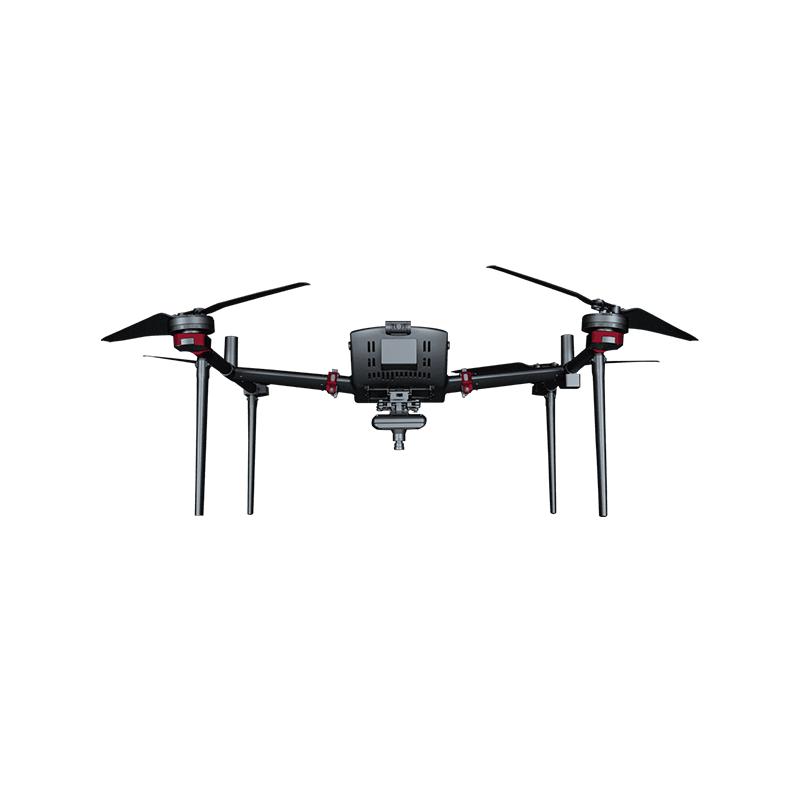
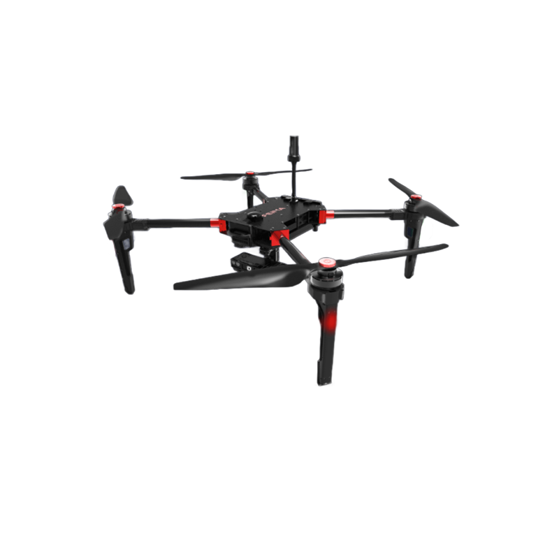
The core sensor of V10 adopts three-way backup design, including 2-way pitot tube, 2-way magnetometer, 2-way optical ranging radar and 1-way laser ranging radar, which improves the safety and stability of flight.
Emergency handling capacity:
In the case of any one-way height measurement failure, the centimeter-level true height data can be obtained in the whole process of V10 take-off and landing.
With the blessing of the true altitude extrapolation algorithm, the UAV can land safely even in the extreme case of 3-way altitude measurement failures.
Wide range of 4. applications
V10 is suitable for aerial survey, remote sensing, inspection, emergency and other fields. Its high precision and high efficiency make it a good assistant in urban planning, environmental monitoring, disaster assessment and other tasks. Especially in the rapid construction of urban three-dimensional white model, V10 shows excellent performance, providing an efficient and economical solution for the construction of smart city.
In summary, the FEIMA ROBOTICS V10 fixed-wing UAV performs well in terms of technical performance, functional richness, safety and reliability, and application areas. However, as the 1 high-performance UAV system, its price may be relatively high, and users should consider it comprehensively according to their own needs and budget before purchasing.
Performance
FEIMA ROBOTICS V10 (may also be referred to as V10) is the 1 large-load, long-duration, multi-function, high-precision fixed-wing unmanned aerial vehicle system. The following is the parameter configuration of V10 organized according to relevant information:
- basic specifications
UAV type: large load vertical take-off and landing UAV system
Take-off weight: 26KG (25KG, may vary depending on configuration)
Body material: high modulus carbon fiber with NOMAX honeycomb and PMI foam sandwich composite
- power system
Drive mode: pure electric drive
Maximum battery life: 240 minutes (under 1kg load)
Cruising speed: 20 m/s (or 72 km/h)
- flight performance
take-off and landing mode: automatic vertical take-off and landing
Flight control distance: 50KM (may vary depending on communication conditions or configuration)
Flying altitude: up to 7500m
- load system
Load type: It can carry a variety of loads, including visible light aerial measurement module, thermal infrared camera module, multi-spectrum module, lidar module, etc.
Load capacity: large load design, to meet the needs of a variety of tasks
- navigation system
High-precision differential GNSS board: supports RTK/PPK fusion calculation and high-precision POS-assisted aerial triangulation
Sensor configuration: integrated flight control, IMU, data transmission radio, high-precision differential GNSS board, navigation GNSS module, millimeter wave radar and other high-performance sensors
Redundant design: The core sensors all use three-way backup to improve flight safety and stability
- other features
Distributed power management system: advanced distributed power management system and battery health monitoring system to improve battery life
UAV butler professional software: support accurate three-dimensional route planning, three-dimensional real-time flight monitoring and other functions, to provide full-process operation support
Free image control mapping capability: 1:500 large scale mapping capability without control points to realize free image control application
- Application Scenarios
Aerial survey: used in urban planning, environmental monitoring and other fields of topographic map and orthophoto map acquisition
Remote sensing: fast acquisition and analysis of surface information by carrying different remote sensing payloads
Inspection: suitable for power line inspection, pipeline inspection and other tasks to improve inspection efficiency and safety
Emergency response: plays an important role in disaster assessment, personnel rescue and other emergency scenarios
In summary, the FEIMA ROBOTICS V10 fixed-wing UAV exhibits high performance, high reliability and versatility in parameter configuration, and is suitable for a variety of application scenarios and requirements. However, please note that the above parameter configurations may vary depending on the product version or configuration. Please refer to the official information for specific parameters.
Logistics information