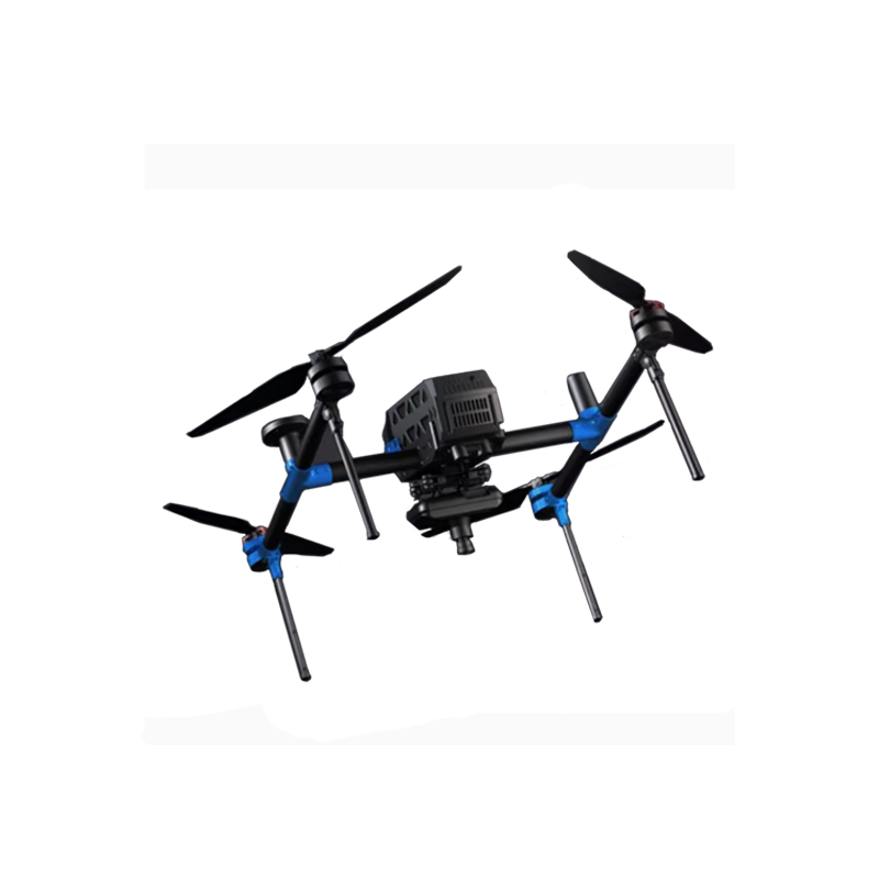

FEIMA ROBOTICS intelligent inspection system E3000 Multi-rotor UAV
Logistics information


Technical Features
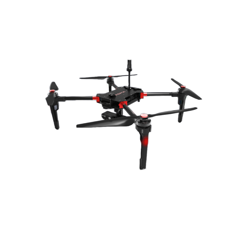
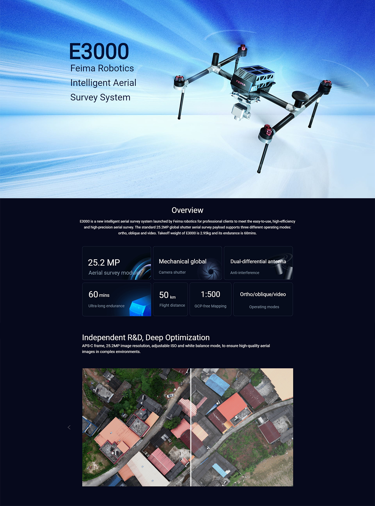
FEIMA ROBOTICS E3000 multi-rotor UAV is the 1 high-performance and high-precision aerial survey UAV. The following is a detailed evaluation of it:
Excellent 1. performance
Efficient Endurance: The E3000 has a battery life of up to 60 minutes, which is essential for missions that require long periods of time for aerial photography or mapping. Long battery life means fewer takeoff and landing times, thereby improving operational efficiency.
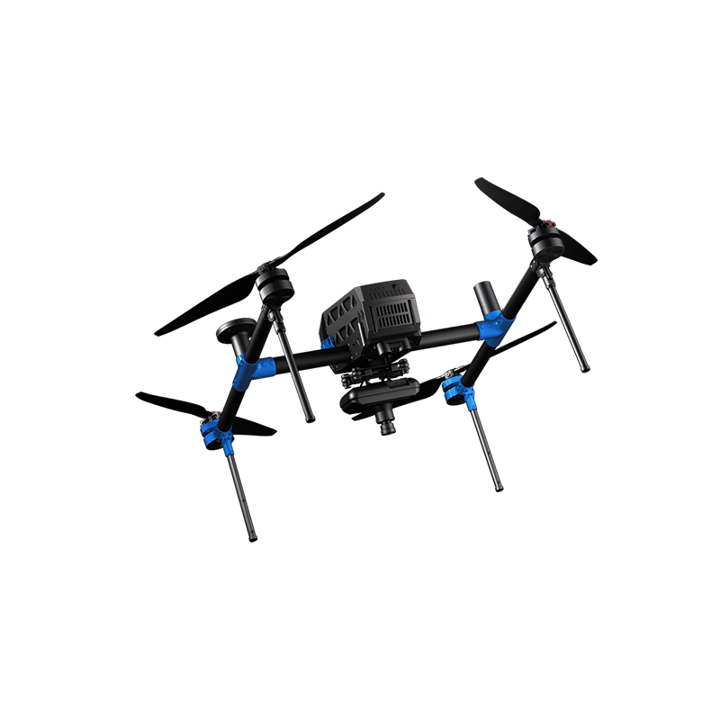
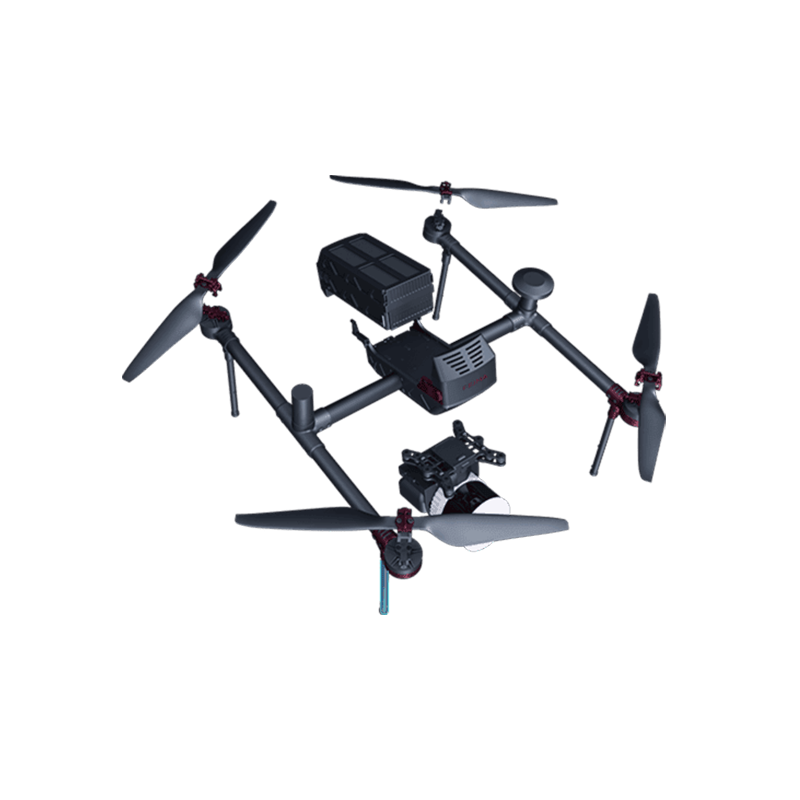
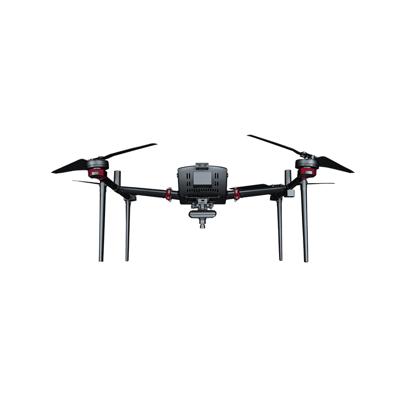
Lightweight design: The takeoff weight is only 2.95kg, making the E3000 easier to carry and transport. At the same time, the lightweight design also helps reduce energy consumption and extend flight time.
High-precision positioning: E3000 is equipped with a high-precision differential GNSS system, supports RTK/PPK fusion operation mode, and can achieve high-precision positioning at the centimeter level. This is very important for tasks that require high-precision mapping or aerial photography.
Excellent 2. image quality
High-resolution camera: E3000 is equipped with a APS-C frame aerial camera module with a mechanical saw shutter, with an image resolution of up to 25.2 million pixels. This makes the captured images clear and delicate, high color reproduction.
Professional lens design: 28mm focal length lens is selected, double Gaussian symmetrical structure and abnormal dispersion lens structure are adopted, which can effectively control the lens volume and suppress the phase difference of the optical system. The optical distortion of the lens is within 2 ‰ to ensure that the captured image has no distortion.
Adjustable parameters: Support users to adjust the ISO white balance and shutter speed, so that users can take high-quality images in different light environments.
Full-featured 3.
Multiple operation modes: supports tilt photography, orthophoto and other operation modes to meet the application requirements in different scenarios.
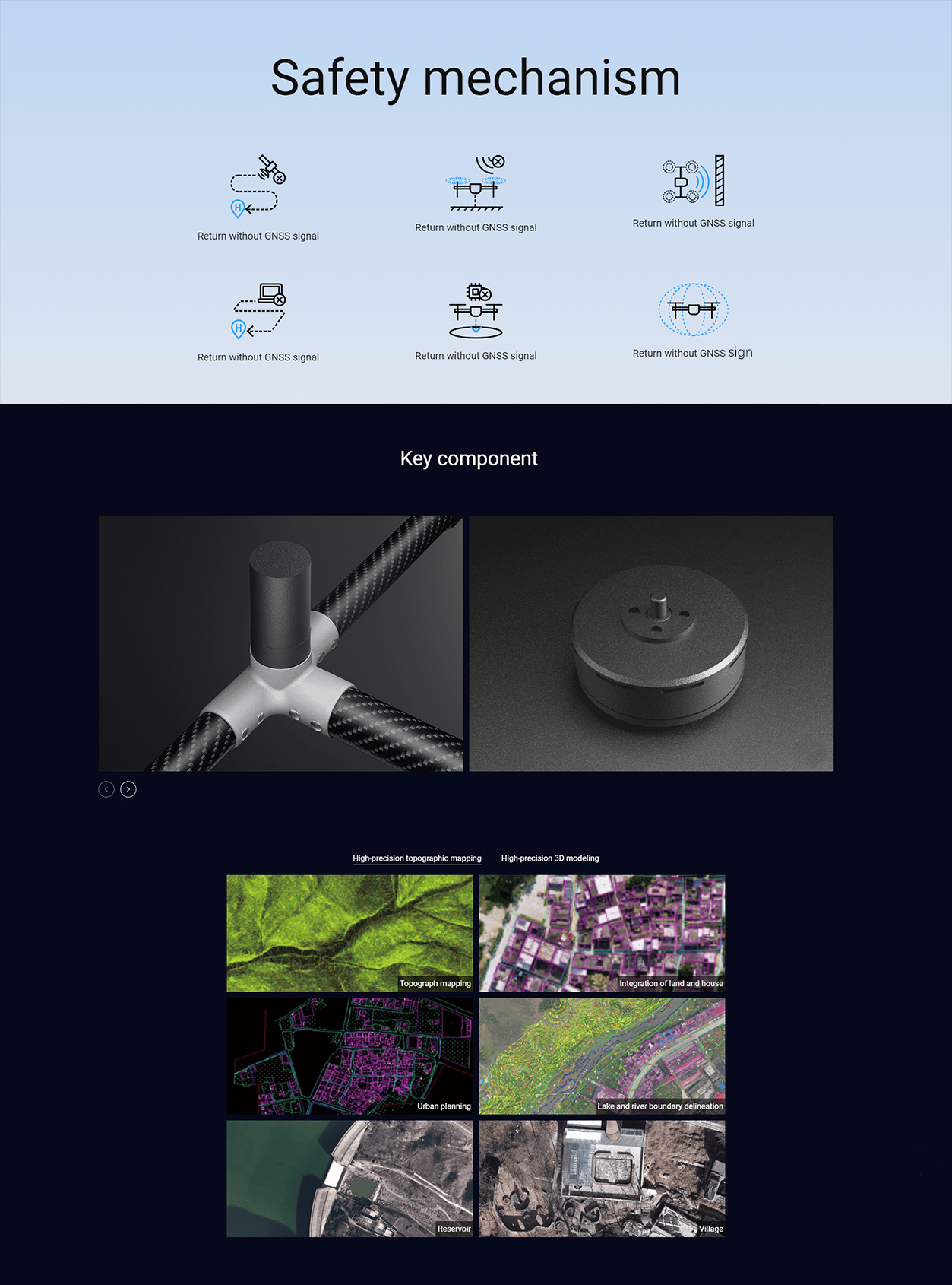
Complex environment operation ability: equipped with double differential antenna, strong anti-interference ability, with mining areas, bridges, ship-borne landing platform and other complex environment operation ability.
Terrain following flight: support variable route, with accurate terrain following flight capability, can improve the image acquisition resolution, and ensure the consistency of image resolution.
- intelligent control
UAV butler control: E3000 can not only be controlled by UAV butler, but also add Android version of ground station. Users can control UAV with one key through mobile phone terminal to realize remote monitoring and command.
Rich data results: equipped with UAV butler professional software, can provide DOM, DEM, DSM, TDS and other data results to meet the diverse data processing needs of users.
- widely used
E3000 multi-rotor UAV is widely used in terrain mapping, urban planning, environmental monitoring, film and television production and other fields. Its high-precision, high-efficiency and high-quality image acquisition capabilities make E3000 show high application value in these fields.
In summary, the FEIMA ROBOTICS E3000 multi-rotor UAV has attracted much attention for its excellent performance, excellent image quality, comprehensive functions, intelligent control and a wide range of applications. Whether from the technical level or from the practical application effect, E3000 has shown a very high cost performance and competitiveness. Therefore, for users who need high-precision aerial survey and high-quality image acquisition, E3000 is undoubtedly a worthy choice.
Performance
FEIMA ROBOTICS E3000 multi-rotor UAV parameter configuration is quite comprehensive and advanced, the following is its detailed parameter configuration information:
- basic parameters
Brand: Pegasus (FEIMA ROBOTICS)
Model: E3000
Type: High performance multi-rotor UAV
- flight performance
Take-off weight: 2.95kg
Endurance: up to 60 minutes (the specific time may vary due to factors such as battery status, load and flight environment)
Flight mode: support policy tilt, video and other operating modes
Anti-interference ability: equipped with double differential antenna, strong anti-interference ability, suitable for complex environment operation
- imaging system
Aerial photography module: APS-C frame aerial photography module equipped with mechanical god saw shutter
Image resolution: 25.2 million pixels
Lens design: 28mm focal length lens is selected, double Gaussian symmetrical structure and abnormal dispersion lens structure are adopted, and the optical distortion of the lens is within 2 ‰
Shutter speed: Built-in mechanical global shutter, the speed can reach up to 1/2000 second, effectively avoiding the jelly effect caused by exposure delay and the phase shift caused by the rapid movement of the UAV
Adjustable parameters: support user adjustable ISO white balance and shutter speed
- Navigation and Positioning
Positioning system: real-time positioning system
Differential GNSS: Support high-precision differential GNSS system to achieve centimeter-level positioning accuracy
- intelligent function
Terrain following: support variable route, with accurate terrain following flight capability
Control mode: not only can it be controlled by the drone butler, but also an Android version of the ground station is added to support one-touch control of the drone on the mobile phone.
Data results: equipped with UAV butler professional software, can provide DOM, DEM, DSM, TDS and other data results
- other features
Reliability test: after a number of components of the whole machine reliability test, to ensure product safety and reliability
Application scenarios: suitable for complex environments such as mining areas, bridges, ship-borne landing platforms, etc.
In summary, the FEIMA ROBOTICS E3000 multi-rotor UAV exhibits excellent performance and comprehensive functions in parameter configuration. Its high-precision positioning, long-time operation capability, high-resolution image system and intelligent software solutions make E3000 highly competitive in aerial survey, remote sensing, inspection and other fields.
Logistics information