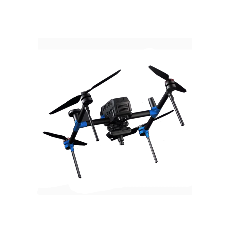
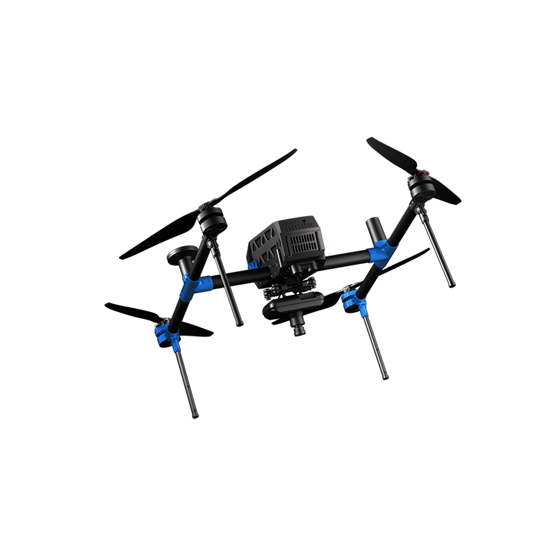
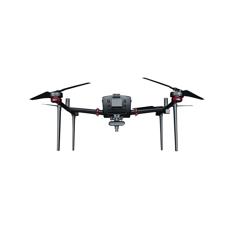
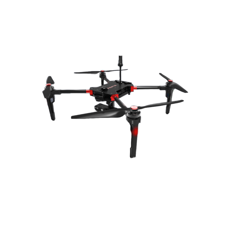
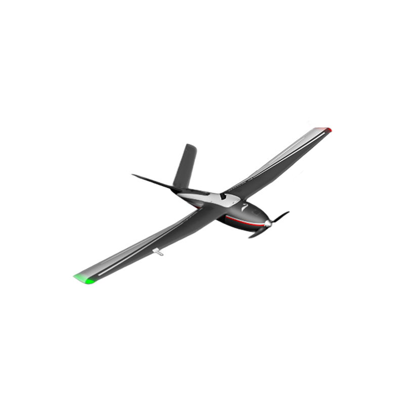

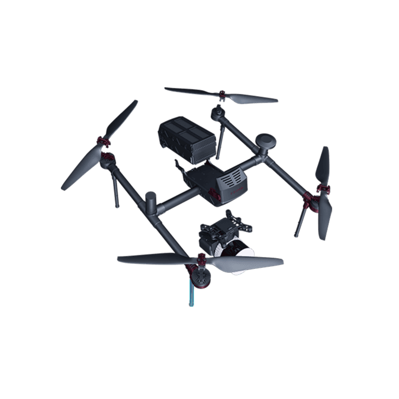
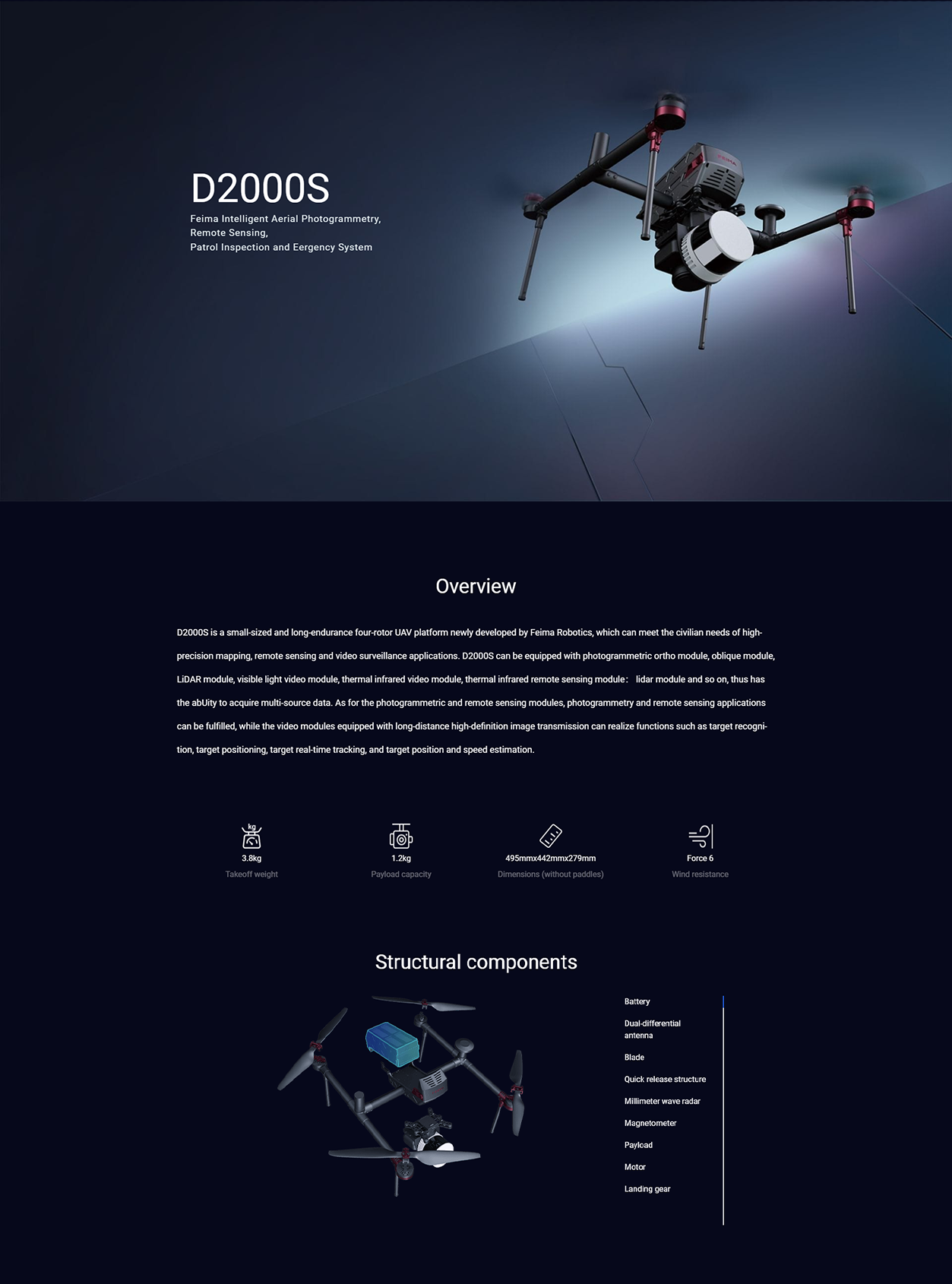
FEIMA ROBOTICS intelligent inspection system D2000S Multi-rotor UAV
Logistics information


Technical Features
The following is a detailed evaluation of the FEIMA ROBOTICS D2000S multi-rotor UAV is the 1 high-performance and full-featured aerial survey UAV system:
Overall 1. evaluation
The D2000S UAV system is known for its miniaturization, long endurance, high precision and multi-source data acquisition capabilities. It is widely used in topographic surveying and mapping, engineering survey, land survey, urban planning, digital city, cultural relics protection and other fields, showing excellent performance and reliability.
- performance characteristics
Long endurance and high precision:
The D2000S has a battery life of up to 74 minutes (single battery) and comes standard with two batteries to ensure long-term operation.
Equipped with high-precision differential GNSS board and dual differential antenna, it supports PPK, RTK and its fusion operation mode, and can realize high-precision mapping without control points or rare control points.
Multi-source data acquisition:
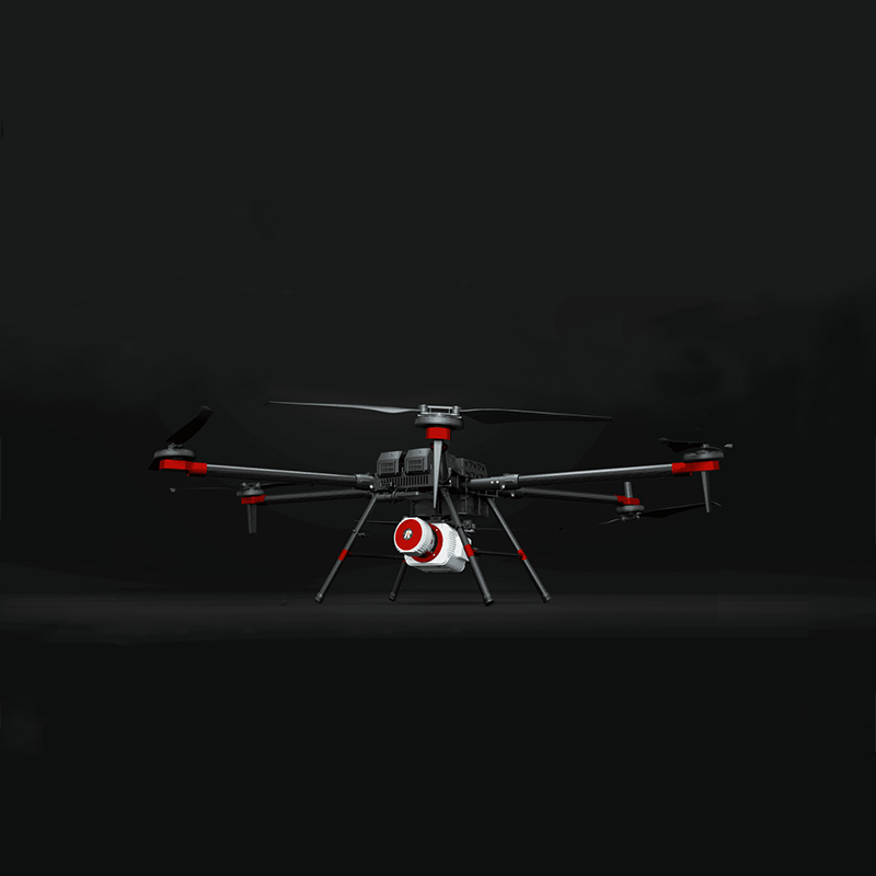
The D2000S adopts modular load design and can carry a variety of application loads such as aerial survey module, tilt module, visible light video module, thermal infrared video module, multi-spectral module, lidar module, etc.
This design enables the D2000S to quickly change the load according to different application scenarios and needs, and to achieve multi-source data acquisition.
High reliability and safety:
The autopilot of D2000S adopts multi-channel redundant sensor design, which supports functions such as obstacle avoidance, lost connection automatic return, strong wind automatic return, low power automatic return and so on.
Equipped with a front millimeter-wave radar obstacle avoidance module, it can automatically detect obstacles in front and improve the safety level.
Through a number of components, the machine reliability test, fully guarantee the safety and reliability of the product.
Portable and efficient:
D2000S adopts industrial modular design, small size, light weight, easy to carry and transport.
After the modular decomposition of the whole system, it can be integrated into a work box, and the work can be carried out by a single person and a single package, with rapid task response capability.
intelligent software solutions:
Equipped with "UAV Butler Professional Edition (Measurement Edition)" software, it supports the whole process of accurate 3D route planning, 3D real-time flight monitoring, data preprocessing to spatial data results processing.
Provide DOM, DEM, DSM, TDOM, 3D model and other data processing and browsing functions.
Support information push, project synchronization, flight data sharing, aircraft active maintenance, flight record analysis and display functions.
- application areas and advantages
D2000S multi-rotor UAV is widely used in topographic mapping, engineering survey, land survey, urban planning, digital city, cultural relics protection and other fields. Its advantages are high-precision mapping, multi-source data acquisition, high reliability and security, and portability and efficiency. These advantages make D2000S highly competitive in the field of aerial survey.
- Summary
To sum up, the FEIMA ROBOTICS D2000S multi-rotor UAV has attracted much attention for its excellent performance, comprehensive functions and wide application fields. Whether from the technical level or from the practical application effect, D2000S has shown a very high cost performance and competitiveness. Therefore, for users who need high-precision aerial data, the D2000S is undoubtedly a worthy choice.
Performance
The parameter configuration of FEIMA ROBOTICS D2000S multi-rotor UAV is quite comprehensive and powerful. The following is a detailed summary of its key parameter configuration:
- basic parameters
Name: Pegasus D2000S multi-rotor UAV
Type: Small, long endurance multi-rotor UAV system
Application: High-precision mapping, remote sensing and video applications
- flight performance
Standard takeoff weight: 2.8kg (otherwise 3.8kg, may vary depending on configuration)
Empty machine weight: 2.6kg
Maximum Takeoff Weight: May vary depending on configuration and mission requirements
Standard load: 200g (it is also said that the load capacity is 1.2kg, which may also vary depending on the configuration)
Battery life: 74 minutes (single battery, two batteries may be included as standard to extend operation time)
Single Hover Time at Sea Level: 60 Minutes
Maximum flight speed: 20 m/s (when the aircraft is inclined at 25 degrees)
Cruising speed:
Maximum range cruise speed: 13.5 m/s (maximum range of 50km)
Maximum cruising speed: 7.0 m/s (maximum cruising time 74 minutes)
Maximum climb speed:
Manual mode: 8.0 m/s
Automatic mode: 5.0 m/s
Maximum descent speed:
Manual mode: 5.0 m/s
Automatic mode: 3.0 m/s
- Navigation and Positioning
Navigation satellites: GPS, BeiDou, GLONASS
Differential GNSS board: high precision, 20Hz update frequency
Double differential antenna: standard, improve positioning accuracy and anti-interference ability
Hover accuracy:
RTK level: 1cm 1ppm
RTK Vertical: 2cm 1ppm
- load and sensor
Modular load design: can carry aerial survey module, tilt module, visible light video module, thermal infrared video module, thermal infrared remote sensing module, multi-spectral module, lidar module, etc.
Sensor:
IMU, barometer, magnetometer, GNSS and other modules are multi-channel redundant design
Equipped with ultrasonic and optical flow modules to provide multiple guarantees
Front millimeter wave radar obstacle avoidance module, automatic detection of obstacles in front
- other parameters
Symmetrical motor wheelbase: 598mm
Overall dimensions:
Unfolding: 495mm × 442mm × 279mm (excluding paddles)
Folding: 495mm × 442mm × 143mm (excluding paddle)
Maximum take-off altitude: 6000m (4000m, may vary depending on specific model or configuration)
Wind resistance: Class 6 (10.8 m/s ~ 13.8 m/s)
Task response time: deployment ≤ 10 minutes, withdrawal ≤ 15 minutes
Measurement and control radius: map transmission distance ≤ 10km, data transmission distance ≤ 20km
Take-off and landing mode: vertical take-off and landing without remote control
Working temperature:-20 ℃ ~ 45 ℃
- Software and Data Processing
Supporting software: "UAV butler Professional Edition (Measurement Edition)" software
Function: support accurate three-dimensional route planning, three-dimensional real-time flight monitoring, data preprocessing to the whole process of spatial data processing
Data results: provide DOM, DEM, DSM, TDOM, 3D model and other data results processing and browsing
In summary, the FEIMA ROBOTICS D2000S multi-rotor UAV has demonstrated excellent performance and comprehensive functions in the parameter configuration. Its high-precision positioning, long-time operation capability, multi-source data acquisition capability and intelligent software solutions make D2000S highly competitive in the field of aerial survey.
Logistics information