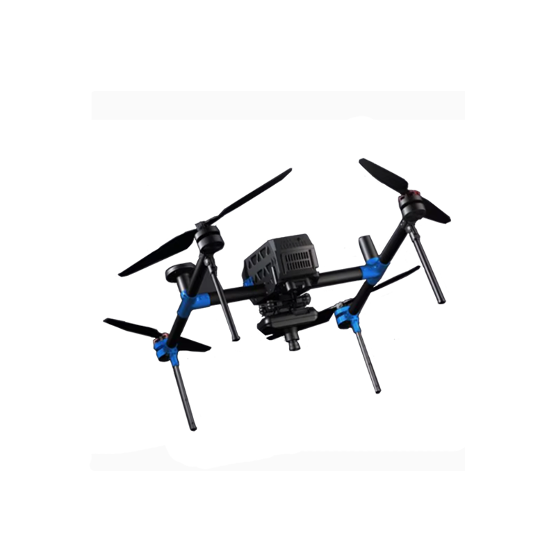
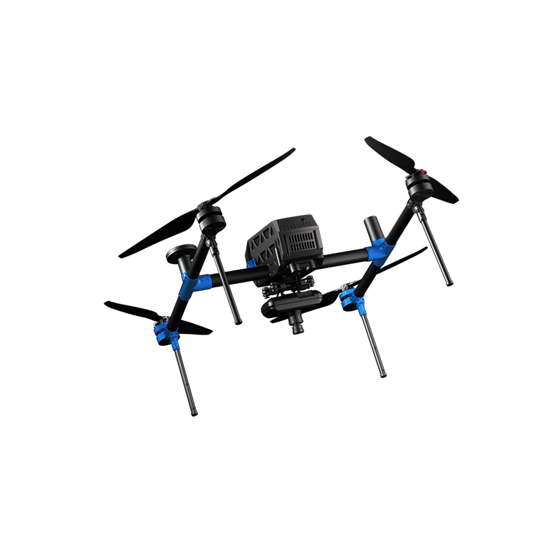

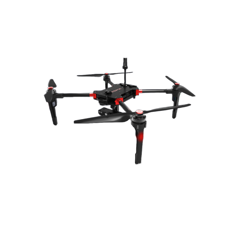
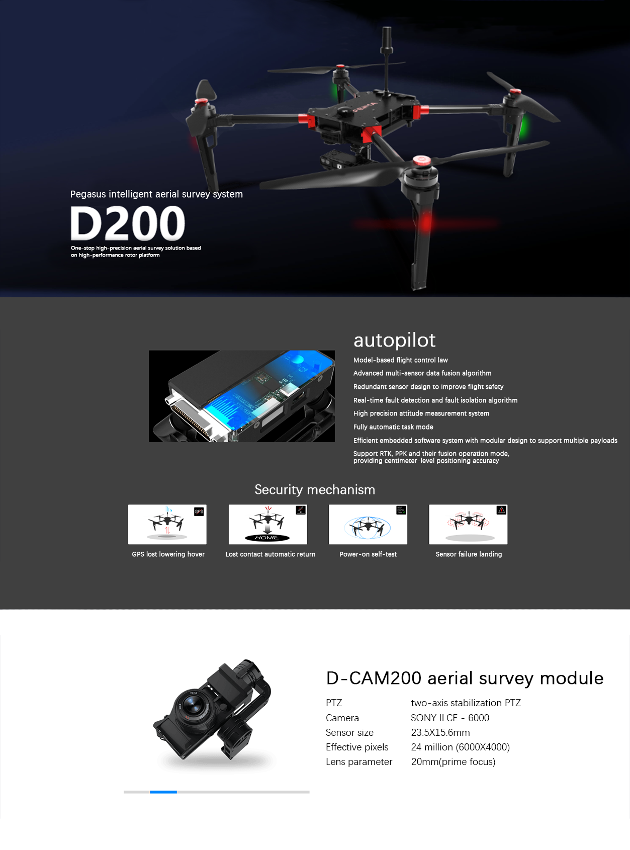
FEIMA ROBOTICS intelligent inspection system D200 Multi-rotor UAV
Logistics information


Technical Features
FEIMA ROBOTICS D200 multi-rotor UAV is the 1 high-performance aerial survey UAV system. The following is a detailed evaluation of it:
Overall 1. evaluation
D200 UAV system is famous for its high precision, high reliability and high efficiency, which is widely used in aerial survey, remote sensing and video applications. Its design concept focuses on safety and reliability, and at the same time provides a variety of high-precision data acquisition solutions to meet the needs of various application scenarios.
- detailed analysis
High-precision drawing:
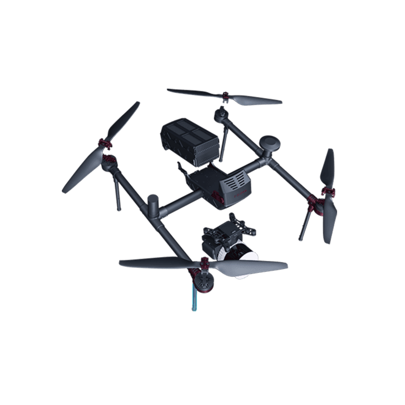
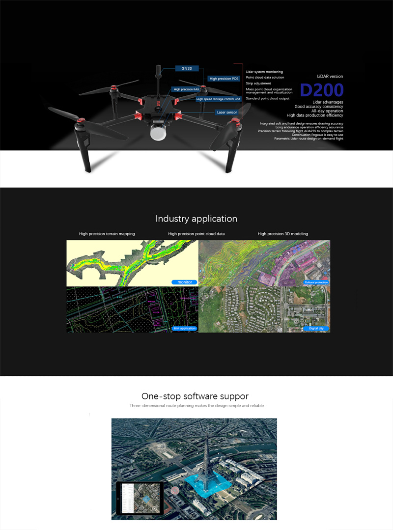
D200 is divided into image version and LiDAR version, both have high-precision mapping capabilities.
The video version can be equipped with a single camera ortho load carrying a two-axis stabilizing pan-tilt or a 5 camera tilt photography load to provide high-quality image data.
The LiDAR version is equipped with a high-precision LiDAR module and POS system to provide a complete LiDAR processing process such as point cloud high-precision solution.
High performance hardware configuration:
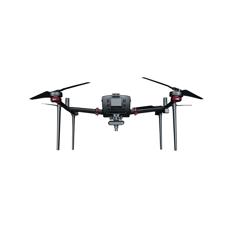
The D200 has a takeoff weight of 7.5kg (some say it is 8.5kg), a standard load of 1kg, and a single flight can hover at sea level for 48 minutes (others say it has a endurance of 48min, and can hover at sea level for nearly one hour).
Equipped with high-precision differential GNSS board, supports PPK, RTK and its fusion operation mode, and can realize the mapping accuracy of 1:500 for image-free control or rare control points under large area.
Sensors such as IMU, barometer, magnetometer, GNSS and so on all adopt multi-channel redundant design to ensure the safety and reliability of flight operations.
Software Solutions:
Equipped with "UAV butler" professional software, to meet the needs of a variety of applications route mode.
It supports accurate three-dimensional route planning, three-dimensional real-time flight monitoring and other functions, and provides DOM, DEM, DSM, TDOM, 2.5D model, true three-dimensional model, standard LiDAR point cloud and other data results and browsing.
The software also supports information push, project synchronization, flight data sharing and other functions, which greatly facilitates the use and management of users.
Easy to operate and efficient:
The modular design of the D200 UAV system makes it easy to operate and maintain.
Can quickly expand the operation, improve the efficiency of the operation. At the same time, its long-term and high-precision characteristics also ensure the efficiency and accuracy of the operation.
Safety performance:
The D200 drone also excels in terms of safety. Its sensor redundancy, multiple safeguards, and rigorously tested components and aircraft reliability ensure flight safety.
In addition, the D200 may also be equipped with automatic obstacle avoidance functions (specific model configurations may vary), which can further reduce risks during flight.
- Application Areas
D200 multi-rotor UAV is widely used in urban planning, land and resources investigation, environmental monitoring, disaster assessment and other fields. Its high precision, high reliability and high performance make the work in these fields more accurate, efficient and convenient.
- Summary
In summary, FEIMA ROBOTICS D200 multi-rotor UAV has become the preferred UAV system in the fields of aerial survey, remote sensing and video applications because of its high-precision mapping, high-performance hardware configuration, perfect software solution, simple operation and high efficiency, and excellent safety performance. Whether from the technical level or from the practical application effect, D200 has shown a very high cost performance and competitiveness.
Performance
The parameter configuration of FEIMA ROBOTICS D200 multi-rotor UAV is quite rich and powerful. The following is a detailed summary of its key parameter configuration:
- flight platform parameters
Empty weight: 6.5kg (it is said that the takeoff weight is 7.5kg, which may be of different configurations or versions)
Take-off weight: 8.5kg (otherwise 7.5kg)
Symmetrical motor wheelbase: 988mm
Overall dimensions:
Deployment: 830 × 732 × 378mm
Folding: 955 x 362 x 378mm
Outer packing size: 1038 x 475 x 366.5mm
Endurance: 48 minutes (single sea level hover time)
Cruise speed:
Numerical representation: 13.5 m/s
or 36 to 54 km/h (data from different sources, may vary depending on configuration or measurement conditions)
Maximum climb speed: 10 m/s
Maximum descent speed: 8 m/s
Hover accuracy: RTK horizontal 1cm 1ppm; vertical 2cm 1ppm
Service ceiling altitude: 4500m above sea level
Wind resistance: Level 5 (normal operation)
Measurement and control radius: 5km
Take-off and landing mode: vertical take-off and landing without remote control
Working temperature:-20~50°C
Task response time: deployment ≤ 10 minutes, withdrawal ≤ 15 minutes
- navigation and positioning parameters
Navigation satellites: GPS(L1 L2), BeiDou(B1 B2), GLONASS(L1 L2)
Sampling frequency: 20Hz
Positioning accuracy: 5cm (may refer to the accuracy in differential mode)
Differential mode: PPK/RTK and its fusion operation mode
- load parameters
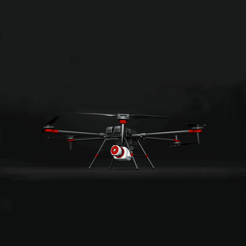
Camera module (take D-CAM series as an example):
D-CAM200:SONY ILCE-6000 camera, 24 million pixels, 20mm fixed focus lens, two-axis stabilizing pan-tilt.
D-CAM300:SONY RX1RII camera, 42 million pixels, 35mm fixed focus lens, two-axis stabilizing pan-tilt.
Tilt module (such as D-OP200/D-OP300): equipped with multiple SONY cameras, to achieve tilt photography, effective pixels and lens parameters vary according to the specific model, equipped with two-axis stabilizing pan-tilt.
LiDAR modules (using the D-LiDAR series as an example):
D-LiDAR100:Velodyne Puck laser, 16 channels, ranging 100m, accuracy ± 3cm, scanning speed 5~20Hz.
D-LiDAR200:RIEGL mini VUX-1UAV laser, single channel, ranging 250m, accuracy 1cm, scanning speed 10~100Hz.
Video module (such as D-EOV100): supports 1920 × 1080 resolution video recording, 25fps frame rate, 30x optical zoom, three-axis stabilization pan-tilt.
- other parameters
Support functions: such as RTK phase-free, precise terrain following flight, etc.
Software: "UAV butler" professional version of the software, support route planning, flight monitoring, data solution and other functions.
In summary, the FEIMA ROBOTICS D200 multi-rotor UAV performs well in parameter configuration, with high precision, high reliability and high efficiency, and is suitable for various aerial survey, remote sensing and video applications. Please note that the above parameters may vary depending on the specific configuration or version, please refer to the official channels or the latest information to obtain the most accurate information.
Logistics information