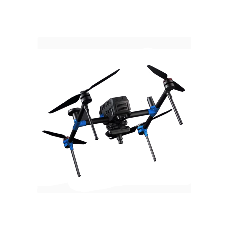
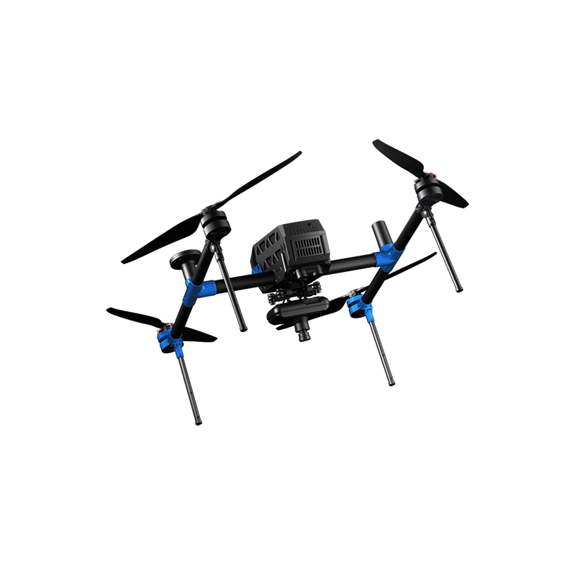
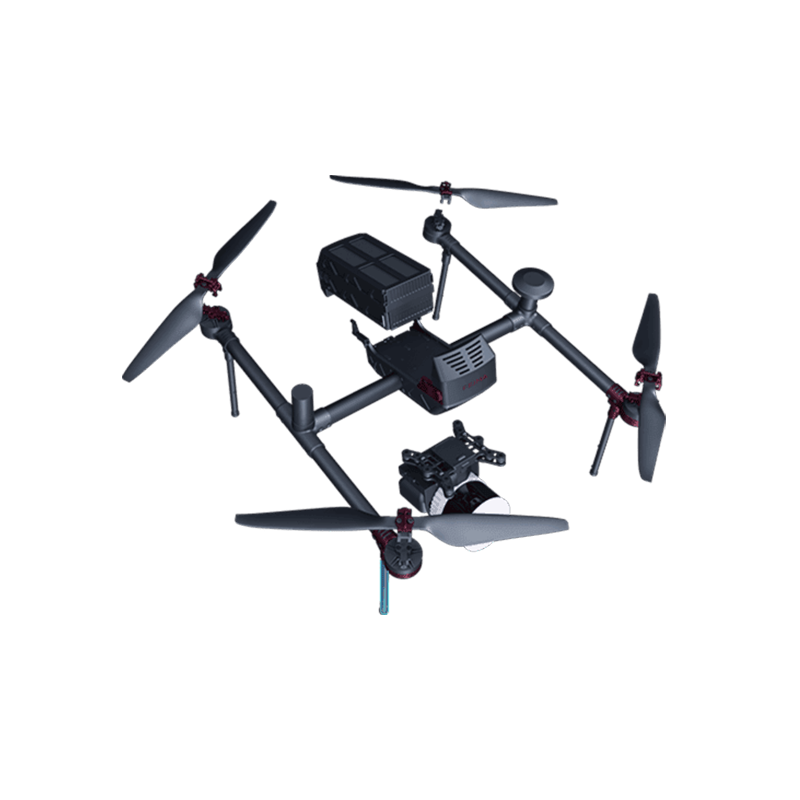
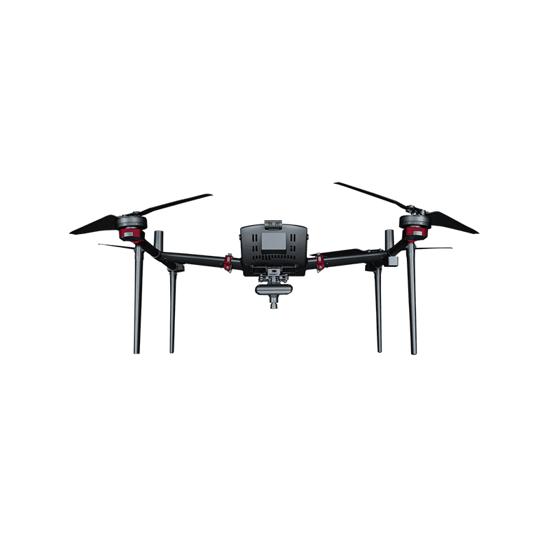
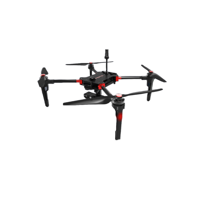

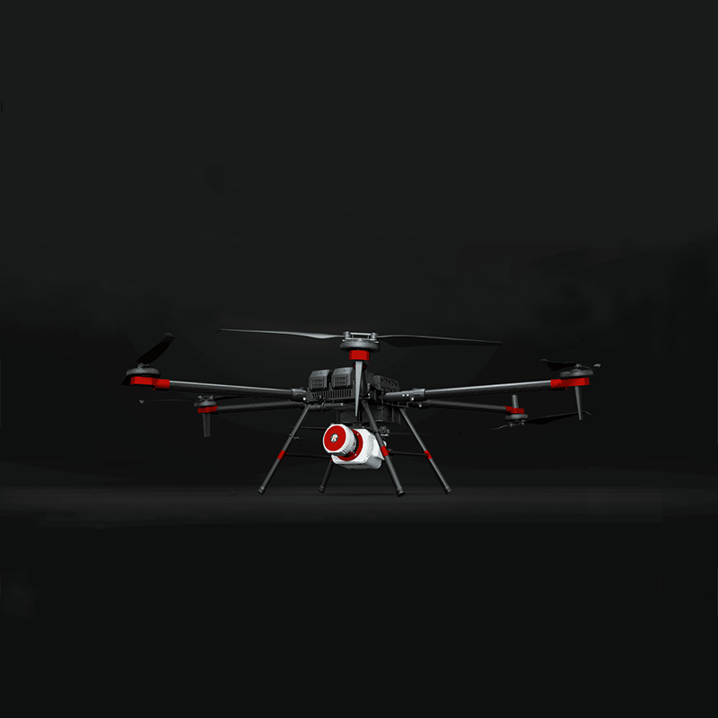
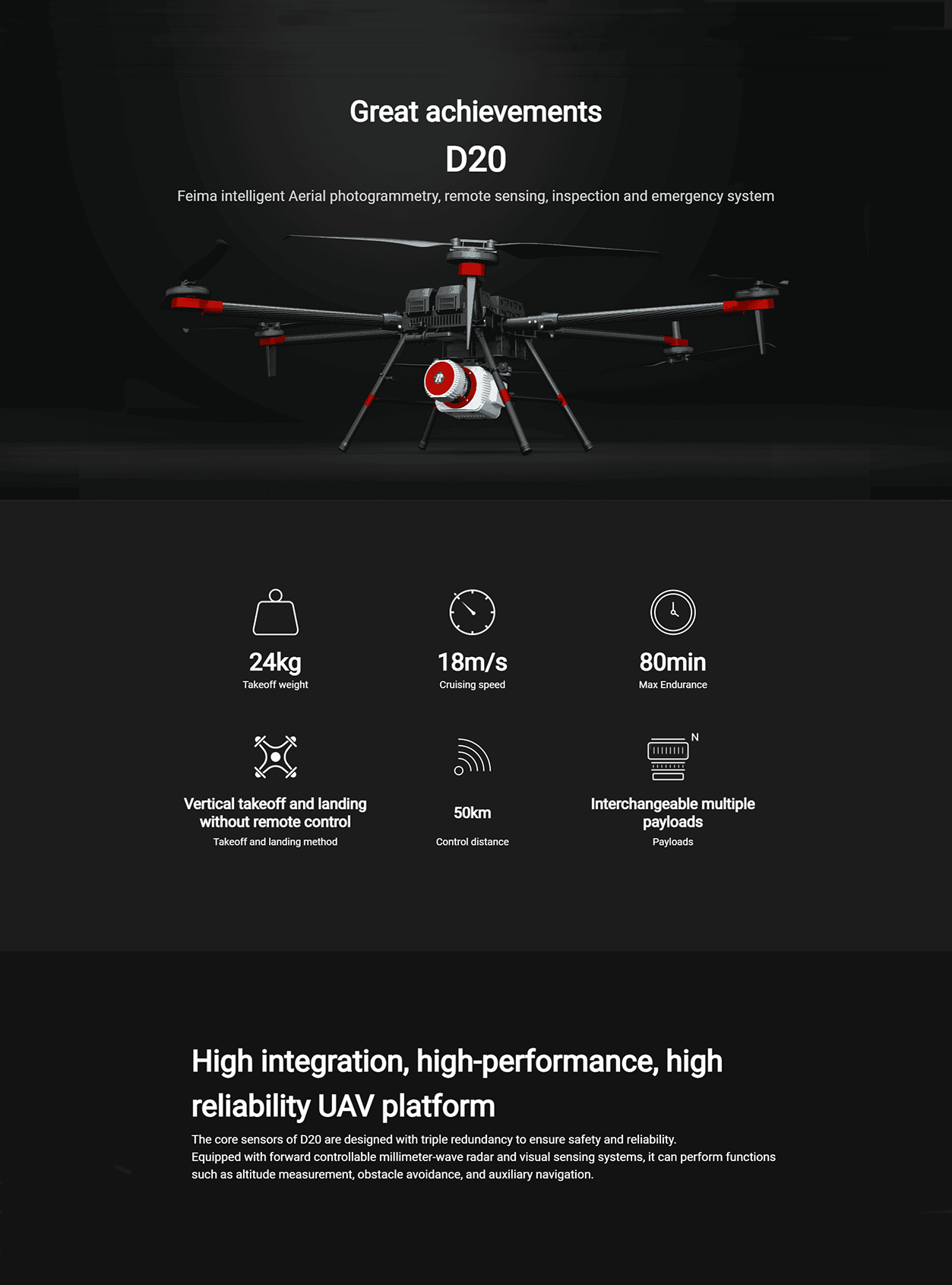
FEIMA ROBOTICS intelligent inspection system D20 Multi-rotor UAV


Logistics information


Technical Features
The FEIMA ROBOTICS D20 multi-rotor UAV is the 1 outstanding and full-featured aerial survey UAV system. The following is a detailed evaluation of it:
Excellent 1. performance
Long endurance with large load: D20, as the 1 large load rotor unmanned aerial vehicle system, has a takeoff weight of 21kg and a maximum endurance of 80 minutes (otherwise 90 minutes, which may vary depending on the specific configuration or battery status), which can meet the requirements of long-term and large-scale aerial survey.
High-precision positioning: equipped with high-precision differential GNSS board, providing RTK/PPK fusion solution capability, supporting high-precision POS-assisted aerial triangulation, and having 1:500 large-scale mapping capability without control points to realize image-free control application.
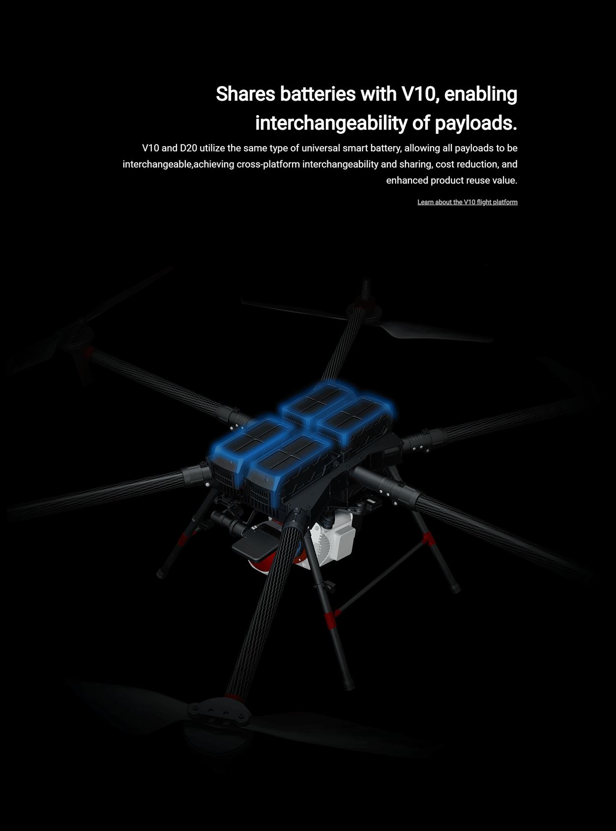
Modular design: continue the industrialization and modular design of Pegasus robot products, using universal intelligent power batteries and high-end load equipment, load modules are interchangeable, meet the needs of various application scenarios, greatly enhance the value of product reuse.
Full-featured 2.
Multi-load support: D20 can carry a variety of load modules, including visible light aerial measurement module, visible light tilt module, thermal infrared camera module, multi-spectral module, lidar module, etc., to achieve multi-source data acquisition.
Intelligent route planning: supporting the "UAV butler professional version (measurement version)" software, support accurate three-dimensional route planning, accurate terrain following flight, three-dimensional real-time flight monitoring and other functions, improve operational efficiency and safety.
Strong data processing ability: supports GPS fusion calculation, control point measurement, empty 3 calculation, one-key mapping, one-key export of three-dimensional mapping and other full-process operations, and provides DOM, DSM, TDOM, LAS point cloud and other data results processing and browsing.
- safe and reliable
Three-way backup of core sensors: The core sensors of D20 adopt three-way backup design to ensure safe flight when any sensor fails.
Obstacle avoidance and auxiliary navigation: Equipped with forward controllable millimeter wave radar and visual perception system, it can realize the functions of height measurement, obstacle avoidance and auxiliary navigation, and improve flight safety.
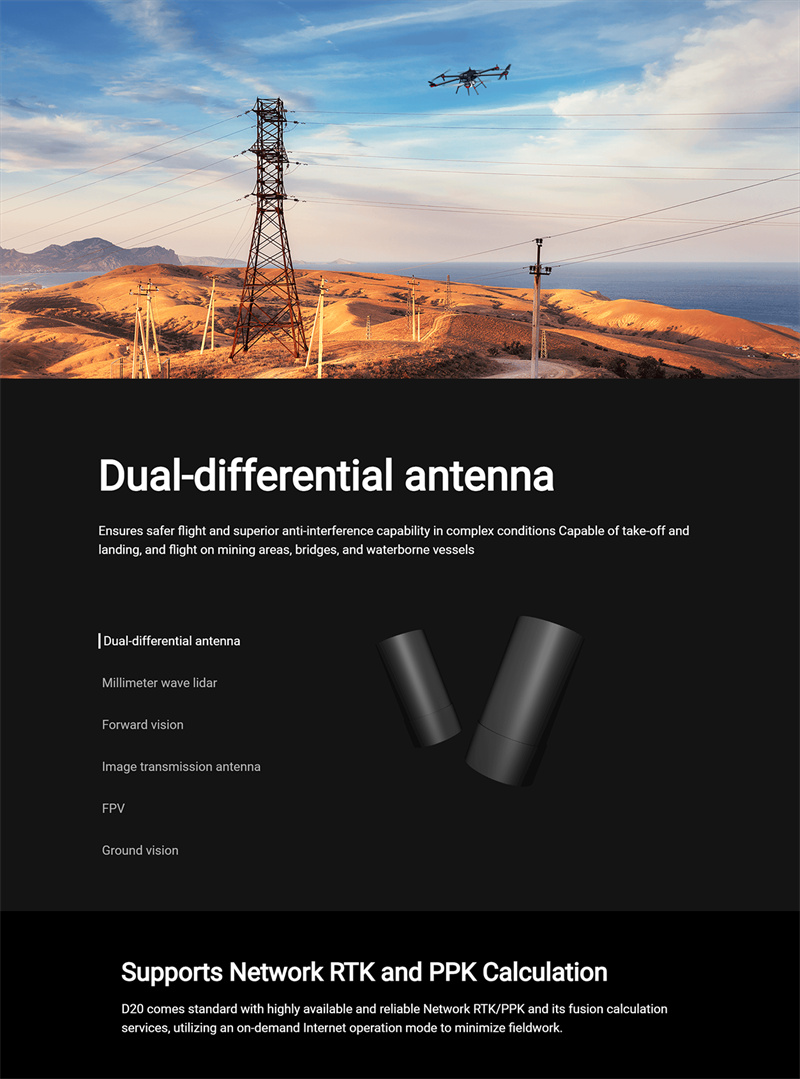
Strong anti-interference ability: dual differential antenna design, in complex conditions to ensure that the flight is safer, better anti-interference ability.
- widely used
D20 multi-rotor UAV is widely used in terrain mapping, engineering survey, land survey, urban planning, digital city, cultural relics protection and other fields. Its high precision, high efficiency and multi-function characteristics make D20 show high application value in these fields.
To sum up, FEIMA ROBOTICS D20 multi-rotor UAV has attracted much attention for its excellent performance, comprehensive functions, high safety and wide application fields. Whether from the technical level or from the practical application effect, D20 has shown a very high cost performance and competitiveness. Therefore, for users who need high-precision aerial survey data, the D20 is undoubtedly a worthy choice.
Performance
FEIMA ROBOTICS D20 multi-rotor UAV parameter configuration is quite comprehensive, the following is a detailed summary of its key parameter configuration:
- basic parameters
Brand: Pegasus (FEIMA)
Type: Large load rotor UAV system
Application place: outdoor, suitable for topographic surveying and mapping, engineering survey, land survey and other fields
- flight performance
Take-off weight: 21kg
Endurance: The maximum endurance can reach 80~90 minutes (the specific time may vary due to factors such as battery status, load and flight environment)
Wind resistance: 6 wind (wind speed up to 10.8 m/s ~ 13.8 m/s)
Cruising speed: 18 m/s
Maximum take-off altitude: up to high altitude (the specific value may vary depending on the model or configuration, and can generally meet the needs of most application scenarios)
- Navigation and Positioning
Differential GNSS board: high-precision, supports RTK/PPK fusion calculation, provides high-precision positioning capability
Positioning accuracy: horizontal direction ± 1cm 1ppm, vertical direction ± 2cm 1ppm (the specific accuracy may vary due to the actual application environment)
- load and sensor
Load design: modular load design, support a variety of load interchange, such as visible light aerial survey module, tilt camera module, thermal infrared camera module, etc.
Sensor: equipped with forward controllable millimeter wave radar and visual perception system to realize height measurement, obstacle avoidance and auxiliary navigation functions; at the same time, the core sensor adopts three-way backup design to improve flight safety
- other parameters
Size: The specific size may vary by model or configuration, but it is generally compact and easy to carry and transport
Operating temperature: can work in a wide temperature range (-20 ℃ ~ 50 ℃, the specific value may vary depending on the model or configuration)
Image transmission distance: up to 50km (the specific distance may vary due to the actual application environment)
Control mode: support vertical take-off and landing without remote control, improve operation flexibility and efficiency
- Software and Data Processing
Supporting software: "UAV Butler Professional Edition (Measurement Edition)" software, supporting accurate 3D route planning, 3D real-time flight monitoring, data pre-processing to spatial data results processing of the whole process of operation.
Data results: provide DOM (digital orthophoto), DSM (digital surface model), TDOM (true three-dimensional model), LAS point cloud and other data results processing and browsing functions
In summary, the FEIMA ROBOTICS D20 multi-rotor UAV exhibits excellent performance and comprehensive functions in terms of parameter configuration. Its high-precision positioning, long-time operation capability, multi-source data acquisition capability and intelligent software solutions make D20 highly competitive in the field of aerial survey.
Logistics information