
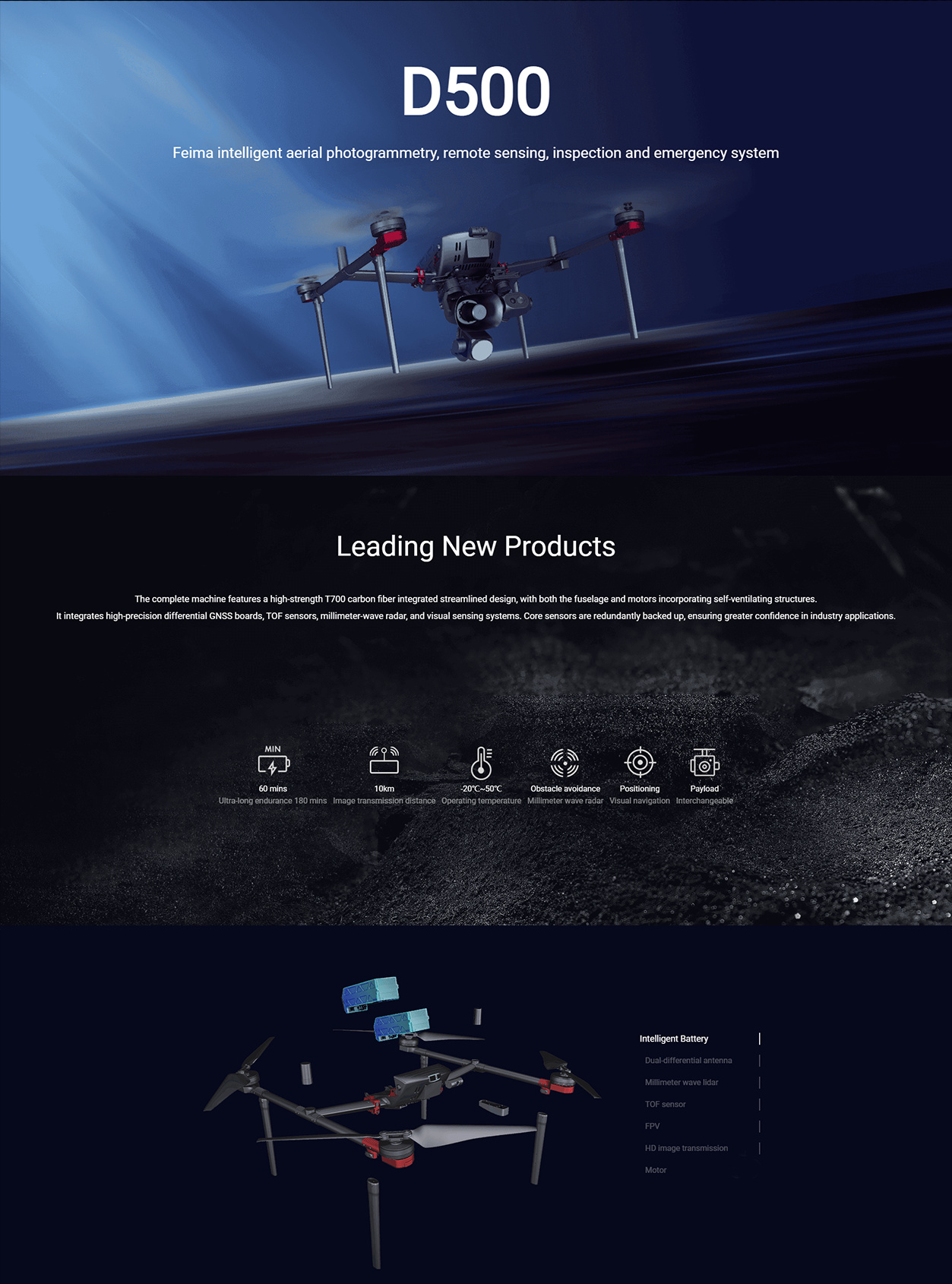
FEIMA ROBOTICS intelligent inspection system 500Multi-rotor UAV
Logistics information


Technical Features
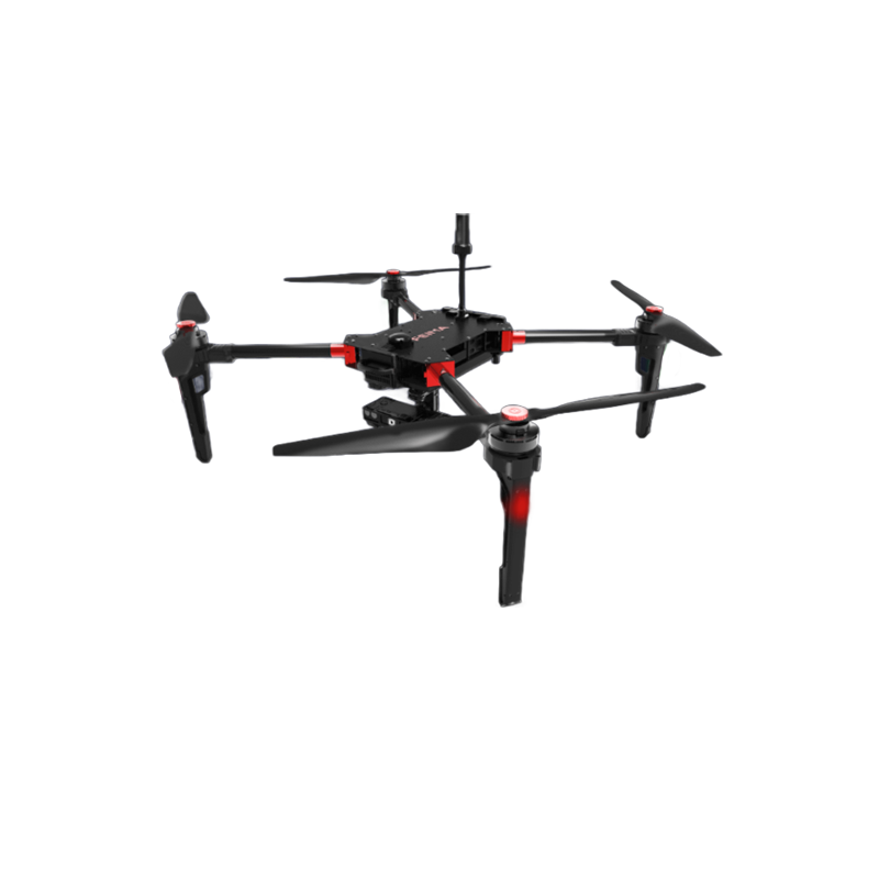
FEIMA ROBOTICS D500 multi-rotor UAV is the 1 high-performance and multi-function UAV system. The following is a detailed evaluation of it:
Excellent 1. performance
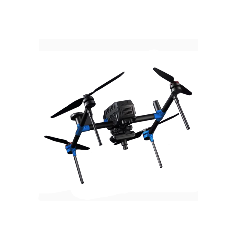
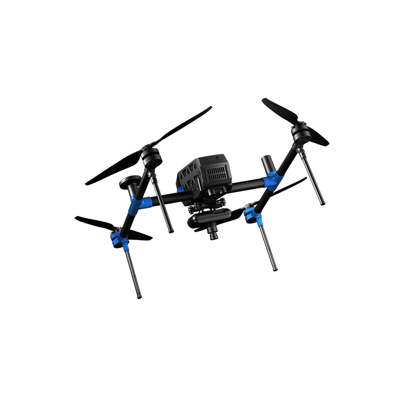
Advanced design: The D500 machine adopts a high-strength T700 carbon fiber integrated streamlined design, which not only reduces the weight, but also improves the strength and durability of the body. At the same time, both the fuselage and the motor adopt a self-priming heat dissipation structure to ensure stability and reliability during long-term flight.
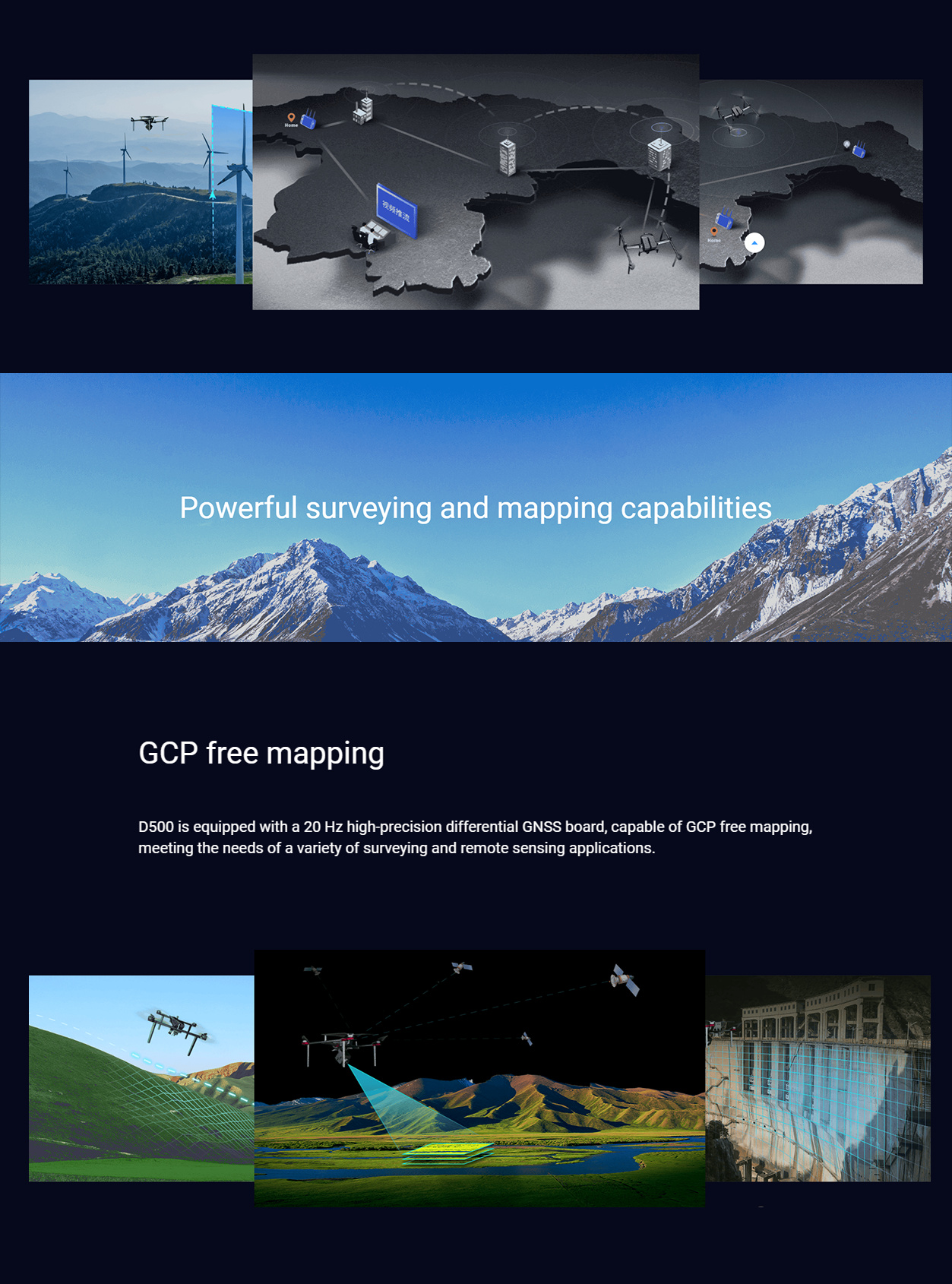
High-precision positioning: D500 integrates high-precision differential GNSS board, navigation GNSS module, TOF sensor, millimeter wave radar, visual perception system and other core sensors, and are redundant backup, safe and reliable. Under the combined action of these sensors, the D500 can achieve high-precision positioning to meet the application requirements of various complex scenarios.
Long-term operation: D500 has a battery life of up to 60 minutes, which can meet the needs of long-term and large-scale aerial survey, remote sensing, inspection and other operations. At the same time, its maximum take-off weight is 9.2kg, and the payload reaches 2.5kg, providing sufficient space for carrying various professional loads.
Full-featured 2.
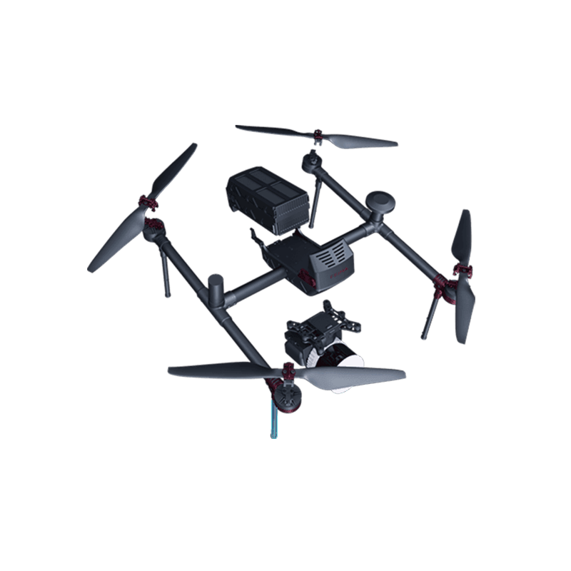
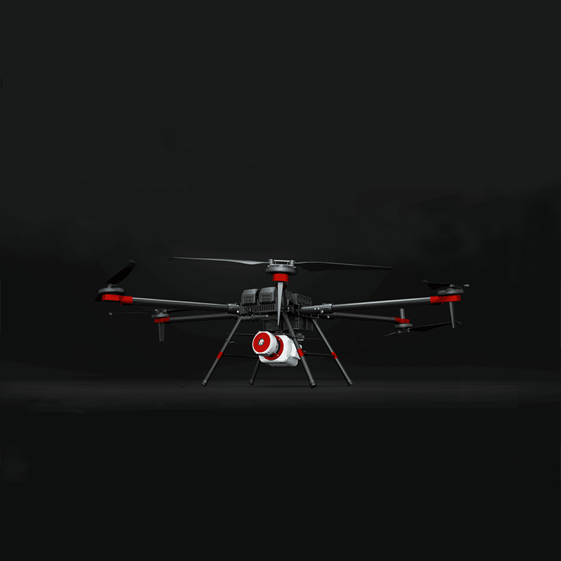
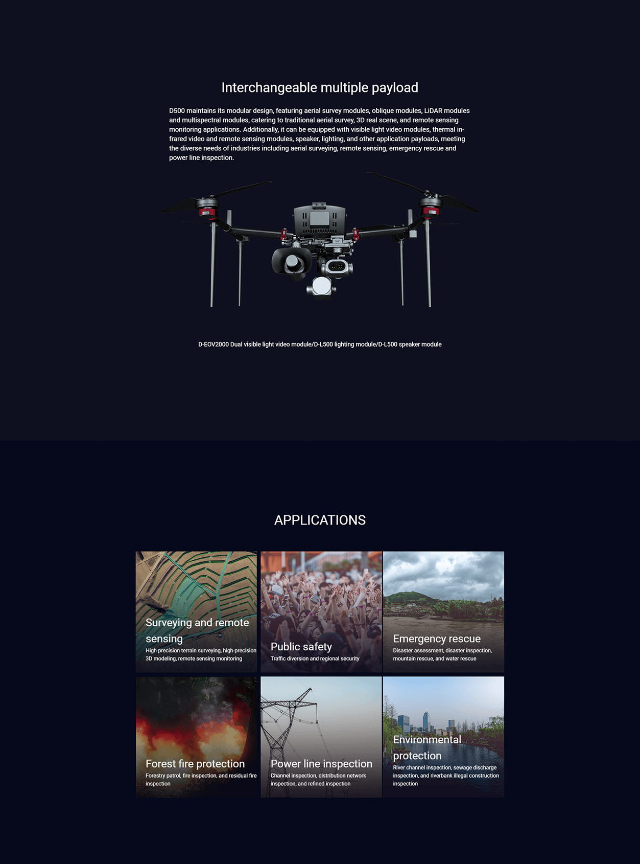
Modular load design: D500 continues the traditional modular design of Pegasus, and can flexibly carry various loads such as aerial survey module, tilt module, laser module, multi-spectral module, etc. to meet the requirements of traditional aerial survey, real-life 3D, remote sensing monitoring and other applications. In addition, it can also be replaced with visible light video module, thermal infrared video/remote sensing module, loudspeaker, lighting, throwing and other application loads to meet the needs of aerial survey, remote sensing, emergency, power line patrol and other industries.
Intelligent route planning: D500 is equipped with "UAV butler Professional Edition (measurement version)" software, which supports accurate three-dimensional route planning, three-dimensional real-time flight monitoring and other functions. Users can plan the route in the software according to actual needs, and monitor the flight status in real time to ensure flight safety and operational efficiency.
Strong data processing capability: D500 supports high-precision POS auxiliary air 3 for image-free control applications. At the same time, its software also supports the processing and browsing of various data results, such as DOM (digital orthophoto), DEM (digital elevation model), DSM (digital surface model), TDOM (true three-dimensional model), etc., to provide users with rich data results.
- safe and reliable
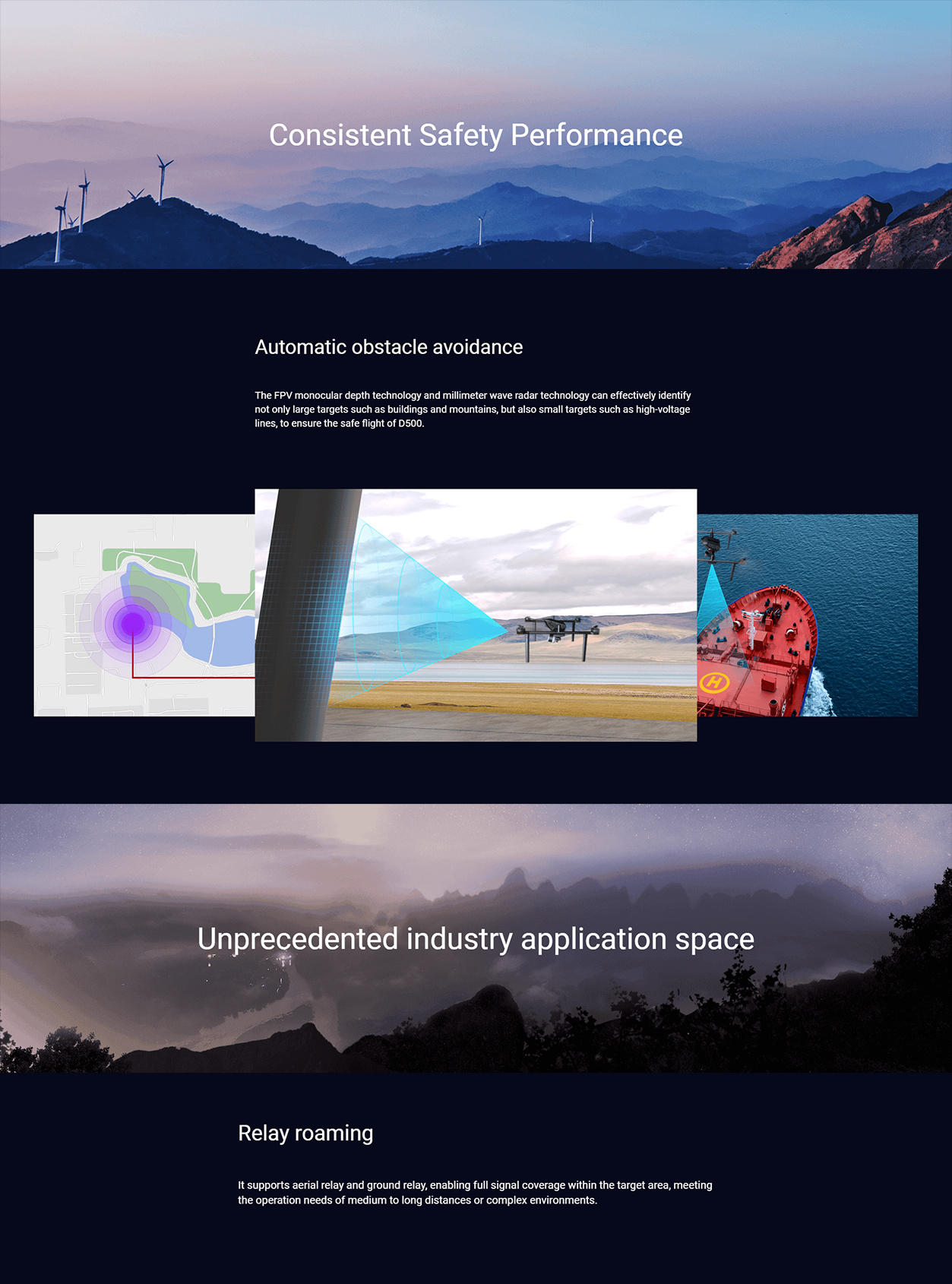
Obstacle avoidance and auxiliary navigation: D500 adopts FPV monocular depth technology millimeter wave radar technology, which can effectively identify large targets such as buildings and mountains, as well as small targets such as high-voltage lines to ensure the safe flight of unmanned aerial vehicles. At the same time, it also supports image matching technology, real-time calculation of the UAV's landing position and take-off point deviation, to achieve accurate take-off and landing on mobile platforms such as ship or vehicle.
Emergency handling capability: D500 has air relay and ground relay capability, which can achieve full coverage of signals within the target area and meet the needs of operation tasks in medium and long distance or complex terrain environment. In addition, when GNSS is interfered, the aircraft automatically plans the return path, enables visual navigation and positioning, and controls the aircraft to return to the take-off point to ensure flight safety.
- widely used
D500 multi-rotor UAV is widely used in terrain mapping, engineering survey, land survey, urban planning, digital city, cultural relics protection and other fields. Its high precision, high efficiency and multi-function characteristics make D500 show high application value in these fields.
To sum up, FEIMA ROBOTICS D500 multi-rotor UAV has attracted much attention for its excellent performance, comprehensive functions, high safety and wide application fields. Whether from the technical level or from the practical application effect, D500 has shown a very high cost performance and competitiveness. Therefore, for users who need high-precision aerial survey, remote sensing, inspection and other data, D500 is undoubtedly a choice worth considering.
Performance
The parameter configuration of FEIMA ROBOTICS D500 multi-rotor UAV is quite comprehensive and advanced. The following is a detailed summary of its key parameter configuration:
- basic parameters
Brand: Pegasus (FEIMA ROBOTICS)
Type: High Performance Multi-Rotor UAV System
Size: body height 370mm, symmetrical motor wheelbase 998mm (specific size may vary depending on model or configuration, but generally more compact, easy to carry and transport)
Weight: takeoff weight 9.2kg, empty weight 6.7kg
- flight performance
Maximum take-off altitude: 6000m
Endurance: 60 minutes (the specific time may vary due to factors such as battery status, load and flight environment)
Maximum climb speed: 5 m/s
Maximum descent speed: 3 m/s
Cruising speed: 13 m/s
Wind resistance: 6 (wind speed up to 10.8~13.8 m/s)
Control distance: 35km
Image transmission distance: 10km (the specific distance may vary due to the actual application environment)
- Navigation and Positioning
Differential GNSS board: 20Hz high precision, support RTK/PPK fusion operation mode, to achieve high precision positioning
Positioning accuracy: 1cm 1ppm in the horizontal direction and 2cm 1ppm in the vertical direction (the specific accuracy may vary due to the actual application environment)
Sensors: Integrated navigation GNSS module, TOF sensor, millimeter wave radar, visual perception system, FPV camera, etc., core sensors are redundant backup, safe and reliable
- load and mission capability
Payload: 2.5kg
Task load design: modular design, can flexibly carry aerial survey module, tilt module, laser module, multi-spectral module and other loads
Extended application load: visible light video module, thermal infrared video/remote sensing module, loudspeaker, lighting, throwing, etc., to meet the needs of aerial survey, remote sensing, emergency, power line patrol and other industries.
- intelligent function
Route planning: support accurate three-dimensional route planning, three-dimensional real-time flight monitoring and other functions
Data processing: equipped with "UAV butler professional version (measurement version)" software, support DOM, DEM, DSM, TDOM and other data results processing and browsing
Air relay and ground relay: to achieve full coverage of signals within the target area, to meet the needs of the task in the medium and long distance or complex terrain environment.
Multi-control terminal networking: support UAV remote takeover, can switch control between multiple control terminals, improve application flexibility
- other features
take-off and landing mode: support vertical take-off and landing without remote control and ground station control load module take-off and landing
Material: carbon fiber magnesium aluminum alloy, which not only reduces the weight, but also improves the strength and durability of the body
Operating temperature:-20°C ~ 50°C (the specific value may vary depending on the model or configuration, but it can generally meet the needs of most application scenarios)
To sum up, FEIMA ROBOTICS D500 multi-rotor UAV shows excellent performance and comprehensive functions in parameter configuration. Its high-precision positioning, long-time operation capability, modular load design and intelligent software solutions make the D500 highly competitive in aerial survey, remote sensing, inspection and other fields.
Logistics information