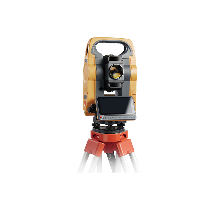
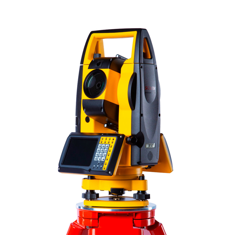
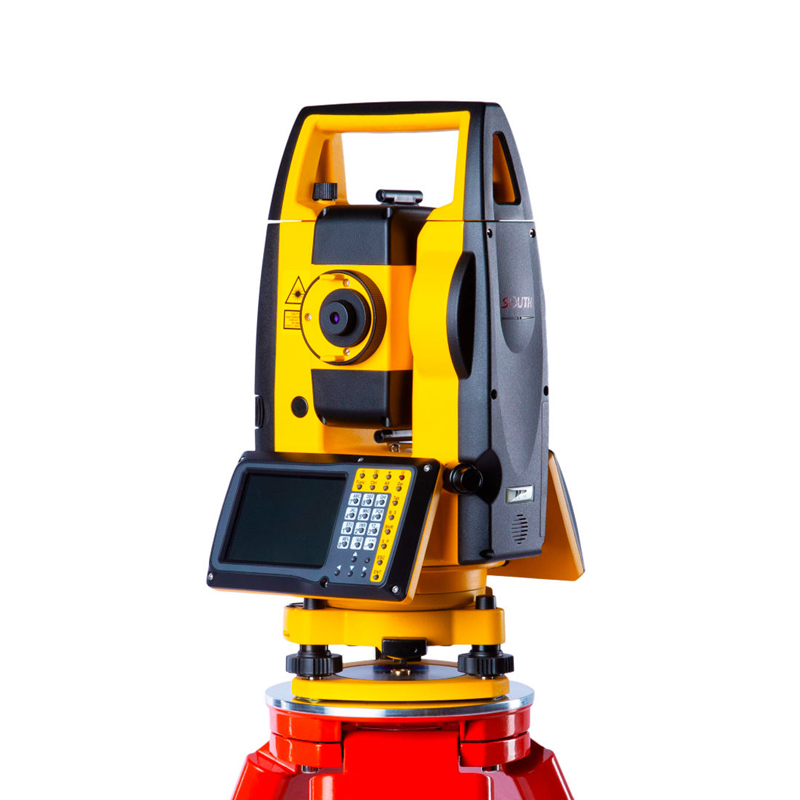
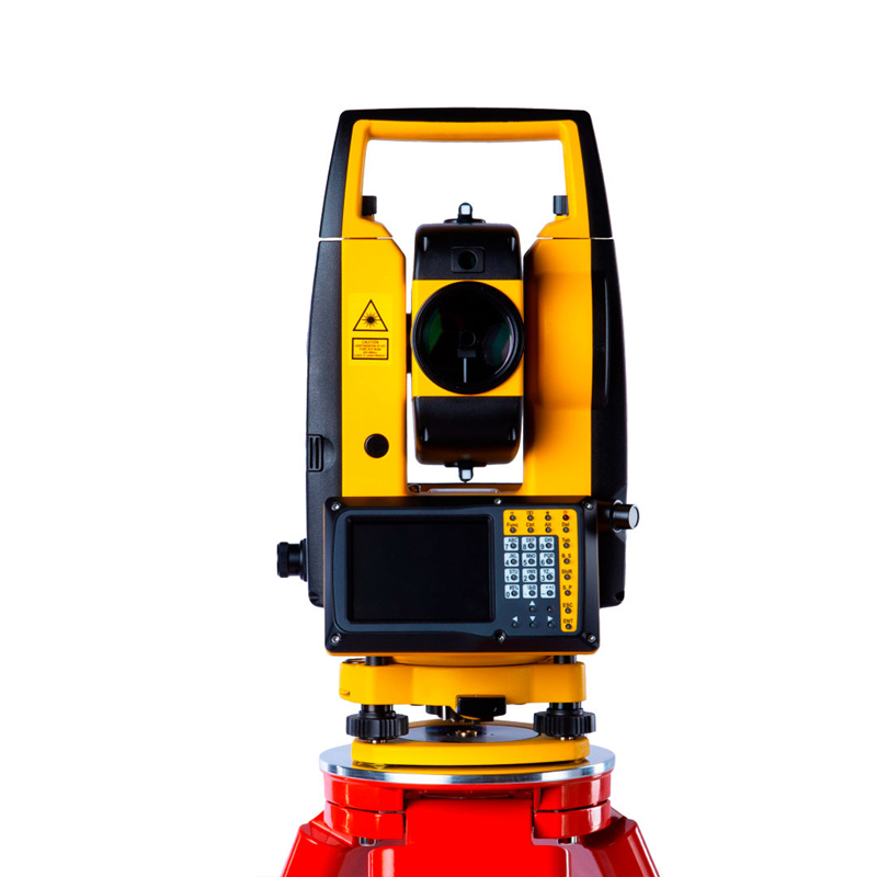


Fast And Accurate Total Station South N40 Series With Bluetooth
Product advantages
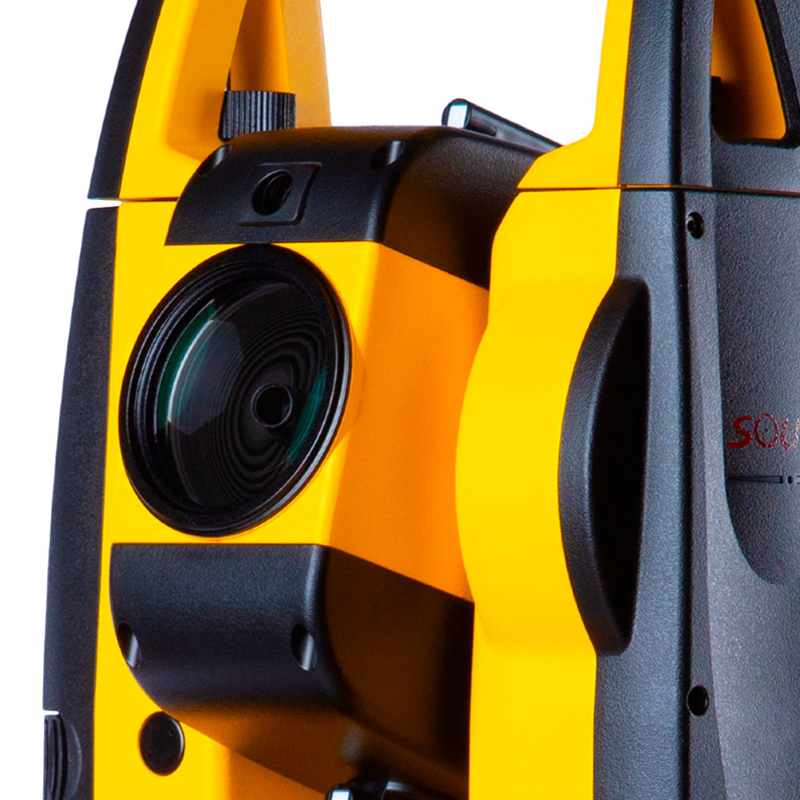
Four-Axis Compensation Function
The N40 series total station features a four-axis compensation function, which automatically compensates for minor deviations during the measurement process, thereby ensuring the accuracy of measurement results. This function is of great significance for improving measurement precision and stability.
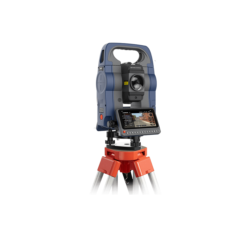
Ease of Operation and User-Friendly Design
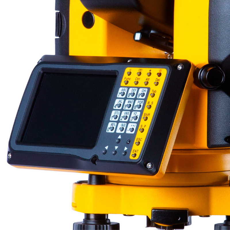
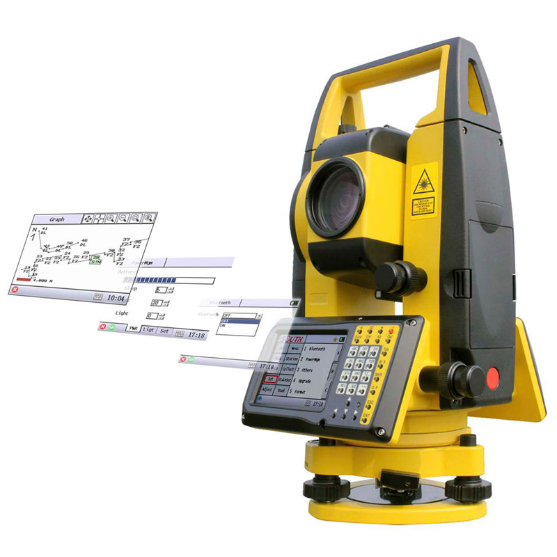
Graphical Operating System: The N40 series total station is equipped with an easy-to-use graphical operating system, allowing users to operate through an intuitive graphical interface, greatly reducing the operational difficulty.
Rich Onboard Applications: The instrument is embedded with a variety of powerful onboard applications, such as coordinate setting out, coordinate measurement, area measurement, etc., catering to different surveying needs.
User-Friendly Button Design: Features like the trigger key make operation more convenient, enabling users to quickly get started and efficiently complete surveying tasks.
High Stability and Durability
Manufactured with high-quality materials and craftsmanship, the N40 series total station boasts high stability and durability. Even in harsh environments, it can maintain stable performance and ensure the accuracy of measurement results.
Data Management and Transmission
Large Storage Capacity: The instrument is equipped with a large storage capacity, capable of storing vast amounts of measurement data, facilitating easy access and analysis by users.
Data Transmission and Compatibility: The N40 series total station supports multiple data transmission methods, such as Bluetooth, USB, etc., enabling seamless connection and data transfer with computers, tablets, and other devices. Additionally, its data format is compatible with various surveying software, facilitating subsequent data processing and analysis.
Wide Range of Applications
With its high precision, long ranging capability, and ease of operation, the N40 series total station is widely used in various fields such as construction, roads, bridges, mines, and geological exploration. Whether for topographic surveying, engineering setting out, or deformation monitoring tasks, it can demonstrate its outstanding performance.
In summary, the N40 series total station, with its high-precision measurement, ultra-long ranging capability, four-axis compensation function, ease of operation and user-friendly design, high stability and durability, data management and transmission capabilities, as well as its wide range of applications, has emerged as a leader in modern surveying.
Application scope
Construction Engineering Survey
The Southern N40 Total Station can be used for foundation surveying, precise measurements, and accurate surveys before groundbreaking in construction projects. Its high-precision measurement capabilities ensure accurate positioning of buildings, providing reliable data support for subsequent construction.
Bridge Engineering Survey
In bridge engineering, the Southern N40 Total Station is utilized for measurement, monitoring, and acceptance of bridges. It provides precise structural data of bridges, assisting engineers in assessing the safety and stability of bridges and ensuring the construction quality.
Road Engineering Survey
In road engineering surveys, the Southern N40 Total Station is employed for road measurement, design, and monitoring. It can quickly and accurately measure parameters such as road length, width, and slope, providing a scientific basis for road design. It also monitors road deformation, ensuring road safety and driving comfort.
Tunnel Engineering Survey
In tunnel engineering, the Southern N40 Total Station plays a crucial role. It is used for tunnel measurement, design, and monitoring, ensuring the construction accuracy and safety of tunnels. With precise measurement data, engineers can promptly identify and address potential issues during tunnel construction, ensuring the construction progress and quality.
Other Application Areas
In addition to the aforementioned fields, the Southern N40 Total Station can also be applied in various other areas, such as mine surveying, geological exploration, installation and debugging of large industrial equipment and components, etc. Its high precision and multifunctionality enable it to perform exceptionally well in various complex environments.
In summary, the Southern N40 Total Station, with its advantages of high-precision measurement, multifunctionality, and wide range of applications, has become a leader in the field of modern surveying. In various engineering surveys, it provides accurate and reliable data support, providing a strong guarantee for engineering construction.
Logistics information


Logistics information
technical parameter
| Angle Measurement | Accuracy | N41: 1” |
| N40: 2” | ||
| Minimum Reading | N41: 0.1”/1” | |
| N40: 1”/5” | ||
| Measure Method | Absolute Encoding Disk | |
| Diatmeter of Encoding Disk | 79mm | |
| Detection Method | Horizontal: 4-path, Vertical: 4-path | |
| Angle Unit | 360°/400gon/6400mil | |
| Horizontal 0/Vertical 0 | V0/H0 | |
| Distance Measurement | Laser Class | Laser Class 3R① |
| Wavelength | 685nm | |
| Distance Unit | m/ft | |
| EDM System | Basic Frequency 70-150MHz | |
| Constant K | Auto Correction, K=0.14/0.2 | |
| Prism Constant | Auto Correction | |
| Atmosperic Correction | Auto Correction | |
| Accuracy: Prism | N41: 1+1ppm | |
| N40: 2+2ppm | ||
| Accuracy: Reflective Sheet | 3+2ppm | |
| Accuracy: Reflectorless | 3+2ppm⑤ | |
| Measure Range: Prism② | Single: 4000m / Triple: 5000m | |
| Measure Range: Prism Enhanced | Single: 5000m / Triple: 6000m | |
| Measure Range: Reflective Sheet③ | 1200m | |
| Measure Range: Reflectorless④ | 1500m | |
| Meaasure Speed: Prism | Single <1.2s, Repeat <0.5s, Tracking <0.25s | |
| Meaasure Speed: Reflective Sheet | Single <1.0s, Repeat <0.5s, Tracking <0.25s | |
| Meaasure Speed: Reflectorless | Single: 0.5s-3s; Tracking: 0.25s-3s, max.10s⑥ | |
| Telescope | Image | Erect |
| Magnifcation | 30x | |
| Effective Aperture | 45mm(DTM:47mm) | |
| Resolution | 3" | |
| Field of View | 1°30' | |
| Minimum Focus | 1.5m | |
| Tube Length | 152mm | |
| Retical Illumination | Adjustable, 4 Levels | |
| Vial | Plate Vial | 30“/2mm |
| Circular Vial | 8'/2mm | |
| Compensator | System | Dual-axis Liquid-electric Sensor |
| Working Range | ±6’ | |
| Resolution | 1” | |
| Plummet | Laser Plummet: Laser Class | Class 2. Red Laser |
| Laser Plummet: Wavelength | 635nm | |
| Laser Plummet: Power | 0.5mW | |
| Laser Plummet: Diameter | ≤2.0mm@1.5m | |
| Laser Plummet: Brightness | Adjustable, 5 Levels | |
| Auto Height *1*2: Measure Range | 0.5m-3m | |
| Auto Height *1*2: Accuracy | ±1.5mm@1.5m | |
| Optical Plummet: Image | N41: - | |
| N40: Erect | ||
| Optical Plummet: Magnifcation | N41: - | |
| N40: 3x | ||
| Optical Plummet: Focusing Range | N41: - | |
| N40: 0.3m~∞ | ||
| Optical Plummet: Field of View | N41: - | |
| N40: ±4° | ||
| Guide Light*1 | Type | LED |
| Wavelength | Red 635nm / Yellow 590nm | |
| Effective Distance | 200m | |
| Camera*2 | Pixel | N41: 780,000 |
| N40: - | ||
| Focal Length | N41: 16mm | |
| N40: - | ||
| Sight of View | N41: 12.5*11.7 Degree | |
| N40: - | ||
| Refresh Rate | N41: 11 Frames/s | |
| N40: - | ||
| Depth of Field | N41: 2m-∞ | |
| N40: - | ||
| Storage | N41: jped | |
| N40: - | ||
| Digital Zoom | N41: 1x, 2x, 3x | |
| N40: - | ||
| White Balance | N41: Auto | |
| N40: - | ||
| Brightness | N41: Auto | |
| N40: - | ||
| Display Unit & Keyboard | Display Unit | 4.0 Inches Colorful LCD Touch Screen |
| Resolution | 800*480 | |
| Backlight | Adjustable, 8 Levels | |
| Keyboard | 30 Keys | |
| Memory | Internal Memory | 98M, 120,000 Points |
| External Memory | 16GB | |
| Data Transfer | USB 2.0 Type A (Max.256GB), Micro USB, RS-232, Bluetooth 2.0/4.2, Wi-Fi 802.11a/b/g | |
| Power Supply | Type | LI-ION Rechargeable Battery |
| Voltage | 7.4V | |
| Capacity | 3900mAh, 29wh | |
| Working Time | 10 Hours | |
| Charging Time | 3 Hours | |
| Others | Working Temperature | -20°C~+50°C |
| Storage Temperature | -40°C~+70°C | |
| Size | 206mm*200mm*353mm | |
| Weight | 6kg |