


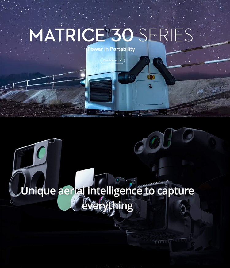
DJI M30 And DJI M30T Matrice 30&30T Drone 4k HD Thermal Camera and 40+ Mins Long Distance Gps RC Quadcopter Drone UAV
Product advantages
Intelligent Functions:
Equipped with intelligent functions such as automatic route planning, obstacle perception and avoidance, simplifying operation processes and lowering the difficulty of operation.
Supports functions like fixed-point hovering, autonomous return-to-home, and automatic flight, further enhancing the drone's intelligence level.
Wide Range of Applications:
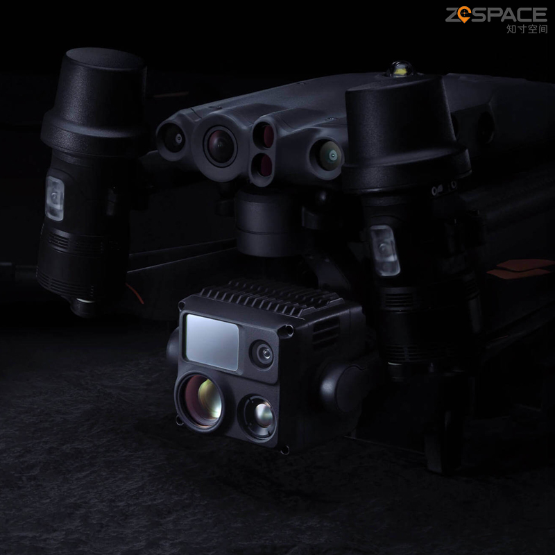
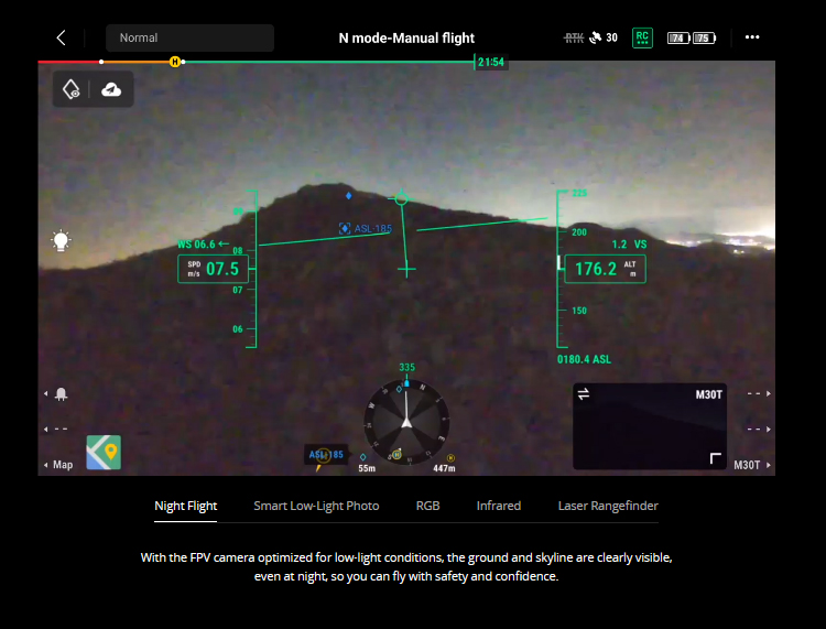
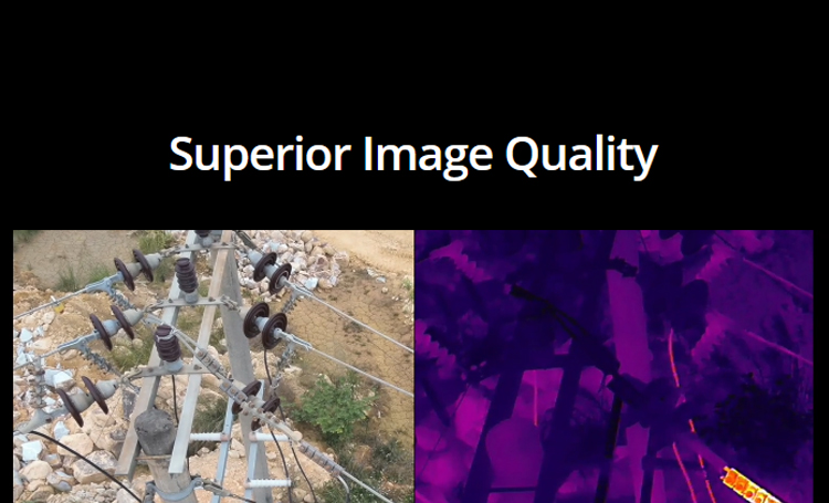
In public safety scenarios such as emergency rescue and firefighting reconnaissance, M30T's infrared camera can help rescuers quickly locate trapped individuals, while the laser rangefinder measures distances, providing crucial data for rescue operations.
For difficult-to-access locations such as power lines, bridges, and wind turbines, M30T can perform remote inspections, avoiding the risks associated with manual climbing.
In the agricultural sector, M30T can monitor crop growth conditions, assisting farmers in promptly identifying issues like pests and diseases.
Its high-quality image output makes it an ideal tool for film and television production, especially for scenes requiring long-distance shooting or special perspectives.
Design Features:
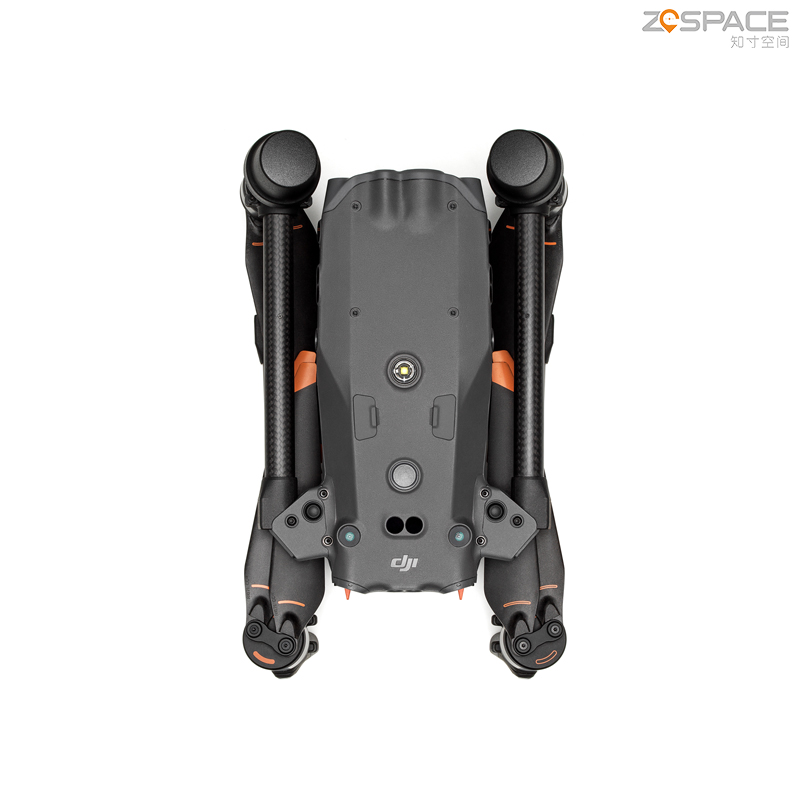
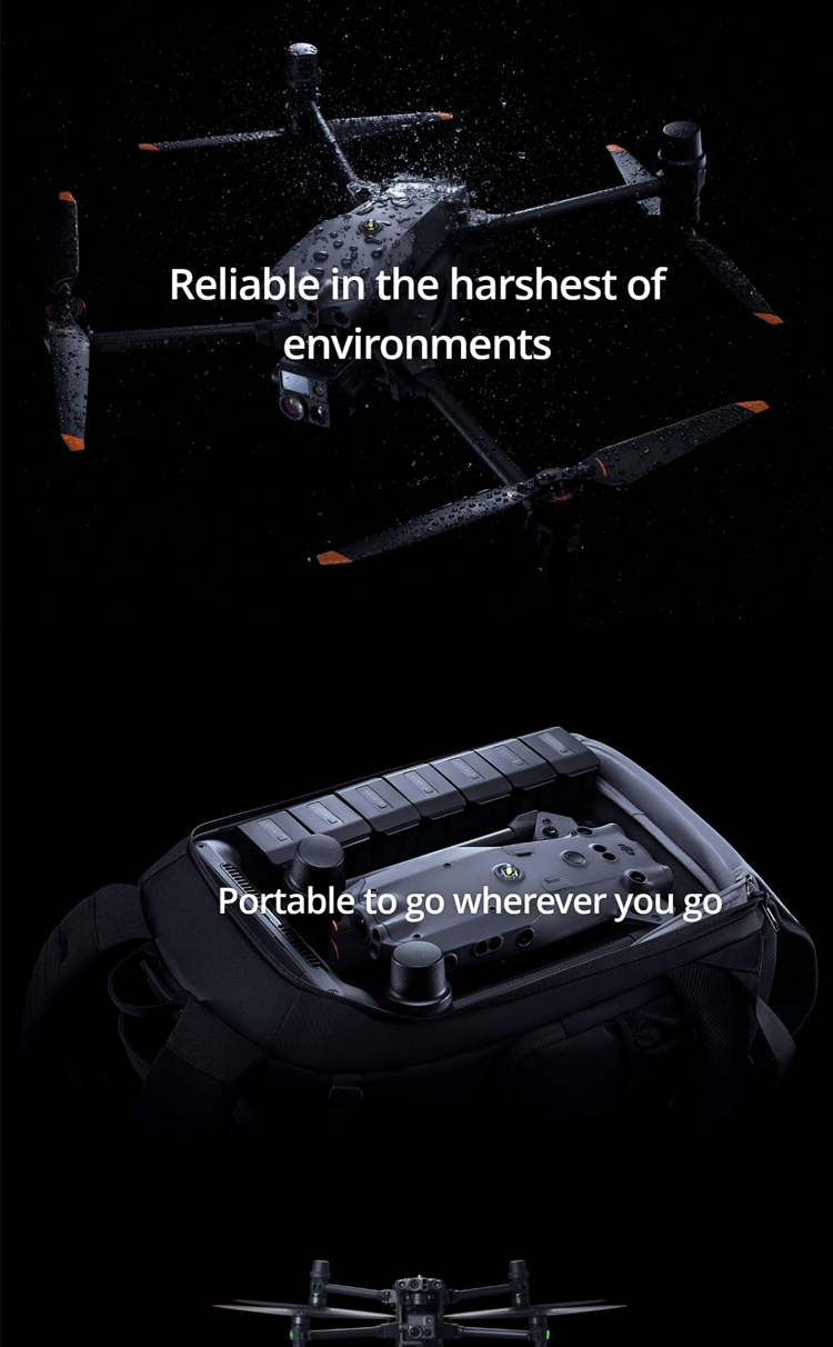
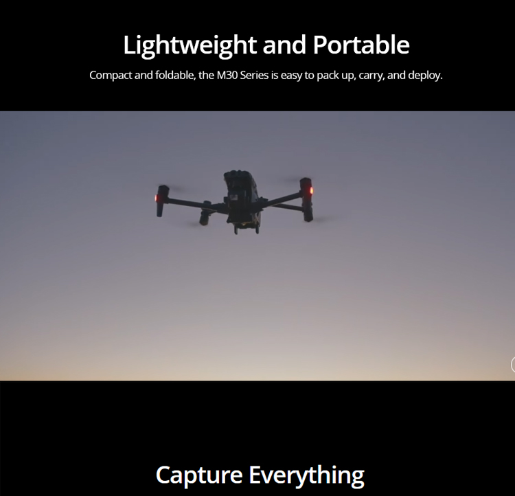
Utilizes lightweight materials, reducing overall weight for easy portability and transportation.
The airport set version's design allows for quick assembly and disassembly of M30T, shortening preparation time and improving operational efficiency.
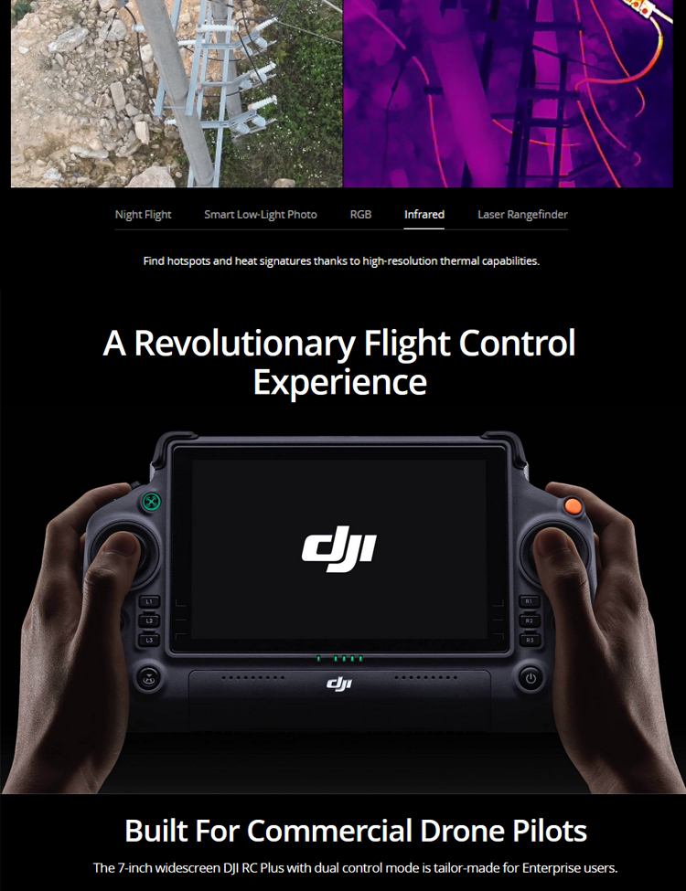
The included remote controller and software interface are intuitive and easy to understand, allowing even inexperienced operators to quickly get started.
In summary, DJI M30T, with its integrated sensor system, high-performance flight platform, intelligent functions, wide range of applications, and design features, has become an ideal choice for numerous fields. Whether for professionals or enterprise users, M30T can provide efficient and reliable solutions to help accomplish complex tasks.
Applications
Environmental Monitoring:
Utilizes high-resolution cameras for environmental monitoring, avoiding human interference and demonstrating high flexibility and a wide monitoring range.
Provides environmental protection personnel with detailed data on plants, soil, water sources, and other areas, aiding in the development of environmental improvement plans.
Construction Industry:
Transforms into an all-around photography assistant, easily capturing panoramic photos and videos of buildings.
Leverages high-precision positioning and data reconstruction technologies to achieve 3D modeling and topographic surveys of buildings and roads.
Government Industry:
Assists in data collection across various fields such as public safety, urban planning, and development management.
Exerts unique advantages in urban planning, safety supervision, key deployments, and other aspects.
Electric Power Industry:
Enables rapid inspections at all heights and from multiple directions, reducing safety risks for personnel in harsh weather conditions.
Utilizes high-definition aerial photography for static or dynamic shooting, providing comprehensive data support for tower structures and equipment status.
Fire Protection:
Provides rich information support for fire inspections of complex buildings.
Its high-precision characteristics aid in precisely locating fire sources and formulating efficient fire-fighting strategies.
Its high flight speed and sensitivity allow it to collaborate with ground forces, providing comprehensive safety monitoring services.
Agricultural Monitoring:
Monitors crop growth conditions and promptly identifies issues such as pests and diseases.
Film and Television Production:
Its high-quality image output makes it an ideal tool for film and television production, suitable for long-distance shooting or scenes requiring special perspectives.
Specifications
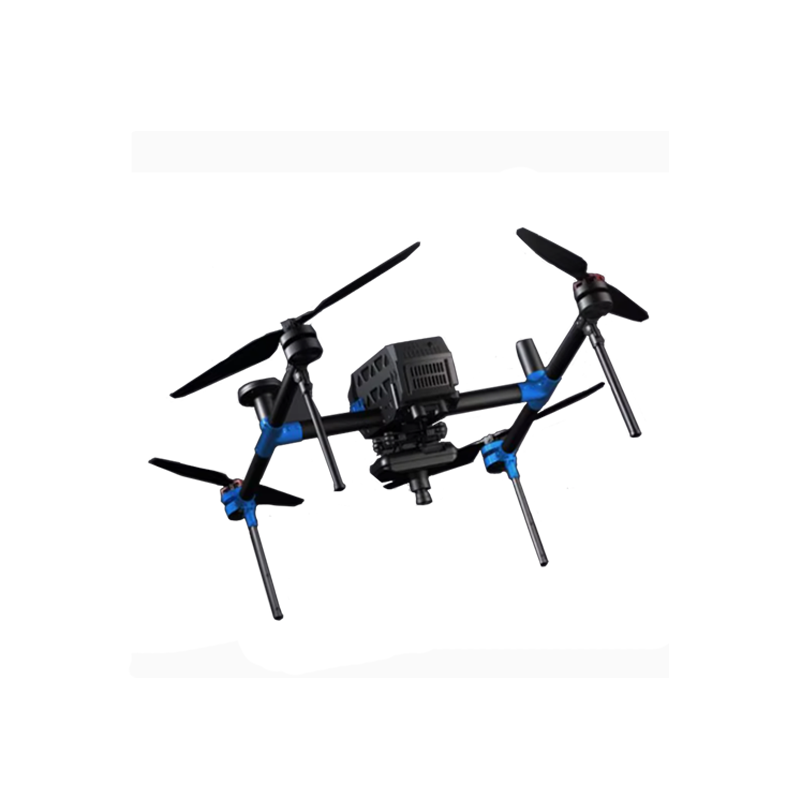
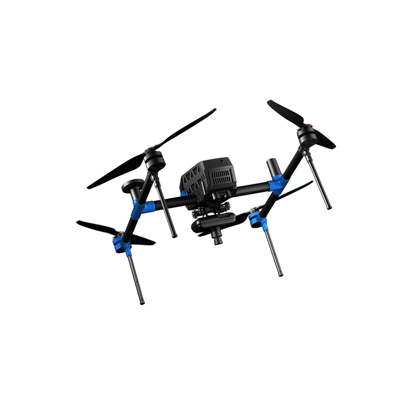
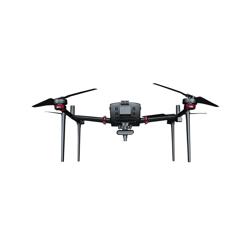
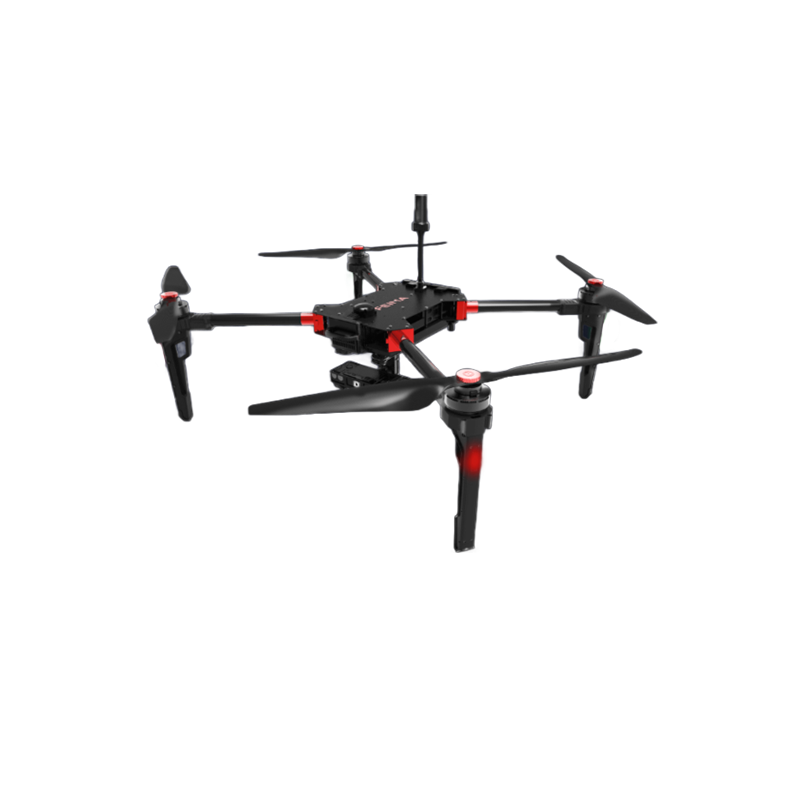
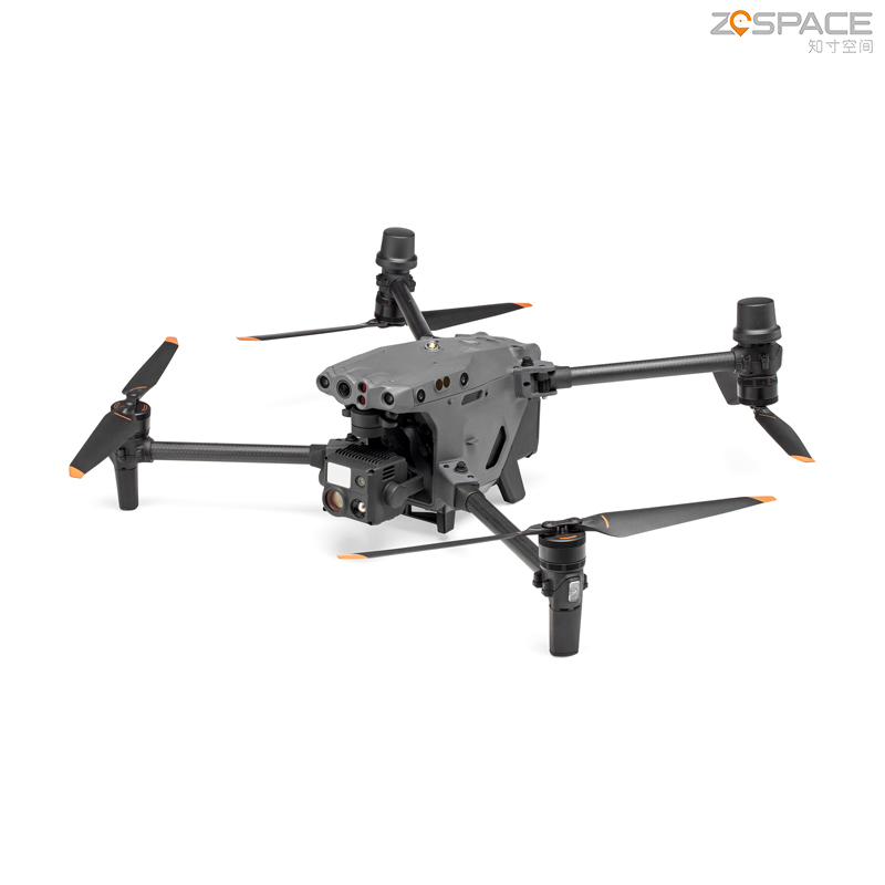
Aircraft Parameters:
Product Type: Four-axis aircraft, professional-grade positioning.
Payload: 4000g.
Hovering Accuracy: Vertical ±0.1m (when visual positioning is working normally), ±0.5m (when GPS is working normally), ±0.1m (when RTK positioning is working normally); Horizontal ±0.3m (when visual positioning is working normally), ±1.5m (when GPS is working normally), ±0.1m (when RTK positioning is working normally).
Rotational Angular Velocity: Pitch axis 150°/s, Yaw axis 100°/s.
Maximum Ascent/Descent Speed: 6m/s (ascent), 5m/s (descent).
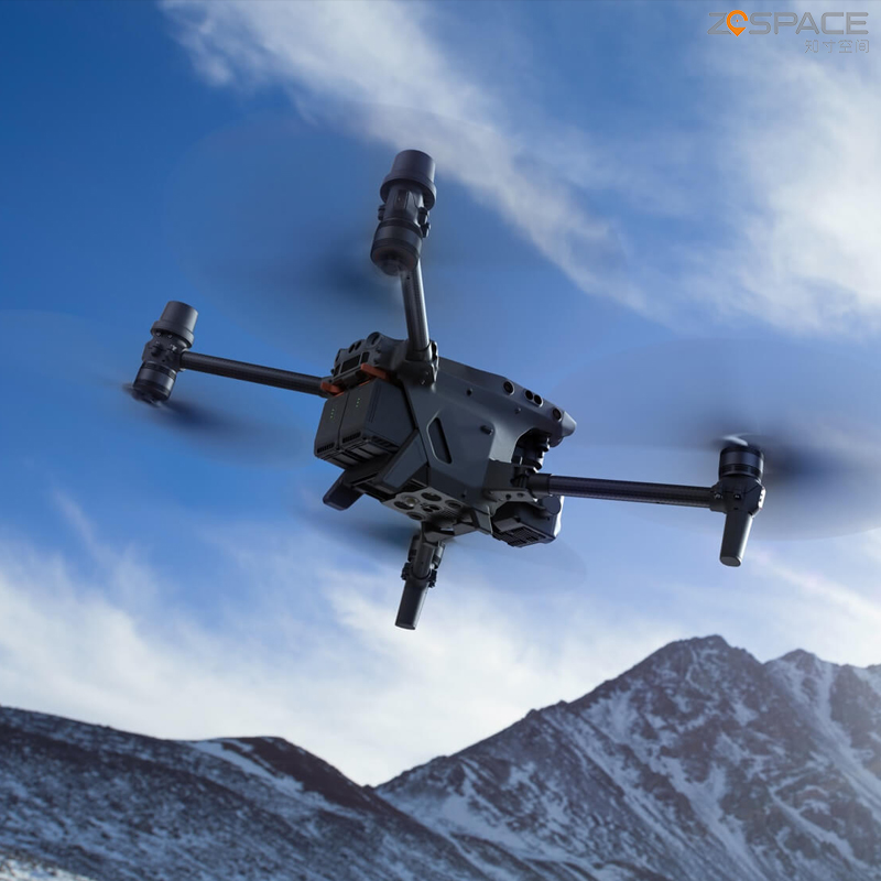
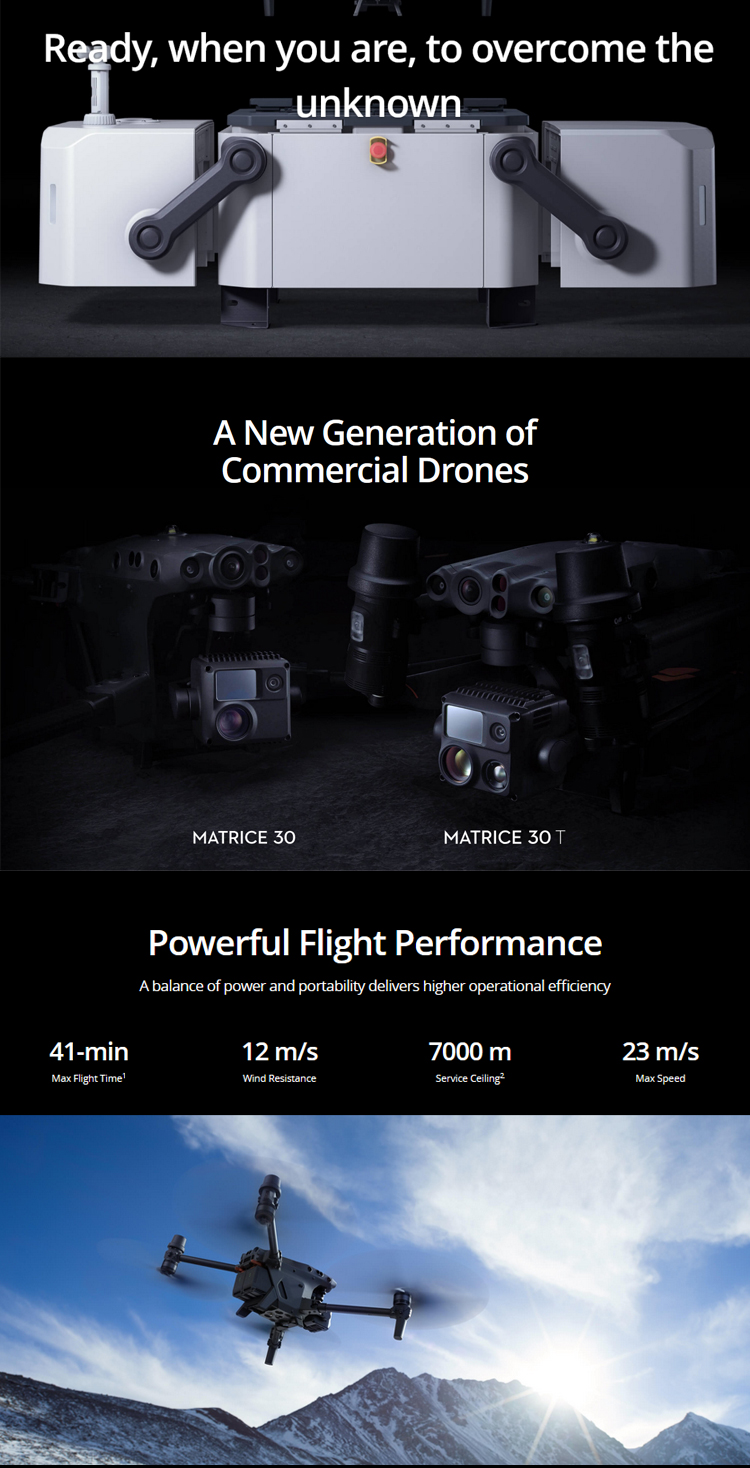
Flying Speed: 23m/s.
Flying Height: Up to 5000m with 1671 propellers, up to 7000m with 1676 plateau propellers.
Flight Time: 41 minutes.
Wheelbase: 668mm.
Wind Resistance Level: 7.
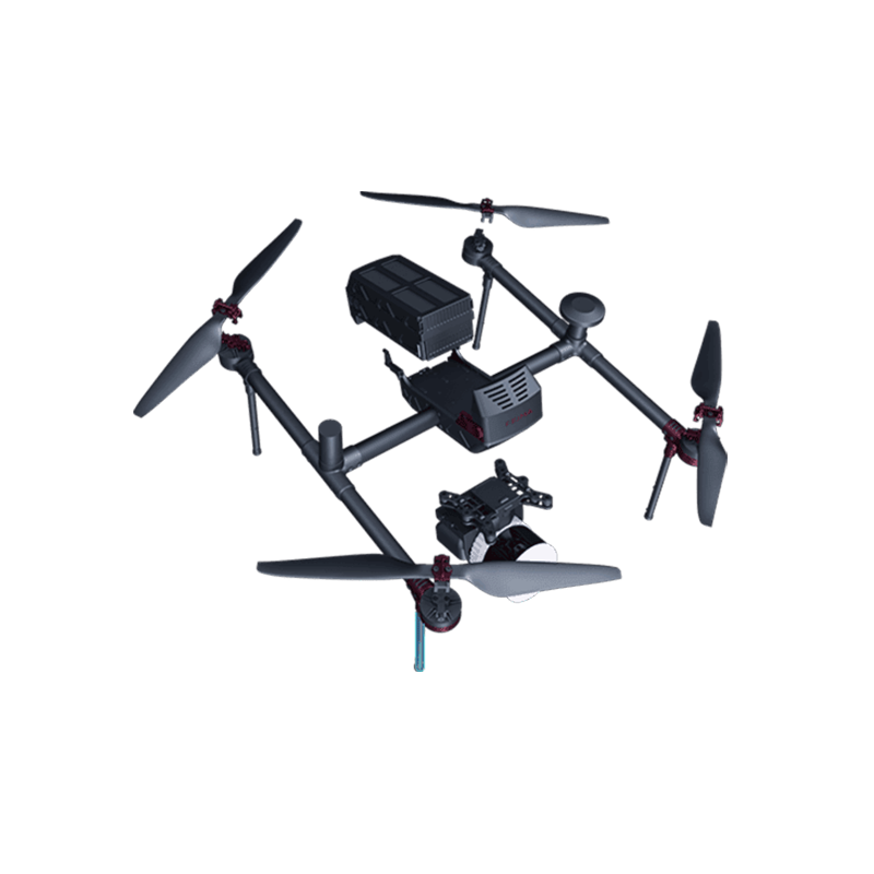
Gimbal Parameters:
Angular Control Accuracy: ±0.01°.
Controllable Rotation Range: Pan ±90°, Tilt -120°-45°.
Camera Parameters:
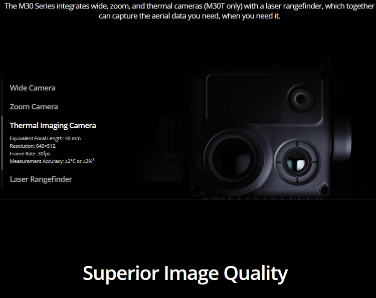
Zoom Lens Camera: Focal length 21-75mm (equivalent focal length 113-405mm), aperture f/2.8-4.2, focusing distance 5m to infinity.
Wide-angle Camera: DFOV 84°, focal length 4.5mm (equivalent focal length 24mm), aperture f/2.8, focusing distance 1m to infinity.
Power Performance:
Battery Type: Li-ion 6S, 5880mAh.
Other Parameters:
Product Size (Unfolded): 470×585×215mm.
Product Size (Folded): 365×215×195mm.
Product Weight (including two batteries): 3770±10g.
Structural Design Range: Pan ±105°, Tilt -135°-60°, Roll ±45°.
In summary, the DJI M30T plays a crucial role in various industries thanks to its wide range of applications and excellent specifications. Whether in environmental monitoring, construction, government, electric power, or fire protection, the M30T provides an efficient, precise, and convenient flying experience.
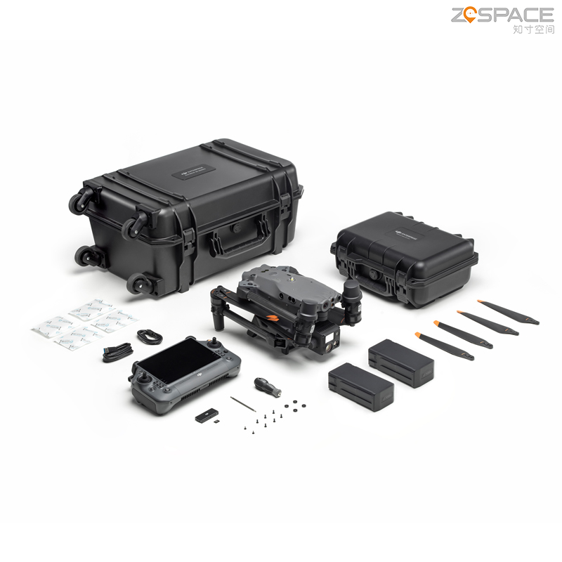
Logistics information


Logistics information
technical parameter
| Aircraft | Dimensions (unfolded, excl. propellers) | 470×585×215 mm (L×W×H) |
| Dimensions (folded) | 365×215×195 mm (L×W×H) | |
| Diagonal Wheelbase | 668 mm | |
| Weight (incl. two batteries) | 3770 ± 10 g | |
| Max Takeoff Weight | 4069 g | |
| Max Takeoff Weight for C2 Certification in EU | 3998 g | |
| Operation Frequency[1] | 2.4000-2.4835 GHz; 5.725-5.850 GHz | |
| Transmitter Power (EIRP) | 2.4 GHz: <33 dBm (FCC); <20 dBm (CE/SRRC/MIC) 5.8 GHz: <33 dBm (FCC/SRRC); <14 dBm (CE) | |
| Hovering Accuracy (windless or breezy) | Vertical: ±0.1 m (Vision System enabled); ±0.5 m (N-mode with GPS); ±0.1 m (RTK) Horizontal: ±0.3 m (Vision System enabled); ±1.5 m (N-mode with GPS); ±0.1 m (RTK) | |
| RTK Positioning Accuracy (fixed RTK enabled) | 1 cm+1 ppm (horizontal) 1.5 cm+1 ppm (vertical) | |
| Max Angular Velocity | Pitch: 150°/sec.; Yaw: 100°/sec | |
| Max Pitch Angle | 35° (N-mode and Forward Vision System enabled: 25°) | |
| Max Ascent/Descent Speed | 6 m/s, 5 m/s | |
| Max Tilt Descent Speed | 7 m/s | |
| Max Horizontal Speed | 23m/s | |
| Max Service Ceiling Above Sea Level (without other payload) | 5,000 m (with 1671 propellers) 7,000 m (with 1676 propellers) | |
| Max Wind Resistance | 12 m/s | |
| Max Hover Time [2] | 36 min | |
| Max Flight Time[2] | 41 min | |
| Motor Model | 3511 | |
| GNSS | GPS+Galileo+BeiDou+GLONASS (GLONASS is supported only when RTK module is enabled) | |
| Ingress Protection Rating[3] | IP55 | |
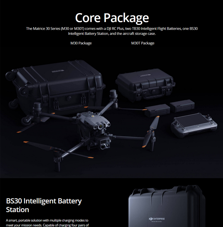
| BS30 Intelligent Battery Station | Dimensions | 353×267×148 mm |
| Net Weight | 3.95 kg | |
| Compatible Battery Type | TB30 Intelligent Flight Battery WB37 Intelligent Battery | |
| Input | 100-240 VAC, 50/60 Hz | |
| Output | TB30 Battery Port: 26.1 V, 8.9 A (supported up to two outputs simultaneously) WB37 Intelligent Battery: 8.7 V, 6 A | |
| Output Power | 525 W | |
| USB-C port | Max. output power of 65 W | |
| USB-A port | Max. output power of 10 W (5 V, 2 A) | |
| Power Consumption (when not charging battery) | < 8 W | |
| Output Power (when warming up battery) | Approx. 30 W | |
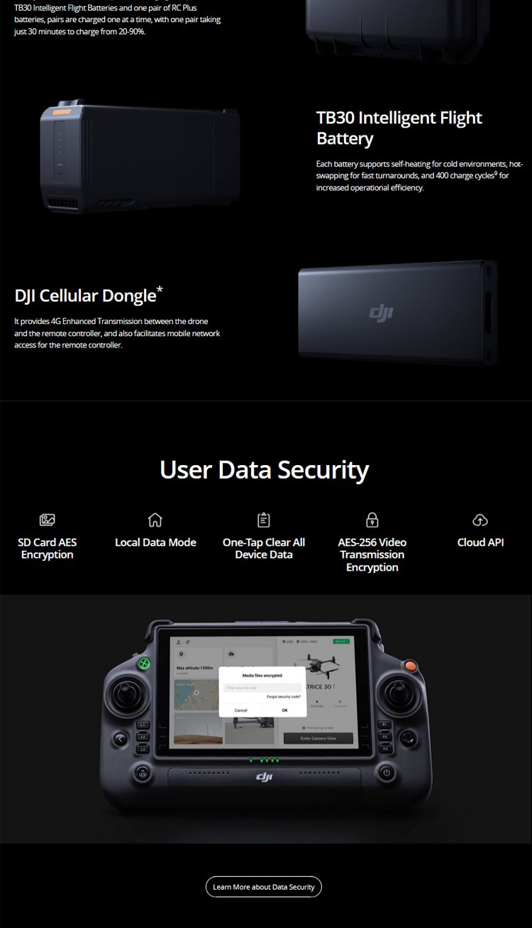
| Charging Time[6] | Approx. 30 min (charging two TB30 batteries from 20% to 90%) Approx. 50 min (charging two TB30 batteries from 0% to 100%) | |
| Ingress Protection Rating[3] | IP55 (with the cover closed properly) |