


COMNAV T60 RTKRTK GPS GNSSGPS RTK HIGH PRECISION SURVEY EQUIPMENT GNSS
innovative functions and convenient operation
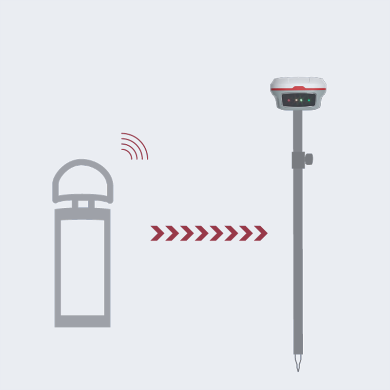
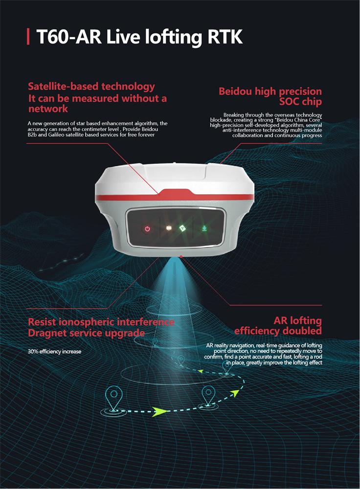
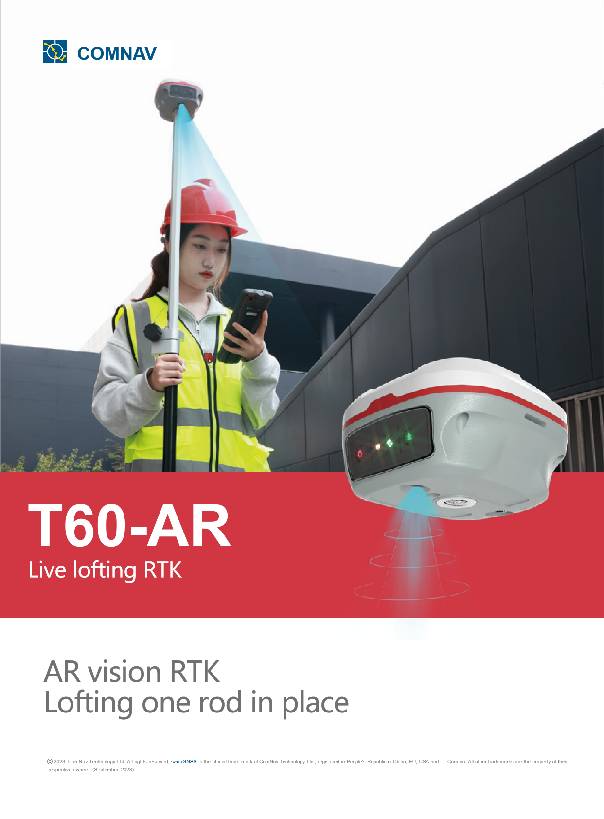
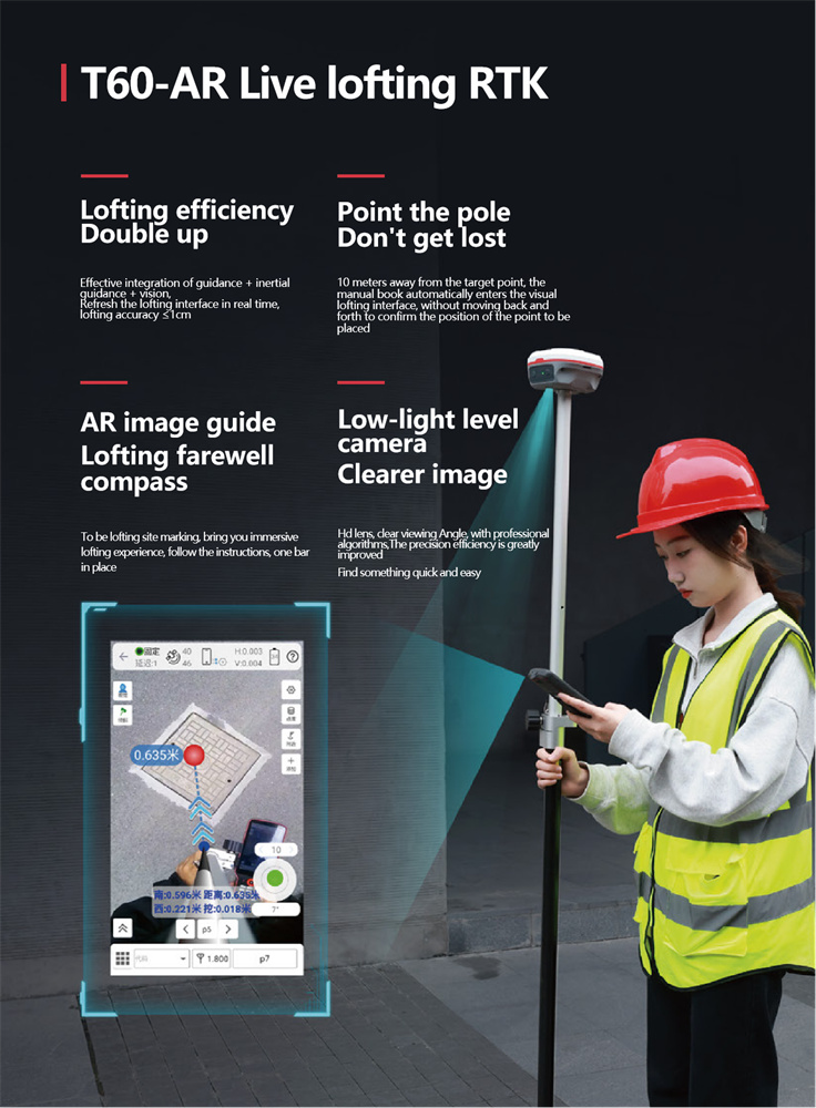
AR visual lofting: T60 RTK is equipped with AR visual lofting function, which combines RTK with the image, and the lofting point is marked in the image in real place. Without repeatedly moving the rod, the lofting effect of 1 rod in place can be realized. These 1 functions greatly improve the efficiency and accuracy of lofting.
Immersive real-scene lofting: The device supports immersive real-scene lofting, provides clear images through the low-light-level camera, and refreshes the manual lofting interface in real time, so that users can intuitively see the location of the lofting point, thereby measuring and lofting more accurately.
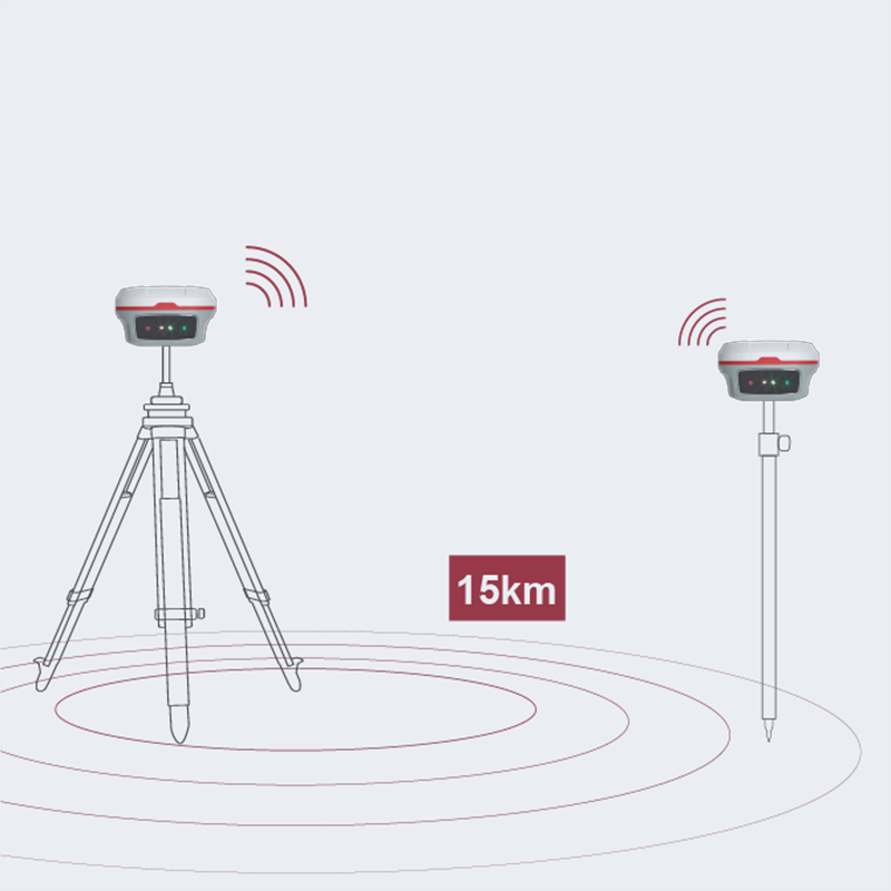
One machine with multiple functions: T60 RTK supports one-key switching between mobile stations and base stations, which is convenient for users to use in different scenarios. At the same time, the equipment also has a nationwide CORS service built in, which can directly output the CGCS2000 coordinates, and can be automatically configured and fixed in an instant with one click, which greatly improves the work efficiency.
durability and environmental adaptability
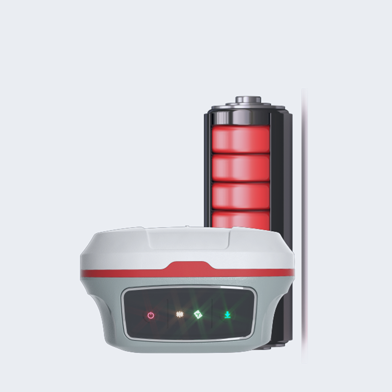
The COMNAV T60 RTK uses rugged materials and design to adapt to a variety of harsh outdoor environments. The equipment has reached a high dustproof and waterproof level (such as IP67), which ensures the normal operation of the equipment in a humid or dusty environment. In addition, T60 RTK is also equipped with long-lasting battery and fast charging function. The power can meet the requirements of easy working 1 all day long. The unique low power consumption process also further prolongs the service life of the equipment.
full compatibility and scalability
T60 RTK is fully compatible with domestic and foreign mainstream data messages, networks, radio and other protocols, which is convenient for users to connect and communicate with different devices and systems. At the same time, the device also provides a wealth of accessories and expansion options, such as laser modules, handbooks, etc., which can be customized and expanded according to user needs.
basic performance parameters
hardware configuration
Communication and Data Link
Software and Features
Logistics information


Technical Specifications
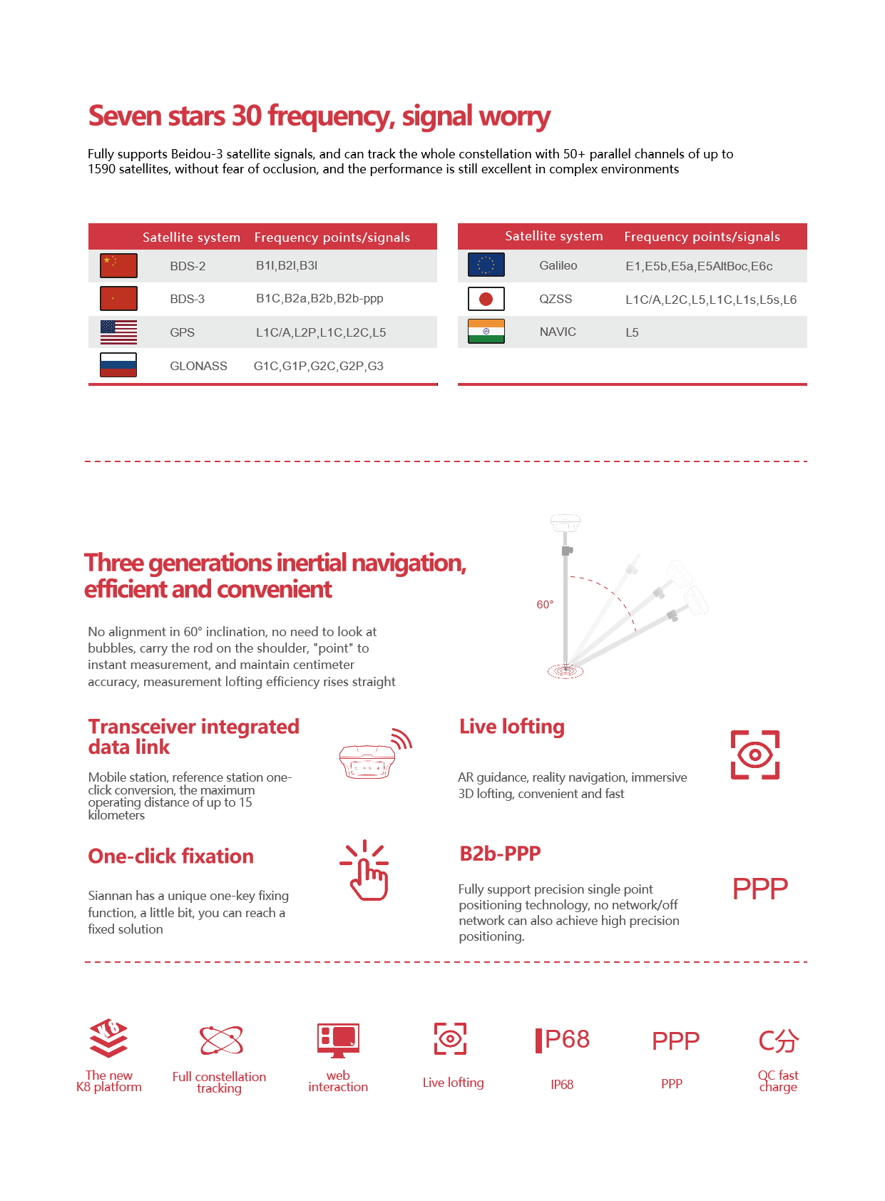
| GNSS Features | Channels | 1408 |
| GPS | L1C/A, L2C, L2P, L5 | |
| GLONASS | L1C/A,L1P,L2C/A,L2P,L3* | |
| BDS | BDS-2: B1I, B2I, B3I BDS-3: B1I, B3I, B1C, B2a, B2b* | |
| GALILEO | E1, E5A, E5B, E6C, AltBOC* | |
| SBAS(WAAS/MSAS/EGNOS/GAGAN) | L1C/A, L5* | |
| IRNSS | L5* | |
| QZSS | L1, L2C, L5* | |
| MSS L-Band | BDS-PPP | |
| Positioning output rate | 1Hz~20Hz | |
| Initialization time | < 10s | |
| Initialization reliability | > 99.99% | |
| Positioning Precision | Code differential GNSS | Horizontal: 0.25 m + 1 ppm RMS Vertical: 0.50 m + 1 ppm RMS |
| Static(long observations) | Horizontal: 2.5 mm + 0.1 ppm RMS Vertical: 3 mm + 0.4 ppm RMS | |
| Static | Horizontal: 2.5 mm + 0.5 ppm RMS Vertical: 3.5 mm + 0.5 ppm RMS | |
| Rapid static | Horizontal: 2.5 mm + 0.5 ppm RMS Vertical: 5 mm + 0.5 ppm RMS | |
| PPK | Horizontal: 3 mm + 1 ppm RMS Vertical: 5 mm + 1 ppm RMS | |
| RTK(UHF) | Horizontal: 8 mm + 1 ppm RMS Vertical: 15 mm + 1 ppm RMS | |
| RTK(NTRIP) | Horizontal: 8 mm + 0.5 ppm RMS Vertical: 15 mm + 0.5 ppm RMS | |
| RTK initialization time | 2-8s | |
| SBAS positioning | Typically < 5m 3DRMS | |
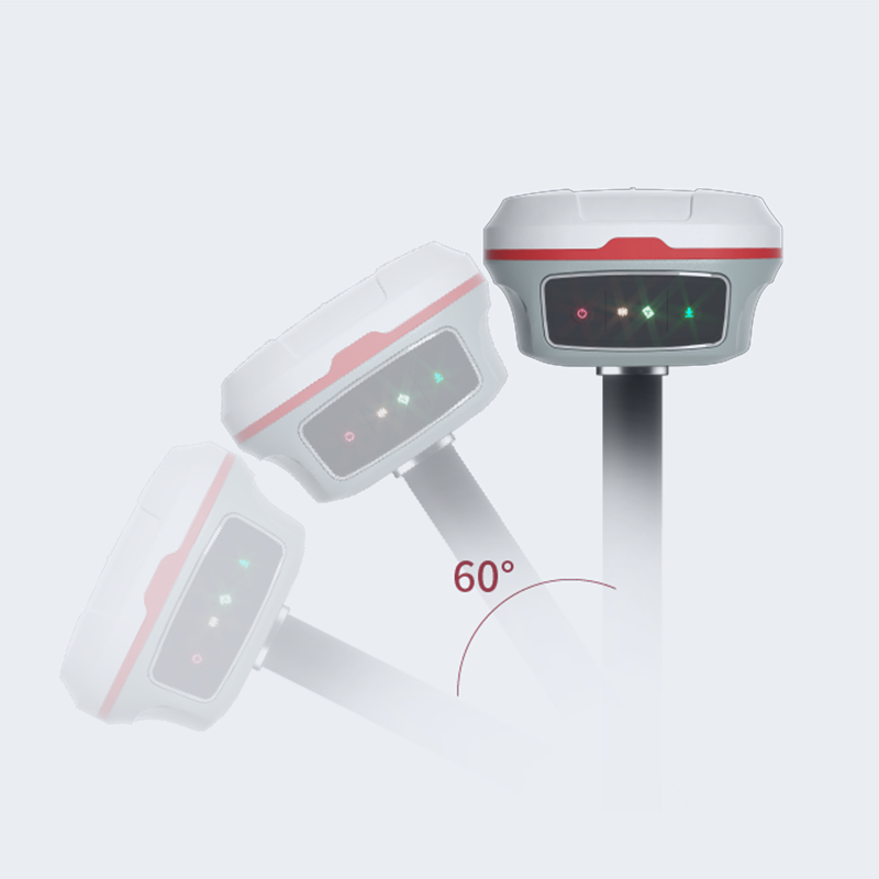
| IMU | Less than 10mm + 0.7 mm/° tilt to 30° | |
| IMU tilt angle | 0° ~ 60° | |
| Hardware Performance | Dimension | 151mmx151mmx94.5mm |
| Weight | 1350g | |
| Material | Magnesium aluminum alloy shell | |
| Operating temperature | -45℃ ~ +65℃ | |
| Storage temperature | -45℃ ~ +85℃ | |
| Humidity | 100% Non-condensing | |
| Waterproof/Dustproof | IP68 standard, protected from long time immersion to depth of 1m | |
| IP68 standard, fully protected against blowing dust | ||
| Shock/Vibration | Withstand 2 meters pole drop onto the cement ground naturally | |
| Power consumption | 2W | |
| Power supply | 6-28V DC, overvoltage protection | |
| Battery | 7.2v 10200mAh | |
| Battery life(Dual-battery) | 15h(Rover Bluetooth mode) | |
| WIFI | Modem | 802.11 b/g standard |
| WIFI hotspot | AP mode, Receiver broadcasts its hotspot form web UI accessing with any mobile terminals | |
| WIFI datalink | Client mode, Receiver can transmit and receive correction data stream via WiFi datalink | |
| Communications | I/O Port | 5-PIN LEMO external power port + RS232 |
| 7-PIN LEMO(USB, OTG and Ethernet) | ||
| 1 PPS data interface | ||
| SIM card slot(standard) | ||
| Internal UHF | Receiver and transmitter 1/2/3W (Just receiver 0.01W for Russia) | |
| Frequency range | 410 - 470MHz | |
| Communication protocol | Farlink, Trimtalk450s, SOUTH, HUACE, ZHD | |
| Communication range | Typically 10km with Farlink protocol | |
| Cellular mobile network | 4G network communication module | |
| Bluetooth | BLEBluetooth 4.0 standard, Bluetooth 2.1 + EDR | |
| NFC Communication | Realizing close range (shorter than 10cm) automatic pair between receiver and controller (controller requires NFC wireless communication module else) | |
| Data Storage/Transmission | Storage | 16GB SSD |
| Automatic cycle storage (The earliest data files will be removed automatically while the memory is not enough) | ||
| Support external USB storage | ||
| Data transmission | Plug and play mode of USB data transmission | |
| Supports FTP/HTTP data download | ||
| Data format | Static data format: STH, Rinex2.01, Rinex3.02, etc. | |
| Differential format: CMR(GPS only), CMR+(GPS only), RTCM 2.3, RTCM 3.0, RTCM 3.1, RTCM 3.2 | ||
| Navigation data format: NMEA 0183, PJK, Binary code | ||
| Network model support: VRS, FKP, MAC, fully support NTRIP protocol | ||
| Sensors | Electronic bubble | Controller software can display electronic bubble, checking leveling status of the carbon pole in real-time |
| IMU | Built-in IMU module, calibration-free and immune to magnetic interference | |
| Thermometer | Built-in thermometer sensor, adopting intelligent temperature control technology, monitoring and adjusting the receiver temperature | |
| User Interaction | Operating system | Linux |
| Buttons | Single button | |
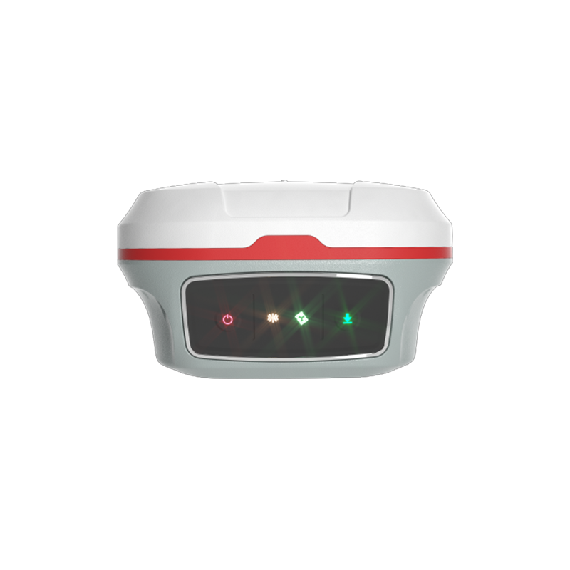
| Indicators | 4 color LED indicators, Battery indicator | |
| Web interaction | With the access of the internal web interface management via WiFi or USB connection, users are able to monitor the receiver status and change the configurations freely | |
| Voice guidance | It provides status and operation voice guidance, and supports Chinese/English/Korean/Spanish/Portuguese/Russian/Turkish | |
| Secondary development | Provides secondary development kit, and opens the OpenSIC observation data format and interaction interface definition | |
| Cloud service | The powerful cloud platform provides online services like remote manage, firmware update, online register and etc. |