


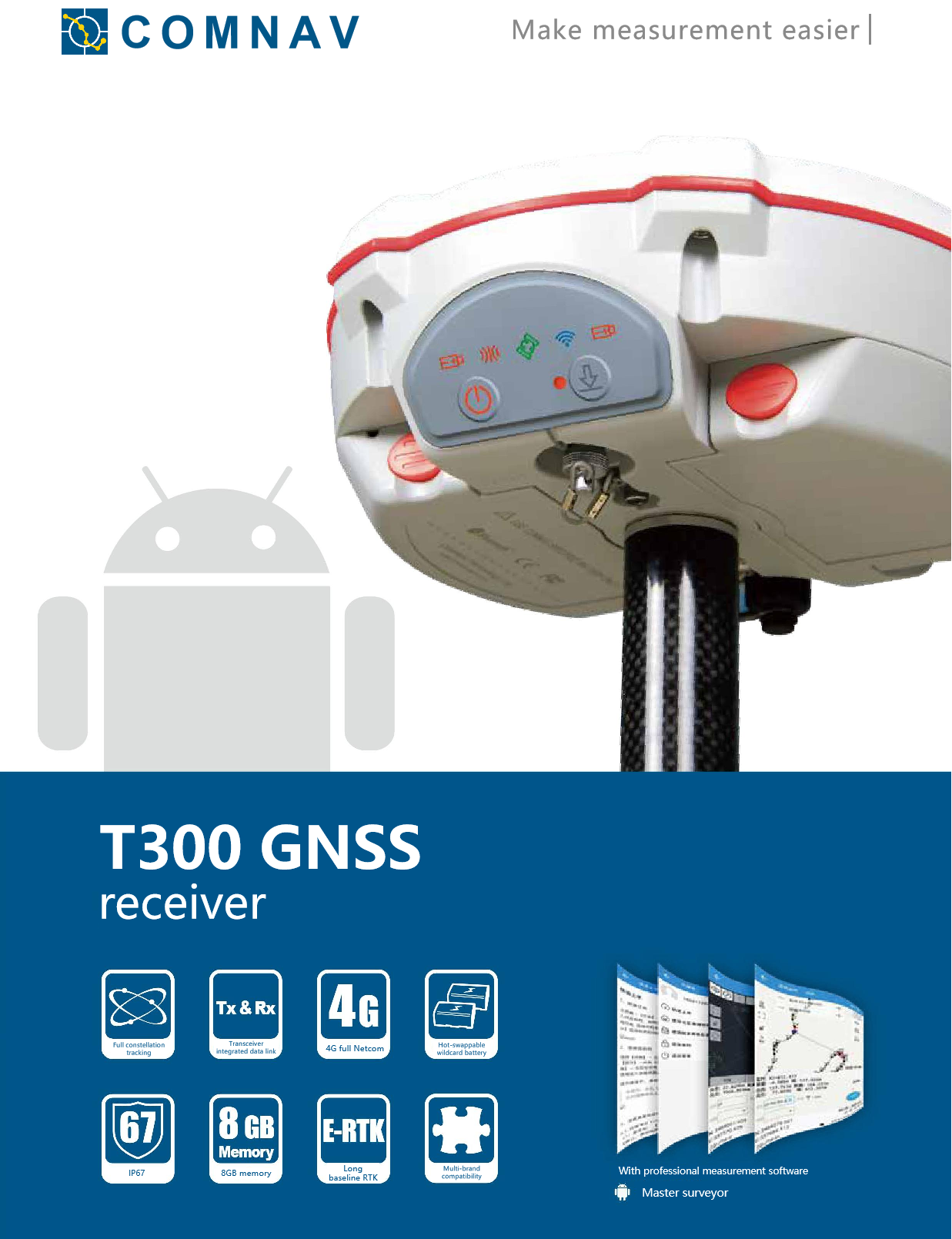
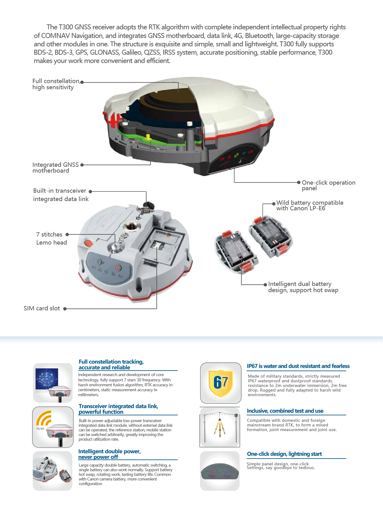
COMNAV T300 RTKRTK GPS GNSSGPS RTK HIGH PRECISION SURVEY EQUIPMENT GNSS
high accuracy and multi-system support
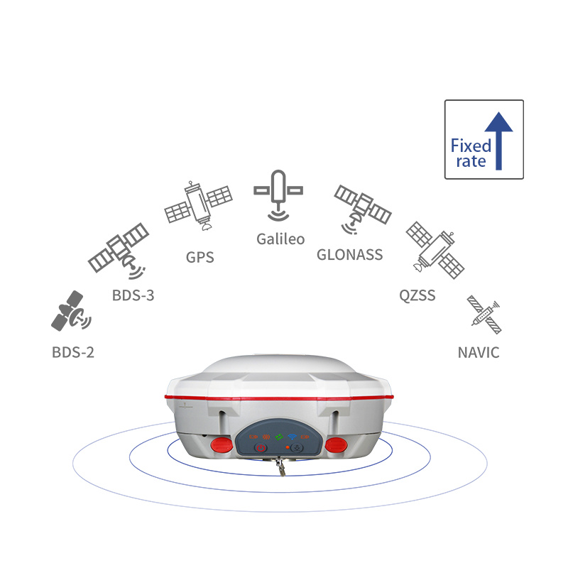
T300 RTK supports multiple global satellite navigation systems including Beidou, GPS, GLONASS, and Galileo, ensuring stable and high-quality satellite signals in various complex environments. Its high-precision positioning capability, static accuracy horizontal direction up to +(2.5 0.5 × 10⁻⁶ × D)mm(D is the baseline length, the unit is mm), to meet a variety of high-precision measurement requirements.
efficient data processing and communication capabilities
T300 RTK built-in high-performance processor and large-capacity storage space, support a variety of data formats and communication protocols, user-friendly data processing and transmission. Its built-in 4G communication module and wireless communication methods such as Bluetooth and WiFi make data transmission more convenient and efficient. At the same time, T300 RTK also supports NTRIP protocol, which is convenient for users to access CORS network for real-time differential positioning.
Rugged and adaptable 3.
T300 RTK uses durable materials and design, with IP67 dustproof and waterproof rating, can float, resist 2 meters free drop, and can work normally in various harsh environments. Its operating temperature range is wide (-40 ℃ 75 ℃), storage temperature range is also large (-55 ℃ 85 ℃), strong adaptability.
rich functionality and extensibility
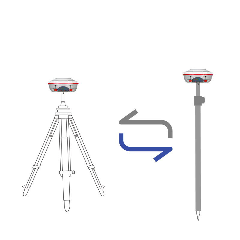
T300 RTK not only has the basic RTK positioning function, but also supports a variety of measurement modes and data import/export functions. At the same time, it also has a wealth of accessories and expansion options, such as laser modules, hand books, etc., which can be customized and expanded according to user needs.
widely used
Because of its high precision, high reliability and powerful features, T300 RTK is widely used in municipal survey, geographic information collection, construction lofting, earthwork survey, GNSS control network construction and topographic mapping and other fields. In addition, it has also played an important role in CORS construction projects in many countries such as Africa, providing strong support for local economic and social development.
In summary, the COMNAV T300 RTK is the 1 high-precision RTK device with excellent performance, rich functions and strong adaptability. Whether it is for professional measurement personnel or for industry users who need high-precision positioning technology, it is a worthy choice.
satellite signal reception capability
positioning accuracy and reliability
initialization and signal tracking performance
communication and data configuration
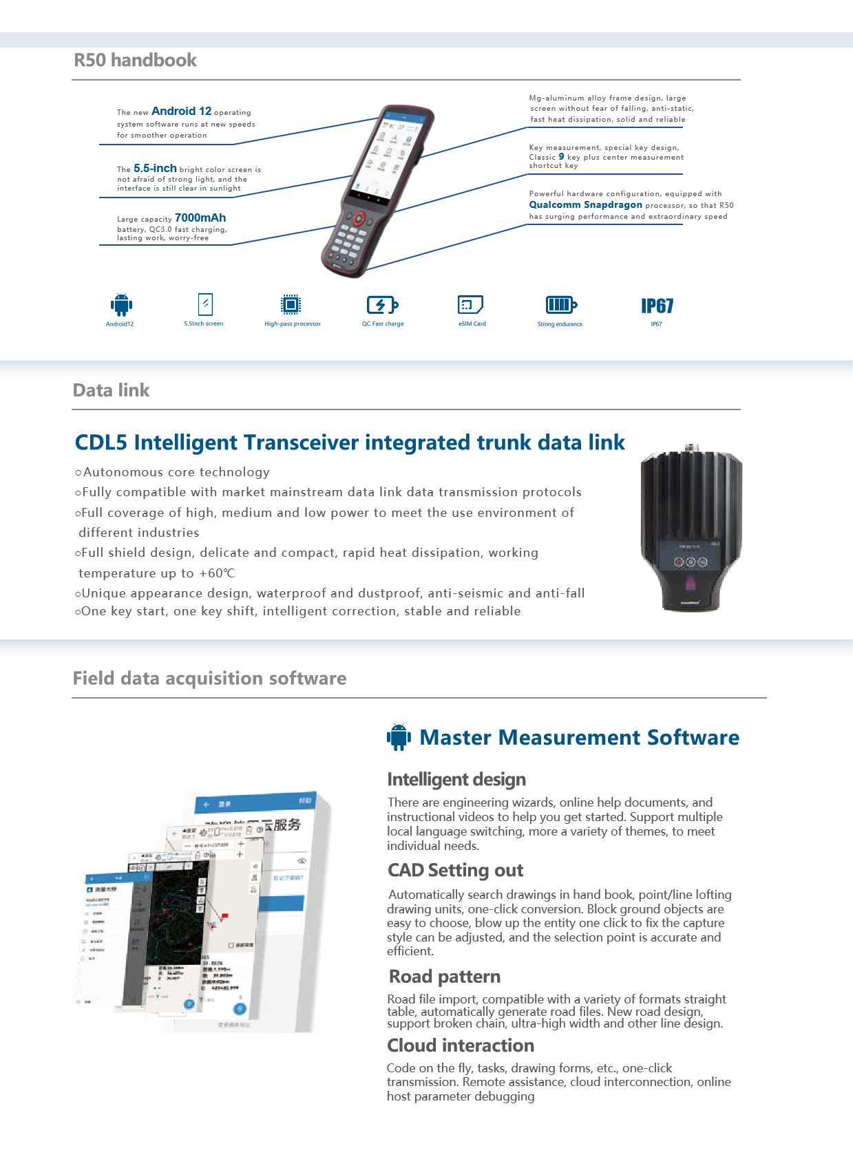
Network module: built-in 4G communication module, full network support.
Network mode: Support NTRIP protocol.
Built-in radio:
Frequency band: 410MHz ~ 470MHz, step 12.5KHz.
Power: 0.5W/1W/2W adjustable.
Air baud rate: 19.2kbps, 9.6kbps.
Transport protocol: Transparent transmission/TT450S/SOUTH/MAC.
Bluetooth: BT4.0 dual-mode Bluetooth.
WiFi:802.11 B/g/n, supports access point and client modes (some models or configurations may support).
Differential formats are supported: CMR, RTCM2.x, RTCM3.x, MSM4, MSM5.
Positioning output frequency: 1Hz, 2Hz, 5Hz, 10Hz, 20Hz, 50Hz (optional).
Data recording format: CNB, RINEX, etc.
electrical index and physical performance
Receiver power supply: DC 6~28V.
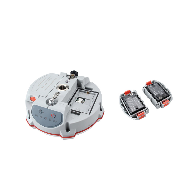
Lithium battery: The working time can reach more than 8 hours (depending on the use conditions and configuration).
Power consumption: 2.4W (static measurement).
Communication interface: 1 serial port (7-pin Lemo header), Bluetooth (some models may also include WiFi).
Baud rate: can be expanded to 921600bps.
Size: 18.5cm x 7.5cm.
Weight: 1.14kg (with battery).
Shell material: polymer environmental protection material (or GE environmental protection material, depending on the production batch and configuration).
environmental characteristics and protection level
Logistics information


Technical Specifications
| GNSS Features | Channels | 1408 |
| GPS | L1C/A, L2C, L2P, L5 | |
| GLONASS | L1C/A,L1P,L2C/A,L2P,L3* | |
| BDS | BDS-2: B1I, B2I, B3I BDS-3: B1I, B3I, B1C, B2a, B2b* | |
| GALILEO | E1, E5A, E5B, E6C, AltBOC* | |
| SBAS(WAAS/MSAS/EGNOS/GAGAN) | L1C/A, L5* | |
| IRNSS | L5* | |
| QZSS | L1, L2C, L5* | |
| MSS L-Band | BDS-PPP | |
| Positioning output rate | 1Hz~20Hz | |
| Initialization time | < 10s | |
| Initialization reliability | > 99.99% | |
| Positioning Precision | Code differential GNSS | Horizontal: 0.25 m + 1 ppm RMS Vertical: 0.50 m + 1 ppm RMS |
| Static(long observations) | Horizontal: 2.5 mm + 0.1 ppm RMS Vertical: 3 mm + 0.4 ppm RMS | |
| Static | Horizontal: 2.5 mm + 0.5 ppm RMS Vertical: 3.5 mm + 0.5 ppm RMS | |
| Rapid static | Horizontal: 2.5 mm + 0.5 ppm RMS Vertical: 5 mm + 0.5 ppm RMS | |
| PPK | Horizontal: 3 mm + 1 ppm RMS Vertical: 5 mm + 1 ppm RMS | |
| RTK(UHF) | Horizontal: 8 mm + 1 ppm RMS Vertical: 15 mm + 1 ppm RMS | |
| RTK(NTRIP) | Horizontal: 8 mm + 0.5 ppm RMS Vertical: 15 mm + 0.5 ppm RMS | |
| RTK initialization time | 2-8s | |
| SBAS positioning | Typically < 5m 3DRMS | |
| IMU | Less than 10mm + 0.7 mm/° tilt to 30° | |
| IMU tilt angle | 0° ~ 60° | |
| Hardware Performance | Dimension | 151mmx151mmx94.5mm |
| Weight | 1350g | |
| Material | Magnesium aluminum alloy shell | |
| Operating temperature | -45℃ ~ +65℃ | |
| Storage temperature | -45℃ ~ +85℃ | |
| Humidity | 100% Non-condensing | |
| Waterproof/Dustproof | IP68 standard, protected from long time immersion to depth of 1m | |
| IP68 standard, fully protected against blowing dust | ||
| Shock/Vibration | Withstand 2 meters pole drop onto the cement ground naturally | |
| Power consumption | 2W | |
| Power supply | 6-28V DC, overvoltage protection | |
| Battery | 7.2v 10200mAh | |
| Battery life(Dual-battery) | 15h(Rover Bluetooth mode) | |
| WIFI | Modem | 802.11 b/g standard |
| WIFI hotspot | AP mode, Receiver broadcasts its hotspot form web UI accessing with any mobile terminals | |
| WIFI datalink | Client mode, Receiver can transmit and receive correction data stream via WiFi datalink | |
| Communications | I/O Port | 5-PIN LEMO external power port + RS232 |
| 7-PIN LEMO(USB, OTG and Ethernet) | ||
| 1 PPS data interface | ||
| SIM card slot(standard) | ||
| Internal UHF | Receiver and transmitter 1/2/3W (Just receiver 0.01W for Russia) | |
| Frequency range | 410 - 470MHz | |
| Communication protocol | Farlink, Trimtalk450s, SOUTH, HUACE, ZHD | |
| Communication range | Typically 10km with Farlink protocol | |
| Cellular mobile network | 4G network communication module | |
| Bluetooth | BLEBluetooth 4.0 standard, Bluetooth 2.1 + EDR | |
| NFC Communication | Realizing close range (shorter than 10cm) automatic pair between receiver and controller (controller requires NFC wireless communication module else) | |
| Data Storage/Transmission | Storage | 16GB SSD |
| Automatic cycle storage (The earliest data files will be removed automatically while the memory is not enough) | ||
| Support external USB storage | ||
| Data transmission | Plug and play mode of USB data transmission | |
| Supports FTP/HTTP data download | ||
| Data format | Static data format: STH, Rinex2.01, Rinex3.02, etc. | |
| Differential format: CMR(GPS only), CMR+(GPS only), RTCM 2.3, RTCM 3.0, RTCM 3.1, RTCM 3.2 | ||
| Navigation data format: NMEA 0183, PJK, Binary code | ||
| Network model support: VRS, FKP, MAC, fully support NTRIP protocol | ||
| Sensors | Electronic bubble | Controller software can display electronic bubble, checking leveling status of the carbon pole in real-time |
| IMU | Built-in IMU module, calibration-free and immune to magnetic interference | |
| Thermometer | Built-in thermometer sensor, adopting intelligent temperature control technology, monitoring and adjusting the receiver temperature | |
| User Interaction | Operating system | Linux |
| Buttons | Single button | |
| Indicators | 4 color LED indicators, Battery indicator | |
| Web interaction | With the access of the internal web interface management via WiFi or USB connection, users are able to monitor the receiver status and change the configurations freely | |
| Voice guidance | It provides status and operation voice guidance, and supports Chinese/English/Korean/Spanish/Portuguese/Russian/Turkish | |
| Secondary development | Provides secondary development kit, and opens the OpenSIC observation data format and interaction interface definition | |
| Cloud service | The powerful cloud platform provides online services like remote manage, firmware update, online register and etc. |