


COMNAV T30 RTKRTK GPS GNSSGPS RTK HIGH PRECISION SURVEY EQUIPMENT GNSS
innovative functions and convenient operation
As the 1 high-performance real-time dynamic differential positioning (RTK) equipment, COMNAV T30 RTK has many remarkable characteristics, which make it have a wide range of applications in the fields of measurement, mapping, UAV navigation and so on. The following are the main features of Sinan Navigation T30 RTK:
High precision positioning:
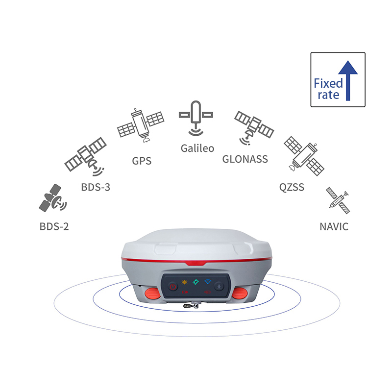
T30 RTK supports multi-frequency signal reception of multi-satellite systems (such as GPS, GLONASS, BDS, Galileo, etc.), and can make full use of the signals of these systems to improve the accuracy and stability of positioning.
The advanced RTK algorithm can achieve centimeter-level or even millimeter-level positioning accuracy in various environments.
Powerful signal processing capabilities:
The equipment is equipped with a large number of signal channels, which can process multiple satellite signals at the same time, improving the reliability and robustness of positioning.
The low-power anti-interference technology is used to maintain stable signal reception in a complex electromagnetic environment.
Flexible communication configuration:
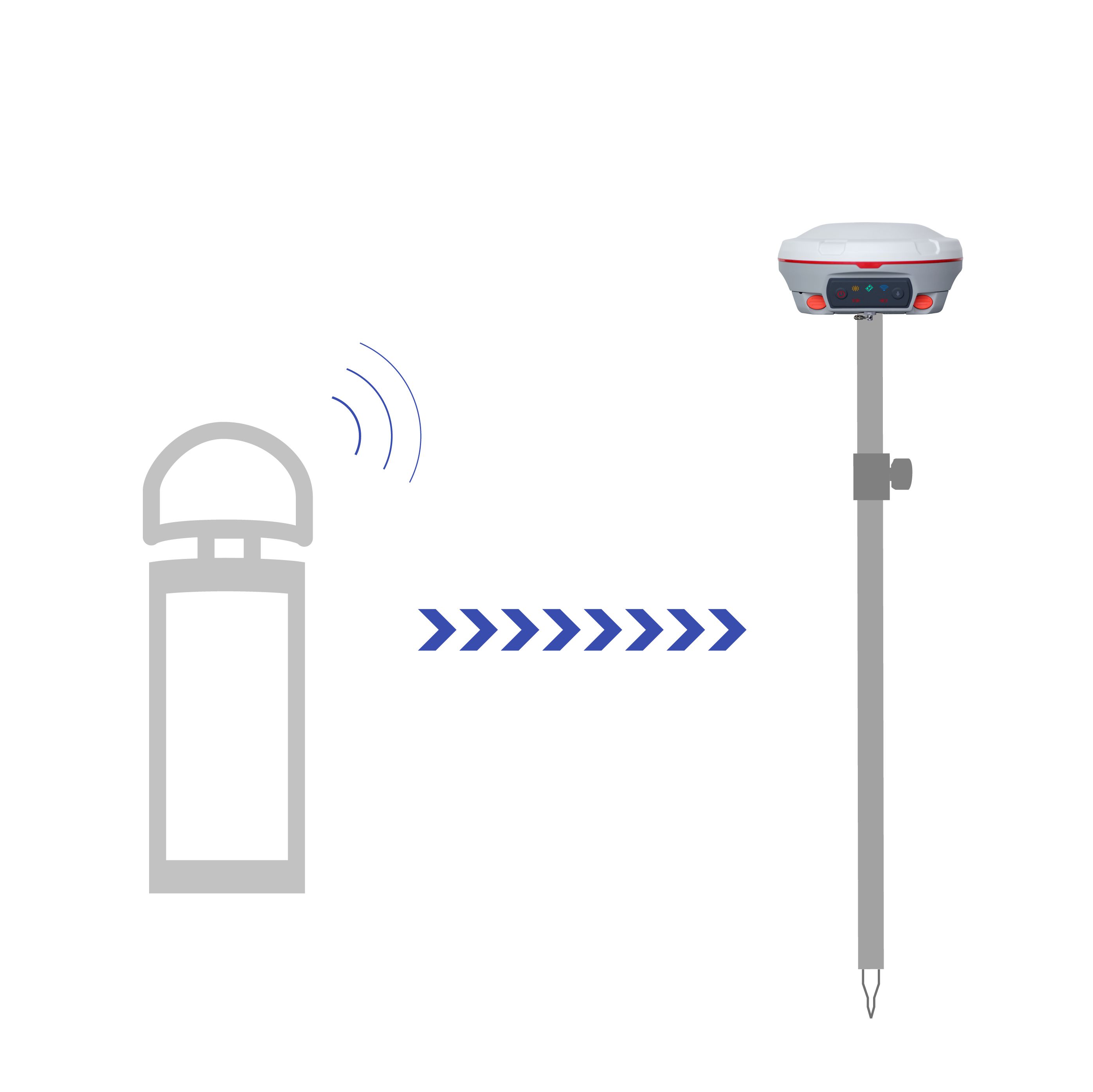
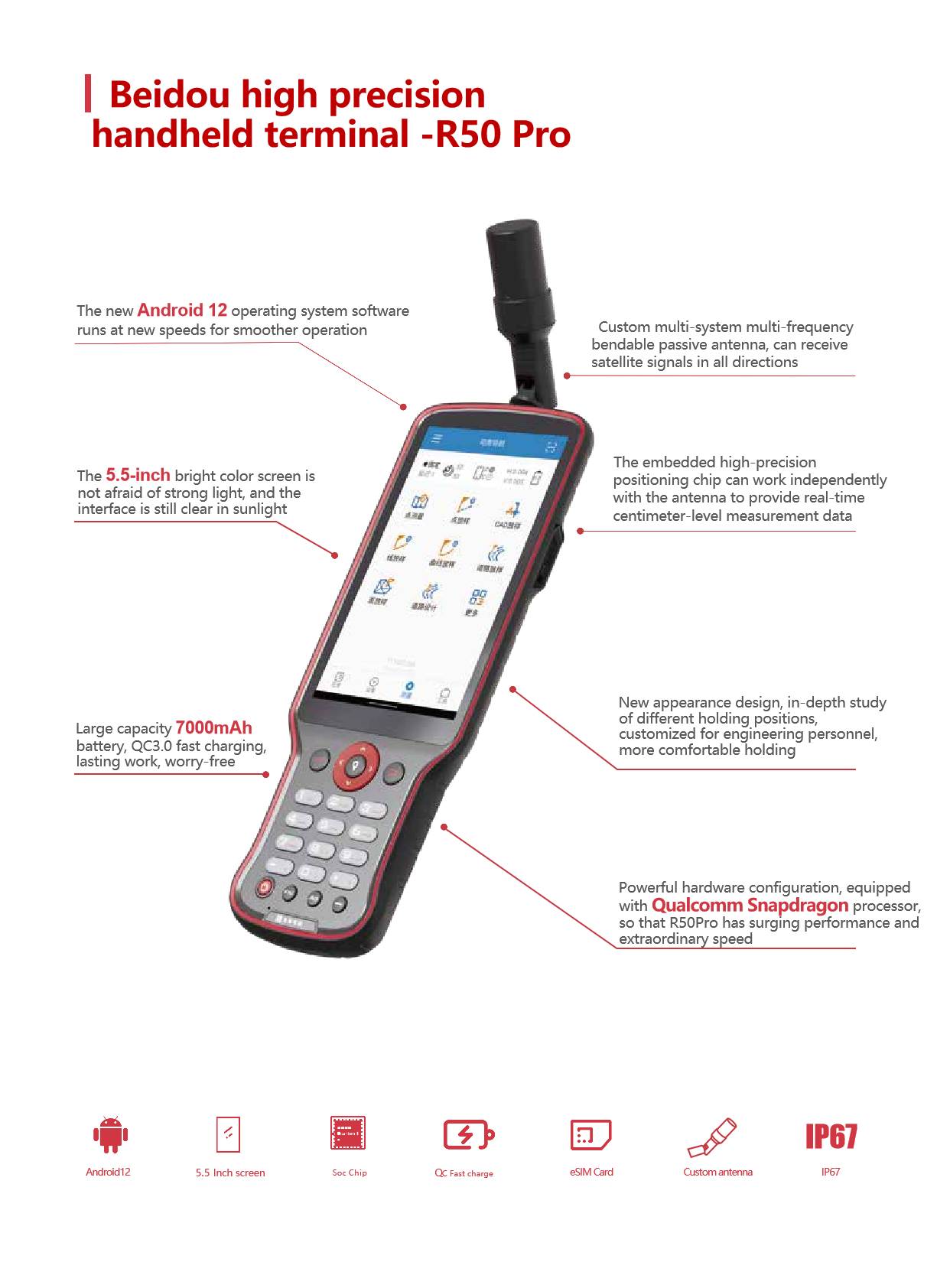
T30 RTK supports a variety of communication methods, including built-in 4G communication module, Bluetooth, WiFi, etc., which is convenient for users to use in different scenarios.
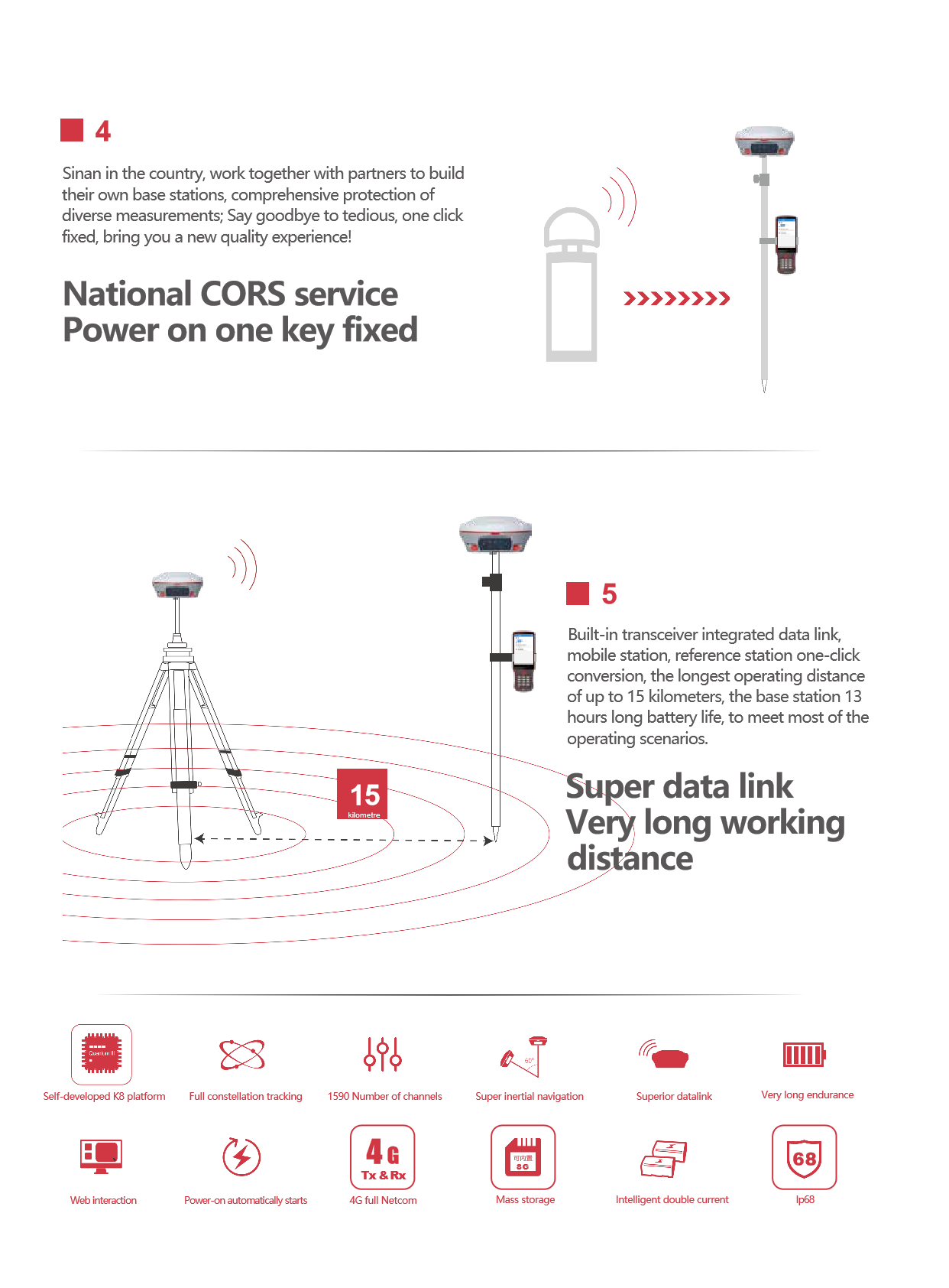
Support NTRIP protocol, you can easily access a variety of network RTK services.
Long life and portability:
The device has a built-in large-capacity battery, which supports long-term work and reduces the trouble of frequent battery replacement.
The appearance is small and light, easy to carry and transport, suitable for outdoor operations.
Full compatibility:
T30 RTK is fully compatible with domestic and foreign mainstream data messages, networks, radio and other protocols, which is convenient for users to connect and communicate with different devices and systems.
Easy to operate and maintain:
The device provides an intuitive user interface and a wealth of operating options for easy user setup and adjustment.
Support one-key conversion function, can quickly switch between mobile station and reference station, improve work efficiency.
Reliable environmental adaptability:
The equipment uses durable materials and design, can adapt to a variety of harsh outdoor environments.
It has reached a high dustproof and waterproof level (such as IP67), ensuring the normal operation of the equipment in a humid or dusty environment.
Abundant accessories and expansibility:
T30 RTK provides a variety of accessories and expansion options, such as laser modules, hand books, etc., which can be customized and expanded according to user needs.To sum up, COMNAV T60 RTK has a wide range of application prospects in the fields of measurement, mapping, UAV navigation and so on, with its high-precision positioning, innovative functions, convenient operation, durability and environmental adaptability, as well as comprehensive compatibility and scalability. The T60 RTK is a worthy choice for both professional surveyors and industrial users who need high-precision positioning technology.
hardware configuration and performance
The COMNAV T30 RTK is the 1 high-performance real-time dynamic differential positioning device, which is widely used in surveying, mapping, UAV navigation and other fields. The following is a detailed evaluation of the equipment:
features
design and durability
Pure magnesium alloy material: T30 RTK uses pure magnesium alloy material, the body is durable, strong resistance to fall, suitable for use in harsh outdoor environments.
Small and light: The appearance of the device is small and exquisite, easy to carry and transport, reducing the burden on users.
Waterproof and dustproof: It has reached the industrial IP67 waterproof and dustproof standard, ensuring the normal operation of the equipment in harsh environments.
user experience
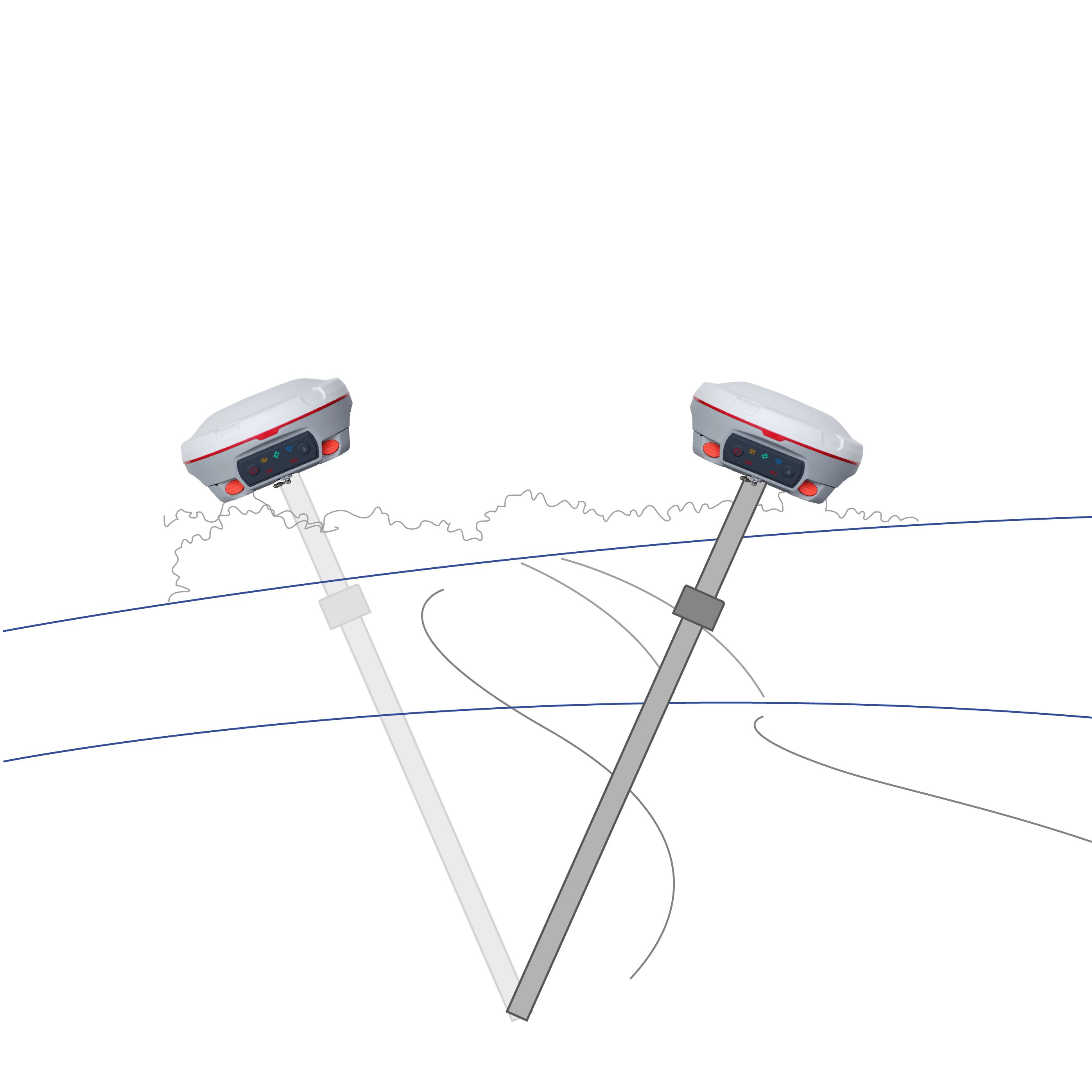
Intelligent signal tracking: The equipment adopts intelligent signal tracking technology, which can adapt to the complex and changeable use environment and improve the accuracy and stability of positioning.
Electronic bubble function: with electronic bubble function, making the measurement more convenient and accurate.
Fully compatible: fully compatible with domestic and foreign mainstream data messages, networks, radio and other protocols, convenient for users to connect and communicate with different devices and systems.
To sum up, the COMNAV T30 RTK is the 1 real-time dynamic differential positioning device with high precision, high performance, multi-function, strong durability and excellent user experience. It is suitable for various fields such as measurement, mapping and UAV navigation, and can meet the needs of users for high-precision positioning.

Logistics information


Technical Specifications
| GNSS Features | Channels | 1408 |
| GPS | L1C/A, L2C, L2P, L5 | |
| GLONASS | L1C/A,L1P,L2C/A,L2P,L3* | |
| BDS | BDS-2: B1I, B2I, B3I BDS-3: B1I, B3I, B1C, B2a, B2b* | |
| GALILEO | E1, E5A, E5B, E6C, AltBOC* | |
| SBAS(WAAS/MSAS/EGNOS/GAGAN) | L1C/A, L5* | |
| IRNSS | L5* | |
| QZSS | L1, L2C, L5* | |
| MSS L-Band | BDS-PPP | |
| Positioning output rate | 1Hz~20Hz | |
| Initialization time | < 10s | |
| Initialization reliability | > 99.99% | |
| Positioning Precision | Code differential GNSS | Horizontal: 0.25 m + 1 ppm RMS Vertical: 0.50 m + 1 ppm RMS |
| Static(long observations) | Horizontal: 2.5 mm + 0.1 ppm RMS Vertical: 3 mm + 0.4 ppm RMS | |
| Static | Horizontal: 2.5 mm + 0.5 ppm RMS Vertical: 3.5 mm + 0.5 ppm RMS | |
| Rapid static | Horizontal: 2.5 mm + 0.5 ppm RMS Vertical: 5 mm + 0.5 ppm RMS | |
| PPK | Horizontal: 3 mm + 1 ppm RMS Vertical: 5 mm + 1 ppm RMS | |
| RTK(UHF) | Horizontal: 8 mm + 1 ppm RMS Vertical: 15 mm + 1 ppm RMS | |
| RTK(NTRIP) | Horizontal: 8 mm + 0.5 ppm RMS Vertical: 15 mm + 0.5 ppm RMS | |
| RTK initialization time | 2-8s | |
| SBAS positioning | Typically < 5m 3DRMS | |
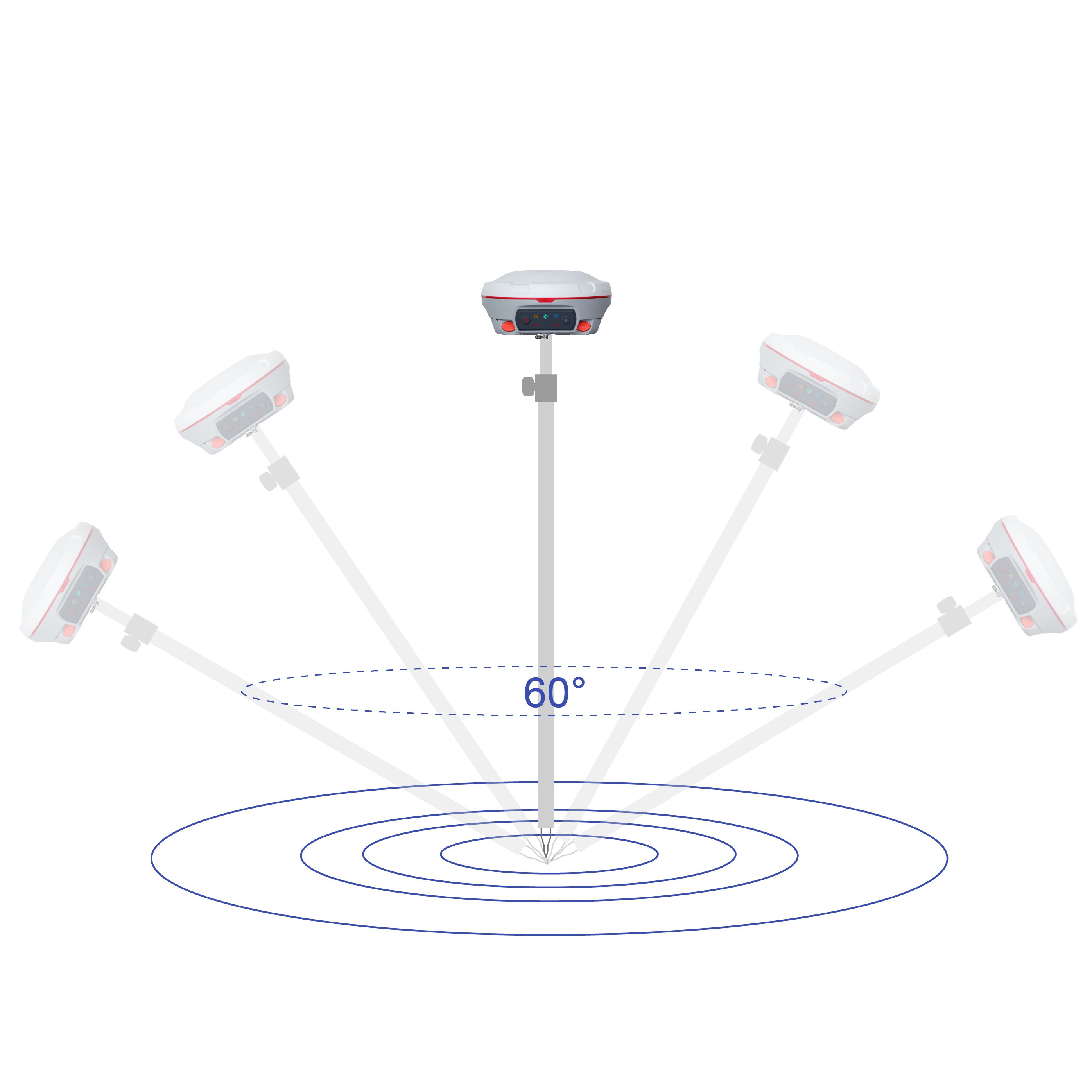
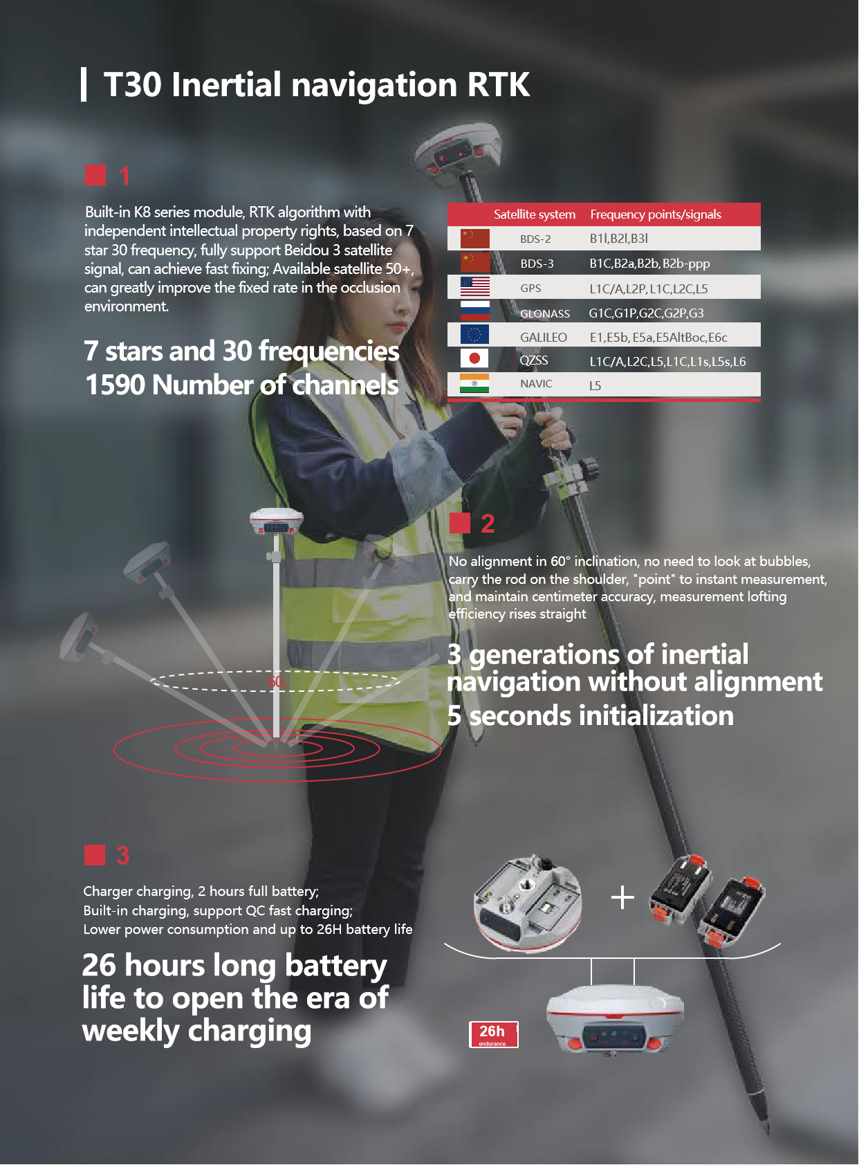
| IMU | Less than 10mm + 0.7 mm/° tilt to 30° | |
| IMU tilt angle | 0° ~ 60° | |
| Hardware Performance | Dimension | 151mmx151mmx94.5mm |
| Weight | 1350g | |
| Material | Magnesium aluminum alloy shell | |
| Operating temperature | -45℃ ~ +65℃ | |
| Storage temperature | -45℃ ~ +85℃ | |
| Humidity | 100% Non-condensing | |
| Waterproof/Dustproof | IP68 standard, protected from long time immersion to depth of 1m | |
| IP68 standard, fully protected against blowing dust | ||
| Shock/Vibration | Withstand 2 meters pole drop onto the cement ground naturally | |
| Power consumption | 2W | |
| Power supply | 6-28V DC, overvoltage protection | |
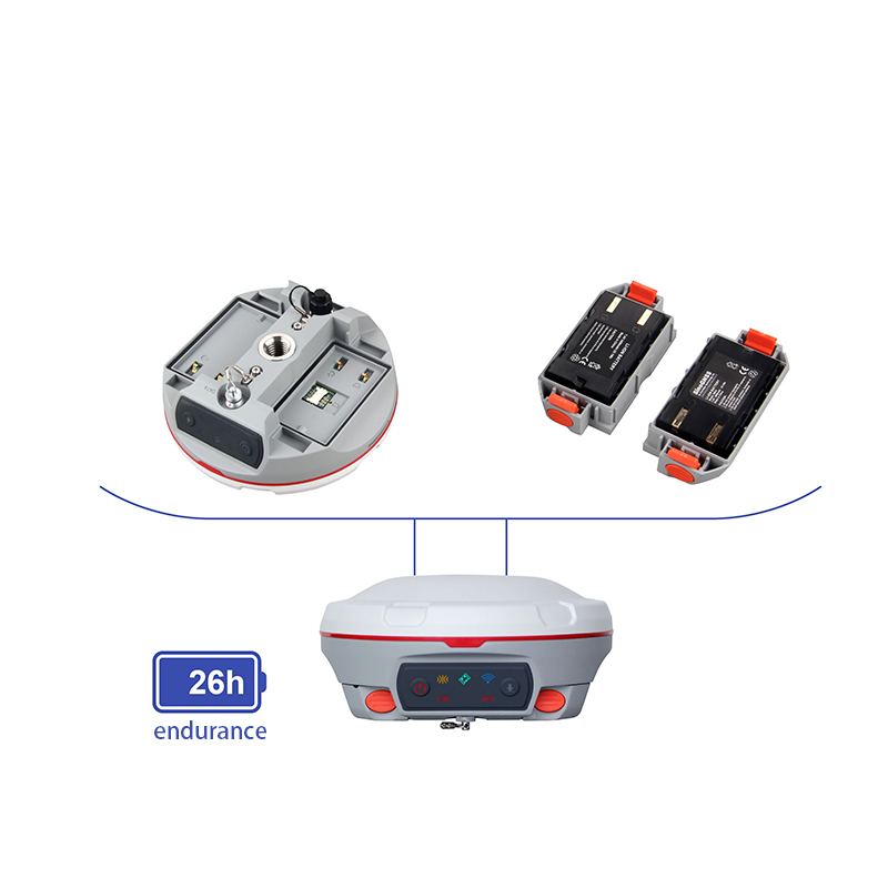
| Battery | 7.2v 10200mAh | |
| Battery life(Dual-battery) | 15h(Rover Bluetooth mode) | |
| WIFI | Modem | 802.11 b/g standard |
| WIFI hotspot | AP mode, Receiver broadcasts its hotspot form web UI accessing with any mobile terminals | |
| WIFI datalink | Client mode, Receiver can transmit and receive correction data stream via WiFi datalink | |
| Communications | I/O Port | 5-PIN LEMO external power port + RS232 |
| 7-PIN LEMO(USB, OTG and Ethernet) | ||
| 1 PPS data interface | ||
| SIM card slot(standard) | ||
| Internal UHF | Receiver and transmitter 1/2/3W (Just receiver 0.01W for Russia) | |
| Frequency range | 410 - 470MHz | |
| Communication protocol | Farlink, Trimtalk450s, SOUTH, HUACE, ZHD | |
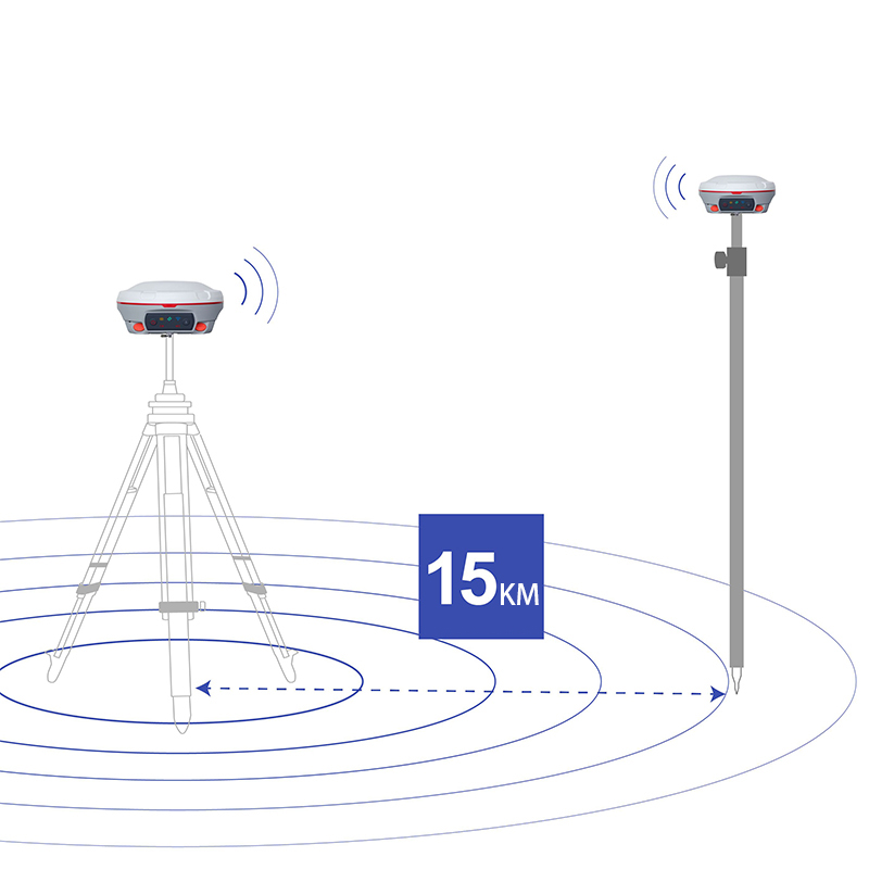
| Communication range | Typically 10km with Farlink protocol | |
| Cellular mobile network | 4G network communication module | |
| Bluetooth | BLEBluetooth 4.0 standard, Bluetooth 2.1 + EDR | |
| NFC Communication | Realizing close range (shorter than 10cm) automatic pair between receiver and controller (controller requires NFC wireless communication module else) | |
| Data Storage/Transmission | Storage | 16GB SSD |
| Automatic cycle storage (The earliest data files will be removed automatically while the memory is not enough) | ||
| Support external USB storage | ||
| Data transmission | Plug and play mode of USB data transmission | |
| Supports FTP/HTTP data download | ||
| Data format | Static data format: STH, Rinex2.01, Rinex3.02, etc. | |
| Differential format: CMR(GPS only), CMR+(GPS only), RTCM 2.3, RTCM 3.0, RTCM 3.1, RTCM 3.2 | ||
| Navigation data format: NMEA 0183, PJK, Binary code | ||
| Network model support: VRS, FKP, MAC, fully support NTRIP protocol | ||
| Sensors | Electronic bubble | Controller software can display electronic bubble, checking leveling status of the carbon pole in real-time |
| IMU | Built-in IMU module, calibration-free and immune to magnetic interference | |
| Thermometer | Built-in thermometer sensor, adopting intelligent temperature control technology, monitoring and adjusting the receiver temperature | |
| User Interaction | Operating system | Linux |
| Buttons | Single button | |
| Indicators | 4 color LED indicators, Battery indicator | |
| Web interaction | With the access of the internal web interface management via WiFi or USB connection, users are able to monitor the receiver status and change the configurations freely | |
| Voice guidance | It provides status and operation voice guidance, and supports Chinese/English/Korean/Spanish/Portuguese/Russian/Turkish | |
| Secondary development | Provides secondary development kit, and opens the OpenSIC observation data format and interaction interface definition | |
| Cloud service | The powerful cloud platform provides online services like remote manage, firmware update, online register and etc. |