


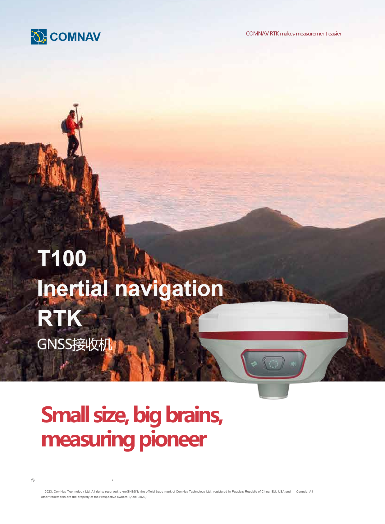
COMNAV T100 RTKRTK GPS GNSSGPS RTK HIGH PRECISION SURVEY EQUIPMENT GNSS
high accuracy and multi-system support
high accuracy and multi-system support
The COMNAV T100 RTK is the 1 high-performance real-time dynamic differential positioning (RTK) device that integrates high-precision positioning, easy operation and durability. The following is a detailed evaluation of the equipment:
high-precision positioning technology
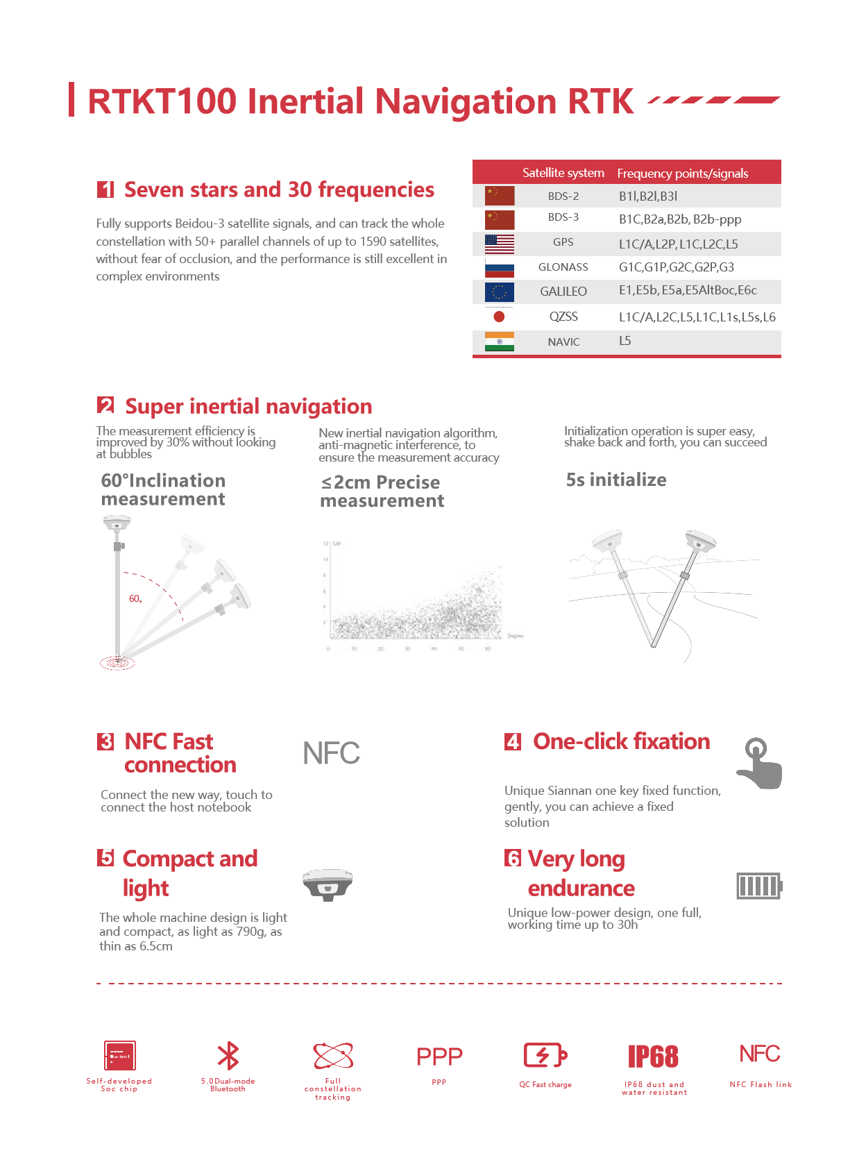
COMNAV T100 RTK fully supports Beidou-3 satellite signals, with up to 1590 parallel channels and more than 50 available satellites. These 1 configurations ensure that the equipment can obtain stable and high-quality satellite signals in various complex environments, thereby achieving high-precision positioning. Its positioning accuracy can reach centimeter level, which can meet the high-precision measurement requirements in many fields such as municipal survey, geographic information collection, construction lofting, earthwork survey, GNSS control network construction and topographic mapping.
convenient operation and humanized design
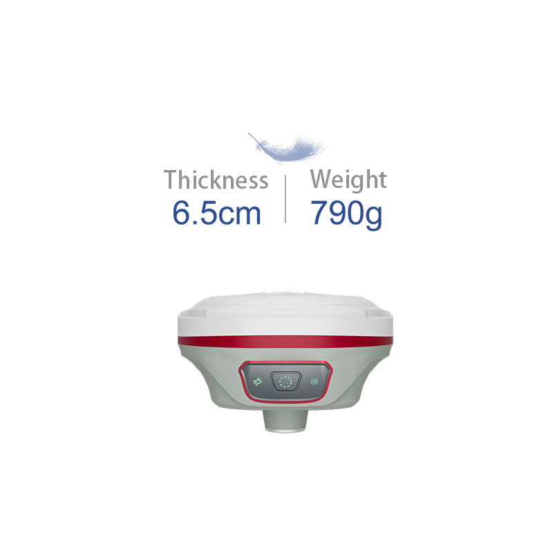
Small and portable: T100 RTK is small and compact in design and can be mastered in one hand. The weight of the whole machine is only 790g and the thickness is only 6.5cm. It is easy to carry and transport and is suitable for outdoor operations.
One-key switching: the device has a built-in transceiver integrated data link, and the mobile station and the reference station can be switched with one key, which is easy and quick to operate.
NFC flash connection: support NFC fast connection function, convenient for users to connect and data transmission with devices such as handbooks.
Intuitive display: The device is equipped with an intuitive display and a wide range of operating options for easy setting and adjustment.
durability and environmental adaptability
Rugged: T100 RTK uses durable materials and design. The host has IP68 protection level, which can resist 2 meters drop, ensuring that the equipment can operate normally in various harsh environments.
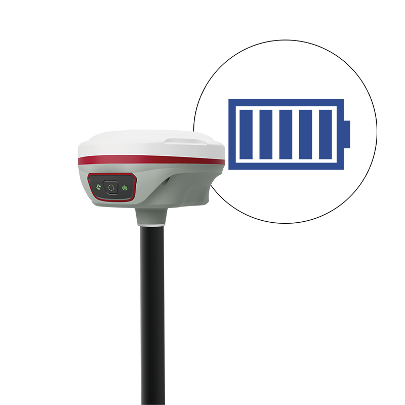
Long endurance performance: The device is equipped with a 10000mAh high-capacity battery and supports QC3.0 fast charging technology to achieve 30 hours of long endurance and meet the needs of all-day work.
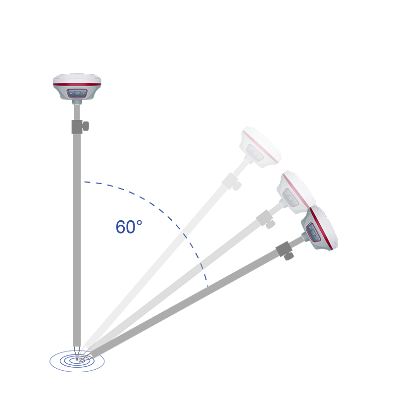
Efficient measurement technology: built-in third-generation inertial navigation technology, support 60 ° tilt measurement, 5 seconds initialization, accurate measurement in place, improve work efficiency.
full compatibility and scalability
Multi-satellite system support: In addition to the Beidou-3 satellite signal, it also supports other mainstream satellite systems, such as GPS, GLONASS, Galileo, etc., to ensure that the equipment can obtain stable satellite signals on a global scale.
Rich accessories and expansion options: T100 RTK provides a variety of accessories and expansion options, such as laser modules, hand books, etc., which can be customized and expanded according to user needs.
To sum up, the COMNAV T100 RTK has a wide range of application prospects in the fields of measurement and mapping because of its high-precision positioning, convenient operation, durability and environmental adaptability, as well as comprehensive compatibility and scalability. The T100 RTK is a worthy choice for both professional surveyors and industrial users who need high-precision positioning technology.
basic performance parameters
hardware configuration
technical characteristics
communication and interface
Communication mode: supports Bluetooth, WiFi and other communication modes, which is convenient for users to connect and communicate with different devices and systems.
Interface configuration: Provide rich interface configuration to meet the needs of users to connect external devices (specific interface types and quantities need to be confirmed according to the latest official information).
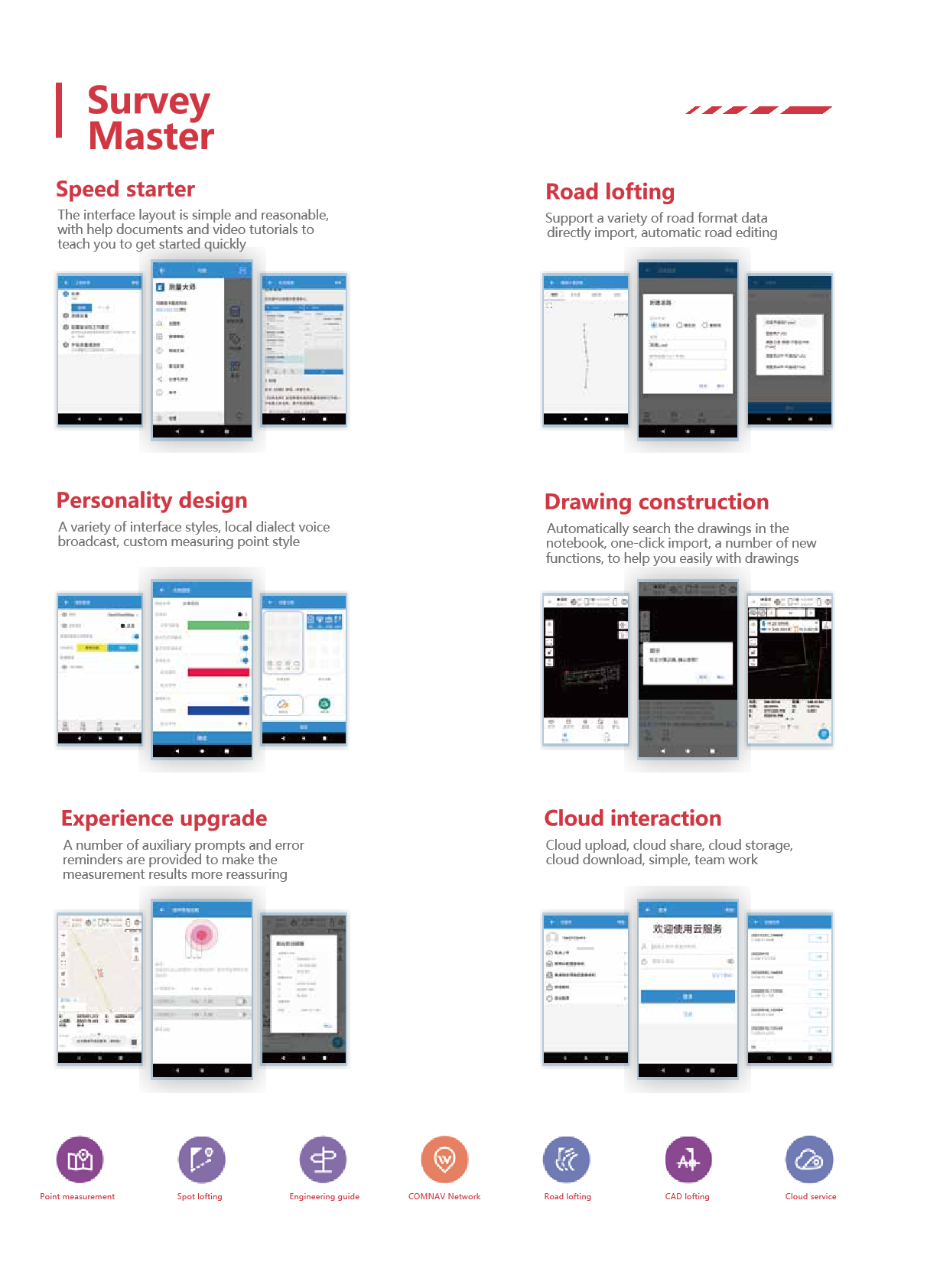
Software and Features
Logistics information


Technical Specifications
| GNSS Features | Channels | 1408 |
| GPS | L1C/A, L2C, L2P, L5 | |
| GLONASS | L1C/A,L1P,L2C/A,L2P,L3* | |
| BDS | BDS-2: B1I, B2I, B3I BDS-3: B1I, B3I, B1C, B2a, B2b* | |
| GALILEO | E1, E5A, E5B, E6C, AltBOC* | |
| SBAS(WAAS/MSAS/EGNOS/GAGAN) | L1C/A, L5* | |
| IRNSS | L5* | |
| QZSS | L1, L2C, L5* | |
| MSS L-Band | BDS-PPP | |
| Positioning output rate | 1Hz~20Hz | |
| Initialization time | < 10s | |
| Initialization reliability | > 99.99% | |
| Positioning Precision | Code differential GNSS | Horizontal: 0.25 m + 1 ppm RMS Vertical: 0.50 m + 1 ppm RMS |
| Static(long observations) | Horizontal: 2.5 mm + 0.1 ppm RMS Vertical: 3 mm + 0.4 ppm RMS | |
| Static | Horizontal: 2.5 mm + 0.5 ppm RMS Vertical: 3.5 mm + 0.5 ppm RMS | |
| Rapid static | Horizontal: 2.5 mm + 0.5 ppm RMS Vertical: 5 mm + 0.5 ppm RMS | |
| PPK | Horizontal: 3 mm + 1 ppm RMS Vertical: 5 mm + 1 ppm RMS | |
| RTK(UHF) | Horizontal: 8 mm + 1 ppm RMS Vertical: 15 mm + 1 ppm RMS | |
| RTK(NTRIP) | Horizontal: 8 mm + 0.5 ppm RMS Vertical: 15 mm + 0.5 ppm RMS | |
| RTK initialization time | 2-8s | |
| SBAS positioning | Typically < 5m 3DRMS | |
| IMU | Less than 10mm + 0.7 mm/° tilt to 30° | |
| IMU tilt angle | 0° ~ 60° | |
| Hardware Performance | Dimension | 151mmx151mmx94.5mm |
| Weight | 1350g | |
| Material | Magnesium aluminum alloy shell | |
| Operating temperature | -45℃ ~ +65℃ | |
| Storage temperature | -45℃ ~ +85℃ | |
| Humidity | 100% Non-condensing | |
| Waterproof/Dustproof | IP68 standard, protected from long time immersion to depth of 1m | |
| IP68 standard, fully protected against blowing dust | ||
| Shock/Vibration | Withstand 2 meters pole drop onto the cement ground naturally | |
| Power consumption | 2W | |
| Power supply | 6-28V DC, overvoltage protection | |
| Battery | 7.2v 10200mAh | |
| Battery life(Dual-battery) | 15h(Rover Bluetooth mode) | |
| WIFI | Modem | 802.11 b/g standard |
| WIFI hotspot | AP mode, Receiver broadcasts its hotspot form web UI accessing with any mobile terminals | |
| WIFI datalink | Client mode, Receiver can transmit and receive correction data stream via WiFi datalink | |
| Communications | I/O Port | 5-PIN LEMO external power port + RS232 |
| 7-PIN LEMO(USB, OTG and Ethernet) | ||
| 1 PPS data interface | ||
| SIM card slot(standard) | ||
| Internal UHF | Receiver and transmitter 1/2/3W (Just receiver 0.01W for Russia) | |
| Frequency range | 410 - 470MHz | |
| Communication protocol | Farlink, Trimtalk450s, SOUTH, HUACE, ZHD | |
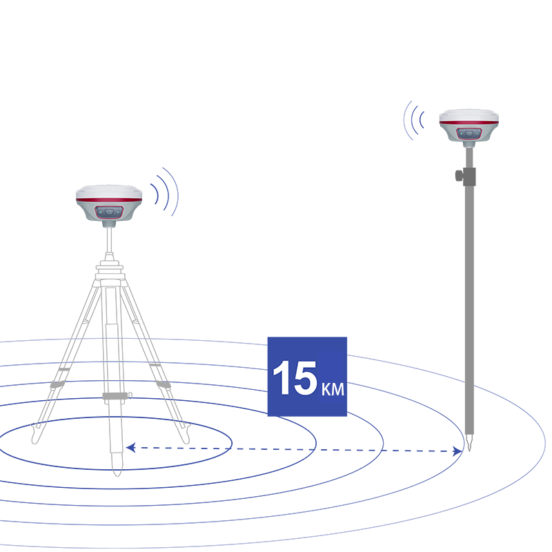
| Communication range | Typically 10km with Farlink protocol | |
| Cellular mobile network | 4G network communication module | |
| Bluetooth | BLEBluetooth 4.0 standard, Bluetooth 2.1 + EDR | |
| NFC Communication | Realizing close range (shorter than 10cm) automatic pair between receiver and controller (controller requires NFC wireless communication module else) | |
| Data Storage/Transmission | Storage | 16GB SSD |
| Automatic cycle storage (The earliest data files will be removed automatically while the memory is not enough) | ||
| Support external USB storage | ||
| Data transmission | Plug and play mode of USB data transmission | |
| Supports FTP/HTTP data download | ||
| Data format | Static data format: STH, Rinex2.01, Rinex3.02, etc. | |
| Differential format: CMR(GPS only), CMR+(GPS only), RTCM 2.3, RTCM 3.0, RTCM 3.1, RTCM 3.2 | ||
| Navigation data format: NMEA 0183, PJK, Binary code | ||
| Network model support: VRS, FKP, MAC, fully support NTRIP protocol | ||
| Sensors | Electronic bubble | Controller software can display electronic bubble, checking leveling status of the carbon pole in real-time |
| IMU | Built-in IMU module, calibration-free and immune to magnetic interference | |
| Thermometer | Built-in thermometer sensor, adopting intelligent temperature control technology, monitoring and adjusting the receiver temperature | |
| User Interaction | Operating system | Linux |
| Buttons | Single button | |
| Indicators | 4 color LED indicators, Battery indicator | |
| Web interaction | With the access of the internal web interface management via WiFi or USB connection, users are able to monitor the receiver status and change the configurations freely | |
| Voice guidance | It provides status and operation voice guidance, and supports Chinese/English/Korean/Spanish/Portuguese/Russian/Turkish | |
| Secondary development | Provides secondary development kit, and opens the OpenSIC observation data format and interaction interface definition | |
| Cloud service | The powerful cloud platform provides online services like remote manage, firmware update, online register and etc. |