


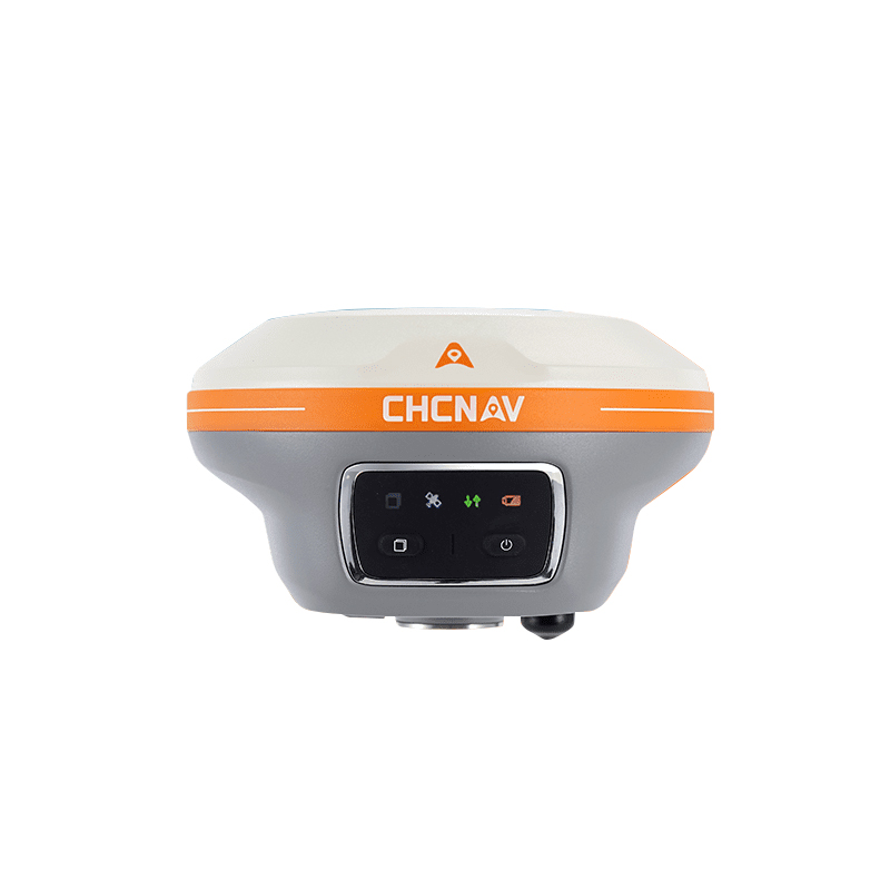
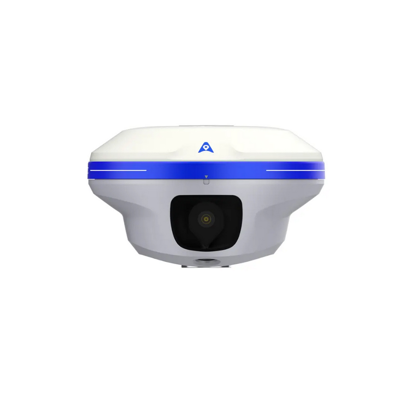
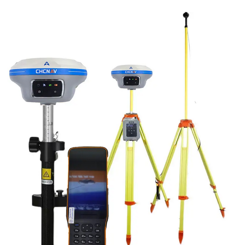
CHCNAV i89/X15 GPS RTK with 1408 Channels and Dual Camera GNSS Receiver
Technical Features
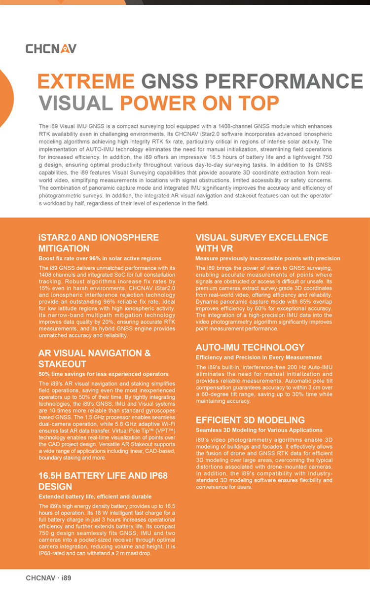
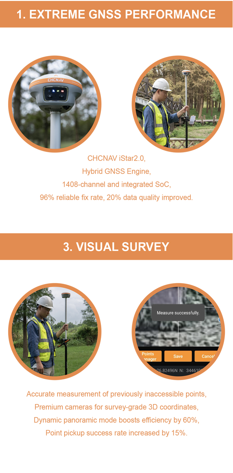
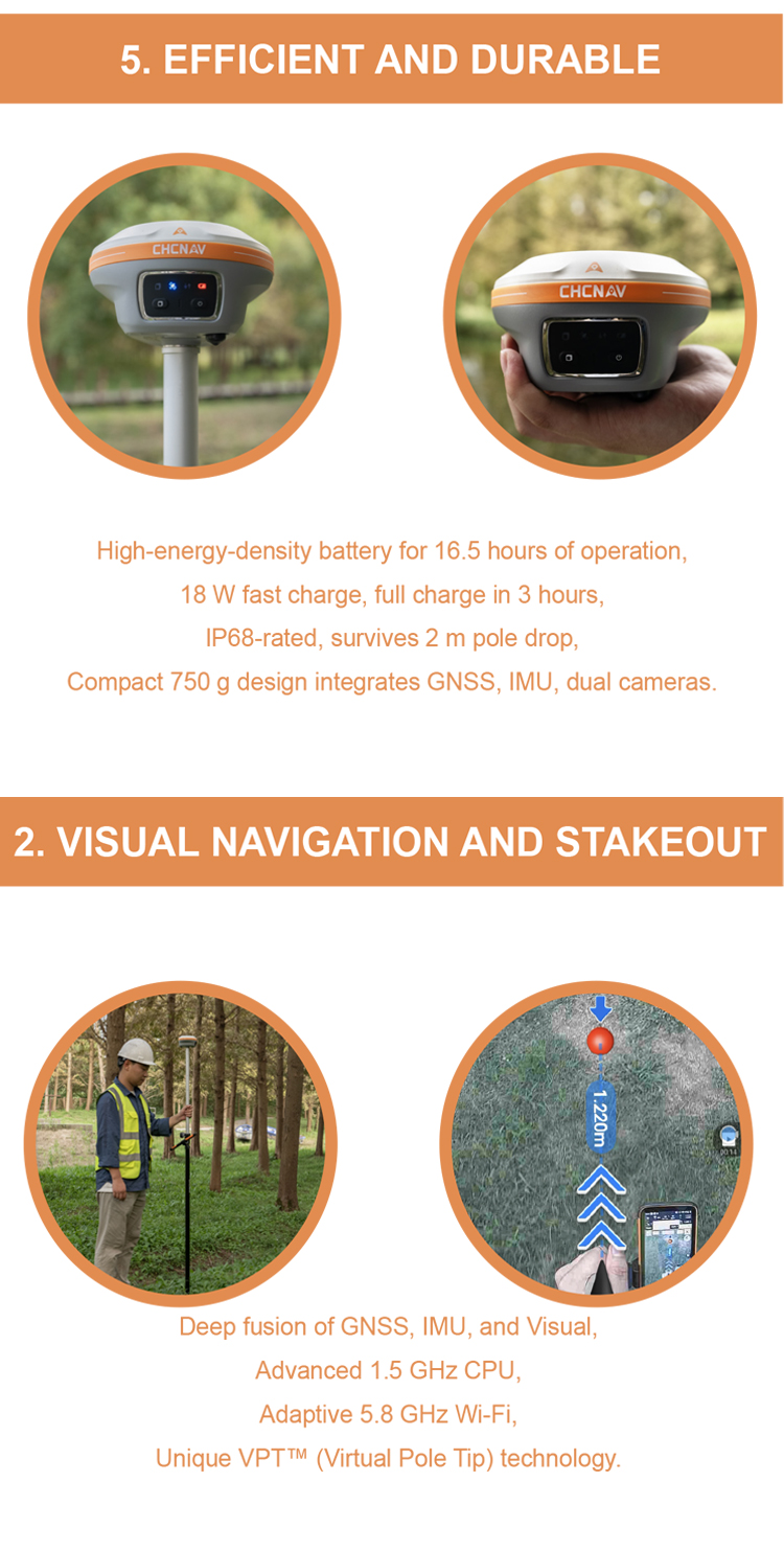
AR NAVIGATION & STAKEOUT
50% time savings for less experienced operators
The i89's AR visual navigation and staking simplify field operations, saving even the most inexperienced operators up to 50% of their time. By tightly integrating technologies, the i89's GNSS, IMU, and Visual systems are 10 times more reliable than standard gyroscopes-based GNSS. The 1.5 GHz processor enables seamless dual-camera operation, while 5.8 GHz adaptive Wi-Fi ensures fast AR data transfer. Virtual Pole Tip™ (VPT™) technology enables real-time visualization of points over the CAD project design. Versatile AR Stakeout supports a wide range of applications, including linear, CAD-based, boundary staking, and more.
VISUAL SURVEY EXCELLENCE
Measure previously inaccessible points with precision
The i89 brings the power of vision to GNSS surveying, enabling accurate measurements of points where signals are obstructed, or access is difficult or unsafe. Its premium cameras extract survey-grade 3D coordinates from real-world video, offering efficiency and reliability. Dynamic panoramic capture mode with 85% overlap improves efficiency by 60% for exceptional accuracy. The integration of a high-precision IMU data into the video photogrammetry algorithm significantly improves point measurement performance.
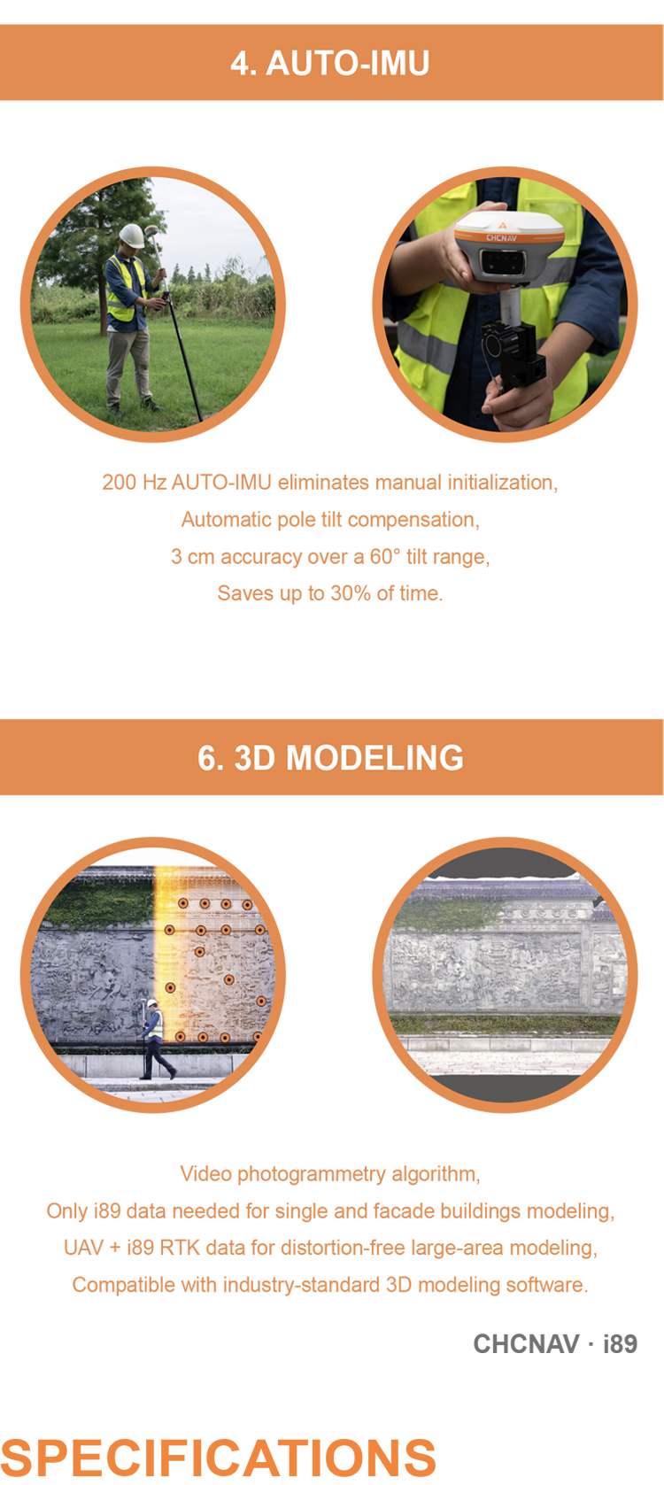
AUTO-IMU TECHNOLOGY
Efficiency and Precision in Every Measurement
The i89's built-in, interference-free 200 Hz Auto-IMU eliminates the need for manual initialization and provides reliable measurements. Automatic pole tilt compensation guarantees accuracy to within 3 cm over a 60-degree tilt range, saving up to 30% time while maintaining accuracy.
16.5H BATTERY LIFE & IP68 DESIGN
Extended battery life, efficient and durable
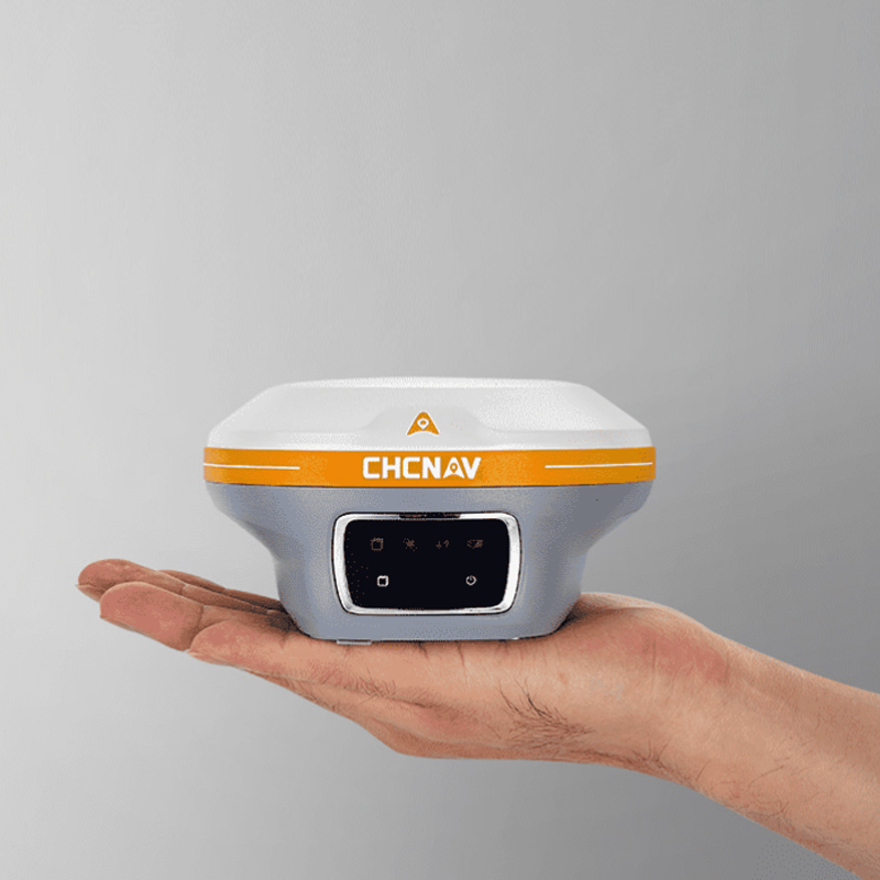
The i89's high energy density battery provides up to 16.5 hours of operation. Its 18W intelligent, fast charge for a full battery charge in just 3 hours increases operational efficiency and further extends battery life. Its compact 750g design seamlessly fits GNSS, IMU, and two cameras into a pocket-sized receiver through optimal camera integration, reducing volume and height. It is IP68-rated and can withstand a 2m mast drop.
EFFICIENT 3D MODELING
Seamless 3D Modeling for Various Applications
The i89's video photogrammetry algorithms enable 3D modeling of buildings, facades, and monuments. It effectively allows the fusion of drone and GNSS RTK data for efficient 3D modeling over large areas, overcoming the typical distortions associated with drone-mounted cameras. In addition, the i89's compatibility with industry-standard 3D modeling software ensures flexibility and convenience for users.
specific benefits
CHCNAV i89/X15, as a real-scene RTK measurement product integrating multiple advanced technologies, has brought significant assistance and improvements to practical measurement projects. The following is a detailed elaboration of its specific benefits in practical measurement engineering:
I. Enhancement of Measurement Efficiency
1.Rapid Positioning and Fixing: Leveraging Huace's OneNet™ technology and Cloud Homology 3.0 system, the CHCNAV i89/X15 can swiftly lock onto satellite signals and achieve rapid fixing, significantly reducing the preparation time before measurement.
2.Batch Acquisition of Three-Dimensional Coordinates: Through the integration of GNSS, IMU, and dual cameras, the CHCNAV i89/X15 can efficiently acquire high-precision three-dimensional coordinates from real-scene videos, avoiding the cumbersome and time-consuming nature of traditional single-point measurements.
3.AR Real-Scene Navigation and Visual Stakeout: This feature ensures that surveyors do not get lost during operations and can place points quickly, accurately, and stably, thereby improving measurement efficiency.
II. Enhancement of Measurement Accuracy
1.High-Precision Measurement Technology: The static accuracy and RTK accuracy of the CHCNAV i89/X15 have reached high levels, capable of meeting various measurement needs. Additionally, tilt compensation technology ensures the accuracy of measurement results.
2.Automatic Calibration and Correction: Through integrated sensors and algorithms, the X15 can automatically calibrate and correct measurement data, reducing human error.
III. Optimization of Operating Environment
1.Waterproof and Dustproof Design: The CHCNAV i89/X15 is equipped with IP68-level waterproof and dustproof capabilities, allowing it to operate normally in harsh environments and expanding the application scope of measurement projects.
2.Impact Resistance and Drop Resistance: Its impact resistance reaches the IK08 level, capable of withstanding a certain degree of mechanical impact and drops, thereby ensuring the safety and reliability of measurement projects.
IV. Reduction of Labor Intensity
1.Lightweight Design: The CHCNAV i89/X15 adopts a lightweight design, ensuring that surveyors do not feel overly fatigued when using it for long periods.
2.Automation and Intelligence Functions: Through integrated automation and intelligence functions, the X15 can alleviate the workload of surveyors and reduce labor intensity.
V. Improvement of Data Management and Sharing Capabilities
1.Cloud Storage and Sharing: Users can upload engineering data to the cloud for remote storage and sharing, facilitating collaboration and data exchange among team members.
2.Multiple Data Communication Methods: The CHCNAV i89/X15 supports various data communication methods such as NFC, Bluetooth, Wi-Fi, etc., making it convenient for users to transmit and interact with data on the device.
VI. Support for Diversified Application Scenarios
1.Urban Surveying and Mapping: In urban surveying and mapping, the CHCNAV i89/X15 can quickly acquire three-dimensional coordinates and shape information of buildings, providing accurate data support for urban planning, architectural design, etc.
2.Topographic Surveying: In topographic surveying, the CHCNAV i89/X15 can efficiently collect and process topographic data, providing a reliable data source for the drawing and updating of topographic maps.
3.Engineering Construction: In engineering construction, the CHCNAV i89/X15 can perform precise stakeout and measurement work, ensuring the accuracy and efficiency of the construction process.
In summary, the CHCNAV i89/X15 has brought significant assistance and improvements to practical measurement projects, including enhancing measurement efficiency, improving measurement accuracy, optimizing the operating environment, reducing labor intensity, enhancing data management and sharing capabilities, and supporting diversified application scenarios. These advantages make the CHCNAV i89/X15 an important tool in the field of measurement engineering.
Logistics information


Logistics information
technical parameter
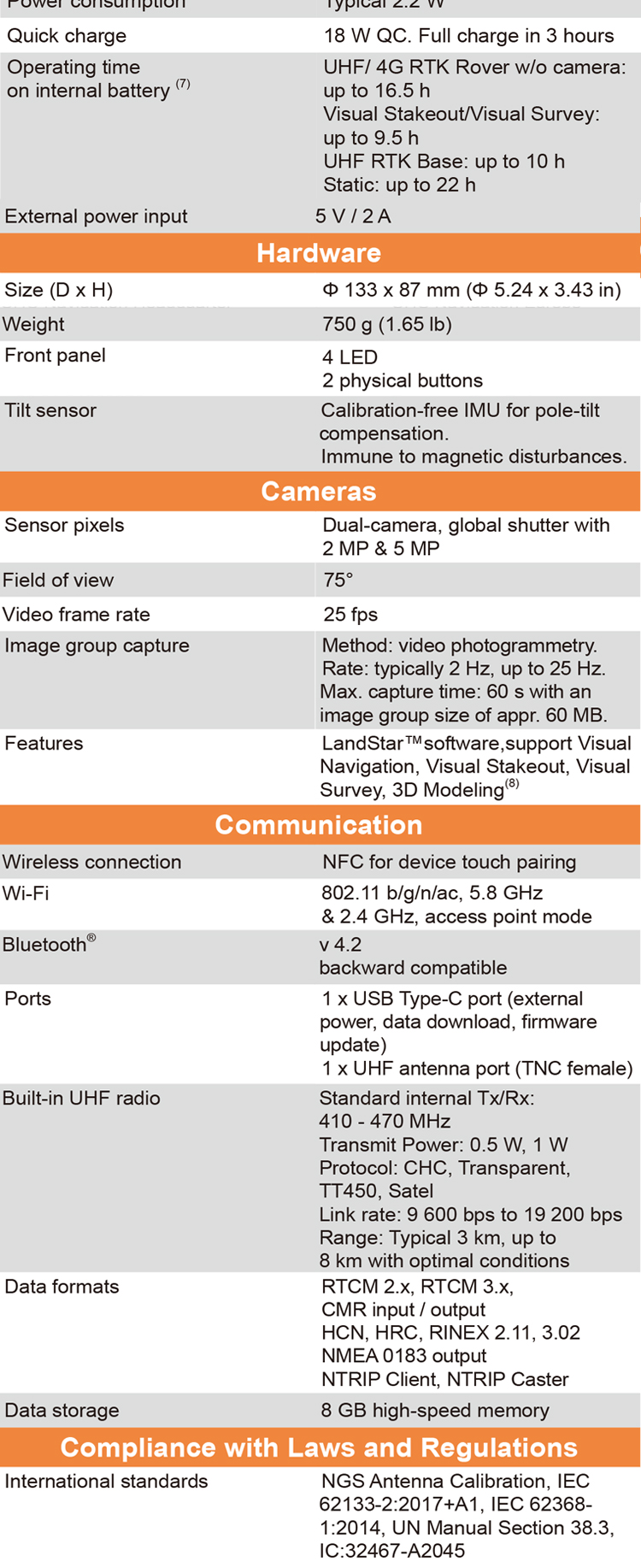
| GNSS Performance | Channels | 1408 channels with iStar2.0 |
| GPS | L1C, A, L2C, L2P(Y), L5 | |
| GLONASS | L1, L2, L3 | |
| Galileo | E1, E5a, E5b, E6* | |
| BeiDou | B1I, B2I, B3I, B1C, B2a, B2b | |
| QZSS | L1, L2, L5, L6* | |
| PPP | B2b-PPP | |
| SBAS (EGNOS Support) | L1, L5 | |
| GNSS Accuracies | Real time kinematic (RTK) | H: 8 mm + 1 ppm RMS |
| V: 15 mm + 1 ppm RMS | ||
| Initialization time: <10 s | ||
| Initialization reliability: >99.9% | ||
| Post-processing kinematic (PPK) | H: 3 mm + 1 ppm RMS V: 5 mm + 1 ppm RMS | |
| High-precision static | H: 2.5 mm + 0.1 ppm RMS V: 3.5 mm + 0.4 ppm RMS | |
| Static and rapid static | H: 2.5 mm + 0.5 ppm RMS V: 5 mm + 0.5 ppm RMS | |
| Code differential | H: 0.4 m RMS | V: 0.8 m RMS | |
| Autonomous | H:1.5 m RMS | V: 2.5 m RMS | |
| Visual survey | Typical 2~4 cm, range 2~15 m | |
| Positioning rate | 1 Hz, 5 Hz and 10 Hz | |
| Time to first fix | Cold start: < 45 s, Hot start: < 10 s Signal re-acquisition: < 1 s | |
| IMU update rate | 200 Hz | |
| Till angle | 0-60° | |
| RTK tilt-compensated | Additional horizontal pole-tilt uncertainty typically less than 8 mm + 0.7 mm/° tilt | |
| Environments | Temperature | Operating: -40°C to +65°C |
| (-40°F to +149°F) | ||
| Storage: -40°C to +85°C | ||
| (-40°F to +185°F) | ||
| Humidity | 100% non-condensation | |
| Ingress protection | IP68(6) (according to IEC 60529) | |
| Drop | Survive a 2-meter pole-drop | |
| Vibration | Compliant with ISO 9022-36-08 and MIL-STD-810G- 514.6-Cat.24. | |
| Waterproof and breathable membrane | Prevent water vapor from entering under harsh environments | |
| Electrical | Power consumption | UHF/ 4G RTK Rover w/o camera: |
| Typical 2.8 W | ||
| Visual Stakeout/Visual Survey: | ||
| Typical 4 W | ||
| Li-ion battery capacity | Built-in non-removable battery 9,600 mAh, 7.4 V | |
| Operating time on internal battery | UHF/ 4G RTK Rover w/o camera: | |
| up to 34 h | ||
| Visual Stakeout/Visual Survey: | ||
| up to 24 h | ||
| UHF RTK Base: up | ||
| External power input | 5 V / 2 A | |
| Hardware | Size (D x H) | Φ 133 x 87 mm (Φ 5.24 x 3.43 in) |
| Weigh | 750 g (1.65 lb) | |
| Front pane | 4 LED | |
| 2 physical buttons | ||
| Tilt sensor | Calibration-free IMU for pole-tilt compensation. Immune to magnetic disturbances | |
| Cameras | Sensor pixels | Dual-camera, global shutter with 2 MP & 5 MP |
| Field of view | 75° | |
| Video frame rate | 25 fps | |
| Image group capture | Method: video photogrammetry. Rate: typically 2 Hz, up to 25Hz. Max. capture time: 60s with an image group size of appr. 60MB | |
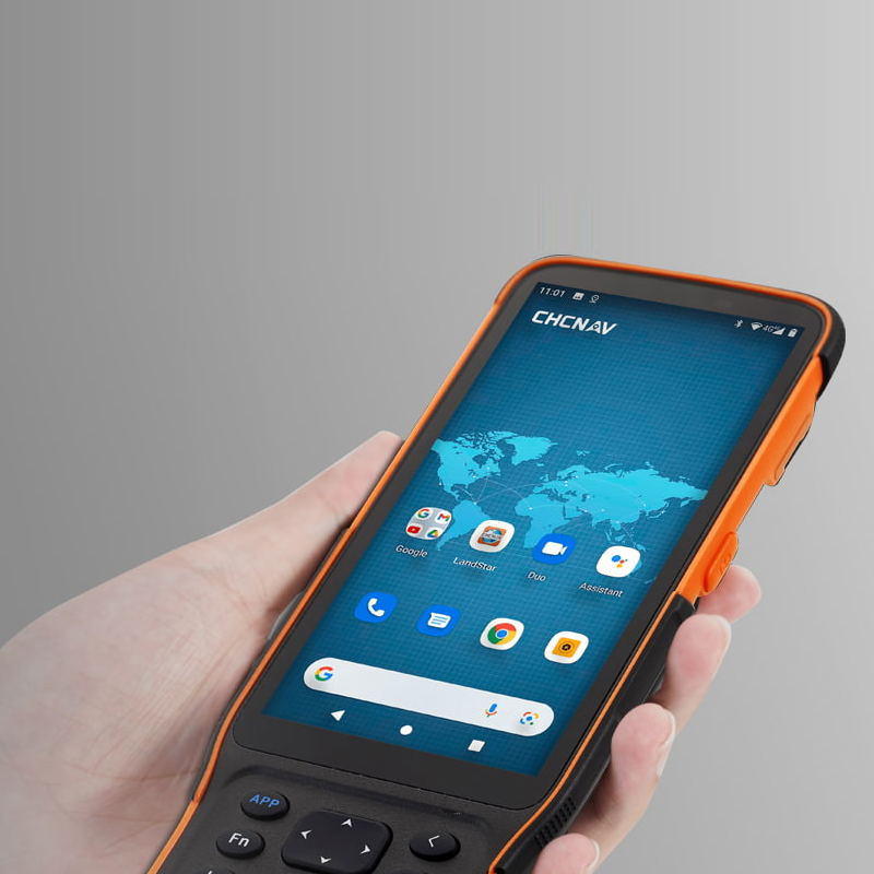
| Features | LandStar™software,support Visual Navigation, Visual Stakeout, Visual Survey, 3D Modeling | |
| Communication | SIM card type | Nano-SIM card |
| Network modem | Integrated 4G modem: TDD-LTE, FDD-LTE, WCDMA, EDGE, GPRS, GSM | |
| Wireless connection | NFC for device touch pairing | |
| Wi-F | Wi-Fi IEEE 802.11a/b/g/n/ac, access point mode | |
| Bluetooth | 5.0 and 4.2 +EDR, backward compatible | |
| Ports | 1 x 7-pin LEMO port (RS-232) 1 x USB Type-C port (external power, data download, firmware update) 1 x UHF antenna port (TNC female) | |
| Built-in UHF radio | Rx/Tx: 410 - 470 MHz Transmit Power: 0.5 W to 2 W Protocol: CHC, Transparent, TT450, Satel Link rate: 9 600 bps to 19 200 bps Range: Typical 3 km to 5 km, up to 15 km with optimal conditions | |
| Data formats | RTCM 2.x, RTCM 3.x, CMR input / output HCN, HRC, RINEX 2.11, 3.02 NMEA 0183 output NTRIP Client, NTRIP Caster | |
| Data storage | 32 GB internal memory. Support 128 GB external expansion |