


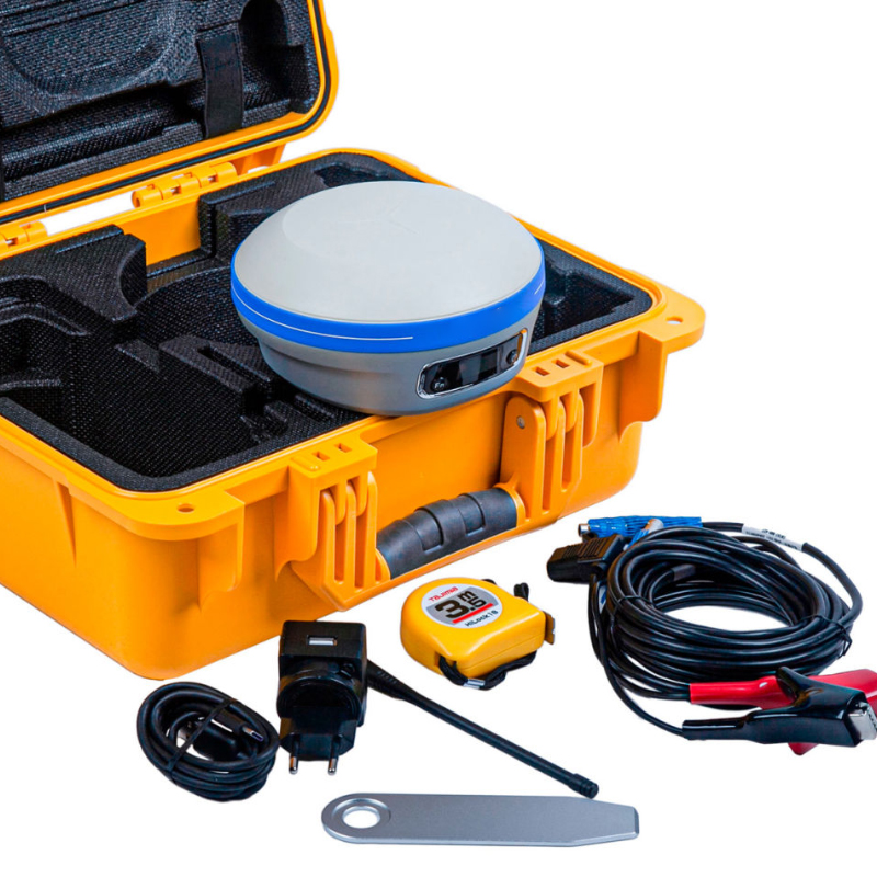
CHCNAV I83PRO GNSS Receiver with Trimble MAXPro Motherboard and IMU for Land Surveying Base Kit And Rover Kit Price
Technical Features
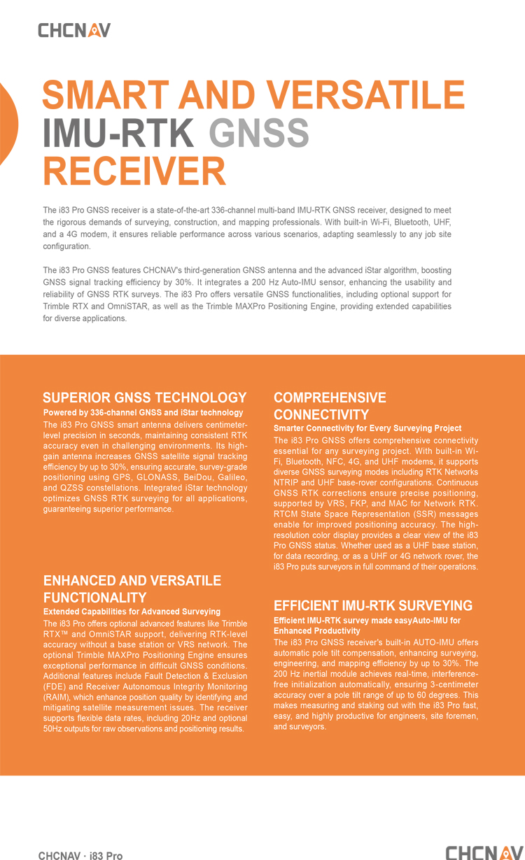
COMPREHENSIVE CONNECTIVITY
Smarter Connectivity for Every Project
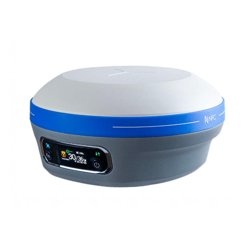
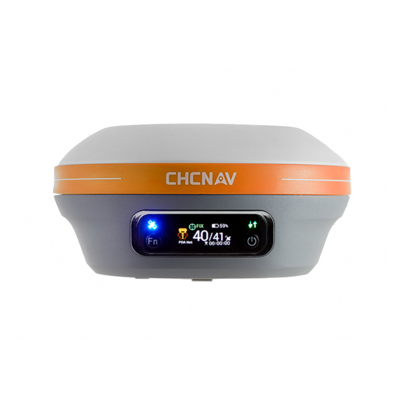
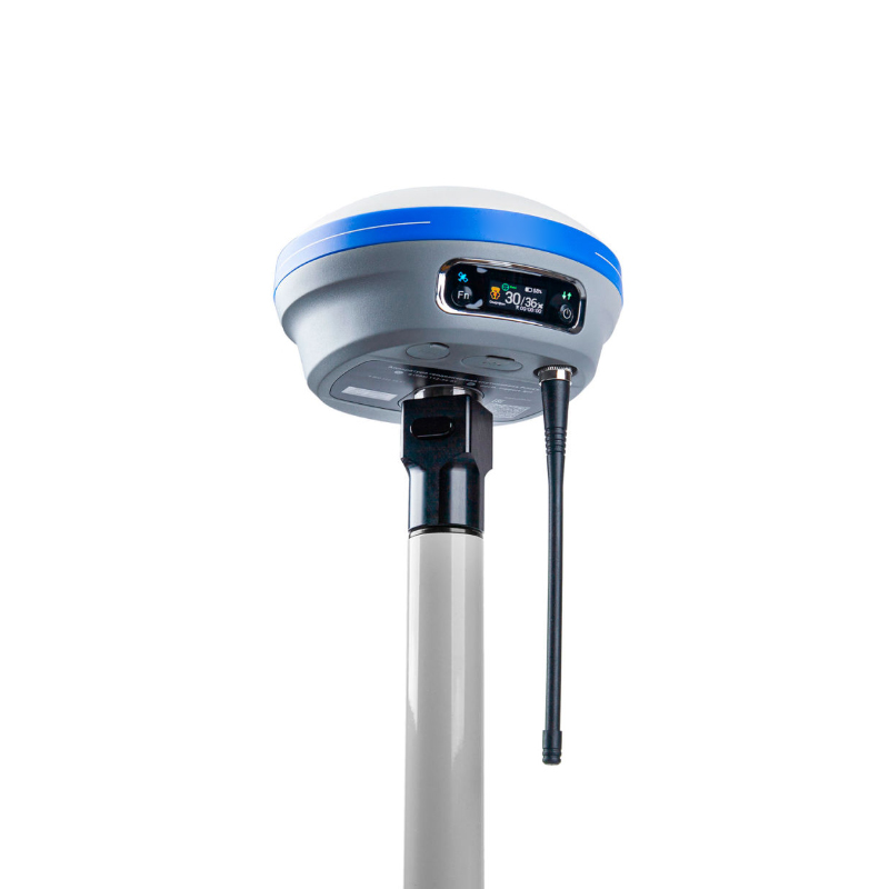
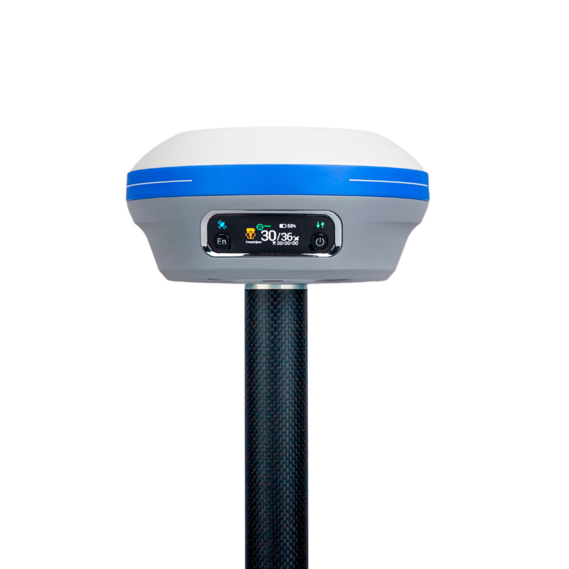
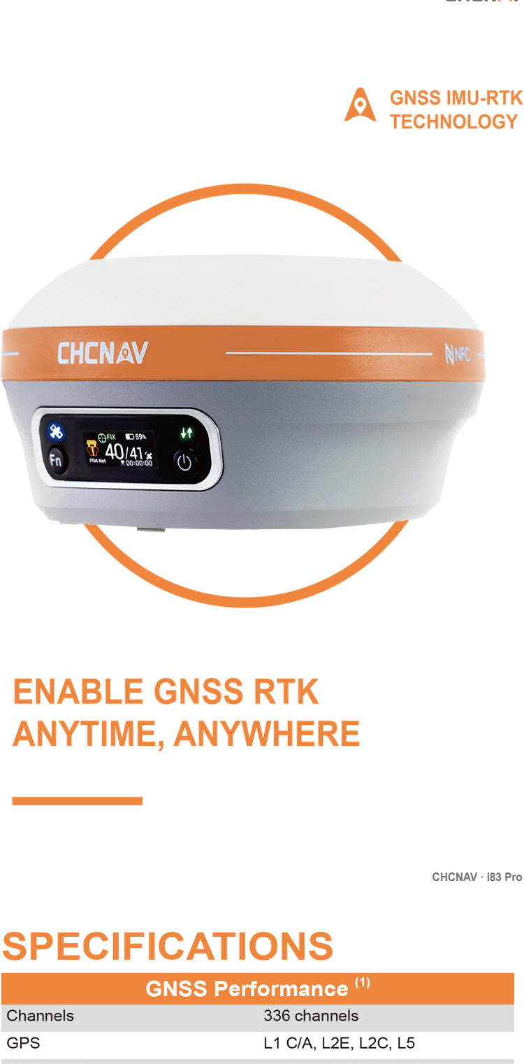
The i83 Pro GNSS offers comprehensive connectivity essential for any surveying project. With built-in Wi-Fi, Bluetooth, NFC, 4G, and UHF modems, it supports diverse GNSS surveying modes, including RTK Networks NTRIP and UHF base-rover configurations. Continuous GNSS RTK corrections ensure precise positioning, supported by VRS, FKP, and MAC for Network RTK. RTCM State Space Representation (SSR) messages enable improved positioning accuracy. The high-resolution color display provides a clear view of the i83 Pro GNSS status. Whether used as a UHF base station, for data recording, or as a UHF or 4G network rover, the i83 Pro puts surveyors in full command of their operations.
ENHANCED AND VERSATILE FUNCTIONALITY
Extended Capabilities for Advanced Surveying
The i83 Pro offers optional advanced features like Trimble RTX and OmniSTAR support, delivering RTK-level accuracy without a base station or VRS network. The optional Trimble MAXPro Positioning Engine ensures exceptional performance in difficult GNSS conditions. Additional features include Fault Detection & Exclusion (FDE) and Receiver Autonomous Integrity Monitoring (RAIM), which enhance position quality by identifying and mitigating satellite measurement issues. The receiver supports flexible data rates, including 20Hz and optional 50Hz outputs for raw observations and positioning results
EFFICIENT IMU-RTK SURVEYING
Efficient IMU-RTK survey made easy Auto-IMU for Enhanced Productivity
The i83 Pro GNSS receiver's built-in AUTO-IMU offers automatic pole tilt compensation, enhancing surveying, engineering, and mapping efficiency by up to 30%. The 200 Hz inertial module automatically achieves real-time, interference-free initialization, ensuring 3-centimeter accuracy over a pole tilt range of up to 60 degrees. This makes measuring and staking out with the i83 Pro fast, easy, and highly productive for engineers, site foremen, and surveyors.
advantage
Compared to other GNSS (Global Navigation Satellite System) receivers, the CHCNAV X7/I83 RTK offers numerous advantages, as detailed below:
I. High Precision and Efficiency
High-precision Positioning: The CHCNAV X7/I83 RTK employs advanced satellite antennas and differential positioning technology to achieve centimeter- or even millimeter-level positioning accuracy, which is crucial for surveying engineering.
Efficient Operational Capability: The CHCNAV X7/I83 RTK is equipped with a high-capacity lithium battery and Huace's power management solution, enabling the rover to operate continuously for up to 18 hours in typical environments, significantly enhancing work efficiency. Additionally, its AI-powered automatic road data compilation service reduces manual operation and further improves efficiency.
II. Intelligence and Ease of Use
AI Technology Integration: The CHCNAV X7/I83 RTK integrates Huace's latest AI technology, which automatically compiles road files based on user-uploaded road drawings, accelerating the entire road construction process.
User-friendly Interface: The CHCNAV X7/I83 RTK features a simple and intuitive operation interface, allowing users to operate it without extensive training. Furthermore, it supports multiple connection methods, such as NFC and Landstar Bluetooth, making it easier to connect to instruments and set up CORS modes.
III. Compatibility and Adaptability
Comprehensive Compatibility with Five Satellites and Sixteen Frequencies: The CHCNAV X7/I83 RTK is fully compatible with signals from GPS, GLONASS, Galileo, BDS, and other global navigation satellite systems, enhancing the receiver's compatibility and reliability.
Adaptability to Various Measurement Scenarios: The CHCNAV X7/I83 RTK is not only suitable for infrastructure construction projects such as road construction but also widely applicable to land surveying, topographic mapping, mineral resource exploration, and other fields, demonstrating its strong adaptability and flexibility.
IV. Signal Stability and Battery Life
Signal Stability: The CHCNAV X7/I83 RTK adopts a third-generation high-gain satellite antenna, improving satellite acquisition and locking efficiency by 30% and signal-to-noise ratio by 5%, ensuring more reliable signals in harsh environments.
Long Battery Life: With its built-in high-capacity lithium battery and power management solution, the rover can operate continuously for up to 18 hours in typical environments, meeting the challenges of various complex project durations.
In summary, the CHCNAV X7/I83 RTK demonstrates significant advantages over other GNSS receivers in terms of precision, efficiency, intelligence, ease of use, compatibility, adaptability, signal stability, and battery life. These advantages make the CHCNAV X7/I83 RTK a highly promising and competitive product in the field of surveying engineering.
Logistics information


Logistics information
technical parameter
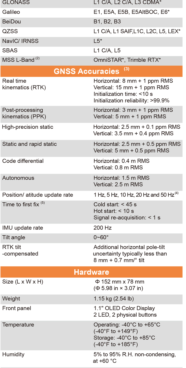
| GNSS Performance | Channels | 336 channels |
| GPS | L1 C/A, L2E, L2C, L5 | |
| GLONASS | L1 C/A, L2 C/A, L3 CDMA | |
| Galileo | E1, E5a, E5b, E6* | |
| BeiDou | B1, B2, B3 | |
| QZSS | L1 C/A, L1 SAIF,L1C, L2C, L5, LEX | |
| PPP | B2b-PPP | |
| SBAS (EGNOS Support) | L1 C/A, L5 | |
| MSS L-Band | OmniSTAR*, Trimble RTX* | |
| NavIC/ IRNSS | L5* | |
| GNSS Accuracies | Real time kinematic (RTK) | H: 8 mm + 1 ppm RMS |
| V: 15 mm + 1 ppm RMS | ||
| Initialization time: <10 s | ||
| Initialization reliability: >99.9% | ||
| Post-processing kinematic (PPK) | H: 3 mm + 1 ppm RMS V: 5 mm + 1 ppm RMS | |
| High-precision static | H: 2.5 mm + 0.1 ppm RMS V: 3.5 mm + 0.4 ppm RMS | |
| Static and rapid static | H: 2.5 mm + 0.5 ppm RMS V: 5 mm + 0.5 ppm RMS | |
| Code differential | H: 0.4 m RMS | V: 0.8 m RMS | |
| Autonomous | H:1.5 m RMS | V: 2.5 m RMS | |
| Visual survey | Typical 2~4 cm, range 2~15 m | |
| Positioning rate | 1 Hz, 5 Hz and 10 Hz | |
| Time to first fix | Cold start: < 45 s, Hot start: < 10 s Signal re-acquisition: < 1 s | |
| IMU update rate | 200 Hz | |
| Till angle | 0-60° | |
| RTK tilt-compensated | Additional horizontal pole-tilt uncertainty typically less than 8 mm + 0.7 mm/° tilt | |
| Environments | Temperature | Operating: -40°C to +65°C |
| (-40°F to +149°F) | ||
| Storage: -40°C to +85°C | ||
| (-40°F to +185°F) | ||
| Humidity | 100% non-condensation | |
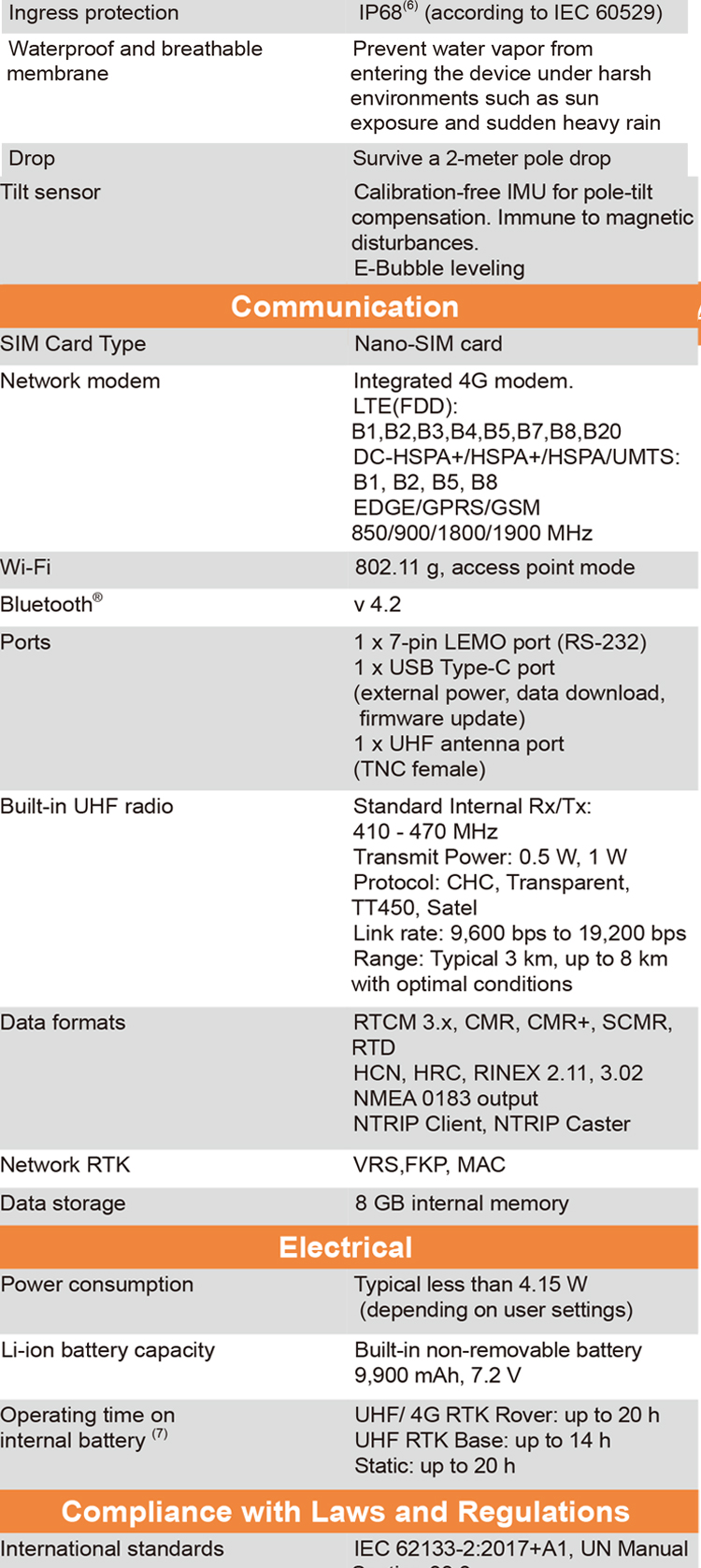
| Ingress protection | IP68(6) (according to IEC 60529) | |
| Drop | Survive a 2-meter pole-drop | |
| Vibration | Compliant with ISO 9022-36-08 and MIL-STD-810G- 514.6-Cat.24. | |
| Waterproof and breathable membrane | Prevent water vapor from entering under harsh environments | |
| Electrical | Power consumption | UHF/ 4G RTK Rover w/o camera: |
| Typical 2.8 W | ||
| Visual Stakeout/Visual Survey: | ||
| Typical 4 W | ||
| Li-ion battery capacity | Built-in non-removable battery 9,600 mAh, 7.4 V | |
| Operating time on internal battery | UHF/ 4G RTK Rover w/o camera: | |
| up to 34 h | ||
| Visual Stakeout/Visual Survey: | ||
| up to 24 h | ||
| UHF RTK Base: up | ||
| External power input | 9 V DC to 24 V DC | |
| Hardware | Size (D x H) | 152 mm x 78 mm (Φ 5.98 in × 3.07 in) |
| Weigh | 1.15 kg (2.54 lb) | |
| Front pane | 1.1'' OLED Color Display | |
| 1.1'' OLED Color Display 2 LED, 2 physical buttons | ||
| Tilt sensor | Calibration-free IMU for pole-tilt compensation. Immune to magnetic disturbances. E-Bubble leveling. | |
| Communication | SIM card type | Nano-SIM card |
| Network modem | Integrated 4G modem: TDD-LTE, FDD-LTE, WCDMA, EDGE, GPRS, GSM | |
| Wireless connection | NFC for device touch pairing | |
| Wi-F | Wi-Fi IEEE 802.11a/b/g/n/ac, access point mode | |
| Bluetooth | 5.0 and 4.2 +EDR, backward compatible | |
| Ports | 1 x 7-pin LEMO port (RS-232) 1 x USB Type-C port (external power, data download, firmware update) 1 x UHF antenna port (TNC female) | |
| Built-in UHF radio | Rx/Tx: 410 - 470 MHz Transmit Power: 0.5 W to 2 W Protocol: CHC, Transparent, TT450, Satel Link rate: 9 600 bps to 19 200 bps Range: Typical 3 km to 5 km, up to 15 km with optimal conditions | |
| Data formats | RTCM 2.x, RTCM 3.x, CMR input / output HCN, HRC, RINEX 2.11, 3.02 NMEA 0183 output NTRIP Client, NTRIP Caster | |
| Data storage | 32 GB internal memory. Support 128 GB external expansion |