01


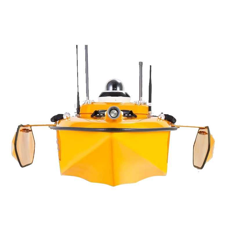
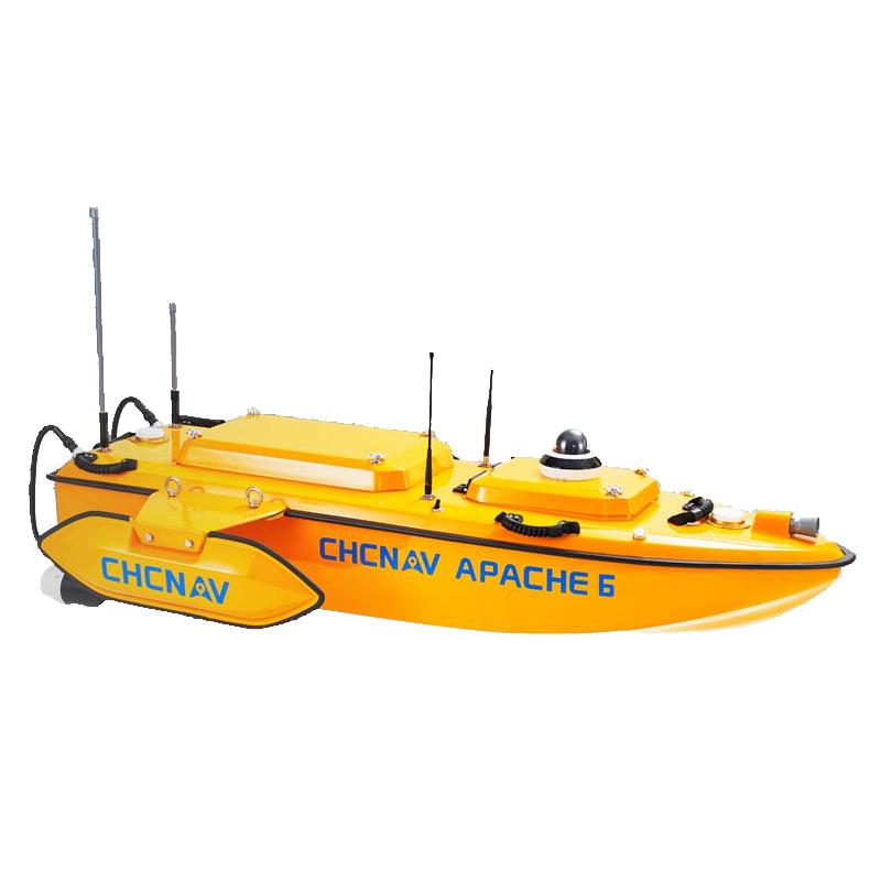

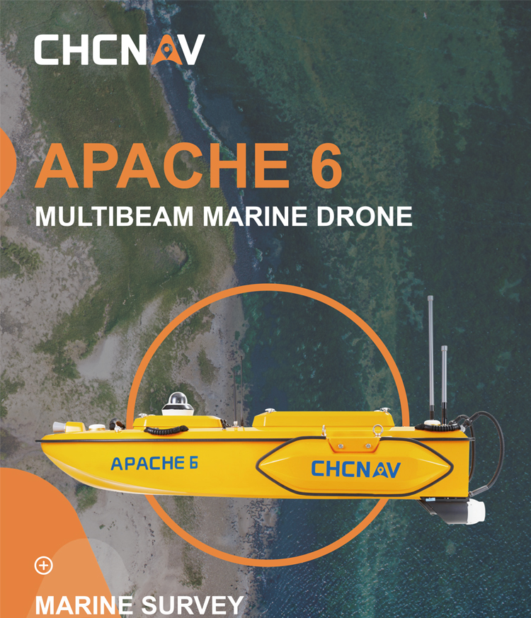
CHCNAV APACHE 6 Portable Autopilot System for Marine Surveying Easy Operation APACHE 6 Survey USV Unmanned Surface Vehicle
Product Features
Autonomous Navigation & Remote Control:
1.The USV adopts autonomous navigation technology, allowing it to navigate autonomously according to mission plans without the need for human intervention.
2.It also supports remote control operations, facilitating manual control and adjustments in complex environments.
Data Processing & Analysis:
The included CHCNAV hydrographic surveying software can record and analyze measurement data, generating 3D models of terrain, contours, and depths, providing decision-makers with intuitive and accurate topographic information.
Performance Parameters
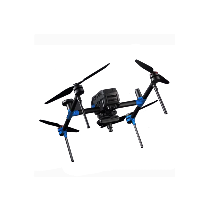
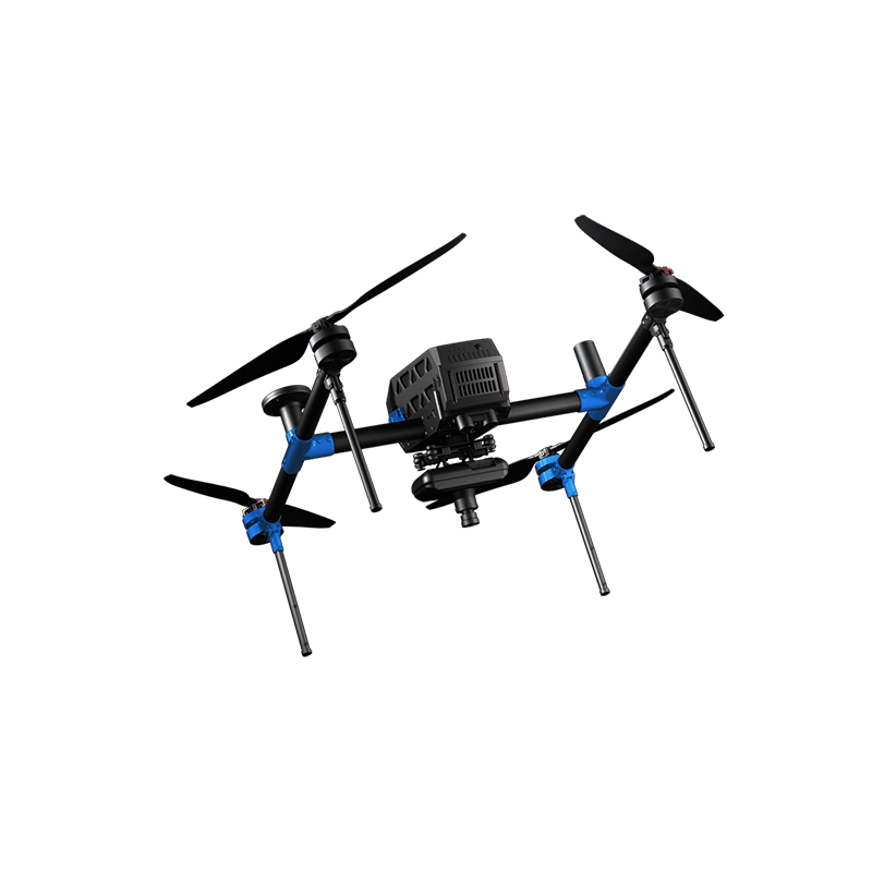
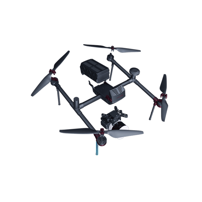
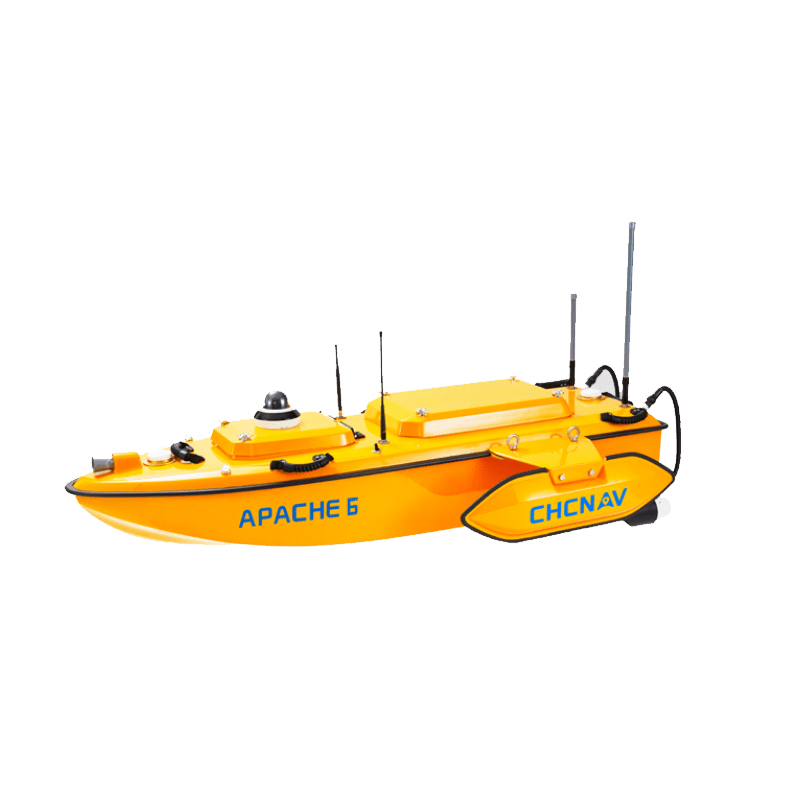
1.Dimensions & Weight:
1.The USV measures L1.8m x W0.55m x H0.25m and weighs 40kg (typical weight), making it easy to transport and deploy.
2.Propulsion & Payload:
1.It is electrically powered, which is environmentally friendly and easy to maintain.
2.The payload capacity reaches 60kg, allowing it to carry a variety of measurement equipment and sensors.
3.Waterproof & Corrosion Resistance:
1.The hull is designed with corrosion-resistant sealing technology, suitable for various types of mission environments.
2.The waterproof rating is IP65, ensuring stable operation in harsh weather conditions.
4.Other Performance:
1.The maximum speed is 6m/s, with a draft of 15cm and an inertial navigation accuracy of 6°/h.
2.It has a wave resistance rating of up to 6-level winds and 4-level waves, making it suitable for various marine and lake environments.
Application Scenarios
1.Water Depth Measurement:
● Measuring seabed heights in port areas to determine where ships can dock and where dredging is needed.
● Measuring bed heights in dams to calculate dam capacity and monitor sedimentation.
2.Topographic Surveying & Mapping:
● Drawing contour maps and depth maps of seabeds or lake beds to provide basic data for terrain analysis, planning, and management.
3.Environmental Monitoring:
● Used in scientific research areas such as water quality monitoring and ecological surveys in oceans or lakes.
In summary, the CHCNAV APACHE 6 USV, with its high-precision measurement, advanced measurement equipment, autonomous navigation and remote control, data processing and analysis capabilities, as well as excellent performance parameters, holds broad application prospects and great potential in the fields of underwater measurement and topographic surveying and mapping.
Product parameters
Ⅰ. Basic Parameters
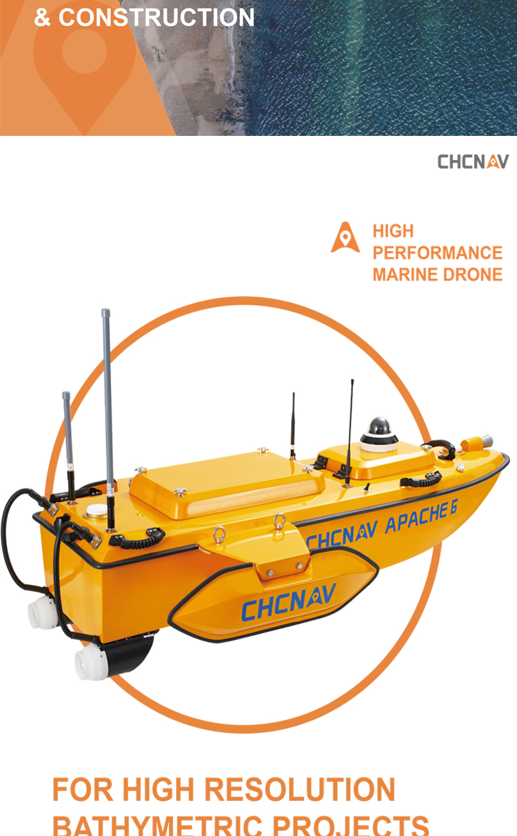
Type: A fully integrated innovative solution for three-dimensional bathymetric survey, underwater object positioning, maritime construction, underwater archaeology, shipwreck rescue, etc.
Dimensions: Length of 1.8m, width of 0.55m, height of 0.25m.
Weight: Typical weight is 40kg, facilitating easy transportation and deployment.
Ⅱ. Performance Parameters
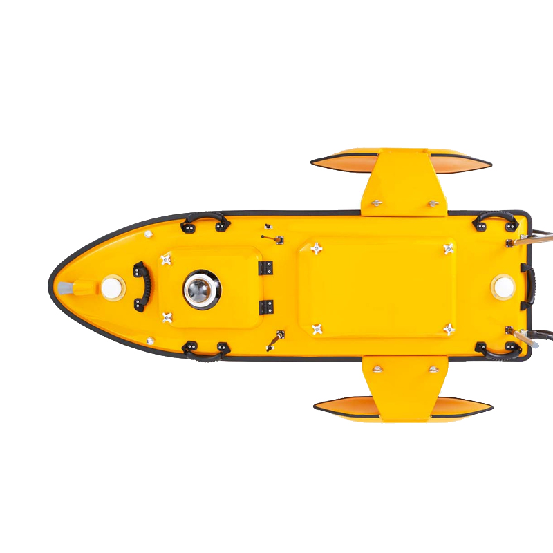
Propulsion System: Equipped with a high-performance dual-propeller system to ensure stable and consistent autonomous cruising speed.
Maximum Speed: Can reach up to 6m/s (or 2.5m/s, may vary based on different configurations).
Draft: 15cm.
Inertial Navigation Accuracy: 6°/h.
Wave and Wind Resistance: Capable of withstanding winds up to Force 6 and waves up to Sea State 4, suitable for various marine and lake environments.
Ⅲ. Survey Equipment Parameters
Single-beam Echo Sounder: Capable of measuring depth and calculating the height of the seabed or lakebed.
Multi-beam Echo Sounder (MBES) Option: Such as the Norbit multi-beam echo sounder, providing reliable bathymetric maps and backscatter strength (BS) profiles of the seabed.
Sensors: The standard package includes the remote-controlled vessel, single-beam echo sounder, and GNSS IMU sensor. Additional sensors, such as third-party fish detection sensors, can also be provided.
Ⅳ. Remote Control and Autonomous Navigation Parameters
Remote Control Range: The APACHE 6 remote control panel allows for manual survey projects within a 2-kilometer range.
Autonomous Navigation: The unmanned vessel employs autonomous navigation technology, enabling it to navigate and complete tasks according to mission plans without human intervention.
Ⅴ. Data Processing and Analysis Parameters
Software Support: The provided CHCNAV hydrographic survey software can record and analyze measurement data, generating 3D models of the terrain, contours, and depths.
Ⅵ. Other Parameters
Load Capacity: With a load capacity of 60kg, it can carry a variety of measurement equipment and sensors.
Waterproof and Corrosion-resistant: The hull adopts corrosion-resistant sealing technology with a waterproof rating of IP65, ensuring stable operation in harsh weather conditions.
Logistics information


Logistics information
technical parameter
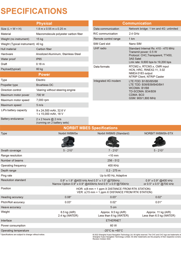
| Physical | Size (L × W × H) | 1.8 m x 0.55 m x 0.25 m |
| Materia | Macromolecule polyester carbon fiber | |
| Weight (no instrument) | 15 kg | |
| Weight (Typical instrument) | 40 kg | |
| Hull material | Carbon fiber | |
| Hardware | Anodized Aluminum, Stainless Steel | |
| Water proof | IP65 | |
| Draft | 0.18 m | |
| Payload(typical) | 60 kg | |
| Power | Type | Electric |
| Propeller type | Brushless DC | |
| Direction control | Veering without steering engine | |
| Maximum motor power | 700 W | |
| Maximum motor speed | 7,000 rpm | |
| Maximum speed | 5 m/s | |
| LiPo battery capacity | 9 x 24,500 mAh, 32.6 V 1 x 15,000 mAh, 18 V | |
| Battery endurance | 2 x 2 hours @ 2 m/s (running on 2 battery sets) | |
| Communication | Data communication | Network bridge: 1 km and 4G: unlimited |
| R/C communication | 2.4 GHz | |
| Remote control range | 1 km | |
| SIM Card slot | Nano SIM | |
| UHF radio | Standard Internal Rx: 410 - 470 MHz Transmit power: 0.5 W Protocol: CHC,Transparent, TT450, 3AS Satel Link rate: 9,600 bps to 19,200 bps | |
| Data formats | RTCM2.x, RTCM3.x, CMR input HCN, HRC, RINEX2.11, 3.02 NMEA 0183 output NTRIP Client, NTRIP Caster | |
| Integrated 4G modem | LTE FDD: B1/B3/B5/B8 LTE TDD: B38/B39/B40/B41 WCDMA: B1/B8 TD-SCDMA: B34/B39 CDMA: BC0 GSM: 900/1,800 MHz | |
| NORBIT MBES Specifications | Type | Norbit IWBMSe Norbit IWBMS (Standard) NORBIT IWBMSh-STX |
| Swath coverage | 5 - 210° 7 - 210° 5 - 210° | |
| Range resolution | <10 mm | |
| Number of beams | 256 - 512 | |
| Depth range | 400 KHz | |
| Ping rate | 0.2 - 275 m | |
| Resolution standard | Up to 60 Hz, Adaptive | |
| Position | 0.9° x 1.9° @400 kHz And 0.5° x 1.0° @700kHz . Narrow Option 0.9° x 0.9° @400kHz And 0.5° x 0.5°@700kHz 0.9° x 0.9° @400 kHz or 0.5° x 0.5° @700 kHz | |
| Heading accuracy | HOR: ±(8 mm + 1 ppm X DISTANCE FROM RTK STATION) VER: ±(15 mm + 1 ppm X DISTANCE FROM RTK STATION) | |
| Pitch/Roll accuracy | 0.08° 0.03° 0.02° | |
| Heave accuracy | 0.03° 0.02° 0.01° | |
| Weight | 6.5 kg (AIR) 2.4 kg (WATER) Approx. 9.5 kg (AIR) Less than 6 kg (WATER) Approx. 11 kg (AIR) Less than 6.5 kg (WATER) | |
| Interface | ETHERNET | |
| Power consumption | 60 W | |
| Operating temperature | -20°C to +60°C |