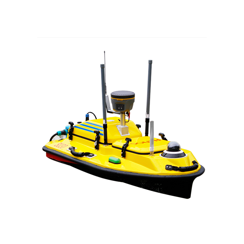
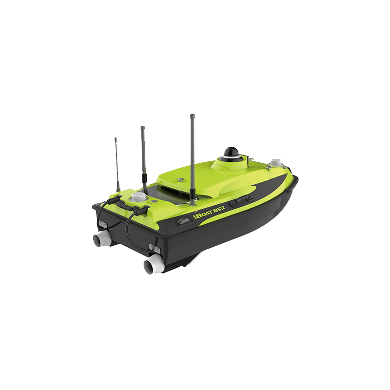
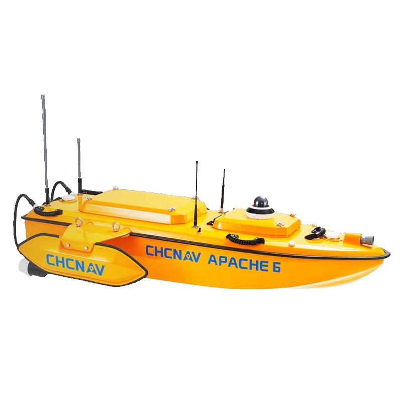


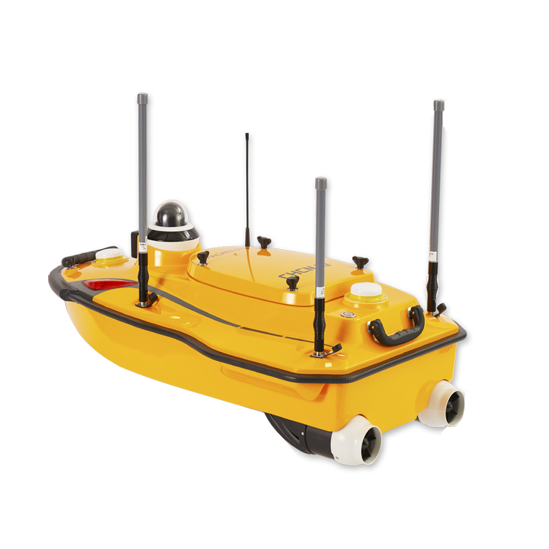


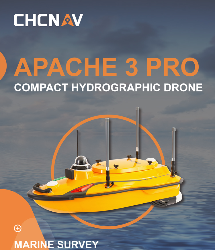
CHCNAV APACHE 3 Pro Portable Autopilot System for Marine Surveying Easy Operation APACHE 3 Pro Survey USV Unmanned Surface Vehicle
Product advantages
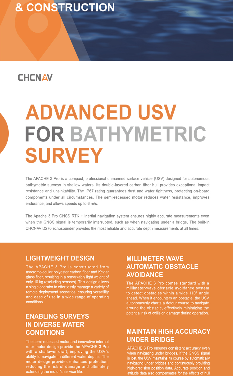
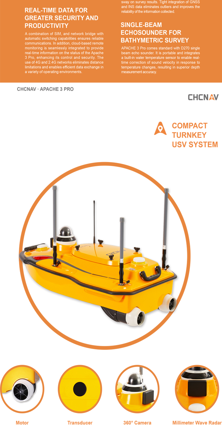
Durability: Adopts a full carbon fiber hull and double-layer hull design, significantly enhancing the product's durability and service life, ensuring stable operation in various complex environments.
Flexibility: The lightweight material and high-strength characteristics of the full carbon fiber hull make the unmanned boat more flexible during operation, capable of easily handling various complex water areas.
Safety: The double-layer hull design effectively improves the stability and safety of the unmanned boat in complex water areas, reducing the risk of accidents.
All-weather operation capability: Equipped with IP67 dust and waterproof rating, as well as functions such as balanced discharge of the power supply box, support for hot-swapping, and continuous measurement after power failure, ensuring the unmanned boat can operate continuously under all-weather conditions.
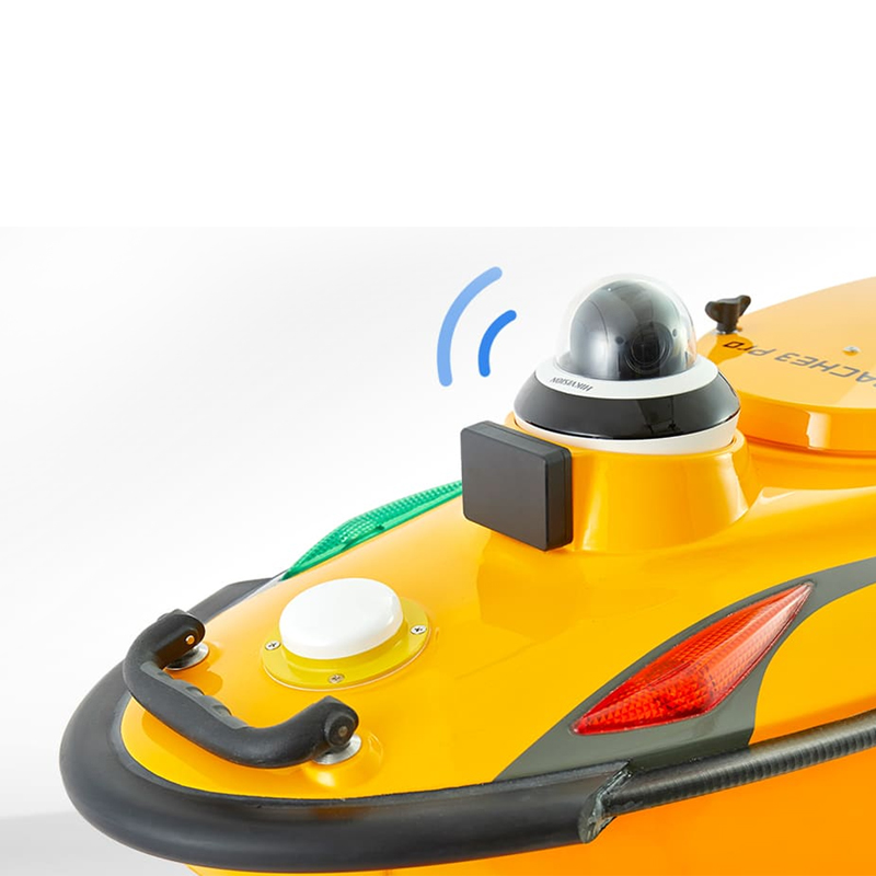
High-precision surveying and mapping: Equipped with the new D270 portable depth sounder, it can perceive water temperature in real-time and correct sound velocity, improving the accuracy and reliability of surveying and mapping through waveform superposition display.
In summary, CHCNAV APACHE 3 Pro demonstrates broad application prospects and great potential in the surveying and mapping field with its significant advantages of efficiency, accuracy, intelligence, and durability.
key parameters
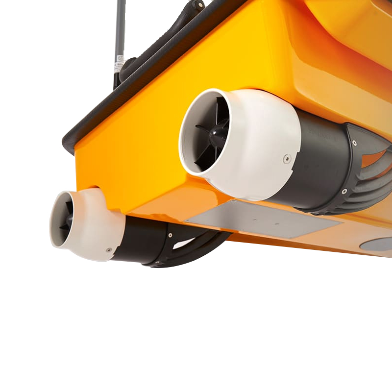
Hull Design
● Material: Full carbon fiber hull, which is lightweight and high in strength, enhancing the unmanned boat's flexibility and durability.
● Design: Double-layer hull design, which is collision-resistant and unsinkable, enhancing the stability and safety of the unmanned boat in complex water areas.
Performance Parameters
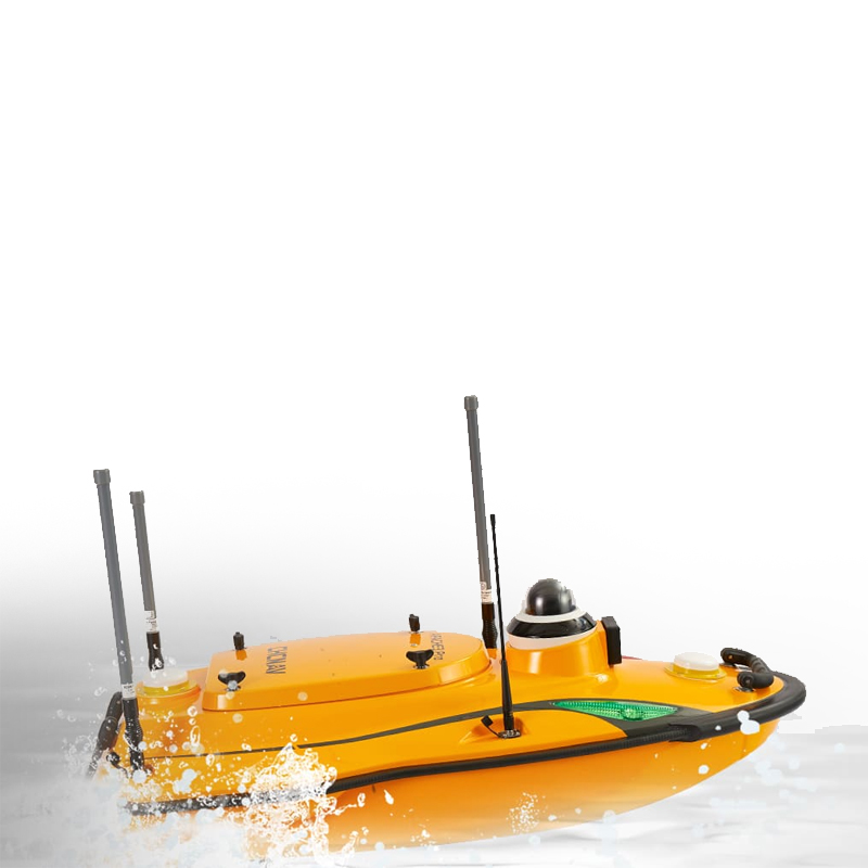
● Maximum Speed: Up to 8m/s, capable of easily navigating high-speed rivers and improving surveying and mapping efficiency.
● Dust and Waterproof Rating: IP67, ensuring the unmanned boat can operate normally in harsh environments and extending its service life.
● Surveying and Mapping Modes: Supports both "semi-automatic surveying and mapping" and "fully automatic surveying and mapping" modes. The "fully automatic surveying and mapping" mode does not require route setting, automatically perceives and measures, greatly simplifying the operation process.
Technical Configuration
● Global Network Standard and PPK Post-Difference Technology: Data can be transmitted anytime and anywhere, while compensating for network coverage gaps, ensuring the accuracy and completeness of surveying and mapping data.
● Inertial Navigation Function and IMU Attitude Compensation: Enables measurement under bridges, improving measurement accuracy. Additionally, the power supply box features balanced discharge, supports hot-swapping, and continuous measurement after power failure, ensuring continuous operation under all-weather conditions.
● Depth Sounder: The new D270 portable depth sounder can perceive water temperature in real-time, correct sound velocity, and display waveforms in post-processing software, improving the accuracy and reliability of surveying and mapping.
Other Configurations
● Power Management: The power supply box features balanced discharge and supports hot-swapping and continuous measurement after power failure, ensuring the unmanned boat can operate continuously under all-weather conditions.
● Control Interface: An intelligent operation interface makes the operation simpler and more intuitive, reducing operation difficulty.
It should be noted that the above parameter configurations may vary depending on the product version or production batch. For the most accurate information, it is recommended to refer directly to the official documentation of the CHCNAV APACHE 3 Pro or contact its technical support team.
Furthermore, the CHCNAV APACHE 3 Pro, as a high-performance unmanned survey boat, has broad application prospects in the fields of surveying and mapping, hydrology, environmental protection, ocean monitoring, and more. Its efficiency, accuracy, intelligence, and durability make it an indispensable surveying tool in these fields.
Logistics information


Logistics information
technical parameter
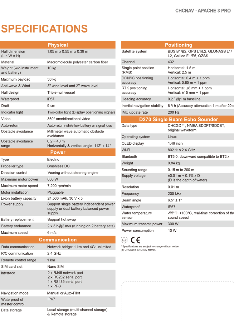
| Physical | Hull dimension (L × W × H) | 1185 mm*593 mm*397 mm |
| Material | Macromolecule polyester carbon fiber | |
| Weight (w/o instrument and battery) | 10 kg | |
| Maximum payload | 30 kg | |
| Anti-wave & Wind | 3rd wind level and 2nd wave level | |
| Hull design | Triple-hull vessel | |
| Waterproof | IP67 | |
| Draft | 9 cm | |
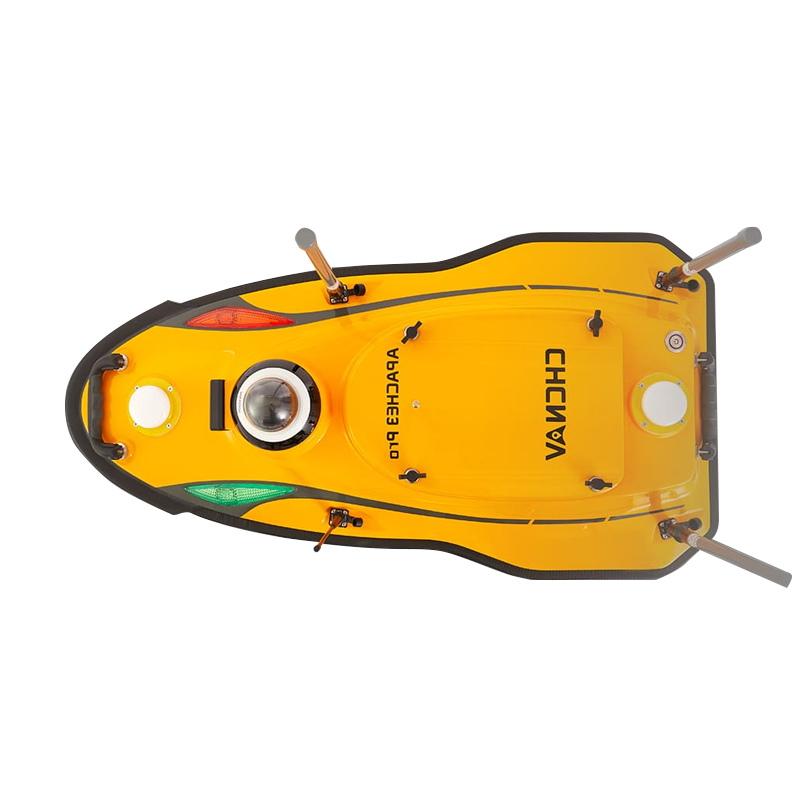
| Indicator light | Two-color light (Display positioning signal) | |
| Video | 360° omnidirectional video | |
| Auto-return | Auto-return while low battery or signal loss | |
| Obstacle avoidance | Millimeter wave automatic obstacle | |
| Obstacle avoidance range | 0.2 ~ 40 m Horizontally & vertical angle: 112° x 14° | |
| Power | Type | Electric |
| Propeller type | Brushless DC | |
| Direction control | Veering without steering engine | |
| Maximum motor power | 800 W | |
| Maximum motor speed | 7,200 rpm/min | |
| Motor installation | Pluggable | |
| Li-ion battery capacity | 24,500 mAh, 36 V x 5 | |
| Power supply | Support single battery independent power supply or dual battery balanced power supply | |
| Battery replacement | Support hot swap | |
| Battery endurance | 2 x 3 h@2 m/s (running on 2 battery sets) | |
| Maximum speed | 6 m/s | |
| Communication | Data communication | Network bridge: 1 km and 4G: unlimited |
| R/C communication | 2.4 GHz | |
| Remote control range | 1 km | |
| SIM card slot | Nano SIM | |
| Interface | 2 x RJ45 network port 2 x RS232 serial port 1 x RS485 serial port 1 x PPS | |
| Navigation mode | Manual or Auto-Pilot | |
| Waterproof of master contro | IP67 | |
| Data storage | Local storage (multi-channel storage) & Remote storage | |
| Positioning | Satellite system | BDS B1/B2, GPS L1/L2, GLONASS L1/ L2, Galileo E1/E5, QZSS |
| Channel | 432 | |
| Single point position (RMS) | Horizontal: 1.5 m Vertical: 2.5 m | |
| DGNSS positioning accuracy | Horizontal: 0.4 m + 1 ppm Vertical: 0.85 m + 1 ppm | |
| RTK positioning accuracy | Horizontal: ±8 mm + 1 ppm Vertical: ±15 mm + 1 ppm | |
| Heading accuracy | 0.2 ⁰ @1 m baseline | |
| Inertial navigation stability | 6 ⁰/ h (Accuracy attenuation 1 m after 20 s) | |
| IMU update rate | 200 Hz | |
| D270 Single Beam Echo Sounder | Data type | CHCGD (1) , NMEA SDDPT/SDDBT, original waveform |
| Operating system | Linux | |
| OLED display | 1.46 inch | |
| Wi-Fi | 802.11n 2.4 GHz | |
| Bluetooth | BT5.0, downward compatible to BT2.x | |
| Weight | 0.84 kg | |
| Sounding range | 0.15 m to 200 m | |
| Supply voltage | ±0.01 m + 0.1% x D (D is the depth of water) | |
| Resolution | 0.01 m | |
| Frequency | 200 kHz | |
| Beam angle | 6.5° ± 1° | |
| Waterproof | IP67 |